
Aji Pangeran Tumenggung Pranoto International Airport
 Samarinda · インドネシア· Aji Pangeran Tumenggung Pranoto International Airport
Aji Pangeran Tumenggung Pranoto International Airport(IATA: AAP、ICAO: WALS)はSamarinda、インドネシアにある中型空港です。
Aji Pangeran Tumenggung Pranoto International Airport is a medium-sized airport, at an elevation of about 82 ft, with scheduled passenger service. This page gathers its location map, airport codes and travel information.
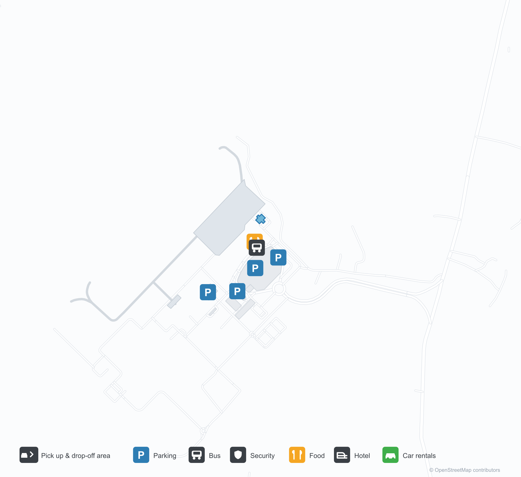
空港マップをダウンロードダウンロード
空港写真空港写真
この空港の実際の写真です。いずれも公開ウェブページを出典として明記しており、著作権は撮影者に帰属します。写真をクリックすると拡大表示され、クレジットをクリックすると元のページが開きます。
サマリンダのAPTプラノト国際空港ターミナル——白い斜めの鉄骨が支える幅広いガラス張りのファサードで、キャノピーが車寄せの上まで張り出している。
赤と白のターボプロップ機がエプロンで待ち、長いガラス張りターミナルの上には厚い雲が立ちこめる。屋根は白い鉄骨トラスが支える。
空港入口の赤い文字の看板には「Aji Pangeran Tumenggung Pranoto」の名が記され、背後に白い曲面屋根のターミナルがそびえる。
ターミナルの壁沿いに緑の名称板と黄色い番号板が並び、乗客がガラスと鉄の歩道橋の下でコンクリートの前庭を横切る。
芝生から見ると、ターミナルの銀色の屋根が両端で持ち上がり、灰白色の空を映すガラス張りの正面が現れる。左にはバスが待つ。
エプロンに幅広いアーチ型の格納庫が開き、内部に搭乗用の階段車が置かれ、薄れゆく光の中で隣に白い管制塔が立つ。
Aji Pangeran Tumenggung Pranoto International Airport発着便 — 出発と到着フライトボード
便名26件、5社の航空会社、6か所の目的地を出発・到着別に掲載しています。コードシェア便も含みます。
| 便 | 航空会社 | 目的地 | 国・地域 |
|---|---|---|---|
| GA581 | Garuda Indonesia | スカルノ=ハッタ国際空港 | インドネシア |
| GA8831 | Garuda Indonesia | スカルノ=ハッタ国際空港 | インドネシア |
| ID6257 | Batik Air | スカルノ=ハッタ国際空港 | インドネシア |
| ID6677 | Batik Air | スカルノ=ハッタ国際空港 | インドネシア |
| IU641 | Super Air Jet | Juanda International Airport | インドネシア |
| IU653 | Super Air Jet | Juanda International Airport | インドネシア |
| IU659 | Super Air Jet | Yogyakarta (YIA) Yogyakarta International Airport | インドネシア |
| IW1472 | Wings Air | GHS | |
| IW1480 | Wings Air | Banjarbaru (BDJ) Syamsudin Noor International Airport | インドネシア |
| IW1484 | Wings Air | Tanjung Redeb - Borneo Island (BEJ) Kalimarau Airport | インドネシア |
| IW1486 | Wings Air | Tanjung Redeb - Borneo Island (BEJ) Kalimarau Airport | インドネシア |
| QG423 | Citilink | スカルノ=ハッタ国際空港 | インドネシア |
| QG461 | Citilink | Juanda International Airport | インドネシア |
便名と路線はaviability.comのフライトインデックス(スナップショット:2026年10月26日)に基づきます。コードシェア便を含み、出発時刻は掲載していません。出典:aviability.com ↗
空港情報と詳細空港の詳細
インタラクティブマップ — Aji Pangeran Tumenggung Pranoto International Airportの位置インタラクティブマップ
他の地図サービスでこの空港を見る:
Samarinda Airport (AAP): A New Terminal Under Steel and Glass空港ガイド
Samarinda's new terminal uses diagonal white steel to carry a wide glass frontage, with the canopy running out over the drop-off lane. The airport serves Samarinda in East Kalimantan, Indonesia, at an elevation of about 25 m, with a 2,250 m runway; the 2014 snapshot records no scheduled routes.
Airport photos
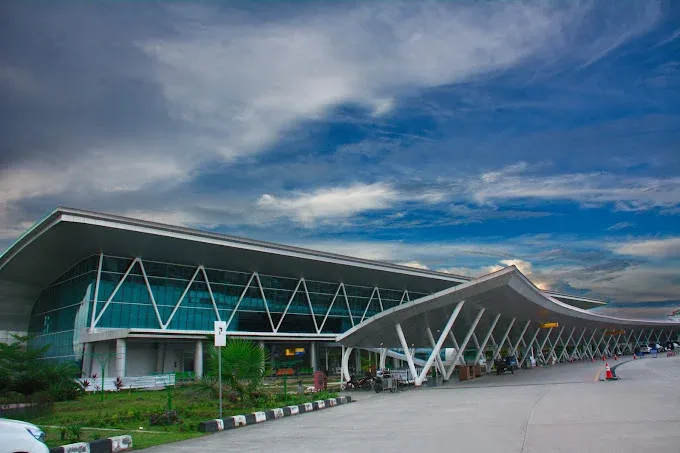
The terminal of Samarinda's APT Pranoto International Airport: a wide glass façade braced by angled white steelwork, with the canopy reaching out over the drop-off area.
The photos come from public web sources and remain the copyright of their photographers; full credits and source links sit in the photo gallery on this page.
Airport at a glance
| Item | Detail |
|---|---|
| IATA / ICAO | AAP / WALS |
| Role | Medium-sized airport |
| Elevation | about 25 m |
| Coordinates | -0.3745, 117.2501 |
| Runways | 1, 2,250 m |
| Non-stop destinations | 0 in the 2014 snapshot |
Runways
| Runway | Length | Width | Surface |
|---|---|---|---|
| 04/22 | 2,250 m | 45 m | asphalt |
1 runway, the longest 2,250 m.
Non-stop routes
The route dataset carries no scheduled non-stop services for this airport. Regional schedules change often — confirm with the airline or airport before booking.
Nearby airports to compare
If the fares are close, these are the nearest airports of the same class (medium-sized airport) — straight-line distance, with their own non-stop counts from the same dataset:
| Airport | Distance | Non-stop destinations |
|---|---|---|
| Abdul Rachman Saleh Airport (MLG) | ~979 km | 2 |
| Adisutjipto International Airport (JOG) | ~1,118 km | 13 |
Before you fly
- The 2014 snapshot has no scheduled routes; check the airport and airlines for current services.
- Onward travel in East Kalimantan often involves road or small-aircraft legs, so allow time for bags and transfers.
About the data
Runways, elevation and coordinates come from OurAirports open data. Routes and carriers come from the June 2014 OpenFlights snapshot and include codeshares and interline services; they indicate network shape and scale, not current schedules.
読者コメントディスカッション
質問、旅行記、訂正など、お気軽にお寄せください。コメントは公開されます。
読み込み中…
コメントを読み込み中…