
Atlantic City International Airport
 Atlantic City · Estados Unidos· Atlantic City International Airport
O Atlantic City International Airport (IATA: ACY, ICAO KACY) é um aeroporto de porte médio que atende Atlantic City, Estados Unidos.
Atlantic City International Airport is a medium-sized airport, at an elevation of about 75 ft, with scheduled passenger service. This page gathers its location map, airport codes and travel information.
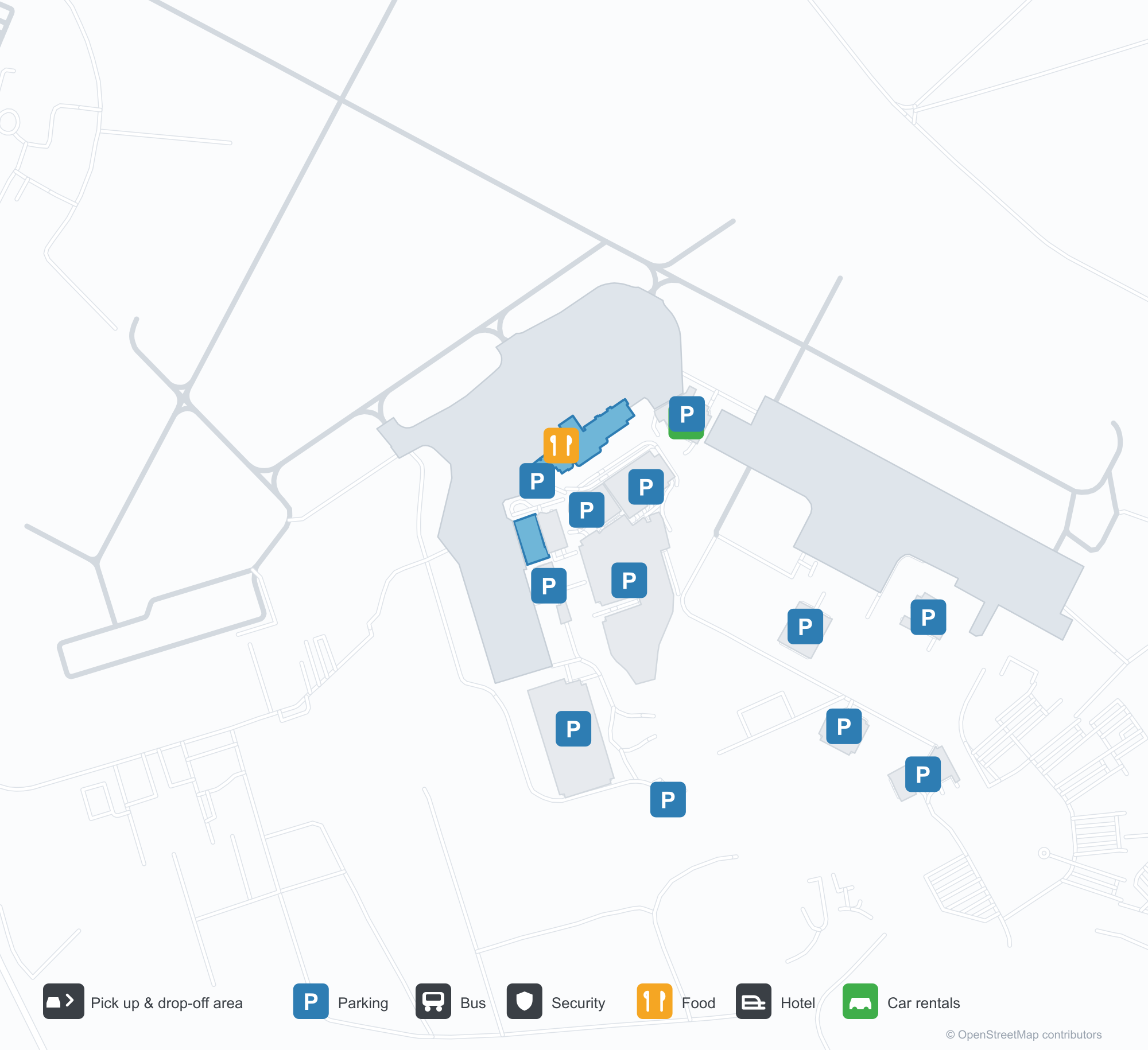
Baixar mapas do aeroportoDownloads
Fotos do aeroportoFotos do aeroporto
Fotos reais deste aeroporto, cada uma creditada à página pública da web onde foi encontrada; os direitos autorais continuam com os fotógrafos originais. Clique em uma foto para ampliar ou em uma linha de crédito para abrir a página de origem.
A fachada do lado terrestre do terminal — painéis prateados e ampla vidraça, com "ATLANTIC CITY INTERNATIONAL AIRPORT" escrito à direita.
O monumento "A" na entrada do aeroporto: uma letra azul cortando a silhueta de um pequeno avião no gramado diante do terminal.
Vista aérea do Atlantic City International: terminal e saguão no centro, estacionamentos e pistas de táxi ao redor, com o skyline da cidade flutuando no horizonte.
Atlantic City International Airport: mapa de rotas — destinos diretosMapa de rotas
9 destinos diretos: mapa, companhias aéreas em operação e distâncias.
Atlantic City International Airport: voos — partidas e chegadasPainel de voos
160 números de voo de 2 companhias aéreas para 12 destinos, separados por direção. Números de codeshare estão incluídos.
| Voo | Companhia aérea | Destino | País/região |
|---|---|---|---|
| G4234 | Allegiant Air | Orlando (SFB) Orlando Sanford International Airport | Estados Unidos |
| G4245 | Allegiant Air | Orlando (SFB) Orlando Sanford International Airport | Estados Unidos |
| G4255 | Allegiant Air | Orlando (SFB) Orlando Sanford International Airport | Estados Unidos |
| G4263 | Allegiant Air | Orlando (SFB) Orlando Sanford International Airport | Estados Unidos |
| G4482 | Allegiant Air | Fort Lauderdale Hollywood International Airport | Estados Unidos |
| G4487 | Allegiant Air | Fort Lauderdale Hollywood International Airport | Estados Unidos |
| G4488 | Allegiant Air | Fort Lauderdale Hollywood International Airport | Estados Unidos |
| G4489 | Allegiant Air | Fort Lauderdale Hollywood International Airport | Estados Unidos |
| G4490 | Allegiant Air | Fort Lauderdale Hollywood International Airport | Estados Unidos |
| G4496 | Allegiant Air | Fort Lauderdale Hollywood International Airport | Estados Unidos |
| G4498 | Allegiant Air | Fort Lauderdale Hollywood International Airport | Estados Unidos |
| G4503 | Allegiant Air | Fort Lauderdale Hollywood International Airport | Estados Unidos |
| G4504 | Allegiant Air | Fort Lauderdale Hollywood International Airport | Estados Unidos |
| G4506 | Allegiant Air | Fort Lauderdale Hollywood International Airport | Estados Unidos |
| G4518 | Allegiant Air | Fort Lauderdale Hollywood International Airport | Estados Unidos |
| G4522 | Allegiant Air | Fort Lauderdale Hollywood International Airport | Estados Unidos |
| G4526 | Allegiant Air | Fort Lauderdale Hollywood International Airport | Estados Unidos |
| G4528 | Allegiant Air | Fort Lauderdale Hollywood International Airport | Estados Unidos |
| G4530 | Allegiant Air | Fort Lauderdale Hollywood International Airport | Estados Unidos |
| G4851 | Allegiant Air | Punta Gorda (PGD) Punta Gorda Airport | Estados Unidos |
Números de voo e rotas do índice de voos da aviability.com (instantâneo de 26 de outubro de 2026); números de codeshare estão incluídos e nenhum horário de partida é exibido. Fonte: aviability.com ↗
Informações e detalhes do aeroportoDetalhes do aeroporto
Mapa interativo — localização do Atlantic City International AirportMapa interativo
Veja este aeroporto em outros serviços de mapas:
Atlantic City Airport (ACY): The 'A' Monument and Nine Domestic RoutesGuia do aeroporto
Atlantic City International Airport (IATA ACY, ICAO KACY) introduces itself with a symbol: a large blue letter "A" on the lawn, a small aircraft silhouette cutting through it. The terminal behind is silver panelling and broad glazing, with the airport's full name lettered along the right. From the air, terminal and concourse sit in the middle of car parks and taxiways, with Atlantic City's skyline floating on the horizon. Together the three images describe a domestic airport serving a seaside leisure city.
The field serves Atlantic City, New Jersey, at an elevation of about 23 m, with runways of 3,048 m and 1,873 m. The 2014 route snapshot records 9 non-stop destinations, all in the United States.
Airport photos
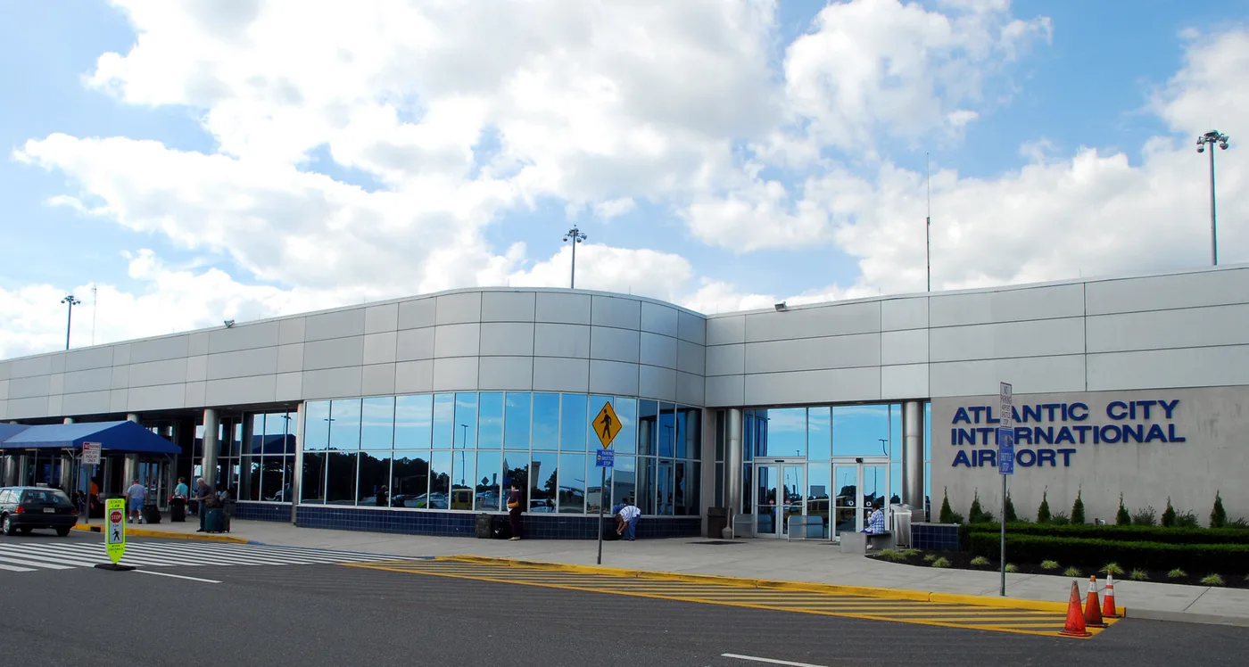
The landside face of the terminal — silver panelling and broad glazing, with 'ATLANTIC CITY INTERNATIONAL AIRPORT' lettered on the right.
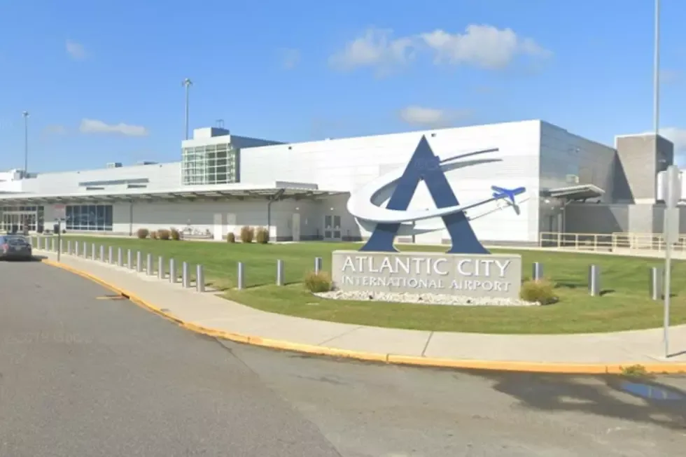
The 'A' monument at the airport entrance: a blue letter slicing through a small aircraft silhouette on the lawn before the terminal.
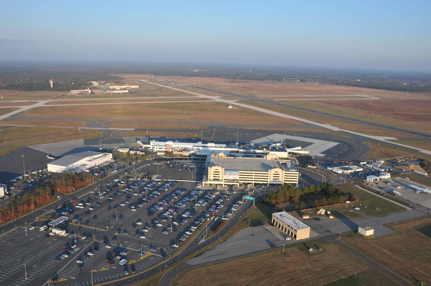
Aerial view of Atlantic City International: terminal and concourse in the middle, car parks and taxiways all around, the city skyline floating on the horizon.
The photos come from public web sources and remain the copyright of their photographers; full credits and source links sit in the photo gallery on this page.
Airport at a glance
| Item | Detail |
|---|---|
| IATA / ICAO | ACY / KACY |
| Role | Medium-sized airport and leisure gateway on the US East Coast |
| Elevation | about 23 m |
| Coordinates | 39.4562, -74.5775 |
| Runways | 2: 13/31 at 3,048 m, 04/22 at 1,873 m |
| Non-stop destinations | 9 (2014 snapshot, all domestic US) |
| Official site | acairport.com |
Network shape: nine destinations, eight listed for Spirit
By distance: 3 destinations within 1,000 km, 6 between 1,000 and 3,000 km, and none beyond 3,000 km. The nearest are Boston (441 km), Myrtle Beach (750 km) and Detroit (799 km). The farthest are Houston (2,163 km), Fort Myers (1,584 km) and Fort Lauderdale (1,576 km). It is an East Coast leisure map: short hops to nearby cities, longer runs to Florida and Texas.
| Distance band | Destinations |
|---|---|
| Under 1,000 km | 3 |
| 1,000–3,000 km | 6 |
| Over 3,000 km | 0 |
Spirit Airlines appears on 8 of the 9 routes, with United Airlines on 2 (some routes list both). The carrier column includes codeshares, so the figures describe concentration. The full list is on the Atlantic City route map.
Getting there and navigating
- Coordinates: 39.4562, -74.5775
- Official site: acairport.com
- Open in a map: Google Maps | Amap | Baidu Maps
If fares are close, compare Westchester County (HPN): about 194 km away with 13 destinations. Joint Base Andrews (ADW) is about 210 km away but has no comparable scheduled-route data. As a leisure airport, ACY sees sharper fare swings around weekends and peak season than a business-oriented field.
The location map on this page shows the field against Atlantic City and the waterfront. Terminal connections and local transport are not covered here; check the airport's or airline's own information.
Before you fly
- The 9 destinations are a 2014 snapshot, and Spirit reshapes its network often. Check the airline's current schedule.
- Spirit is a low-cost carrier: bags, seat selection and changes are priced separately. Compare the total cost, not just the headline fare.
- Leisure traffic peaks around summer weekends and holidays, when security queues run longer. Allow 90–120 minutes and more at peak times.
About the data
Runways, elevation and coordinates come from OurAirports open data. Routes and carriers come from the June 2014 OpenFlights snapshot and include codeshares and interline services; they indicate network shape and scale, not current schedules. Photos are from public web sources and remain the copyright of their photographers.
History
A joint civil-military field about 17 km north-west of Atlantic City, owned and operated by the South Jersey Transportation Authority. It hosts the New Jersey Air National Guard's 177th Fighter Wing (F-16C/Ds) and the U.S. Coast Guard's Atlantic City air station.
Source: Atlantic City Intl Airport.
Comentários dos leitoresDiscussão
Perguntas, relatos de viagem e correções são bem-vindos. Os comentários são públicos.
Carregando…
Carregando comentários…