
Almaty International Airport
 알마티 · 카자흐스탄· Almaty International Airport
Almaty International Airport(IATA: ALA, ICAO: UAAA)은 카자흐스탄 알마티에 위치한 대형 공항입니다.
Almaty International Airport is a large airport, at an elevation of about 2,234 ft, with scheduled passenger service. This page gathers its location map, airport codes and travel information.
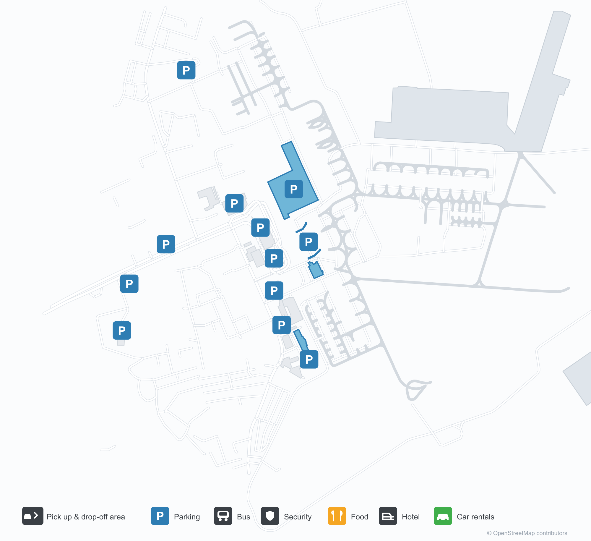
공항 지도 다운로드다운로드
공항 실제 사진공항 사진
다음은 이 공항의 실제 사진으로, 모두 공개된 인터넷 출처에서 가져왔으며 사진마다 출처를 표시했습니다. 저작권은 원저작자에게 있습니다. 사진을 클릭하면 크게 볼 수 있고, 출처를 클릭하면 원본 페이지가 열립니다.
낮의 알마티 터미널 — 출발층으로 차량을 실어 올리는 경사로와 이어지는 유려한 지붕선.
밤이면 유리 외벽 위로 빛나는 붉은 네온 'АЭРОПОРТ АЛМАТЫ'.
겨울날 터미널 앞 풍경 — 지붕의 다이아몬드형 장식 아래 눈밭에 선 택시와 승합차.
Almaty International Airport 노선도 · 직항 목적지노선도
직항 목적지 42개: 노선도, 운항 항공사, 비행 거리.
공항 정보 및 상세공항 상세
Almaty International Airport 인터랙티브 지도 — 공항 위치인터랙티브 지도
다른 지도 서비스에서 이 공항 보기:
Almaty Airport (ALA): A Central Asian Hub in Winter공항 안내
Three photographs tell the Almaty story from different angles. By day, a flowing roofline carries traffic up to the departures level. At night, red neon spelling "АЭРОПОРТ АЛМАТЫ" glows above the glazed frontage, with the roof's diamond finial picked out in light. The third image is the same forecourt under snow, taxis and minibuses waiting in the cold. Together they describe a Central Asian hub that has to keep working through winter.
Almaty International Airport (IATA ALA, ICAO UAAA) serves Almaty, Kazakhstan, at an elevation of about 681 m. Its two runways measure 4,500 m and 4,400 m. The 2014 route snapshot records 42 non-stop destinations: 14 in Kazakhstan and 28 abroad.
Airport photos
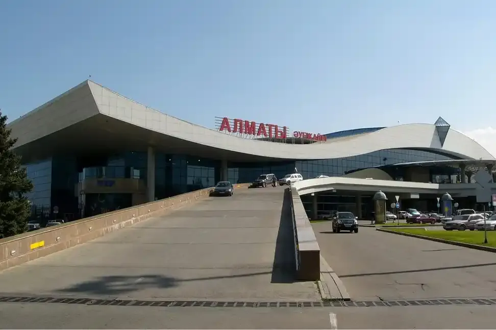
Almaty's terminal by day — the flowing roofline with its ramp carrying traffic up to departures.
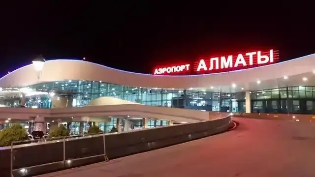
At night the red neon 'АЭРОПОРТ АЛМАТЫ' glows above the glazed frontage.
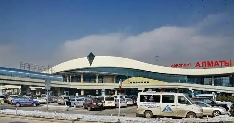
A winter view in front of the terminal — taxis and minibuses in the snow beneath the roof's diamond finial.
The photos come from public web sources and remain the copyright of their photographers; full credits and source links sit in the photo gallery on this page.
Airport at a glance
| Item | Detail |
|---|---|
| IATA / ICAO | ALA / UAAA |
| Role | Large airport and regional hub for Central Asia |
| Elevation | about 681 m |
| Coordinates | 43.3543, 77.0428 |
| Runways | 2: 05L/23R at 4,500 m, 05R/23L at 4,400 m |
| Non-stop destinations | 42 (14 domestic, 28 international; 2014 snapshot) |
Network shape: 28 international routes, the longest to London
By distance: 11 destinations within 1,000 km, 15 between 1,000 and 3,000 km, 16 between 3,000 and 6,000 km, and none beyond 6,000 km. The near layer is Taraz (469 km), Shymkent (626 km) and Tashkent (679 km). The far layer reaches London Heathrow (5,624 km), Amsterdam (5,256 km) and Kuala Lumpur (5,131 km). In this snapshot every route is under 5,700 km, making ALA a regional hub focused on the CIS, the Middle East, Europe and Southeast Asia rather than a transoceanic gateway.
| Distance band | Destinations |
|---|---|
| Under 1,000 km | 11 |
| 1,000–3,000 km | 15 |
| 3,000–6,000 km | 16 |
| Over 6,000 km | 0 |
Air Astana appears on 27 of the 42 routes and Scat Air on 11. The carrier column includes codeshares, so the figures describe concentration rather than who operates every flight. The full list is on the Almaty route map.
Getting there and navigating
- Coordinates: 43.3543, 77.0428
- Open in a map: Google Maps | Amap | Baidu Maps
If fares are close, the nearest large-airport comparison in the snapshot is Tashkent (TAS): about 679 km away with 52 non-stop destinations. Tashkent is also one of ALA's own destinations, which makes a short connection between the two cities practical.
The location map on this page shows the field against Almaty and the surrounding road network. This page does not cover terminal connections or local transport; confirm them with the airport or airline.
Before you fly
- Allow 2–3 hours for an international departure. The snow in the photos is not decorative: de-icing and runway clearing can push early flights into a longer queue.
- The two 4,400 m-plus runways can take long-haul widebodies, but none of the 42 destinations in the 2014 snapshot is beyond 6,000 km. Do not treat ALA as an intercontinental long-haul hub on that data alone.
- The 42 destinations are a 2014 snapshot; Air Astana and Scat have expanded since. Check current schedules before booking.
About the data
Runways, elevation and coordinates come from OurAirports open data. Routes and carriers come from the June 2014 OpenFlights snapshot and include codeshares and interline services; they indicate network shape and scale, not current schedules. Photos are from public web sources and remain the copyright of their photographers.
History
Opened in 1935, the field became Alma-Ata Airport in 1991 and today's joint-stock Almaty International in 1994. The Tu-144's first scheduled freight run — Moscow to Alma-Ata — landed here in December 1975; passenger service began in November 1977, and the supersonic airliner's final scheduled flight was on this route on 1 June 1978. A 1998 runway rebuild brought CAT II capability and international status.
Source: Almaty Airport.