
Matsu Nangan Airport
 Matsu · Taïwan· Matsu Nangan Airport
Matsu Nangan Airport (IATA : LZN, OACI RCFG) est un aéroport de taille moyenne qui dessert Matsu (Taïwan).
Matsu Nangan Airport is a medium-sized airport, at an elevation of about 232 ft, with scheduled passenger service. This page gathers its location map, airport codes and travel information.
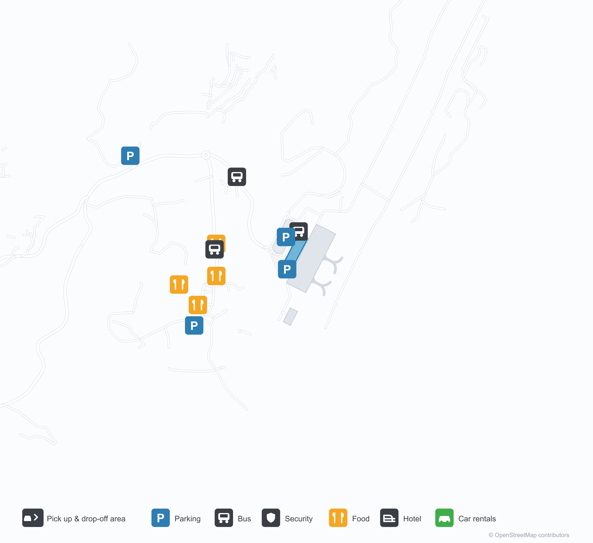
Télécharger les cartes de l’aéroportTéléchargements
Photos de l’aéroportPhotos de l’aéroport
De vraies photos de cet aéroport, chacune créditée à la page web publique où elle a été trouvée ; le droit d’auteur reste celui des photographes d’origine. Cliquez sur une photo pour l’agrandir, ou sur une mention de source pour ouvrir sa page.
In the satellite image, the layout of Matsu Nangan Airport (LZN) and its surroundings are clearly visible.
The front of Matsu Nangan Airport's terminal with its red-tiled roof, looking across the car park and roundabout.
The gold "Matsu Nangan Airport" lettering above the terminal entrance.
Informations et détails sur l’aéroportDétails de l’aéroport
Carte interactive — localisation de Matsu Nangan AirportCarte interactive
Voir cet aéroport sur d’autres services de cartes :
Matsu Nangan Airport GuideGuide de l’aéroport
Matsu Nangan Airport (IATA LZN, ICAO RCFG) serves Matsu, Taiwan, East Asia, and is classified as a medium-sized airport. This page gathers what the site's database, maps and route dataset say about it in one place.
Airport photos
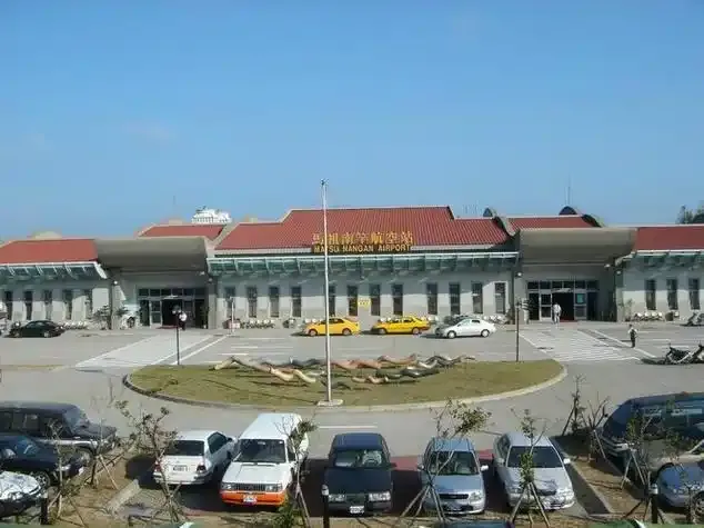
The front of Matsu Nangan Airport's terminal with its red-tiled roof, looking across the car park and roundabout.

The gold "Matsu Nangan Airport" lettering above the terminal entrance.
In the satellite image, the layout of Matsu Nangan Airport (LZN) and its surroundings are clearly visible.
The photos come from public web sources and remain the copyright of their photographers; full credits and source links sit in the photo gallery on this page.
Facts at a glance
| IATA / ICAO | LZN / RCFG |
| Airport class | medium-sized airport |
| Location | Matsu, Taiwan (East Asia) |
| Coordinates | 26.1597, 119.9584 |
Airport map
The map on this page is rendered from OpenStreetMap data: airports with terminal polygons show the terminal buildings, aprons and access roads, while small fields show the airfield outline and runway. Icons for parking, buses, food, hotels and car rentals follow whatever OSM has mapped.
- Full-size view — open the map card on this page to zoom in; the 2000 px original can be downloaded.
- Location map — the interactive map lets you pan and zoom to see the field against the city and road network.
- Schematic — the page also draws a size-based schematic to indicate the airport's scale; it is not the actual layout.
Direct routes
The route dataset carries no non-stop services for this airport. Regional schedules change often — confirm with the airline or airport before booking.
Nearby airports
If nothing fits, these nearby fields are worth comparing:
| Airport | Distance |
|---|---|
| Matsu Beigan Airport (MFK) | 8.4 km |
| Fuzhou Changle International Airport (FOC) | 38.4 km |
| Taiwan Taoyuan International Airport (TPE) | 176 km |
Getting there
The airport: coordinates 26.1597, 119.9584; elevation about 71 m.
Navigate straight to the field:
- Driving / taxi: 高德地图 | 百度地图 | Google Maps
The location map on this page shows the field against the city and road network, and the ground-transport section lists the public transport recorded for it. For driving routes, timetables and parking, rely on the airport's own information.
Size and facilities
Medium-sized airports are regional hubs: one compact terminal, walkable distances and usually faster check-in than a major hub — but with fewer frequencies, so rebooking after a missed flight is harder. Aim for 90–120 minutes before departure.
Terminal plans, check-in locations and ground-transport timetables are published by the airport itself; for detail that must be right on the day, rely on the airport's own information. If something here looks wrong, please tell us via the Contact page and we will check it.
Tips
- Use the search box at the top of the page to compare alternatives: type a city name or IATA code.
- In peak season parking and rental cars run short at small fields too — book ahead if you are driving.