
Prayagraj Airport
 Allahabad · India· Prayagraj Airport
Prayagraj Airport (IATA: IXD, OACI VIAL) es un aeropuerto mediano que da servicio a Allahabad, India.
Prayagraj Airport is a medium-sized airport, at an elevation of about 322 ft, with scheduled passenger service. This page gathers its location map, airport codes and travel information.
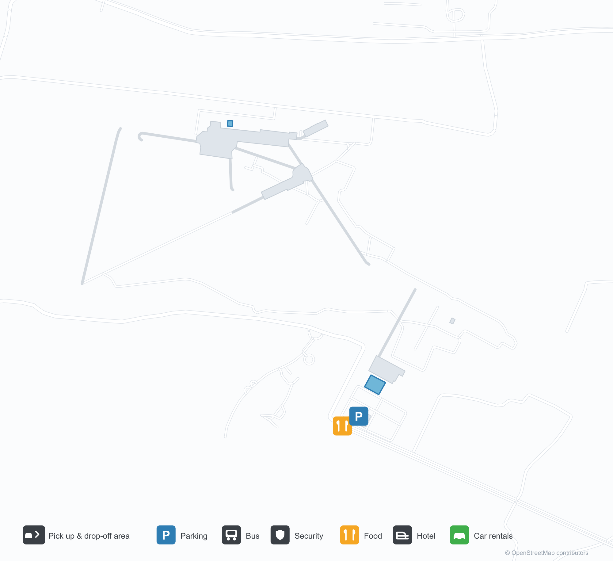
Descargar mapas de aeropuertosDescargas
Fotos del aeropuertoFotos del aeropuerto
Fotos reales de este aeropuerto, cada una con la referencia de la página web pública donde se encontró; los derechos de autor siguen siendo de los fotógrafos originales. Haz clic en una foto para ampliarla o en la línea de crédito para abrir su página de origen.
Vista satelital: las pistas de Prayagraj se extienden entre ciudad y tierras agrícolas en la llanura del Ganges, con la terminal y la plataforma junto al aeródromo.
Mapa de rutas de Prayagraj Airport — destinos directosMapa de rutas
2 destinos directos: mapa, aerolíneas que operan y distancias.
Vuelos de Prayagraj Airport — salidas y llegadasPanel de vuelos
28 números de vuelo de 4 aerolíneas y 6 destinos, divididos por dirección. Se incluyen los números de código compartido.
| Vuelo | Aerolínea | Destino | País/región |
|---|---|---|---|
| 6E2348 | IndiGo | Aeropuerto Internacional Indira Gandhi | India |
| 6E6532 | IndiGo | Kempegowda International Airport Bengaluru | India |
| 6E6819 | IndiGo | Rajiv Gandhi International Airport | India |
| 6E6841 | IndiGo | Aeropuerto Internacional Indira Gandhi | India |
| 6E6938 | IndiGo | Chhatrapati Shivaji Maharaj International Airport | India |
| 6E7266 | IndiGo | Bhubaneswar (BBI) Biju Patnaik International Airport | India |
| 6E7724 | IndiGo | Bhubaneswar (BBI) Biju Patnaik International Airport | India |
| 9I697 | Alliance Air | Bilaspur (PAB) Bilaspur Airport | India |
| 9I698 | Alliance Air | Aeropuerto Internacional Indira Gandhi | India |
| QP1124 | Akasa Air | Chhatrapati Shivaji Maharaj International Airport | India |
| VS9215 | Virgin Atlantic | Kempegowda International Airport Bengaluru | India |
| VS9216 | Virgin Atlantic | Chhatrapati Shivaji Maharaj International Airport | India |
| VS9217 | Virgin Atlantic | Aeropuerto Internacional Indira Gandhi | India |
Números de vuelo y rutas del índice de vuelos de aviability.com (instantánea de 26 de octubre de 2026); se incluyen los números de código compartido y no se muestran horarios de salida. Fuente: aviability.com ↗
Información y datos del aeropuertoDatos del aeropuerto
Mapa interactivo — ubicación de Prayagraj AirportMapa interactivo
Consulta este aeropuerto en otros servicios de mapas:
Prayagraj Airport (IXD): Two Domestic Routes on the Ganges PlainGuía del aeropuerto
From above, Prayagraj's runways lie between city and farmland on the Ganges plain, with the terminal and apron alongside the field. The airport serves Prayagraj (Allahabad) in Uttar Pradesh, India, at an elevation of about 98 m, with runways of 2,472 m and 1,463 m; the 2014 snapshot records two domestic destinations, Delhi at 575 km and Mumbai at 1,153 km.
Satellite view
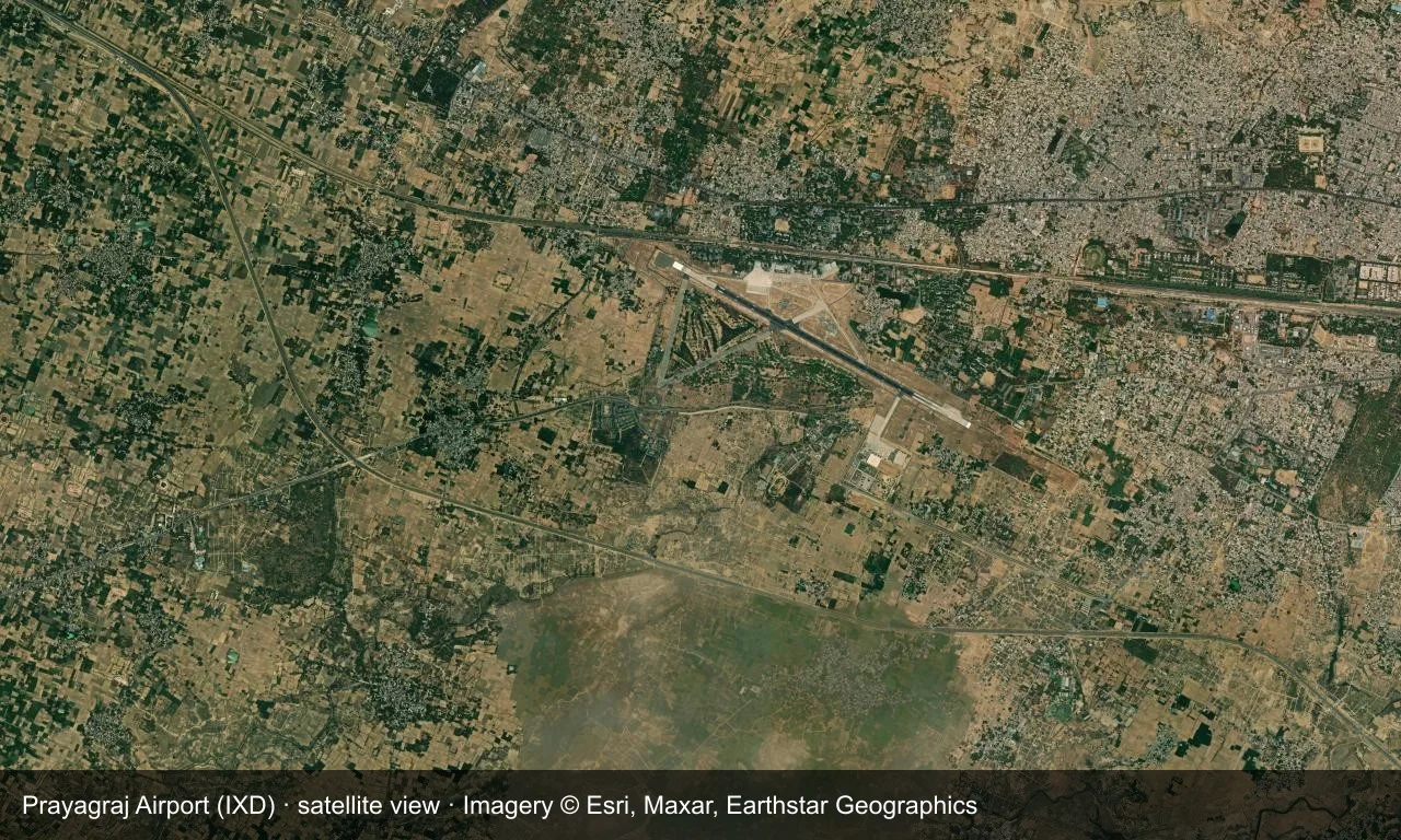
Satellite view: Prayagraj's runways lie between city and farmland on the Ganges plain, with the terminal and apron alongside the field.
The satellite image comes from Esri World Imagery (© Esri, Maxar, Earthstar Geographics); the field and attribution are labelled in the image. This is a satellite view, not a ground-level photograph.
Airport at a glance
| Item | Detail |
|---|---|
| IATA / ICAO | IXD / VIAL |
| Role | Medium-sized airport |
| Elevation | about 98 m |
| Coordinates | 25.4401, 81.7339 |
| Runways | 2, longest 2,472 m |
| Non-stop destinations | 2 (2014 snapshot, all domestic) |
| Official site | www.aai.aero/en/node/75695 |
Runways
| Runway | Length | Width | Surface |
|---|---|---|---|
| 12/30 | 2,472 m | 46 m | asphalt |
| 06/24 | 1,463 m | 46 m | concrete |
2 runways, the longest 2,472 m.
Non-stop routes
2 non-stop destinations, nearest first (OpenFlights route snapshot compiled in 2014 — confirm with the airline or airport):
| Destination | Distance | Carriers |
|---|---|---|
| Indira Gandhi International Airport (DEL) | ~575 km | Air India Limited |
| Chhatrapati Shivaji Maharaj International Airport (BOM) | ~1153 km | Air India Limited |
The carrier column comes from the same snapshot and includes codeshare and interline services; treat it as an indication of how busy the route is and check the airline for who actually flies it.
Nearby airports to compare
If the fares are close, these are the nearest airports of the same class (medium-sized airport) — straight-line distance, with their own non-stop counts from the same dataset:
| Airport | Distance | Non-stop destinations |
|---|---|---|
| Maharshi Valmiki International Airport (AYJ) | ~152 km | — |
| Agra Airport / Agra Air Force Station (AGR) | ~422 km | 2 |
Before you fly
- Prayagraj gets very busy during major festivals, with tighter security and ground traffic.
- The two destinations are a 2014 snapshot and Indian domestic networks have expanded since.
About the data
Runways, elevation and coordinates come from OurAirports open data. Routes and carriers come from the June 2014 OpenFlights snapshot and include codeshares and interline services; they indicate network shape and scale, not current schedules.
Comentarios de los lectoresDebate
Las preguntas, los relatos de viaje y las correcciones son bienvenidos. Los comentarios son públicos.
Cargando…
Cargando comentarios…