
Toronto Pearson International Airport Terminal Map
 Toronto · Canada· Toronto Pearson International Airport
Toronto Pearson International Airport (IATA: YYZ, ICAO CYYZ) is a large airport serving Toronto, Canada, with 2 terminals and 100 gates, about 22 km from central Toronto.
Toronto Pearson International Airport (YYZ) serves Toronto, Canada. It has 2 terminals with 100 gates in total and handles about 46 million passengers a year. The airport is about 22 km from the city centre. Ground transport into the city: rail, bus and taxi.
Download Airport MapsDownloads
Airport time information — YYZ current timeAirport Time
Current time at YYZ (America/Toronto) compared with your local time.
Toronto Pearson International Airport route map — direct destinationsRoute Map
145 direct destinations: map, operating airlines and distances.
Airport information & detailsAirport Details
Interactive map — Toronto Pearson International Airport locationInteractive Map
View this airport on other map services:
Toronto Pearson International Airport terminal guideAirport Guide
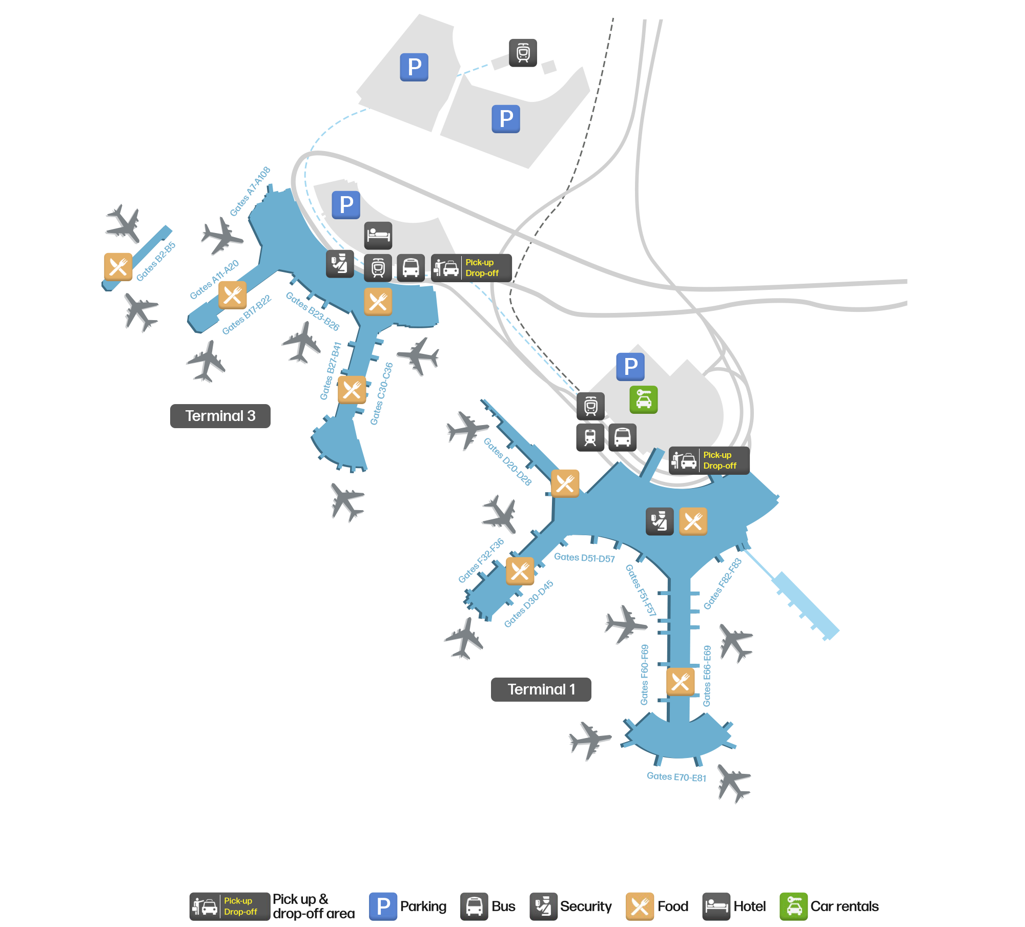
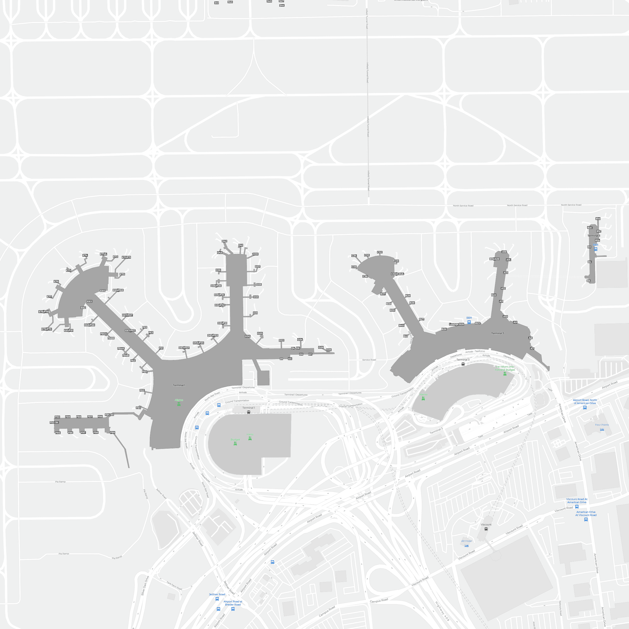
Toronto Pearson sits about 27 km from the city centre and handles around 47 million passengers a year, making it Canada's largest airport. It has only two terminals: the Air Canada and Star Alliance carriers in T1, and oneworld, SkyTeam, WestJet and others in T3 — Terminal 3 does not mean "the third", because Terminal 2 was demolished in 2007.
The two terminals
| Code | Name | Main users |
|---|---|---|
| T1 | Terminal 1 | Air Canada and Star Alliance carriers; Emirates, Etihad and others as well |
| T3 | Terminal 3 | oneworld, SkyTeam, WestJet, Air Transat and others |
Working out where you are going: go by the operating airline — the Air Canada group is in T1, and most other foreign carriers are in T3. The two buildings are not connected airside, so a transfer has to go landside.
- Terminal Link train — free, running 24 hours, every few minutes, linking T1, T3, the Sheraton hotel and the long-term car parks.
- The ride between the buildings takes only 2–3 minutes, and it is the backbone of every connection at the airport.
Our diagram draws only two buildings, T1 and T3, precisely to make the point: the Terminal 2 that older maps still show is gone.
Transfers and connections
- An Air Canada to Air Canada connection is made inside T1; oneworld and SkyTeam transfers are mostly made inside T3.
- Between T1 and T3 you must go landside — clearing immigration, collecting bags, taking the Terminal Link and then checking in and clearing security again; allow more than 3 hours.
- A cross-alliance connection is the most time-consuming kind of transfer here, so when booking, favour itineraries that stay in one building.
Routes and flights
| Aspect | Detail |
|---|---|
| Routes | Canada's largest airport, with around 180 destinations; long-haul points reach London, Tokyo, Delhi, Tel Aviv, Dubai, Hong Kong and São Paulo, alongside a dense North American network. About 22% of passengers connect here. |
| Flights | A record around 47 million passengers in 2025, on roughly 450,000 movements (about 1,200 a day). |
| Aircraft | The main base is Air Canada (Star Alliance, T1; about 240 aircraft group-wide — 787 / 777 / A330 widebodies internationally, A320 family and 737 MAX domestically), followed by WestJet (T3) and Air Transat (leisure). |
Getting into Toronto
- UP Express — about 25 minutes direct to Union Station in the city centre, every 15 minutes, and the first choice into town.
- Note: the station is in T1 only; from T3 you first take the Terminal Link to T1.
- Taxi / ride-hailing — about 27 km, 30 minutes when the roads are clear, but Highway 401 is badly congested at peak times.
- GO airport bus — links the city centre with surrounding towns, and still runs at night.
- Airport bus — covers the downtown hotel district.
Practical tips
- The two main routes into the city are the UP Express and a taxi — the train is immune to traffic, so take it when time matters.
- You can tap a contactless credit card to enter the UP Express, with no need to buy a ticket in advance.
- Winter snowstorms often cause widespread delays, so for a connection between December and February allow a more generous buffer.
Terminal guideTerminal Guide
Gate ranges, main airlines and facilities for each terminal at Toronto Pearson International Airport.