
Arctic Village Airport
 Arctic Village · Hoa Kỳ· Arctic Village Airport
Arctic Village Airport (IATA: ARC, ICAO PARC) là một sân bay trung bình phục vụ Arctic Village, Hoa Kỳ.
Arctic Village Airport is a medium-sized airport, at an elevation of about 2,092 ft, with scheduled passenger service. This page gathers its location map, airport codes and travel information.
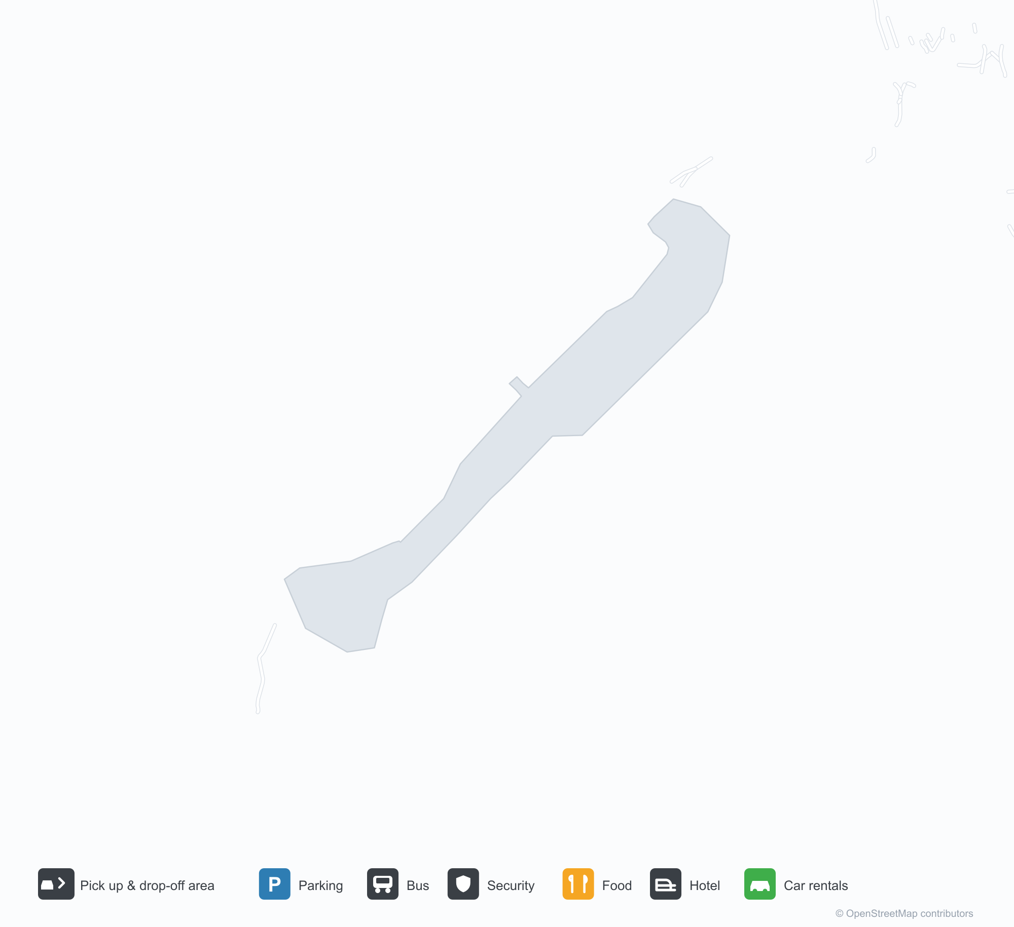
Tải bản đồ sân bayTải xuống
Ảnh sân bayẢnh sân bay
Ảnh thực tế của sân bay này, mỗi ảnh đều ghi nguồn từ trang web công khai nơi tìm thấy ảnh; bản quyền thuộc về nhiếp ảnh gia gốc. Nhấp vào ảnh để phóng to, hoặc nhấp vào dòng ghi nguồn để mở trang nguồn.
Ảnh vệ tinh: một đường băng sỏi cắt qua rừng và hồ gần Arctic Village, ngôi làng nằm ở đầu phía bắc.
Chuyến bay tại Arctic Village Airport — khởi hành & đếnBảng chuyến bay
6 số hiệu chuyến bay của 2 hãng hàng không, kết nối 2 điểm đến, phân theo chiều bay. Bao gồm số hiệu liên danh.
| Chuyến bay | Hãng hàng không | Điểm đến | Quốc gia/khu vực |
|---|---|---|---|
| 5V5041 | Everts Air | Fairbanks (FAI) Fairbanks International Airport | Hoa Kỳ |
| 5V5043 | Everts Air | Fairbanks (FAI) Fairbanks International Airport | Hoa Kỳ |
| 8V331 | Wright Air Service | VEE |
Số hiệu chuyến bay và tuyến bay từ chỉ mục chuyến bay aviability.com (ảnh chụp 26 tháng 10, 2026); bao gồm số hiệu liên danh và không hiển thị giờ khởi hành. Nguồn: aviability.com ↗
Thông tin & chi tiết sân bayChi tiết sân bay
Bản đồ tương tác — vị trí Arctic Village AirportBản đồ tương tác
Xem sân bay này trên các dịch vụ bản đồ khác:
Arctic Village Airport (ARC): A Gravel Runway Through Woods and LakesHướng dẫn sân bay
From above, a gravel runway cuts through woods and lakes, with the village at its northern end and the rivers and wetlands of interior Alaska around it. The field serves Arctic Village, Alaska, at an elevation of about 638 m, with a 1,372 m gravel runway; the 2014 snapshot records no scheduled routes.
Satellite view
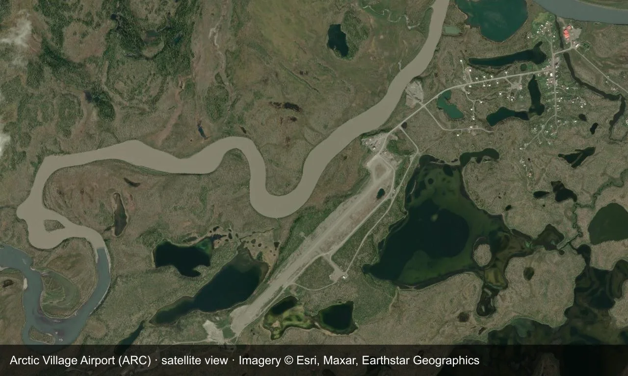
Satellite view: a gravel runway cuts through woods and lakes near Arctic Village, with the village at its northern end.
The satellite image comes from Esri World Imagery (© Esri, Maxar, Earthstar Geographics); the field and attribution are labelled in the image. This is a satellite view, not a ground-level photograph.
Airport at a glance
| Item | Detail |
|---|---|
| IATA / ICAO | ARC / PARC |
| Role | Medium-sized airport |
| Elevation | about 638 m |
| Coordinates | 68.1147, -145.5790 |
| Runways | 1, 1,372 m |
| Non-stop destinations | 0 in the 2014 snapshot |
Runways
| Runway | Length | Width | Surface |
|---|---|---|---|
| 02/20 | 1,372 m | 23 m | GVL |
1 runway, the longest 1,372 m.
Non-stop routes
The route dataset carries no scheduled non-stop services for this airport. Regional schedules change often — confirm with the airline or airport before booking.
Nearby airports to compare
If the fares are close, these are the nearest airports of the same class (medium-sized airport) — straight-line distance, with their own non-stop counts from the same dataset:
| Airport | Distance | Non-stop destinations |
|---|---|---|
| Anaktuvuk Pass Airport (AKP) | ~255 km | 1 |
| Allen Army Airfield (BIG) | ~458 km | — |
Before you fly
- There is no road link; access is mainly by small aircraft, and weather can disrupt flights, so build in a buffer.
- No scheduled routes are recorded; arrange charters or general-aviation flights directly with the operator.
About the data
Runways, elevation and coordinates come from OurAirports open data. Routes and carriers come from the June 2014 OpenFlights snapshot and include codeshares and interline services; they indicate network shape and scale, not current schedules.
History
Owned by the Venetie Tribal Government, the field has a single 1,372 m gravel runway. Nearly 90% of its 1,627 operations in 2005 were air taxis — the village's main link to the outside world.
Source: Arctic Village Airport.
Bình luận của độc giảThảo luận
Hoan nghênh mọi câu hỏi, báo cáo chuyến đi và góp ý chỉnh sửa. Bình luận được công khai.
Đang tải…
Đang tải bình luận…