
Aleppo International Airport
 Aleppo · Syria· Aleppo International Airport
Aleppo International Airport (IATA: ALP, ICAO OSAP) là một sân bay lớn phục vụ Aleppo, Syria.
Aleppo International Airport is a large airport, at an elevation of about 1,276 ft, with scheduled passenger service. This page gathers its location map, airport codes and travel information.
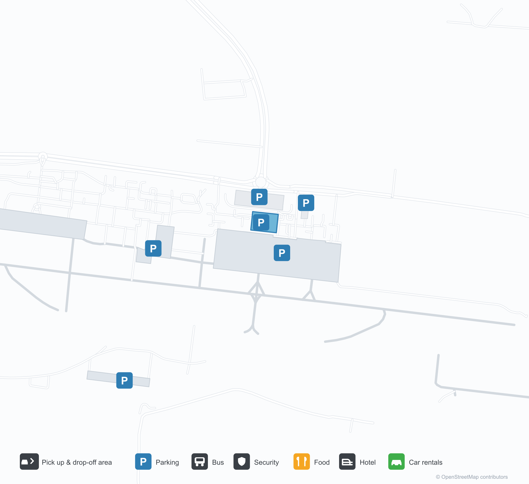
Tải bản đồ sân bayTải xuống
Ảnh sân bayẢnh sân bay
Ảnh thực tế của sân bay này, mỗi ảnh đều ghi nguồn từ trang web công khai nơi tìm thấy ảnh; bản quyền thuộc về nhiếp ảnh gia gốc. Nhấp vào ảnh để phóng to, hoặc nhấp vào dòng ghi nguồn để mở trang nguồn.
Trên ảnh vệ tinh, đường băng của Sân bay Quốc tế Aleppo (ALP) nằm giữa đất khô và vùng đất trống.
Chuyến bay tại Aleppo International Airport — khởi hành & đếnBảng chuyến bay
64 số hiệu chuyến bay của 18 hãng hàng không, kết nối 15 điểm đến, phân theo chiều bay. Bao gồm số hiệu liên danh.
| Chuyến bay | Hãng hàng không | Điểm đến | Quốc gia/khu vực |
|---|---|---|---|
| 3L457 | Air Arabia Abu Dhabi | Zayed International Airport | Các Tiểu vương quốc Ả Rập Thống nhất |
| A15633 | Apg Airlines | Bucharest Henri Coandă International Airport | Romania |
| DN552 | Dan Air | Bucharest Henri Coandă International Airport | Romania |
| EK2321 | Emirates | Sân bay Quốc tế Dubai | Các Tiểu vương quốc Ả Rập Thống nhất |
| FYC455 | Fly Cham | Yerevan (EVN) Zvartnots International Airport | Armenia |
| FYC491 | Fly Cham | Istanbul Sabiha Gökçen International Airport | Thổ Nhĩ Kỳ |
| FYC525 | Fly Cham | Arbil (EBL) Erbil International Airport | Iraq |
| FYC725 | Fly Cham | Sân bay Quốc tế Dubai | Các Tiểu vương quốc Ả Rập Thống nhất |
| FYC761 | Fly Cham | Sharjah International Airport | Các Tiểu vương quốc Ả Rập Thống nhất |
| FZ1192 | Flydubai | Sân bay Quốc tế Dubai | Các Tiểu vương quốc Ả Rập Thống nhất |
| FZ1548 | Flydubai | Sân bay Quốc tế Dubai | Các Tiểu vương quốc Ả Rập Thống nhất |
| G9352 | Air Arabia | Sharjah International Airport | Các Tiểu vương quốc Ả Rập Thống nhất |
| J9176 | Jazeera Airways | Kuwait International Airport | Kuwait |
| KK473 | Leav Aviation | Köln (Cologne) (CGN) Cologne Bonn Airport | Đức |
| PC771 | Pegasus Airlines | Istanbul Sabiha Gökçen International Airport | Thổ Nhĩ Kỳ |
| QR6116 | Qatar Airways | Amman (AMM) Queen Alia International Airport | Jordan |
| RB381 | Syrian Arab Airlines | King Abdulaziz International Airport | Ả Rập Xê Út |
| RB389 | Syrian Arab Airlines | Sân bay Quốc tế King Khalid | Ả Rập Xê Út |
| RB445 | Syrian Arab Airlines | Sân bay Istanbul | Thổ Nhĩ Kỳ |
| RJ432 | Royal Jordanian | Amman (AMM) Queen Alia International Airport | Jordan |
Số hiệu chuyến bay và tuyến bay từ chỉ mục chuyến bay aviability.com (ảnh chụp 26 tháng 10, 2026); bao gồm số hiệu liên danh và không hiển thị giờ khởi hành. Nguồn: aviability.com ↗
Thông tin & chi tiết sân bayChi tiết sân bay
Bản đồ tương tác — vị trí Aleppo International AirportBản đồ tương tác
Xem sân bay này trên các dịch vụ bản đồ khác:
Aleppo International Airport (ALP) Guide: A regional runway in contextHướng dẫn sân bay
Satellite imagery of Aleppo International Airport (ALP) in Syria shows a field surrounded by a patchwork of vegetation and open ground. At about 389 m above sea level, it has a single 2,910 m runway. The 2014 snapshot lists no scheduled destinations; Hatay Airport is 86.7 km away.
Satellite view
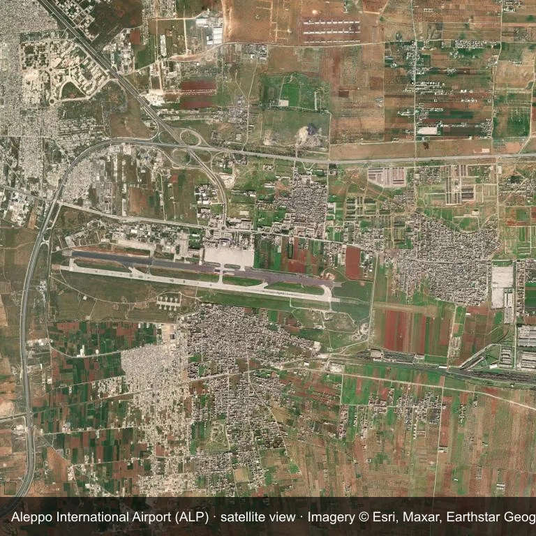
Satellite view of Aleppo International Airport (ALP), with the airfield visible among a patchwork of vegetation and open ground.
Imagery: Esri World Imagery (© Esri, Maxar, Earthstar Geographics), with attribution in the image. It shows the field from orbit, not from the ground.
Airport at a glance
| Item | Detail |
|---|---|
| IATA / ICAO | ALP / OSAP |
| Role | large airport |
| Elevation | about 389 m |
| Coordinates | 36.1813, 37.2269 |
| Runways | 1, longest 2,910 m |
| Non-stop destinations | 0 in the 2014 snapshot |
Runways
| Runway | Length | Surface |
|---|---|---|
| 09/27 | 2,910 m | ASP |
Why there is no route table
The 2014 OpenFlights snapshot contains no scheduled services for ALP. Absence from that dataset is not proof that the field is unused today; check current airport and airline information before travelling.
Nearby airports
| Airport | Distance | Non-stop destinations |
|---|---|---|
| Hatay Airport (HTY) | ~86.7 km | 8 |
| Gaziantep Oğuzeli International Airport (GZT) | ~88.1 km | 5 |
| Latakia International Airport (LTK) | ~144 km | — |
Getting there and navigating
- Coordinates: 36.1813, 37.2269
- Open in a map: Google Maps | Amap | Baidu Maps
The location map on this page places the field in relation to nearby towns and roads. Terminal connections and local transport fall outside this dataset; the airport or airline can confirm them.
Airport sketch
Aleppo International Airport occupies ground in Syria surrounded by a patchwork of vegetation and open ground. The 09/27 runway runs east–west and offers 2,910 m of asphalt; elevation is about 389 m.
The runway gives 2,910 m of asphalt, a narrowbody profile. The paved surface supports regular operations, though it does not imply scheduled service. Hatay Airport is 86.7 km away, with 8 destinations in the same snapshot.
With no routes in the 2014 data, this is not a reliable scheduled destination. Use Hatay Airport as the nearest back-up and verify access with the airport operator.
Before you fly
- The 2,910 m runway can take larger regional aircraft, but that does not guarantee scheduled service.
- The runway is paved, which supports year-round operations, but scheduled service is still not guaranteed.
- Hatay Airport is 86.7 km away with 8 destinations in the 2014 snapshot, making it the nearest alternative for a scheduled flight.
- The site has no terminal guide on this page, so allow extra time for local arrangements and onward transport.
- Treat this as a general-aviation or charter field rather than a large terminal; confirm handling and opening hours in advance.
About the data
Runways, elevation and coordinates come from OurAirports open data; routes come from the June 2014 OpenFlights snapshot. That snapshot describes network shape and scale, not current schedules.
Bình luận của độc giảThảo luận
Hoan nghênh mọi câu hỏi, báo cáo chuyến đi và góp ý chỉnh sửa. Bình luận được công khai.
Đang tải…
Đang tải bình luận…