
Aleppo International Airport
 Aleppo · シリア· Aleppo International Airport
Aleppo International Airport(IATA: ALP、ICAO: OSAP)はAleppo、シリアにある大型空港です。
Aleppo International Airport is a large airport, at an elevation of about 1,276 ft, with scheduled passenger service. This page gathers its location map, airport codes and travel information.
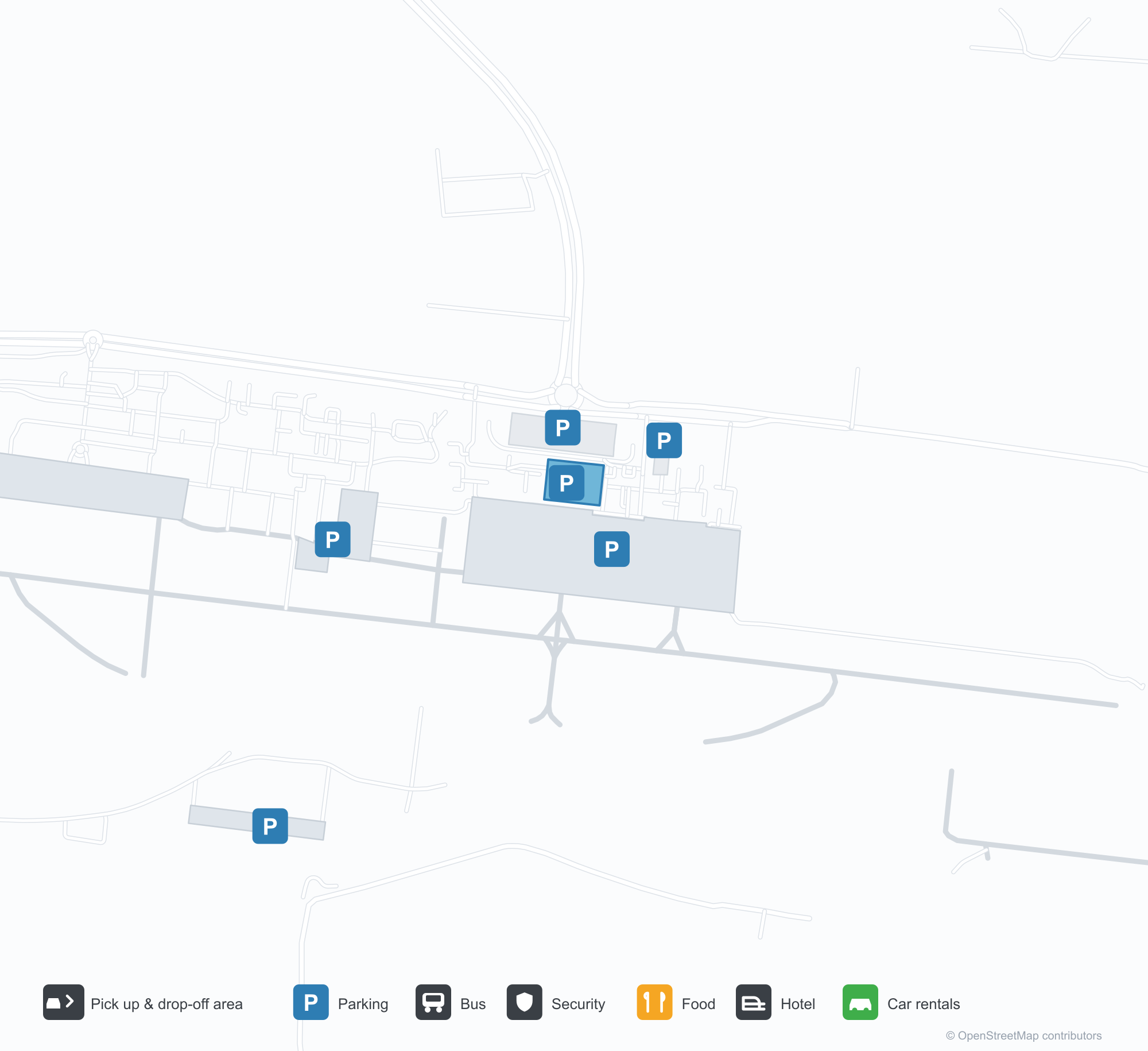
空港マップをダウンロードダウンロード
空港写真空港写真
この空港の実際の写真です。いずれも公開ウェブページを出典として明記しており、著作権は撮影者に帰属します。写真をクリックすると拡大表示され、クレジットをクリックすると元のページが開きます。
衛星画像では、アレッポ国際空港(ALP)の滑走路が乾いた土地と裸地の間に位置する。
Aleppo International Airport発着便 — 出発と到着フライトボード
便名64件、18社の航空会社、15か所の目的地を出発・到着別に掲載しています。コードシェア便も含みます。
| 便 | 航空会社 | 目的地 | 国・地域 |
|---|---|---|---|
| 3L457 | Air Arabia Abu Dhabi | Zayed International Airport | アラブ首長国連邦 |
| A15633 | Apg Airlines | Bucharest Henri Coandă International Airport | ルーマニア |
| DN552 | Dan Air | Bucharest Henri Coandă International Airport | ルーマニア |
| EK2321 | Emirates | ドバイ国際空港 | アラブ首長国連邦 |
| FYC455 | Fly Cham | エレバン (EVN) Zvartnots International Airport | アルメニア |
| FYC491 | Fly Cham | Istanbul Sabiha Gökçen International Airport | トルコ |
| FYC525 | Fly Cham | Arbil (EBL) Erbil International Airport | イラク |
| FYC725 | Fly Cham | ドバイ国際空港 | アラブ首長国連邦 |
| FYC761 | Fly Cham | Sharjah International Airport | アラブ首長国連邦 |
| FZ1192 | Flydubai | ドバイ国際空港 | アラブ首長国連邦 |
| FZ1548 | Flydubai | ドバイ国際空港 | アラブ首長国連邦 |
| G9352 | Air Arabia | Sharjah International Airport | アラブ首長国連邦 |
| J9176 | Jazeera Airways | Kuwait International Airport | クウェート |
| KK473 | Leav Aviation | ケルン (CGN) Cologne Bonn Airport | ドイツ |
| PC771 | Pegasus Airlines | Istanbul Sabiha Gökçen International Airport | トルコ |
| QR6116 | Qatar Airways | Amman (AMM) Queen Alia International Airport | ヨルダン |
| RB381 | Syrian Arab Airlines | King Abdulaziz International Airport | サウジアラビア |
| RB389 | Syrian Arab Airlines | キング・ハリド国際空港 | サウジアラビア |
| RB445 | Syrian Arab Airlines | イスタンブール空港 | トルコ |
| RJ432 | Royal Jordanian | Amman (AMM) Queen Alia International Airport | ヨルダン |
便名と路線はaviability.comのフライトインデックス(スナップショット:2026年10月26日)に基づきます。コードシェア便を含み、出発時刻は掲載していません。出典:aviability.com ↗
空港情報と詳細空港の詳細
インタラクティブマップ — Aleppo International Airportの位置インタラクティブマップ
他の地図サービスでこの空港を見る:
Aleppo International Airport (ALP) Guide: A regional runway in context空港ガイド
Satellite imagery of Aleppo International Airport (ALP) in Syria shows a field surrounded by a patchwork of vegetation and open ground. At about 389 m above sea level, it has a single 2,910 m runway. The 2014 snapshot lists no scheduled destinations; Hatay Airport is 86.7 km away.
Satellite view
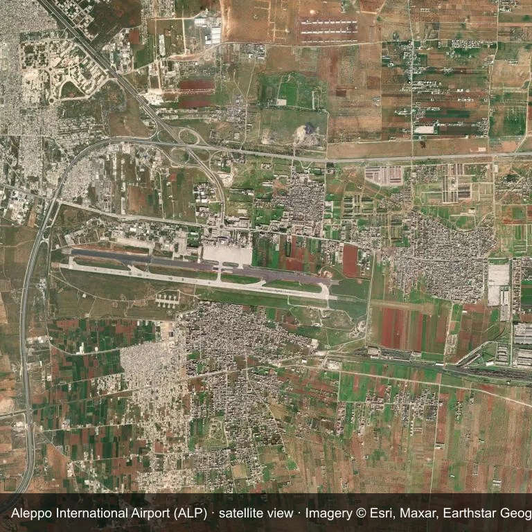
Satellite view of Aleppo International Airport (ALP), with the airfield visible among a patchwork of vegetation and open ground.
Imagery: Esri World Imagery (© Esri, Maxar, Earthstar Geographics), with attribution in the image. It shows the field from orbit, not from the ground.
Airport at a glance
| Item | Detail |
|---|---|
| IATA / ICAO | ALP / OSAP |
| Role | large airport |
| Elevation | about 389 m |
| Coordinates | 36.1813, 37.2269 |
| Runways | 1, longest 2,910 m |
| Non-stop destinations | 0 in the 2014 snapshot |
Runways
| Runway | Length | Surface |
|---|---|---|
| 09/27 | 2,910 m | ASP |
Why there is no route table
The 2014 OpenFlights snapshot contains no scheduled services for ALP. Absence from that dataset is not proof that the field is unused today; check current airport and airline information before travelling.
Nearby airports
| Airport | Distance | Non-stop destinations |
|---|---|---|
| Hatay Airport (HTY) | ~86.7 km | 8 |
| Gaziantep Oğuzeli International Airport (GZT) | ~88.1 km | 5 |
| Latakia International Airport (LTK) | ~144 km | — |
Getting there and navigating
- Coordinates: 36.1813, 37.2269
- Open in a map: Google Maps | Amap | Baidu Maps
The location map on this page places the field in relation to nearby towns and roads. Terminal connections and local transport fall outside this dataset; the airport or airline can confirm them.
Airport sketch
Aleppo International Airport occupies ground in Syria surrounded by a patchwork of vegetation and open ground. The 09/27 runway runs east–west and offers 2,910 m of asphalt; elevation is about 389 m.
The runway gives 2,910 m of asphalt, a narrowbody profile. The paved surface supports regular operations, though it does not imply scheduled service. Hatay Airport is 86.7 km away, with 8 destinations in the same snapshot.
With no routes in the 2014 data, this is not a reliable scheduled destination. Use Hatay Airport as the nearest back-up and verify access with the airport operator.
Before you fly
- The 2,910 m runway can take larger regional aircraft, but that does not guarantee scheduled service.
- The runway is paved, which supports year-round operations, but scheduled service is still not guaranteed.
- Hatay Airport is 86.7 km away with 8 destinations in the 2014 snapshot, making it the nearest alternative for a scheduled flight.
- The site has no terminal guide on this page, so allow extra time for local arrangements and onward transport.
- Treat this as a general-aviation or charter field rather than a large terminal; confirm handling and opening hours in advance.
About the data
Runways, elevation and coordinates come from OurAirports open data; routes come from the June 2014 OpenFlights snapshot. That snapshot describes network shape and scale, not current schedules.
読者コメントディスカッション
質問、旅行記、訂正など、お気軽にお寄せください。コメントは公開されます。
読み込み中…
コメントを読み込み中…