
Abraham Lincoln Capital Airport
 Springfield · ABD· Abraham Lincoln Capital Airport
Abraham Lincoln Capital Airport (IATA: SPI, ICAO KSPI), Springfield, ABD kentine hizmet veren bir orta büyüklükte havalimanıdır.
Abraham Lincoln Capital Airport is a medium-sized airport, at an elevation of about 598 ft, with scheduled passenger service. This page gathers its location map, airport codes and travel information.
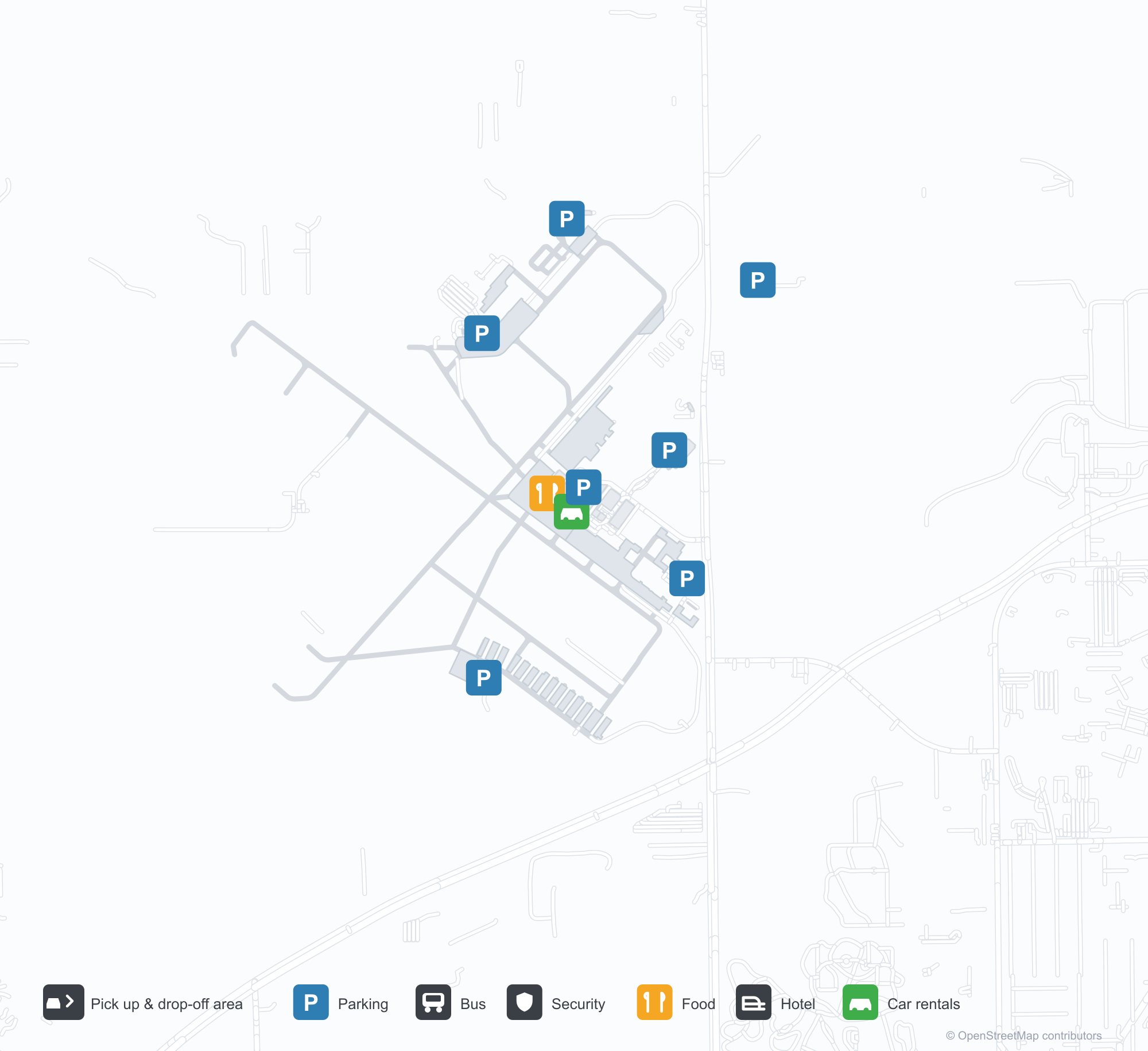
Havalimanı Haritalarını İndirinİndirmeler
Havalimanı fotoğraflarıHavalimanı Fotoğrafları
Bu havalimanının gerçek fotoğrafları; her fotoğrafın altında, fotoğrafın bulunduğu kamuya açık web sayfasına bir atıf yer alır ve telif hakkı özgün fotoğrafçılarda kalır. Yakınlaştırmak için bir fotoğrafa, kaynak sayfasını açmak için bir atıf satırına tıklayın.
Abraham Lincoln Capital Havalimanı'nın giriş anıtı — taşa oyulmuş tam ad ve "AT SPRINGFIELD" yazısı.
Springfield apronsunda bir C-47 nakliye uçağı; pervaneleri ve askeri işaretleri net görünüyor.
Abraham Lincoln Capital Airport uçuşları — kalkışlar ve varışlarUçuş Panosu
84 uçuş numarası, 5 havayolu şirketi ve 3 varış noktası, yönlere göre ayrılmıştır. Ortak uçuş numaraları dahildir.
| Uçuş | Havayolu şirketi | Varış noktası | Ülke/bölge |
|---|---|---|---|
| AA3845 | American Airlines | O'Hare Uluslararası Havalimanı | ABD |
| AA4313 | American Airlines | O'Hare Uluslararası Havalimanı | ABD |
| AA4330 | American Airlines | O'Hare Uluslararası Havalimanı | ABD |
| AA4332 | American Airlines | O'Hare Uluslararası Havalimanı | ABD |
| BA1657 | British Airways | O'Hare Uluslararası Havalimanı | ABD |
| BA4706 | British Airways | O'Hare Uluslararası Havalimanı | ABD |
| G4860 | Allegiant Air | Punta Gorda (PGD) Punta Gorda Airport | ABD |
| G4870 | Allegiant Air | Punta Gorda (PGD) Punta Gorda Airport | ABD |
| G4871 | Allegiant Air | Punta Gorda (PGD) Punta Gorda Airport | ABD |
| G4881 | Allegiant Air | Punta Gorda (PGD) Punta Gorda Airport | ABD |
| G4883 | Allegiant Air | Punta Gorda (PGD) Punta Gorda Airport | ABD |
| G4887 | Allegiant Air | Punta Gorda (PGD) Punta Gorda Airport | ABD |
| G4900 | Allegiant Air | Punta Gorda (PGD) Punta Gorda Airport | ABD |
| G4914 | Allegiant Air | Punta Gorda (PGD) Punta Gorda Airport | ABD |
| G4917 | Allegiant Air | Punta Gorda (PGD) Punta Gorda Airport | ABD |
| G4927 | Allegiant Air | Punta Gorda (PGD) Punta Gorda Airport | ABD |
| G4928 | Allegiant Air | Punta Gorda (PGD) Punta Gorda Airport | ABD |
| G4938 | Allegiant Air | Punta Gorda (PGD) Punta Gorda Airport | ABD |
| G4943 | Allegiant Air | Punta Gorda (PGD) Punta Gorda Airport | ABD |
| G4947 | Allegiant Air | Punta Gorda (PGD) Punta Gorda Airport | ABD |
Uçuş numaraları ve rotalar aviability.com uçuş dizininden (anlık görüntü: 26 Ekim 2026); ortak uçuş numaraları dahildir ve kalkış saatleri gösterilmez. Kaynak: aviability.com ↗
Havalimanı bilgileri ve ayrıntılarıHavalimanı Ayrıntıları
Etkileşimli harita — Abraham Lincoln Capital Airport konumuEtkileşimli Harita
Bu havalimanını diğer harita hizmetlerinde görüntüleyin:
Springfield Airport (SPI): Three Runways and a Gap in the Route DataHavalimanı Rehberi
Both photos of Abraham Lincoln Capital Airport (IATA SPI, ICAO KSPI) feel historical. One shows the entrance monument carved with "ABRAHAM LINCOLN CAPITAL AIRPORT" and "AT SPRINGFIELD". The other shows a C-47 transport on the apron, propellers and military markings clearly visible. They establish a real airfield with a real identity — yet the 2014 OpenFlights snapshot records no scheduled non-stop routes at all.
The field serves Springfield, Illinois, at an elevation of about 182 m, with three runways: 04/22 at 2,439 m, 13/31 at 2,255 m and 18/36 at 1,615 m.
Airport photos
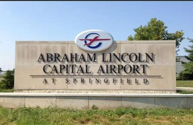
The entrance monument at Abraham Lincoln Capital Airport — the full name and "AT SPRINGFIELD" carved into the stone.
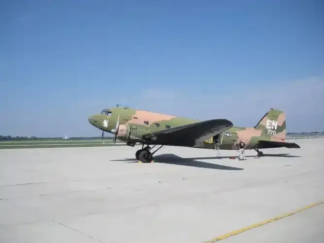
A C-47 transport on the Springfield apron, its propellers and military markings clearly visible.
The photos come from public web sources and remain the copyright of their photographers; full credits and source links sit in the photo gallery on this page.
Airport at a glance
| Item | Detail |
|---|---|
| IATA / ICAO | SPI / KSPI |
| Role | Medium-sized airport and regional field for the Illinois capital |
| Elevation | about 182 m |
| Coordinates | 39.8441, -89.6779 |
| Runways | 3: 04/22 at 2,439 m, 13/31 at 2,255 m, 18/36 at 1,615 m |
| Non-stop destinations | 0 in the 2014 snapshot (not proof that none operate today) |
| Official site | flyspi.com |
Why there is no route table
OpenFlights' 2014 snapshot did not capture SPI's scheduled routes, but the entrance monument and the C-47 show the field is not idle. Regional schedules may be operated by regional carriers, charters or seasonal services, or may simply fall outside the dataset. "Not recorded" is not "no aircraft".
So this page lists no route table and does not guess destinations. To find out what operates today, check the regional airlines' websites or contact the airport directly. Of the three runways, 04/22 and 13/31 are long enough for the regional airliners typically seen at a field this size; 18/36 is shorter.
Getting there and navigating
- Coordinates: 39.8441, -89.6779
- Official site: flyspi.com
- Open in a map: Google Maps | Amap | Baidu Maps
In the comparison table, Arkansas International (BYH, about 432 km) has no comparable data, while Appleton (ATW, about 500 km) has 7 destinations and is the more usable nearby alternative. If no SPI flight turns up, use the search box at the top of the page to compare ATW and other Midwestern airports.
The location map on this page shows the field against Springfield and the surrounding highways. Terminal connections and local transport fall outside this dataset; the airport or airline can confirm them.
Before you fly
- With scheduled data missing, confirm with the airline that the flight is operating after booking; do not rely on an aggregator's display alone.
- Three runways make this a substantial field, and 90 minutes before departure is usually enough. For a connection, include the road time towards Chicago or St. Louis.
- The C-47 in the photo is a historical or display aircraft, not today's scheduled equipment. If you plan to photograph, confirm the airport's spotting rules first.
About the data
Runways, elevation and coordinates come from OurAirports open data. Route data comes from the June 2014 OpenFlights snapshot, in which SPI has no scheduled routes recorded. Photos are from public web sources and remain the copyright of their photographers.
History
Owned by the Springfield Airport Authority, the field hosts the Illinois Air National Guard's 183d Fighter Wing at Capital Airport Air National Guard Station, a 91-acre enclave.
Source: Abraham Lincoln Capital Airport.
Okuyucu yorumlarıTartışma
Sorular, seyahat deneyimleri ve düzeltmeler memnuniyetle karşılanır. Yorumlar herkese açıktır.
Yükleniyor…
Yorumlar yükleniyor…