
A.N.R. Robinson International Airport
 Scarborough · ตรินิแดดและโตเบโก· A.N.R. Robinson International Airport
A.N.R. Robinson International Airport (IATA: TAB, ICAO TTCP) เป็นสนามบินขนาดใหญ่ที่ให้บริการScarborough, ตรินิแดดและโตเบโก
A.N.R. Robinson International Airport is a large airport, at an elevation of about 38 ft, with scheduled passenger service. This page gathers its location map, airport codes and travel information.
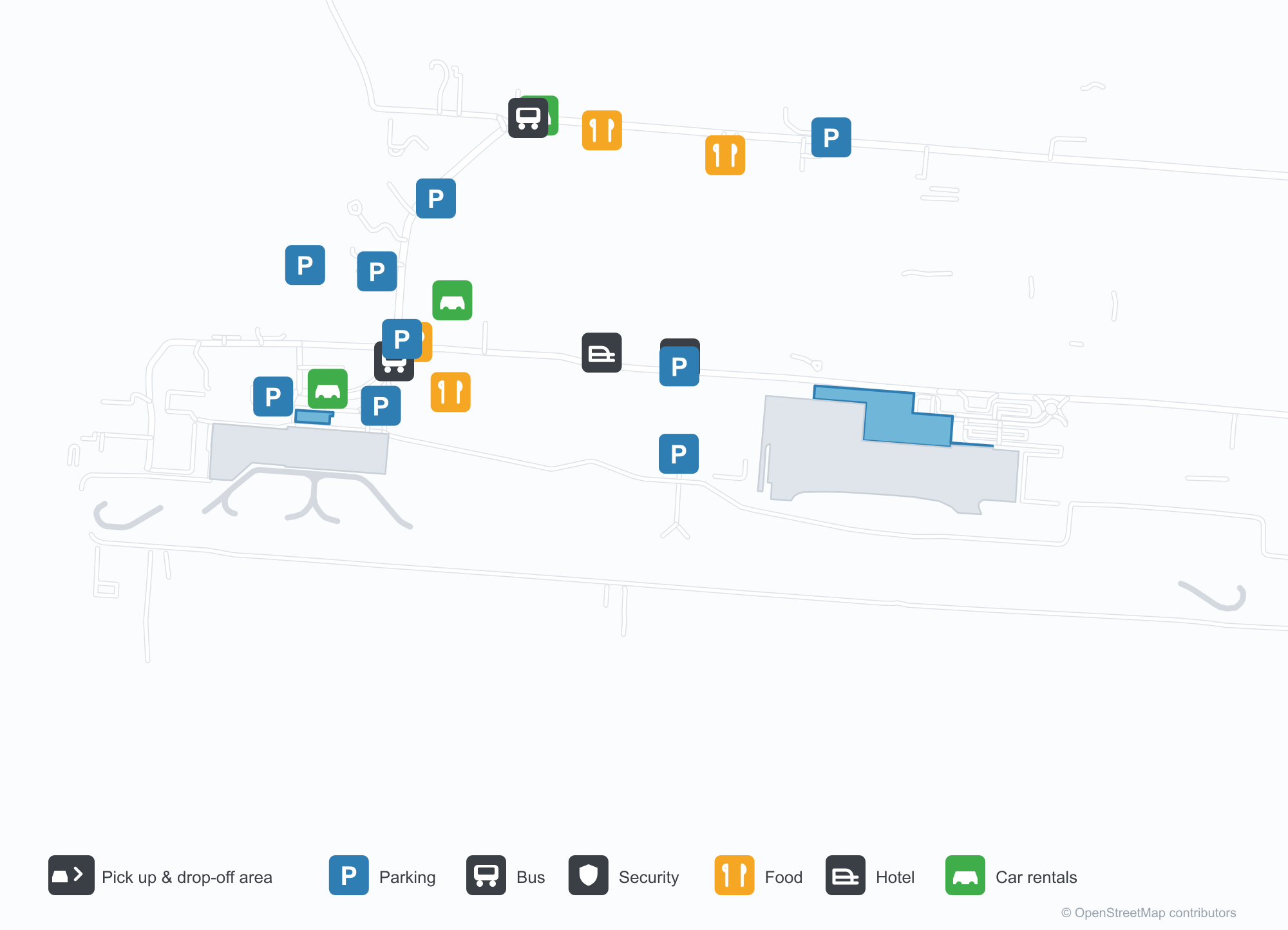
ดาวน์โหลดแผนที่สนามบินดาวน์โหลด
ภาพสนามบินภาพสนามบิน
ภาพจริงของสนามบินแห่งนี้ พร้อมเครดิตของหน้าเว็บสาธารณะที่พบภาพ; ลิขสิทธิ์ยังเป็นของผู้ถ่ายภาพต้นฉบับ คลิกที่ภาพเพื่อขยาย หรือคลิกบรรทัดเครดิตเพื่อเปิดหน้าแหล่งที่มา
ภาพถ่ายดาวเทียม: ทางวิ่งของสการ์โบโรอยู่ข้างชายฝั่งโตเบโก โดยมีอาคารผู้โดยสารและลานจอดอยู่เคียงข้าง พร้อมชายหาดและเนินเขาสีเขียวรอบ ๆ
อาคารผู้โดยสารทันสมัยหลังคาเป็นลูกคลื่นและผนังกระจกมีชื่อเต็มของสนามบินเป็นตัวอักษรสีแดงเหนือลานคอนกรีตที่ว่างเปล่า
ทางวิ่งตรงแนบชายฝั่ง น้ำสีเทอร์ควอยซ์ซัดเข้าหาด ขณะที่รีสอร์ตหลังคาแดงและตัวเมืองแผ่ไปตามแนวชายฝั่ง
ป้ายสีฟ้าตั้งอยู่ข้างช่องทางเข้า เต็นท์สีขาวเรียงตามเสาของด้านหน้าอาคารผู้โดยสาร และเมฆสีเทาต่ำลอยอยู่เหนือหลังคา
แถวที่นั่งสีน้ำเงินเข้มหันหน้าไปทางหน้าต่างสูงจรดเพดานของเลานจ์ขาออก ซึ่งเพดานไม้เรืองแสงโทนอุ่นในแสงยามบ่าย
เครื่องบินเจ็ต Caribbean Airlines แล่นผ่านคันดินหญ้าที่ประดับไฟสีส้ม โดยมีแถวอาคารอยู่ในระยะไกลสีเทา
ภายในโถงเช็คอินเก่า เสาคอนกรีตตั้งขึ้นเหนือเคาน์เตอร์สีม่วงมีหมายเลข แผงกั้นเชือกสีแดงก่อเป็นช่องคิว และคู่รักคู่หนึ่งรออยู่บนม้านั่ง
หลังมืด ป้ายเรืองแสงของอาคารผู้โดยสารส่องสว่างหลังคากันแดดโค้งเหนือช่องจอดส่งผู้โดยสาร ซึ่งมีรถยนต์คันหนึ่งรออยู่ข้างเสาลายทางแดงขาว
แผนที่เส้นทาง A.N.R. Robinson International Airport — จุดหมายบินตรงแผนที่เส้นทาง
4 จุดหมายบินตรง: แผนที่ สายการบินที่ให้บริการ และระยะทาง
เที่ยวบินของA.N.R. Robinson International Airport — ขาออกและขาเข้าป้ายเที่ยวบิน
84 หมายเลขเที่ยวบิน ครอบคลุม 3 สายการบิน และ 5 จุดหมายปลายทาง แยกตามทิศทาง หมายเลขเที่ยวบินร่วม (codeshare) รวมอยู่ด้วย
| เที่ยวบิน | สายการบิน | จุดหมายปลายทาง | ประเทศ/ภูมิภาค |
|---|---|---|---|
| BA2152 | British Airways | Bridgetown (BGI) Grantley Adams International Airport | บาร์เบโดส |
| BW212 | Caribbean Airlines | Bridgetown (BGI) Grantley Adams International Airport | บาร์เบโดส |
| BW213 | Caribbean Airlines | Port of Spain (POS) Piarco International Airport | ตรินิแดดและโตเบโก |
| BW422 | Caribbean Airlines | ท่าอากาศยานนานาชาติจอห์น เอฟ. เคนเนดี | สหรัฐอเมริกา |
| BW423 | Caribbean Airlines | Port of Spain (POS) Piarco International Airport | ตรินิแดดและโตเบโก |
| BW614 | Caribbean Airlines | ท่าอากาศยานนานาชาติโทรอนโตเพียร์สัน | แคนาดา |
| BW615 | Caribbean Airlines | Port of Spain (POS) Piarco International Airport | ตรินิแดดและโตเบโก |
| BW1501 | Caribbean Airlines | Port of Spain (POS) Piarco International Airport | ตรินิแดดและโตเบโก |
| BW1503 | Caribbean Airlines | Port of Spain (POS) Piarco International Airport | ตรินิแดดและโตเบโก |
| BW1505 | Caribbean Airlines | Port of Spain (POS) Piarco International Airport | ตรินิแดดและโตเบโก |
| BW1507 | Caribbean Airlines | Port of Spain (POS) Piarco International Airport | ตรินิแดดและโตเบโก |
| BW1509 | Caribbean Airlines | Port of Spain (POS) Piarco International Airport | ตรินิแดดและโตเบโก |
| BW1511 | Caribbean Airlines | Port of Spain (POS) Piarco International Airport | ตรินิแดดและโตเบโก |
| BW1513 | Caribbean Airlines | Port of Spain (POS) Piarco International Airport | ตรินิแดดและโตเบโก |
| BW1515 | Caribbean Airlines | Port of Spain (POS) Piarco International Airport | ตรินิแดดและโตเบโก |
| BW1517 | Caribbean Airlines | Port of Spain (POS) Piarco International Airport | ตรินิแดดและโตเบโก |
| BW1519 | Caribbean Airlines | Port of Spain (POS) Piarco International Airport | ตรินิแดดและโตเบโก |
| BW1521 | Caribbean Airlines | Port of Spain (POS) Piarco International Airport | ตรินิแดดและโตเบโก |
| BW1523 | Caribbean Airlines | Port of Spain (POS) Piarco International Airport | ตรินิแดดและโตเบโก |
| BW1525 | Caribbean Airlines | Port of Spain (POS) Piarco International Airport | ตรินิแดดและโตเบโก |
หมายเลขเที่ยวบินและเส้นทางจากดัชนีเที่ยวบิน aviability.com (ข้อมูล ณ วันที่ 26 ตุลาคม 2569); รวมหมายเลขเที่ยวบินร่วมและไม่แสดงเวลาเดินทาง ที่มา: aviability.com ↗
ข้อมูลและรายละเอียดสนามบินรายละเอียดสนามบิน
แผนที่อินเทอร์แอกทีฟ — ตำแหน่ง A.N.R. Robinson International Airportแผนที่อินเทอร์แอกทีฟ
ดูสนามบินนี้บนบริการแผนที่อื่น:
Scarborough Airport (TAB): Four Routes on Tobagoคู่มือสนามบิน
Seen from above, Scarborough's runway lies beside the Tobago coast, with the terminal and apron alongside it and beach and green hills around. The airport serves Scarborough, Trinidad and Tobago, at an elevation of about 12 m, with a 2,744 m runway; the 2014 snapshot records 4 destinations, 1 domestic and 3 international, from Port of Spain at 83 km to New York JFK at 3,516 km.
Satellite view
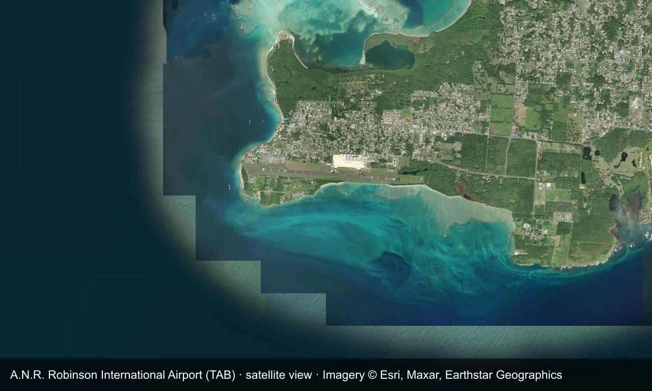
Satellite view: Scarborough's runway lies beside the Tobago coast, with the terminal and apron alongside it and beach and green hills around.
The satellite image comes from Esri World Imagery (© Esri, Maxar, Earthstar Geographics); the field and attribution are labelled in the image. This is a satellite view, not a ground-level photograph.
Airport at a glance
| Item | Detail |
|---|---|
| IATA / ICAO | TAB / TTCP |
| Role | Large airport |
| Elevation | about 12 m |
| Coordinates | 11.1496, -60.8313 |
| Runways | 1, 2,744 m |
| Non-stop destinations | 4 (1 domestic, 3 international; 2014 snapshot) |
| Official site | tntairports.com/anr-robinson-international-airport/# |
Runways
| Runway | Length | Width | Surface |
|---|---|---|---|
| 11/29 | 2,744 m | 48 m | asphalt |
1 runway, the longest 2,744 m.
Non-stop routes
4 non-stop destinations, nearest first (OpenFlights route snapshot compiled in 2014 — confirm with the airline or airport):
| Destination | Distance | Carriers |
|---|---|---|
| Piarco International Airport (POS) | ~83 km | Caribbean Airlines |
| Grantley Adams International Airport (BGI) | ~259 km | Condor Flugdienst |
| V. C. Bird International Airport (ANU) | ~674 km | British Airways |
| John F. Kennedy International Airport (JFK) | ~3516 km | Caribbean Airlines |
The carrier column comes from the same snapshot and includes codeshare and interline services; treat it as an indication of how busy the route is and check the airline for who actually flies it.
Nearby airports to compare
If the fares are close, these are the nearest airports of the same class (large airport) — straight-line distance, with their own non-stop counts from the same dataset:
| Airport | Distance | Non-stop destinations |
|---|---|---|
| Argyle International Airport (SVD) | ~226 km | 4 |
| Arturo Michelena International Airport (VLN) | ~783 km | 6 |
Before you fly
- Inter-island flights enforce strict baggage limits; Port of Spain has the most frequent service.
- The four destinations are a 2014 snapshot and Caribbean schedules have changed.
About the data
Runways, elevation and coordinates come from OurAirports open data. Routes and carriers come from the June 2014 OpenFlights snapshot and include codeshares and interline services; they indicate network shape and scale, not current schedules.
ความคิดเห็นจากผู้อ่านการสนทนา
ยินดีรับคำถาม รายงานการเดินทาง และการแก้ไข ความคิดเห็นเป็นสาธารณะ
กำลังโหลด…
กำลังโหลดความคิดเห็น…