
Argyle International Airport
 Kingstown · เซนต์วินเซนต์และเกรนาดีนส์· Argyle International Airport
Argyle International Airport (IATA: SVD, ICAO TVSA) เป็นสนามบินขนาดใหญ่ที่ให้บริการKingstown, เซนต์วินเซนต์และเกรนาดีนส์
Argyle International Airport is a large airport, at an elevation of about 136 ft, with scheduled passenger service. This page gathers its location map, airport codes and travel information.
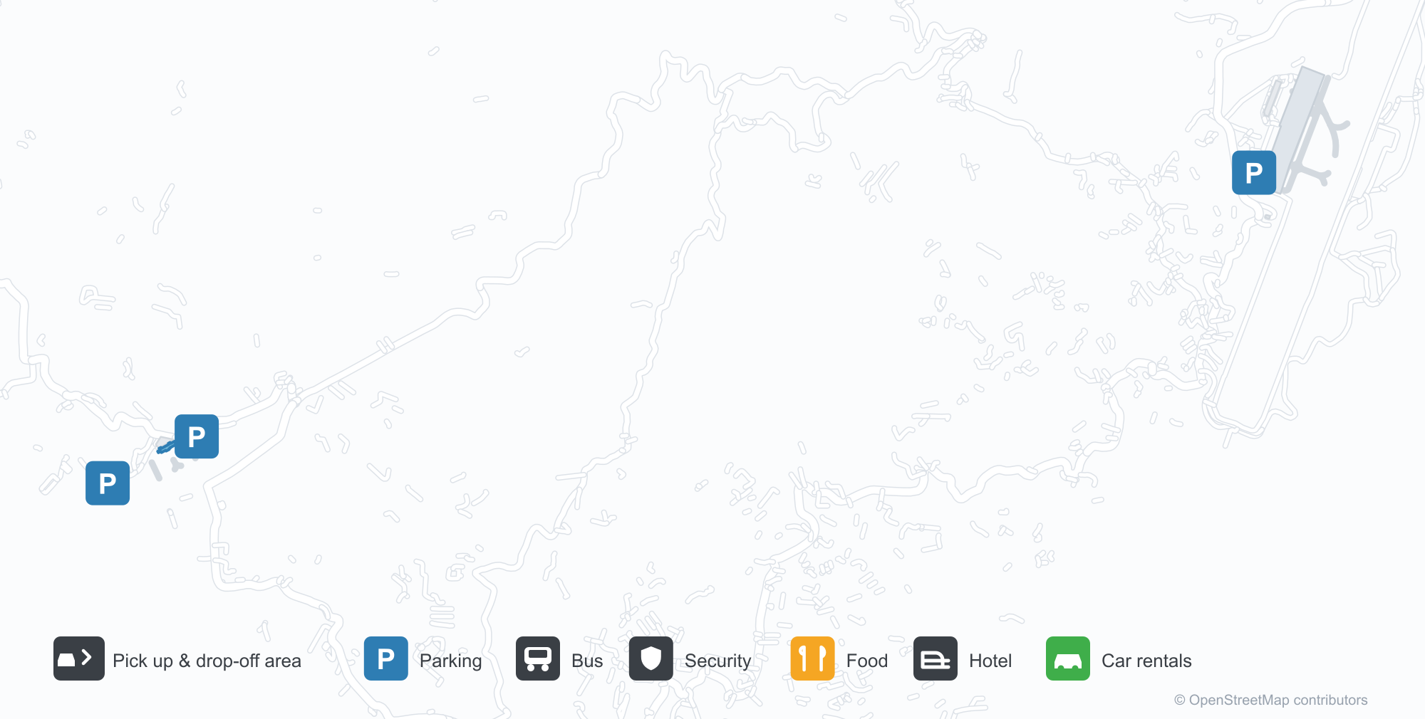
ดาวน์โหลดแผนที่สนามบินดาวน์โหลด
ภาพสนามบินภาพสนามบิน
ภาพจริงของสนามบินแห่งนี้ พร้อมเครดิตของหน้าเว็บสาธารณะที่พบภาพ; ลิขสิทธิ์ยังเป็นของผู้ถ่ายภาพต้นฉบับ คลิกที่ภาพเพื่อขยาย หรือคลิกบรรทัดเครดิตเพื่อเปิดหน้าแหล่งที่มา
อาร์ไกล์หลังฝน — อากาศยาน LIAT หน้าอาคารผู้โดยสารหลังคาโค้งสีฟ้า ลานจอดเปียกสะท้อนท้องฟ้า เนินเขาซ้อนชั้นใต้เมฆ
อาคารผู้โดยสารสีฟ้าและเขียวสดใสมีชื่อสนามบินเหนือลานจอดรถที่เต็ม โดยมีแถบทะเลลึกอยู่ด้านหลัง
มองจากที่สูง ลานจอดกว้างแผ่ข้างอาคารผู้โดยสารหลังคาสีฟ้า ซึ่งมีเครื่องบินเบาหลายลำจอดอยู่และทางวิ่งทอดไปตามชายฝั่ง
เครื่องบินเจ็ต Virgin Atlantic, British Airways, jetBlue และ Air Canada เรียงที่สะพานเชื่อมของอาคารผู้โดยสารหลังคาสีฟ้าโดยมีเนินเขาที่เต็มไปด้วยป่าอยู่ด้านหลัง
เครื่องบินแอร์บัส A330-300 จอดอยู่ที่ประตูโดยต่อสะพานเชื่อม เจ้าหน้าที่ภาคพื้นทำงานใต้ลำตัวและเนินเขาสีเขียวอยู่ไกลออกไป
ด้านหน้ากระจกโค้งของอาคารผู้โดยสารมีชื่อสนามบินเป็นตัวอักษรสีฟ้าเหนือลานจอดสีอ่อนว่างเปล่าภายใต้ท้องฟ้าเต็มไปด้วยเมฆ
ภาพถ่ายทางอากาศแสดงทางวิ่งสีดำใหม่ที่ปูข้ามงานดินดิบ โดยมีทุ่งสีเขียวและคลื่นสีขาวโอบชายฝั่งโดยรอบ
ยามพลบค่ำ เครื่องบินใบพัดลำเล็กรออยู่บนลานจอด ขณะที่ผู้โดยสารพร้อมสัมภาระเดินระหว่างกรวยไปยังอาคารผู้โดยสารใต้ท้องฟ้าแต้มสีชมพู
แผนที่เส้นทาง Argyle International Airport — จุดหมายบินตรงแผนที่เส้นทาง
4 จุดหมายบินตรง: แผนที่ สายการบินที่ให้บริการ และระยะทาง
เที่ยวบินของArgyle International Airport — ขาออกและขาเข้าป้ายเที่ยวบิน
88 หมายเลขเที่ยวบิน ครอบคลุม 13 สายการบิน และ 13 จุดหมายปลายทาง แยกตามทิศทาง หมายเลขเที่ยวบินร่วม (codeshare) รวมอยู่ด้วย
| เที่ยวบิน | สายการบิน | จุดหมายปลายทาง | ประเทศ/ภูมิภาค |
|---|---|---|---|
| 5L307 | Liat 2020 | Castries (SLU) George F. L. Charles Airport | เซนต์ลูเซีย |
| 5L308 | Liat 2020 | Osbourn (ANU) V. C. Bird International Airport | แอนติกาและบาร์บูดา |
| 5L311 | Liat 2020 | Port of Spain (POS) Piarco International Airport | ตรินิแดดและโตเบโก |
| 5L321 | Liat 2020 | Osbourn (ANU) V. C. Bird International Airport | แอนติกาและบาร์บูดา |
| 5L340 | Liat 2020 | Osbourn (ANU) V. C. Bird International Airport | แอนติกาและบาร์บูดา |
| 5L365 | Liat 2020 | Bridgetown (BGI) Grantley Adams International Airport | บาร์เบโดส |
| 5L380 | Liat 2020 | Castries (SLU) George F. L. Charles Airport | เซนต์ลูเซีย |
| 5L385 | Liat 2020 | Bridgetown (BGI) Grantley Adams International Airport | บาร์เบโดส |
| 5L390 | Liat 2020 | Castries (SLU) George F. L. Charles Airport | เซนต์ลูเซีย |
| 5L392 | Liat 2020 | Port of Spain (POS) Piarco International Airport | ตรินิแดดและโตเบโก |
| AA831 | American Airlines | Charlotte Douglas International Airport | สหรัฐอเมริกา |
| AA878 | American Airlines | Charlotte Douglas International Airport | สหรัฐอเมริกา |
| AA909 | American Airlines | ท่าอากาศยานนานาชาติไมแอมี | สหรัฐอเมริกา |
| AA1324 | American Airlines | Charlotte Douglas International Airport | สหรัฐอเมริกา |
| AA1440 | American Airlines | Charlotte Douglas International Airport | สหรัฐอเมริกา |
| AA2490 | American Airlines | Charlotte Douglas International Airport | สหรัฐอเมริกา |
| AA2587 | American Airlines | ท่าอากาศยานนานาชาติจอห์น เอฟ. เคนเนดี | สหรัฐอเมริกา |
| AA3098 | American Airlines | ท่าอากาศยานนานาชาติไมแอมี | สหรัฐอเมริกา |
| AC1869 | Air Canada | ท่าอากาศยานนานาชาติโทรอนโตเพียร์สัน | แคนาดา |
| B61640 | Jetblue Airways | ท่าอากาศยานนานาชาติจอห์น เอฟ. เคนเนดี | สหรัฐอเมริกา |
หมายเลขเที่ยวบินและเส้นทางจากดัชนีเที่ยวบิน aviability.com (ข้อมูล ณ วันที่ 26 ตุลาคม 2569); รวมหมายเลขเที่ยวบินร่วมและไม่แสดงเวลาเดินทาง ที่มา: aviability.com ↗
ข้อมูลและรายละเอียดสนามบินรายละเอียดสนามบิน
แผนที่อินเทอร์แอกทีฟ — ตำแหน่ง Argyle International Airportแผนที่อินเทอร์แอกทีฟ
ดูสนามบินนี้บนบริการแผนที่อื่น:
Kingstown Argyle Airport (SVD): A Blue Vault and Four Caribbean Routesคู่มือสนามบิน
After rain at Argyle International, a LIAT aircraft stands before the blue vaulted terminal, the wet apron reflecting the sky and layered hills under cloud. The airport serves Kingstown, Saint Vincent and the Grenadines, at an elevation of about 41 m, with a 2,743 m runway; the 2014 snapshot records four international destinations, from Saint Lucia at 97 km to Port of Spain at 286 km.
Airport photos

Argyle International after rain — a LIAT aircraft before the blue-vaulted terminal, the wet apron mirroring the sky, hills layered under cloud.
The photos come from public web sources and remain the copyright of their photographers; full credits and source links sit in the photo gallery on this page.
Airport at a glance
| Item | Detail |
|---|---|
| IATA / ICAO | SVD / TVSA |
| Role | Large airport |
| Elevation | about 41 m |
| Coordinates | 13.1597, -61.1488 |
| Runways | 1, 2,743 m |
| Non-stop destinations | 4 (2014 snapshot, all international) |
| Official site | www.svgiadc.com |
Runways
| Runway | Length | Width | Surface |
|---|---|---|---|
| 04/22 | 2,743 m | 45 m | asphalt |
1 runway, the longest 2,743 m.
Non-stop routes
4 non-stop destinations, nearest first (OpenFlights route snapshot compiled in 2014 — confirm with the airline or airport):
| Destination | Distance | Carriers |
|---|---|---|
| George F. L. Charles Airport (SLU) | ~97 km | Leeward Islands Air Transport |
| Maurice Bishop International Airport (GND) | ~146 km | Leeward Islands Air Transport |
| Grantley Adams International Airport (BGI) | ~180 km | Leeward Islands Air Transport |
| Piarco International Airport (POS) | ~286 km | Leeward Islands Air Transport |
The carrier column comes from the same snapshot and includes codeshare and interline services; treat it as an indication of how busy the route is and check the airline for who actually flies it.
Nearby airports to compare
If the fares are close, these are the nearest airports of the same class (large airport) — straight-line distance, with their own non-stop counts from the same dataset:
| Airport | Distance | Non-stop destinations |
|---|---|---|
| A.N.R. Robinson International Airport (TAB) | ~226 km | 4 |
| Arturo Michelena International Airport (VLN) | ~811 km | 6 |
Before you fly
- With four Caribbean routes, allow about 2 hours; inter-island flights enforce strict baggage limits.
- The LIAT network in the 2014 snapshot has changed since; confirm the airline and schedule when booking.
About the data
Runways, elevation and coordinates come from OurAirports open data. Routes and carriers come from the June 2014 OpenFlights snapshot and include codeshares and interline services; they indicate network shape and scale, not current schedules.
ความคิดเห็นจากผู้อ่านการสนทนา
ยินดีรับคำถาม รายงานการเดินทาง และการแก้ไข ความคิดเห็นเป็นสาธารณะ
กำลังโหลด…
กำลังโหลดความคิดเห็น…