
Adisoemarmo International Airport
 Surakarta · อินโดนีเซีย· Adisoemarmo International Airport
Adisoemarmo International Airport (IATA: SOC, ICAO WARQ) เป็นสนามบินขนาดใหญ่ที่ให้บริการSurakarta, อินโดนีเซีย
Adisoemarmo International Airport is a large airport, at an elevation of about 421 ft, with scheduled passenger service. This page gathers its location map, airport codes and travel information.
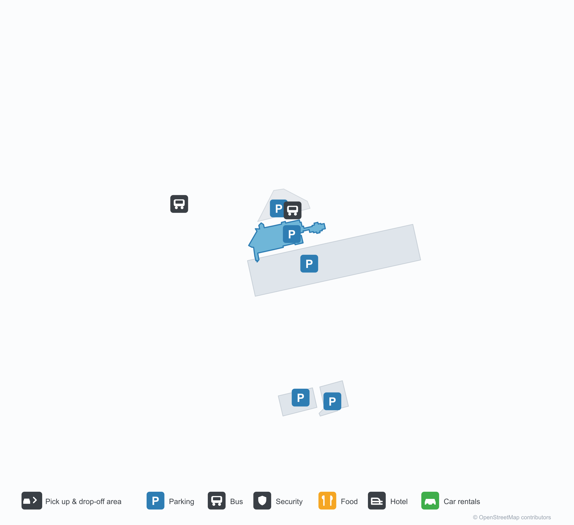
ดาวน์โหลดแผนที่สนามบินดาวน์โหลด
ภาพสนามบินภาพสนามบิน
ภาพจริงของสนามบินแห่งนี้ พร้อมเครดิตของหน้าเว็บสาธารณะที่พบภาพ; ลิขสิทธิ์ยังเป็นของผู้ถ่ายภาพต้นฉบับ คลิกที่ภาพเพื่อขยาย หรือคลิกบรรทัดเครดิตเพื่อเปิดหน้าแหล่งที่มา
ด้านหน้าอาคารผู้โดยสาร — ข้อความ 'ADI SOEMARMO AIRPORT' ใต้หลังคากระเบื้องแดง มีเสาธงและรั้วเรียงเป็นแถวเรียบ
ถนนทางเข้าตรงที่มีลูกศรสีขาวและทางม้าลายนำไปสู่อาคารผู้โดยสาร มีต้นปาล์มและไม้พุ่มตัดแต่งตลอดไหล่ทางใต้เมฆคิวมูลัส
ในโถงเช็คอิน พื้นสีอ่อนขัดเงาสะท้อนแถวเสาลวดลายและโคมไฟทรงกลองแขวน ขณะที่ผู้โดยสารต่อคิวที่เคาน์เตอร์
เครื่องบินเจ็ต Garuda Indonesia พักอยู่บนลานจอดหน้าอาคารผู้โดยสาร หางสีฟ้าสูงตั้งตระหง่านตัดกับแถบหลังคากระเบื้องแดงยาว
หลังคาสไตล์ชวาหลายชั้นและจั่วแกะสลักทำให้อาคารผู้โดยสารโดดเด่น ป้ายทางเข้าอยู่เหนือสนามหญ้าที่มีต้นไม้ให้ร่มเงา
มองไปตามลานจอด เครื่องบินเจ็ต Garuda Indonesia หลายลำจอดเรียงหน้าอาคารผู้โดยสารหลังคาแดงและหลังคาบ้านเมืองอยู่ไกลออกไป
ในแสงทองต่ำ เครื่องบินเจ็ต Garuda Indonesia สีเขียวเหลืองจอดอยู่บนพื้นปูหน้าหอบังคับการบินลายตารางและโรงเก็บอากาศยาน
อาคารผู้โดยสารเก่าเป็นบล็อกสีขาวยาวใต้หลังคากระเบื้องสีเข้มเหลื่อมชั้น มีบันไดขึ้นเครื่องจอดอยู่ด้านนอกและเส้นนำทางสีเหลืองบนลานจอด
แผนที่เส้นทาง Adisoemarmo International Airport — จุดหมายบินตรงแผนที่เส้นทาง
3 จุดหมายบินตรง: แผนที่ สายการบินที่ให้บริการ และระยะทาง
เที่ยวบินของAdisoemarmo International Airport — ขาออกและขาเข้าป้ายเที่ยวบิน
53 หมายเลขเที่ยวบิน ครอบคลุม 13 สายการบิน และ 3 จุดหมายปลายทาง แยกตามทิศทาง หมายเลขเที่ยวบินร่วม (codeshare) รวมอยู่ด้วย
| เที่ยวบิน | สายการบิน | จุดหมายปลายทาง | ประเทศ/ภูมิภาค |
|---|---|---|---|
| 6E3547 | IndiGo | ท่าอากาศยานนานาชาติซูการ์โน-ฮัตตา | อินโดนีเซีย |
| EK3585 | Emirates | ท่าอากาศยานนานาชาติซูการ์โน-ฮัตตา | อินโดนีเซีย |
| EK3586 | Emirates | ท่าอากาศยานนานาชาติซูการ์โน-ฮัตตา | อินโดนีเซีย |
| EK7261 | Emirates | ท่าอากาศยานนานาชาติซูการ์โน-ฮัตตา | อินโดนีเซีย |
| EK7297 | Emirates | ท่าอากาศยานนานาชาติซูการ์โน-ฮัตตา | อินโดนีเซีย |
| EY7118 | Etihad Airways | ท่าอากาศยานนานาชาติซูการ์โน-ฮัตตา | อินโดนีเซีย |
| EY8175 | Etihad Airways | ท่าอากาศยานนานาชาติซูการ์โน-ฮัตตา | อินโดนีเซีย |
| GA221 | Garuda Indonesia | ท่าอากาศยานนานาชาติซูการ์โน-ฮัตตา | อินโดนีเซีย |
| GA225 | Garuda Indonesia | ท่าอากาศยานนานาชาติซูการ์โน-ฮัตตา | อินโดนีเซีย |
| GA8757 | Garuda Indonesia | ท่าอากาศยานนานาชาติซูการ์โน-ฮัตตา | อินโดนีเซีย |
| ID6375 | Batik Air | ท่าอากาศยานนานาชาติซูการ์โน-ฮัตตา | อินโดนีเซีย |
| ID6862 | Batik Air | ท่าอากาศยานนานาชาติซูการ์โน-ฮัตตา | อินโดนีเซีย |
| ID7040 | Batik Air | ท่าอากาศยานนานาชาติซูการ์โน-ฮัตตา | อินโดนีเซีย |
| ID7363 | Batik Air | ท่าอากาศยานนานาชาติซูการ์โน-ฮัตตา | อินโดนีเซีย |
| ID7367 | Batik Air | ท่าอากาศยานนานาชาติซูการ์โน-ฮัตตา | อินโดนีเซีย |
| ID7532 | Batik Air | ท่าอากาศยานนานาชาติซูการ์โน-ฮัตตา | อินโดนีเซีย |
| IN435 | Nam Air | Pontianak (PNK) Supadio International Airport | อินโดนีเซีย |
| IU127 | Super Air Jet | Denpasar I Gusti Ngurah Rai International Airport | อินโดนีเซีย |
| IU129 | Super Air Jet | Denpasar I Gusti Ngurah Rai International Airport | อินโดนีเซีย |
| JL8486 | Japan Airlines | ท่าอากาศยานนานาชาติซูการ์โน-ฮัตตา | อินโดนีเซีย |
หมายเลขเที่ยวบินและเส้นทางจากดัชนีเที่ยวบิน aviability.com (ข้อมูล ณ วันที่ 26 ตุลาคม 2569); รวมหมายเลขเที่ยวบินร่วมและไม่แสดงเวลาเดินทาง ที่มา: aviability.com ↗
ข้อมูลและรายละเอียดสนามบินรายละเอียดสนามบิน
แผนที่อินเทอร์แอกทีฟ — ตำแหน่ง Adisoemarmo International Airportแผนที่อินเทอร์แอกทีฟ
ดูสนามบินนี้บนบริการแผนที่อื่น:
Solo Airport (SOC): A Red-Tile Terminal and Three Routesคู่มือสนามบิน
The terminal at Solo carries "ADI SOEMARMO AIRPORT" beneath a red-tiled roof, with flagpoles and a neat fence outside. The airport serves Surakarta in Central Java, Indonesia, at an elevation of about 128 m, with a 2,600 m runway; the 2014 snapshot records three destinations, one domestic and two international, from Jakarta at 478 km to Kuala Lumpur at 1,520 km.
Airport photos
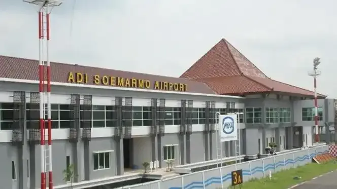
The terminal front — 'ADI SOEMARMO AIRPORT' lettered beneath a red-tiled roof, flagpoles and fencing in neat rows.
The photos come from public web sources and remain the copyright of their photographers; full credits and source links sit in the photo gallery on this page.
Airport at a glance
| Item | Detail |
|---|---|
| IATA / ICAO | SOC / WARQ |
| Role | Large airport |
| Elevation | about 128 m |
| Coordinates | -7.5160, 110.7575 |
| Runways | 1, 2,600 m |
| Non-stop destinations | 3 (1 domestic, 2 international; 2014 snapshot) |
| Official site | adisumarmo-airport.com/en |
Runways
| Runway | Length | Width | Surface |
|---|---|---|---|
| 08/26 | 2,600 m | 45 m | asphalt |
1 runway, the longest 2,600 m.
Non-stop routes
3 non-stop destinations, nearest first (OpenFlights route snapshot compiled in 2014 — confirm with the airline or airport):
| Destination | Distance | Carriers |
|---|---|---|
| Soekarno-Hatta International Airport (CGK) | ~478 km | Garuda Indonesia, Lion Mentari Airlines, Sriwijaya Air |
| Singapore Changi Airport (SIN) | ~1239 km | Garuda Indonesia, SilkAir, Singapore Airlines Cargo |
| Kuala Lumpur International Airport (KUL) | ~1520 km | AirAsia |
The carrier column comes from the same snapshot and includes codeshare and interline services; treat it as an indication of how busy the route is and check the airline for who actually flies it.
Nearby airports to compare
If the fares are close, these are the nearest airports of the same class (large airport) — straight-line distance, with their own non-stop counts from the same dataset:
| Airport | Distance | Non-stop destinations |
|---|---|---|
| Jenderal Ahmad Yani Airport (SRG) | ~74 km | 8 |
| Soekarno-Hatta International Airport (CGK) | ~478 km | 60 |
Before you fly
- With three routes, 90–120 minutes is usually enough; allow 2 hours for the Singapore and Kuala Lumpur flights.
- The 2014 snapshot records only three destinations and Indonesian regional routes have changed; check current schedules.
About the data
Runways, elevation and coordinates come from OurAirports open data. Routes and carriers come from the June 2014 OpenFlights snapshot and include codeshares and interline services; they indicate network shape and scale, not current schedules.
ความคิดเห็นจากผู้อ่านการสนทนา
ยินดีรับคำถาม รายงานการเดินทาง และการแก้ไข ความคิดเห็นเป็นสาธารณะ
กำลังโหลด…
กำลังโหลดความคิดเห็น…