
Sandane Airport, Anda
 Sandane · นอร์เวย์· Sandane Airport, Anda
Sandane Airport, Anda (IATA: SDN, ICAO ENSD) เป็นสนามบินขนาดเล็กที่ให้บริการSandane, นอร์เวย์
Sandane Airport, Anda is a small airport, at an elevation of about 196 ft, with scheduled passenger service. This page gathers its location map, airport codes and travel information.
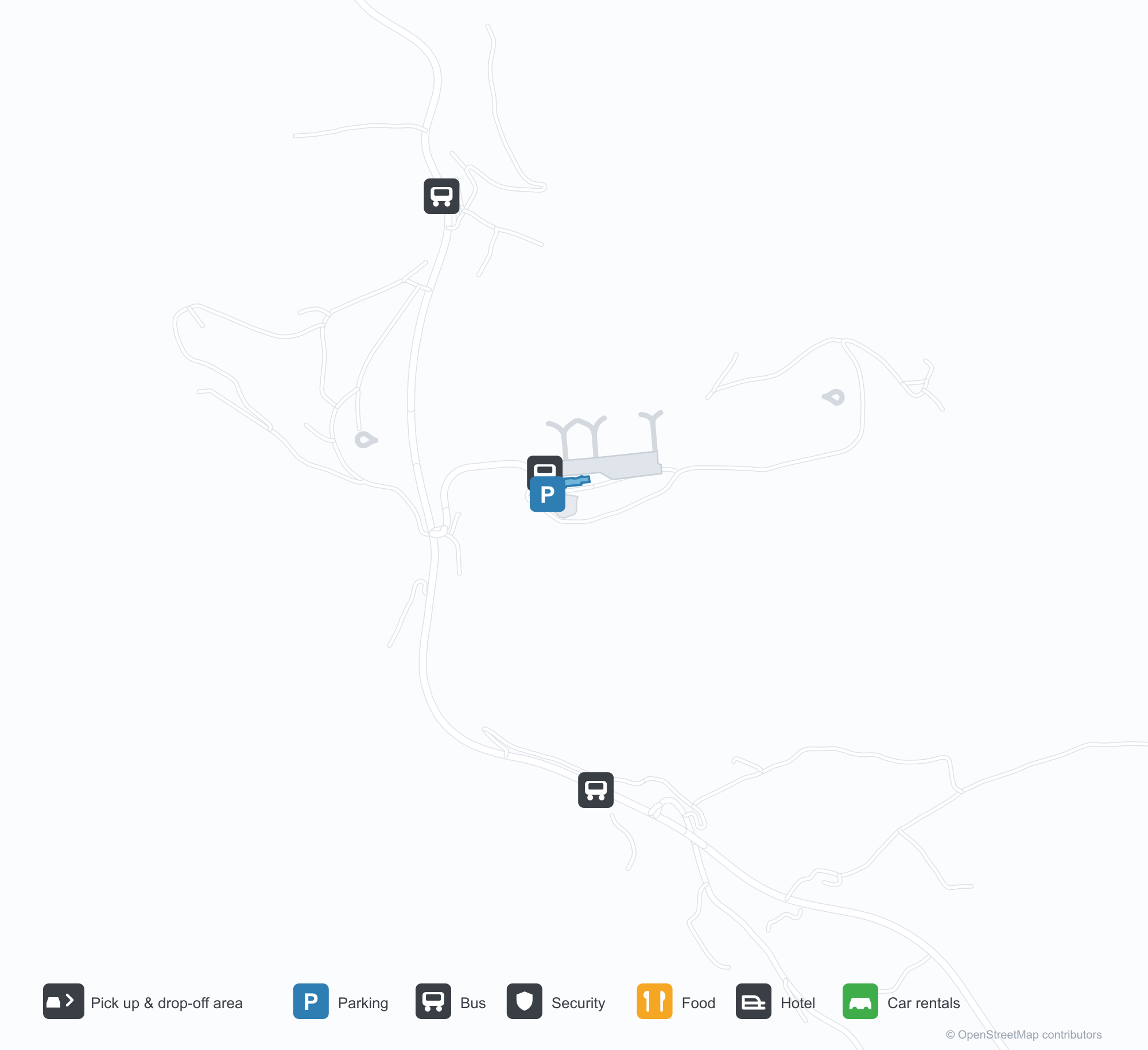
ดาวน์โหลดแผนที่สนามบินดาวน์โหลด
ภาพสนามบินภาพสนามบิน
ภาพจริงของสนามบินแห่งนี้ พร้อมเครดิตของหน้าเว็บสาธารณะที่พบภาพ; ลิขสิทธิ์ยังเป็นของผู้ถ่ายภาพต้นฉบับ คลิกที่ภาพเพื่อขยาย หรือคลิกบรรทัดเครดิตเพื่อเปิดหน้าแหล่งที่มา
สนามบินซันดาเน — เครื่องบิน Widerøe Dash 8 บนลานจอดโดยลดบันไดลง โดยมีฟยอร์ดและภูเขาอยู่ด้านหลังอากาศยาน (ภาพ: Bjoern Huke / PlanePictures.net)
เที่ยวบินของSandane Airport, Anda — ขาออกและขาเข้าป้ายเที่ยวบิน
14 หมายเลขเที่ยวบิน ครอบคลุม 1 สายการบิน และ 2 จุดหมายปลายทาง แยกตามทิศทาง หมายเลขเที่ยวบินร่วม (codeshare) รวมอยู่ด้วย
| เที่ยวบิน | สายการบิน | จุดหมายปลายทาง | ประเทศ/ภูมิภาค |
|---|---|---|---|
| WF140 | Wideroe | SOG | |
| WF141 | Wideroe | Oslo-Gardermoen International Airport | นอร์เวย์ |
| WF142 | Wideroe | SOG | |
| WF145 | Wideroe | Oslo-Gardermoen International Airport | นอร์เวย์ |
| WF146 | Wideroe | Oslo-Gardermoen International Airport | นอร์เวย์ |
| WF147 | Wideroe | Oslo-Gardermoen International Airport | นอร์เวย์ |
| WF148 | Wideroe | SOG |
หมายเลขเที่ยวบินและเส้นทางจากดัชนีเที่ยวบิน aviability.com (ข้อมูล ณ วันที่ 26 ตุลาคม 2569); รวมหมายเลขเที่ยวบินร่วมและไม่แสดงเวลาเดินทาง ที่มา: aviability.com ↗
ข้อมูลและรายละเอียดสนามบินรายละเอียดสนามบิน
แผนที่อินเทอร์แอกทีฟ — ตำแหน่ง Sandane Airport, Andaแผนที่อินเทอร์แอกทีฟ
ดูสนามบินนี้บนบริการแผนที่อื่น:
Sandane Airport (SDN): A 970 m Runway Between Fjord and Snowคู่มือสนามบิน
A Widerøe Dash 8 stands on Sandane's apron with the airstairs down, fjord and snow peaks behind it. The airport serves Sandane in Norway at an elevation of about 60 m, with a 970 m runway; the 2014 snapshot records no scheduled routes.
Airport photos
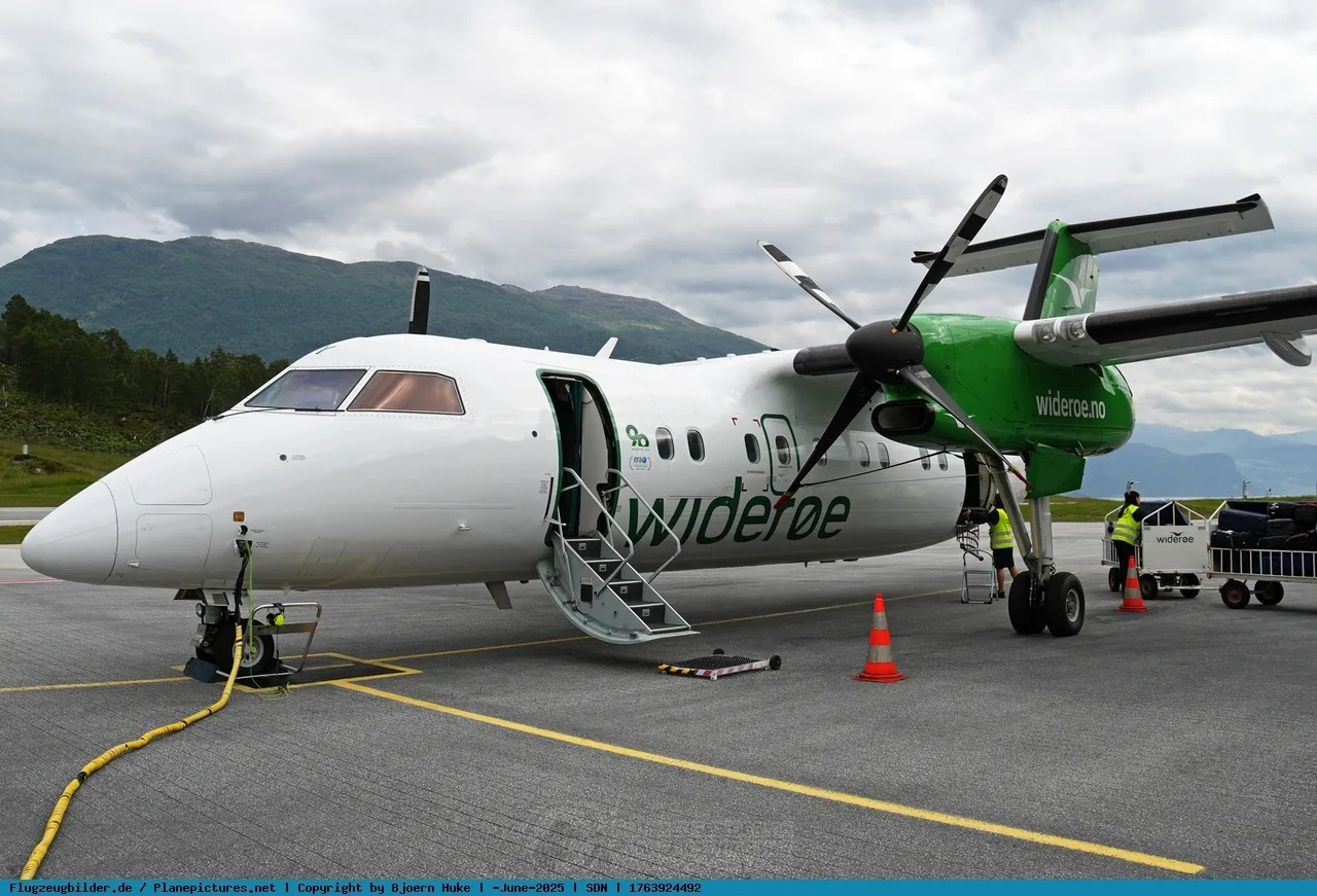
Sandane airport — a Widerøe Dash 8 on the apron with its airstair down, the fjord and mountains spread out behind the aircraft (photo: Bjoern Huke / PlanePictures.net).
The photos come from public web sources and remain the copyright of their photographers; full credits and source links sit in the photo gallery on this page.
Airport at a glance
| Item | Detail |
|---|---|
| IATA / ICAO | SDN / ENSD |
| Role | Small airport |
| Elevation | about 60 m |
| Coordinates | 61.8300, 6.1058 |
| Runways | 1, 970 m |
| Non-stop destinations | 0 in the 2014 snapshot |
| Official site | avinor.no/en/airport/sandane-airport |
Runways
| Runway | Length | Width | Surface |
|---|---|---|---|
| 08/26 | 970 m | 30 m | asphalt |
1 runway, the longest 970 m.
Non-stop routes
The route dataset carries no scheduled non-stop services for this airport. Regional schedules change often — confirm with the airline or airport before booking.
Nearby airports to compare
If the fares are close, these are the nearest airports of the same class (small airport) — straight-line distance, with their own non-stop counts from the same dataset:
| Airport | Distance | Non-stop destinations |
|---|---|---|
| Arnsberg-Menden Airport (ZCA) | ~1,156 km | — |
| 阿什福德机场 (LYM) | ~1,234 km | — |
Before you fly
- The 970 m runway limits aircraft and payloads, and fjord weather and crosswinds affect operations.
- The 2014 snapshot has no scheduled routes, but the Widerøe aircraft shows regional service exists; check the airline before booking.
About the data
Runways, elevation and coordinates come from OurAirports open data. Routes and carriers come from the June 2014 OpenFlights snapshot and include codeshares and interline services; they indicate network shape and scale, not current schedules.
History
Opened in 1975 on the neck of a peninsula between the Nordfjord and Gloppefjord, Sandane is run by Avinor with Widerøe as its sole operator, flying Dash 8s on public service obligation routes.
Source: Sandane Airport.
ความคิดเห็นจากผู้อ่านการสนทนา
ยินดีรับคำถาม รายงานการเดินทาง และการแก้ไข ความคิดเห็นเป็นสาธารณะ
กำลังโหลด…
กำลังโหลดความคิดเห็น…