
Antoine de Saint Exupéry Airport
 San Antonio Oeste · อาร์เจนตินา· Antoine de Saint Exupéry Airport
Antoine de Saint Exupéry Airport (IATA: OES, ICAO SAVN) เป็นสนามบินขนาดเล็กที่ให้บริการSan Antonio Oeste, อาร์เจนตินา
Antoine de Saint Exupéry Airport is a small airport, at an elevation of about 85 ft, with scheduled passenger service. This page gathers its location map, airport codes and travel information.
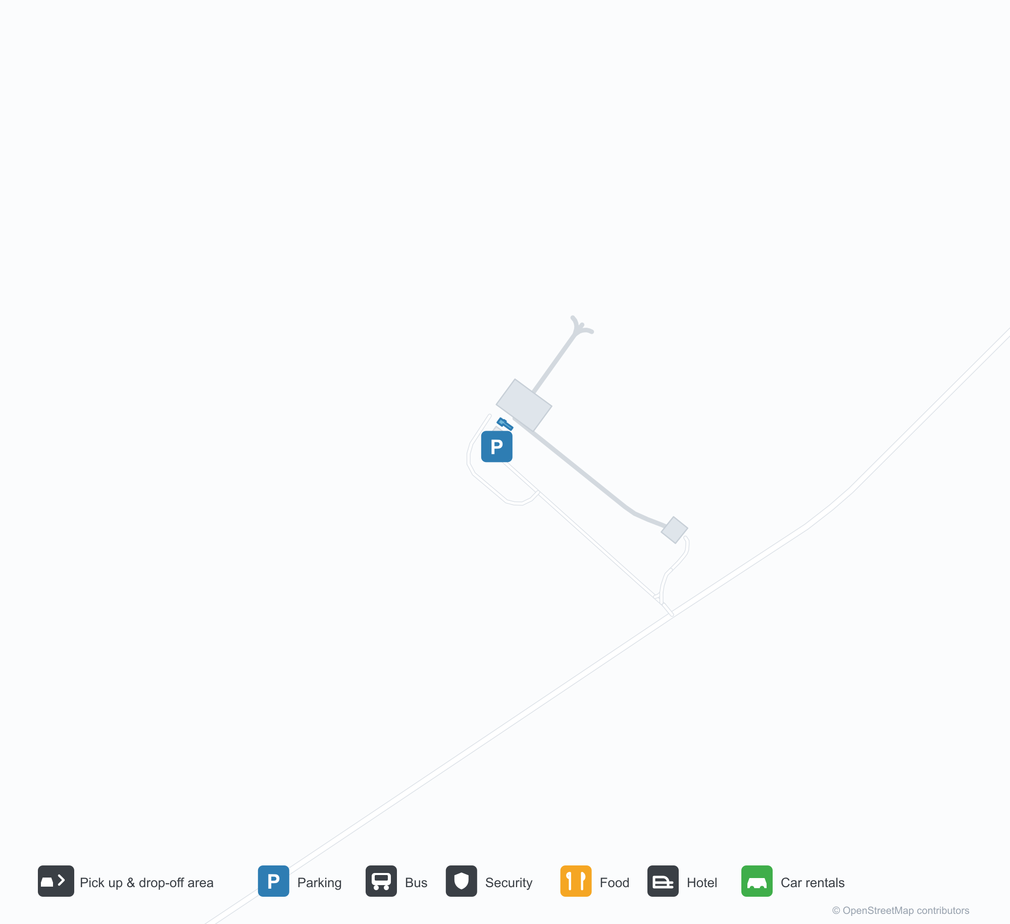
ดาวน์โหลดแผนที่สนามบินดาวน์โหลด
ภาพสนามบินภาพสนามบิน
ภาพจริงของสนามบินแห่งนี้ พร้อมเครดิตของหน้าเว็บสาธารณะที่พบภาพ; ลิขสิทธิ์ยังเป็นของผู้ถ่ายภาพต้นฉบับ คลิกที่ภาพเพื่อขยาย หรือคลิกบรรทัดเครดิตเพื่อเปิดหน้าแหล่งที่มา
ในภาพถ่ายดาวเทียม ท่าอากาศยานอองตวน เดอ แซ็งเต็กซูเปรี (OES) กลมกลืนกับพื้นดินแห้งและที่ดินว่างเปล่าโดยรอบ
ผนังอิฐสีขาวมีข้อความ Aerodromo Saint A Exupery และสำนักงานการบินพลเรือน ขณะที่กลุ่มคนเดินผ่านเสาประตูสีเทอร์ควอยซ์
หอบังคับการบินสีขาวขอบเขียวเชื่อมกับอาคารผู้โดยสารเตี้ย ๆ มีต้นไม้เล็ก ๆ ด้านหน้าและเมฆบาง ๆ ทั่วท้องฟ้าสีฟ้า
ทางวิ่งกรวดสีแดงเรื่อที่ว่างเปล่าทอดยาวระหว่างหญ้าแห้ง ขอบฟ้าแบนราบบรรจบท้องฟ้าสีฟ้าอ่อน
ถ่ายจากด้านล่าง ห้องกระจกของหอบังคับการบินสีขาวตั้งตระหง่านตัดกับท้องฟ้าสีฟ้าใสเหนือหลังคากระเบื้องสีเขียวและผนังอิฐ
เครื่องบินสองใบพัดสีขาวที่มีแถบสีเขียวจอดหันจมูกเข้าหากล้องบนลานแอสฟัลต์ โดยมีแนวต้นไม้อยู่ด้านหลัง
นี่คือภาพหน้าจอแผนที่ที่มีหมุดสีแดงทำเครื่องหมาย Aeroclub San Antonio Oeste ข้างเขตอนุรักษ์ธรรมชาติอ่าวและถนนชายฝั่ง
ข้อมูลและรายละเอียดสนามบินรายละเอียดสนามบิน
แผนที่อินเทอร์แอกทีฟ — ตำแหน่ง Antoine de Saint Exupéry Airportแผนที่อินเทอร์แอกทีฟ
ดูสนามบินนี้บนบริการแผนที่อื่น:
Antoine de Saint Exupéry Airport (OES) Guide: Runway dimensions missing, location clearคู่มือสนามบิน
From above, Antoine de Saint Exupéry Airport (OES) sits among dry ground broken by vegetation and fields in Argentina. The airport is about 26 m above sea level and has a single 1,800 m runway; its 2014 route table is empty. The nearest airport is Gobernador Castello Airport (172 km).
Satellite view
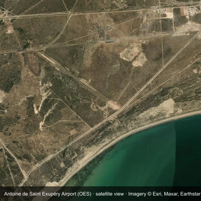
Satellite view: the airfield at Antoine de Saint Exupéry Airport (OES) surrounded by dry ground broken by vegetation and fields.
Source: Esri World Imagery (© Esri, Maxar, Earthstar Geographics); attribution is in the image. This is an overhead view, not a ground-level photograph.
Airport at a glance
| Item | Detail |
|---|---|
| IATA / ICAO | OES / SAVN |
| Role | small airport |
| Elevation | about 26 m |
| Coordinates | -40.7512, -65.0343 |
| Runways | 1, longest 1,800 m |
| Non-stop destinations | 0 in the 2014 snapshot |
Runways
| Runway | Length | Surface |
|---|---|---|
| 12/30 | 1,800 m | ASP |
Why there is no route table
The 2014 OpenFlights snapshot contains no scheduled services for OES. Absence from that dataset is not proof that the field is unused today; check current airport and airline information before travelling.
Nearby airports
| Airport | Distance | Non-stop destinations |
|---|---|---|
| Gobernador Castello Airport (VDM) | ~172 km | 1 |
| El Tehuelche Airport (PMY) | ~223 km | 1 |
| Almirante Marco Andres Zar Airport (REL) | ~274 km | 6 |
Getting there and navigating
- Coordinates: -40.7512, -65.0343
- Open in a map: Google Maps | Amap | Baidu Maps
You can use the map to place the airport against the surrounding road network. For terminal connections and local transport, consult the airport or airline.
Using this airport
Antoine de Saint Exupéry Airport sits in Argentina, where dry ground broken by vegetation and fields surrounds the field. Runway 12/30 runs northwest–southeast, with 1,800 m of asphalt at an elevation of about 26 m.
Operationally, 1,800 m of asphalt places the field in the regional-jet bracket. The paved surface supports regular operations, though it does not imply scheduled service. Gobernador Castello Airport is the closest alternative, 172 km away, with 1 destination in the same snapshot.
The 2014 route record is empty. For a planned trip, begin with Gobernador Castello Airport or another airport with a recorded schedule, then check locally whether a charter can use this field.
Before you fly
- At 1,800 m, the runway suits turboprops and smaller jets rather than widebodies; confirm the aircraft type with the operator.
- The runway is paved, which supports year-round operations, but scheduled service is still not guaranteed.
- Gobernador Castello Airport is 172 km away with 1 destination in the 2014 snapshot, making it the nearest alternative for a scheduled flight.
- Ask the operator about customs, fuel and handling before booking; services at fields this size are not always available on demand.
- Treat this as a general-aviation or charter field rather than a large terminal; confirm handling and opening hours in advance.
About the data
OurAirports supplies the runway, elevation and coordinate figures. The 2014 OpenFlights snapshot supplies the route list; both are reference data, not live operational information.
ความคิดเห็นจากผู้อ่านการสนทนา
ยินดีรับคำถาม รายงานการเดินทาง และการแก้ไข ความคิดเห็นเป็นสาธารณะ
กำลังโหลด…
กำลังโหลดความคิดเห็น…