
Alfonso Bonilla Aragon International Airport
 Cali · โคลอมเบีย· Alfonso Bonilla Aragon International Airport
Alfonso Bonilla Aragon International Airport (IATA: CLO, ICAO SKCL) เป็นสนามบินขนาดใหญ่ที่ให้บริการCali, โคลอมเบีย
Alfonso Bonilla Aragon International Airport is a large airport, at an elevation of about 3,162 ft, with scheduled passenger service. This page gathers its location map, airport codes and travel information.
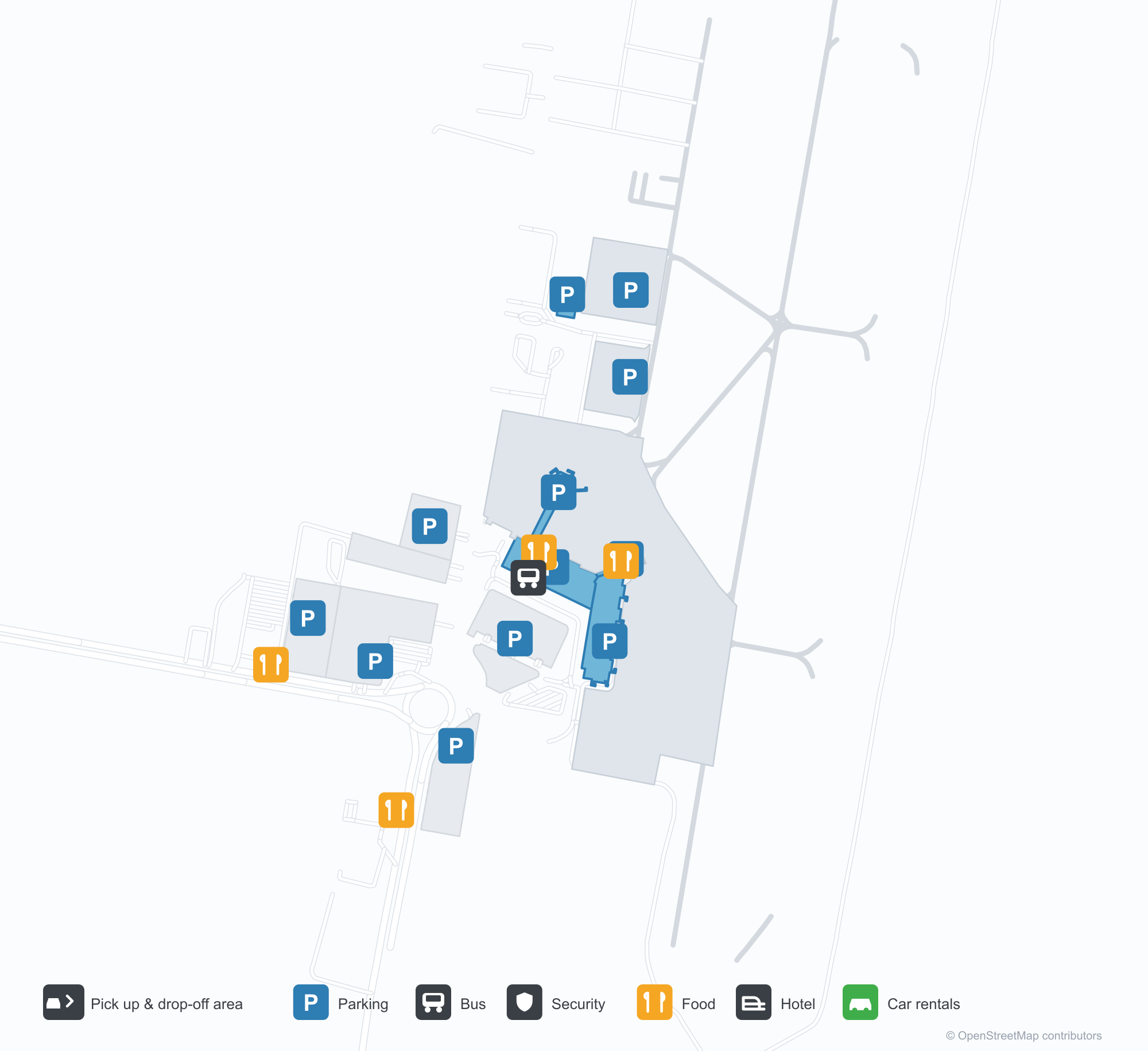
ดาวน์โหลดแผนที่สนามบินดาวน์โหลด
ภาพสนามบินภาพสนามบิน
ภาพจริงของสนามบินแห่งนี้ พร้อมเครดิตของหน้าเว็บสาธารณะที่พบภาพ; ลิขสิทธิ์ยังเป็นของผู้ถ่ายภาพต้นฉบับ คลิกที่ภาพเพื่อขยาย หรือคลิกบรรทัดเครดิตเพื่อเปิดหน้าแหล่งที่มา
ภาพถ่ายดาวเทียม: ทางวิ่งของกาลีอยู่ในหุบเขากาอูกา โดยมีอาคารผู้โดยสารและลานจอดอยู่ทางตะวันออก พร้อมตัวเมืองและไร่อ้อยรอบ ๆ
เส้นหลังคาแบบฟันเลื่อยสีเข้มของอาคารผู้โดยสารยื่นสู่ท้องฟ้ามีเมฆ ขณะที่แท็กซี่และรถยนต์รออยู่บนถนนส่งผู้โดยสาร โดยมีหอบังคับการบินอยู่ไกลออกไป
ภาพถ่ายทางอากาศติดตามทางวิ่งตรงยาวและทางขับขนาน โดยมีอากาศยานจอดข้างอาคารผู้โดยสารทางซ้ายท่ามกลางพื้นที่เกษตรราบเรียบ
มองจากด้านหลัง เครื่องบินเจ็ตสองเครื่องยนต์สีขาวจอดอยู่บนลานจอด โดยมีหอบังคับการบินทรงสอบ เสาไฟสูง และอาคารผู้โดยสารที่ด้านบนมีไม้พุ่มอยู่ด้านหลัง
ผู้เดินทางนั่งเป็นคู่และสามคนบนม้านั่งในโถงขาออก ร้านค้าและจอเที่ยวบินเรียงทั้งสองด้าน และมองเห็นใบปาล์มเลยช่องเปิดออกไป
เครื่องบินเจ็ตหางสีแดงและฝาครอบเครื่องยนต์สีแดงรออยู่ที่ประตู B9 มีรถเข็นสัมภาระและอุปกรณ์ภาคพื้นกระจัดกระจายทั่วลานจอดด้านหน้า
ภายใต้ท้องฟ้าสีฟ้ามีเมฆเป็นแถบ เครื่องบินเจ็ตที่ทำเครื่องหมาย LATAM จอดอยู่บนลานจอด ขณะที่หอบังคับการบินคอนกรีตตั้งอยู่เหนืออาคารผู้โดยสารข้างต้นปาล์ม
เครื่องบินโดยสารหันหน้าเข้าหากล้องที่ประตู โดยมีสะพานเชื่อมยื่นจากอาคารผู้โดยสารทางขวาและรถเข็นสัมภาระสีฟ้าบนลานจอดที่ตีเส้นสีแดง
แผนที่เส้นทาง Alfonso Bonilla Aragon International Airport — จุดหมายบินตรงแผนที่เส้นทาง
18 จุดหมายบินตรง: แผนที่ สายการบินที่ให้บริการ และระยะทาง
เที่ยวบินของAlfonso Bonilla Aragon International Airport — ขาออกและขาเข้าป้ายเที่ยวบิน
621 หมายเลขเที่ยวบิน ครอบคลุม 27 สายการบิน และ 31 จุดหมายปลายทาง แยกตามทิศทาง หมายเลขเที่ยวบินร่วม (codeshare) รวมอยู่ด้วย
| เที่ยวบิน | สายการบิน | จุดหมายปลายทาง | ประเทศ/ภูมิภาค |
|---|---|---|---|
| 2W2094 | W2fly | ท่าอากาศยานมาดริด-บาราฆัส | สเปน |
| 9R6540 | Satena | TBD | |
| 9R6542 | Satena | COG | |
| 9R6544 | Satena | Bahía Solano (BSC) José Celestino Mutis Airport | โคลอมเบีย |
| 9R6546 | Satena | Neiva (NVA) Benito Salas Airport | โคลอมเบีย |
| 9R6548 | Satena | NQU | |
| 9R8652 | Satena | Guapi (GPI) Guapi Airport | โคลอมเบีย |
| 9R8654 | Satena | Ipiales (IPI) San Luis Airport | โคลอมเบีย |
| 9R8687 | Satena | Tumaco (TCO) La Florida Airport | โคลอมเบีย |
| 9R8768 | Satena | Puerto Asís (PUU) Tres De Mayo Airport | โคลอมเบีย |
| 9R8772 | Satena | Florencia (FLA) Gustavo Artunduaga Paredes Airport | โคลอมเบีย |
| 9R8820 | Satena | Tumaco (TCO) La Florida Airport | โคลอมเบีย |
| 9R8890 | Satena | Guapi (GPI) Guapi Airport | โคลอมเบีย |
| A15335 | Apg Airlines | Guapi (GPI) Guapi Airport | โคลอมเบีย |
| A15337 | Apg Airlines | Medellín (EOH) Enrique Olaya Herrera Airport | โคลอมเบีย |
| A15341 | Apg Airlines | Medellín (EOH) Enrique Olaya Herrera Airport | โคลอมเบีย |
| A15346 | Apg Airlines | Puerto Asís (PUU) Tres De Mayo Airport | โคลอมเบีย |
| A15364 | Apg Airlines | Antonio Nariño Airport | โคลอมเบีย |
| A15366 | Apg Airlines | Antonio Nariño Airport | โคลอมเบีย |
| A15378 | Apg Airlines | Villavicencio (VVC) Vanguardia Airport | โคลอมเบีย |
หมายเลขเที่ยวบินและเส้นทางจากดัชนีเที่ยวบิน aviability.com (ข้อมูล ณ วันที่ 26 ตุลาคม 2569); รวมหมายเลขเที่ยวบินร่วมและไม่แสดงเวลาเดินทาง ที่มา: aviability.com ↗
ข้อมูลและรายละเอียดสนามบินรายละเอียดสนามบิน
แผนที่อินเทอร์แอกทีฟ — ตำแหน่ง Alfonso Bonilla Aragon International Airportแผนที่อินเทอร์แอกทีฟ
ดูสนามบินนี้บนบริการแผนที่อื่น:
Cali Airport (CLO): Eighteen Routes in the Cauca Valleyคู่มือสนามบิน
On satellite imagery, Cali's runway sits in the Cauca valley, with the terminal and apron east of it and city and sugar-cane fields around. The airport serves Cali, Colombia, at an elevation of about 964 m, with a 3,000 m runway; the 2014 snapshot records 18 destinations, 10 domestic and 8 international, from Guapi at 200 km to Madrid at 8,302 km.
Satellite view
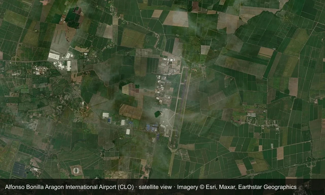
Satellite view: Cali's runway sits in the Cauca valley, with the terminal and apron east of it and city and sugar-cane fields around.
The satellite image comes from Esri World Imagery (© Esri, Maxar, Earthstar Geographics); the field and attribution are labelled in the image. This is a satellite view, not a ground-level photograph.
Airport at a glance
| Item | Detail |
|---|---|
| IATA / ICAO | CLO / SKCL |
| Role | Large airport |
| Elevation | about 964 m |
| Coordinates | 3.5427, -76.3819 |
| Runways | 1, 3,000 m |
| Non-stop destinations | 18 (10 domestic, 8 international; 2014 snapshot) |
| Official site | www.aerocali.com.co |
Runways
| Runway | Length | Width | Surface |
|---|---|---|---|
| 02/20 | 3,000 m | 45 m | asphalt |
1 runway, the longest 3,000 m.
Non-stop routes
18 non-stop destinations, nearest first (OpenFlights route snapshot compiled in 2014 — confirm with the airline or airport):
| Destination | Distance | Carriers |
|---|---|---|
| Guapi Airport (GPI) | ~200 km | SATENA, Avianca - Aerovias Nacionales de Colombia |
| El Caraño Airport (UIB) | ~241 km | SATENA |
| Antonio Nariño Airport (PSO) | ~259 km | Avianca - Aerovias Nacionales de Colombia |
| El Dorado International Airport (BOG) | ~279 km | Avianca - Aerovias Nacionales de Colombia, Copa Airlines, Iberia Airlines |
| Jose Maria Córdova International Airport (MDE) | ~310 km | Avianca - Aerovias Nacionales de Colombia |
| La Florida Airport (TCO) | ~326 km | Avianca - Aerovias Nacionales de Colombia |
| Tres De Mayo Airport (PUU) | ~338 km | SATENA |
| Carlos Concha Torres International Airport (ESM) | ~460 km | TAME |
| Mariscal Sucre International Airport (UIO) | ~463 km | LAN Airlines |
| Tocumen International Airport (PTY) | ~698 km | Copa Airlines |
| José Joaquín de Olmedo International Airport (GYE) | ~744 km | Aerolineas Galapagos (Aerogal), Avianca - Aerovias Nacionales de Colombia |
| Rafael Nuñez International Airport (CTG) | ~773 km | Avianca - Aerovias Nacionales de Colombia |
| Ernesto Cortissoz International Airport (BAQ) | ~836 km | Avianca - Aerovias Nacionales de Colombia |
| Gustavo Rojas Pinilla International Airport (ADZ) | ~1164 km | Copa Airlines, LAN Airlines |
| Jorge Chávez International Airport (LIM) | ~1733 km | Avianca - Aerovias Nacionales de Colombia |
| El Salvador International Airport Saint Óscar Arnulfo Romero y Galdámez (SAL) | ~1775 km | Avianca - Aerovias Nacionales de Colombia |
| Miami International Airport (MIA) | ~2509 km | American Airlines, Avianca - Aerovias Nacionales de Colombia, LAN Airlines |
| Adolfo Suárez Madrid–Barajas Airport (MAD) | ~8302 km | Avianca - Aerovias Nacionales de Colombia |
The carrier column comes from the same snapshot and includes codeshare and interline services; treat it as an indication of how busy the route is and check the airline for who actually flies it.
Nearby airports to compare
If the fares are close, these are the nearest airports of the same class (large airport) — straight-line distance, with their own non-stop counts from the same dataset:
| Airport | Distance | Non-stop destinations |
|---|---|---|
| Arturo Michelena International Airport (VLN) | ~1,187 km | 6 |
| Antonio Maceo International Airport (SCU) | ~1,828 km | 4 |
Before you fly
- Allow 2–3 hours for international and 90–120 minutes for domestic departures.
- At about 964 m, altitude has limited effect on performance; wet-season thunderstorms can cause delays.
About the data
Runways, elevation and coordinates come from OurAirports open data. Routes and carriers come from the June 2014 OpenFlights snapshot and include codeshares and interline services; they indicate network shape and scale, not current schedules.
ความคิดเห็นจากผู้อ่านการสนทนา
ยินดีรับคำถาม รายงานการเดินทาง และการแก้ไข ความคิดเห็นเป็นสาธารณะ
กำลังโหลด…
กำลังโหลดความคิดเห็น…