
Mactan Cebu International Airport
 เซบู / ลาปู-ลาปู · ฟิลิปปินส์· Mactan Cebu International Airport
Mactan Cebu International Airport (IATA: CEB, ICAO RPVM) เป็นสนามบินขนาดกลางที่ให้บริการเซบู / ลาปู-ลาปู, ฟิลิปปินส์
Mactan Cebu International Airport (CEB) is a medium airport serving Cebu City/Lapu-Lapu City, Philippines. This page gathers the airport codes, location map and travel information.
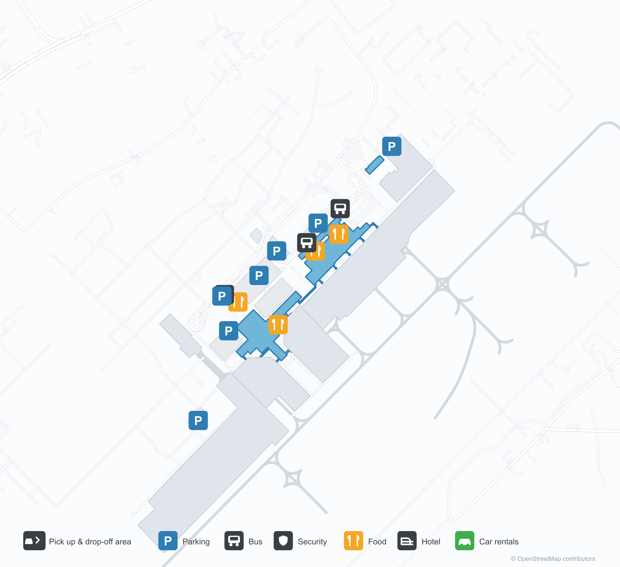
ดาวน์โหลดแผนที่สนามบินดาวน์โหลด
ภาพสนามบินภาพสนามบิน
ภาพจริงของสนามบินแห่งนี้ พร้อมเครดิตของหน้าเว็บสาธารณะที่พบภาพ; ลิขสิทธิ์ยังเป็นของผู้ถ่ายภาพต้นฉบับ คลิกที่ภาพเพื่อขยาย หรือคลิกบรรทัดเครดิตเพื่อเปิดหน้าแหล่งที่มา
ที่แมกตัน-เซบูหลังพระอาทิตย์ตก — เครื่องบินของ Cebu Pacific จอดที่สะพานเทียบเครื่องบิน โดยมีเจ้าหน้าที่ภาคพื้นดินและรถเข็นสัมภาระทำงานอยู่ด้านล่าง
ในภาพถ่ายดาวเทียม มองเห็นผังของสนามบินนานาชาติแมกตัน เซบู (CEB) และบริเวณโดยรอบได้อย่างชัดเจน
แผนที่เส้นทาง Mactan Cebu International Airport — จุดหมายบินตรงแผนที่เส้นทาง
27 จุดหมายบินตรง: แผนที่ สายการบินที่ให้บริการ และระยะทาง
เที่ยวบินของMactan Cebu International Airport — ขาออกและขาเข้าป้ายเที่ยวบิน
694 หมายเลขเที่ยวบิน ครอบคลุม 43 สายการบิน และ 46 จุดหมายปลายทาง แยกตามทิศทาง หมายเลขเที่ยวบินร่วม (codeshare) รวมอยู่ด้วย
| เที่ยวบิน | สายการบิน | จุดหมายปลายทาง | ประเทศ/ภูมิภาค |
|---|---|---|---|
| 2R849 | Sunlight Air | Coron (USU) Francisco B. Reyes (Busuanga) Airport | ฟิลิปปินส์ |
| 2R851 | Sunlight Air | Coron (USU) Francisco B. Reyes (Busuanga) Airport | ฟิลิปปินส์ |
| 2R857 | Sunlight Air | IAO | |
| 2R875 | Sunlight Air | IQR | |
| 5J130 | Cebu Pacific | ท่าอากาศยานนานาชาติอินชอน | เกาหลีใต้ |
| 5J132 | Cebu Pacific | Caticlan (MPH) Godofredo P. Ramos Airport | ฟิลิปปินส์ |
| 5J134 | Cebu Pacific | Caticlan (MPH) Godofredo P. Ramos Airport | ฟิลิปปินส์ |
| 5J136 | Cebu Pacific | Caticlan (MPH) Godofredo P. Ramos Airport | ฟิลิปปินส์ |
| 5J203 | Cebu Pacific | Laguindingan (CGY) Laguindingan International Airport | ฟิลิปปินส์ |
| 5J205 | Cebu Pacific | Laguindingan (CGY) Laguindingan International Airport | ฟิลิปปินส์ |
| 5J207 | Cebu Pacific | Laguindingan (CGY) Laguindingan International Airport | ฟิลิปปินส์ |
| 5J209 | Cebu Pacific | Laguindingan (CGY) Laguindingan International Airport | ฟิลิปปินส์ |
| 5J225 | Cebu Pacific | Puerto Princesa (PPS) Puerto Princesa International Airport / PAF Antonio Bautista Air Base | ฟิลิปปินส์ |
| 5J227 | Cebu Pacific | Puerto Princesa (PPS) Puerto Princesa International Airport / PAF Antonio Bautista Air Base | ฟิลิปปินส์ |
| 5J229 | Cebu Pacific | Puerto Princesa (PPS) Puerto Princesa International Airport / PAF Antonio Bautista Air Base | ฟิลิปปินส์ |
| 5J236 | Cebu Pacific | ท่าอากาศยานนานาชาติฮ่องกง | จีน |
| 5J240 | Cebu Pacific | ท่าอากาศยานนานาชาติฮ่องกง | จีน |
| 5J249 | Cebu Pacific | General Santos (GES) General Santos International Airport | ฟิลิปปินส์ |
| 5J251 | Cebu Pacific | General Santos (GES) General Santos International Airport | ฟิลิปปินส์ |
| 5J433 | Cebu Pacific | Zamboanga (ZAM) Zamboanga International Airport | ฟิลิปปินส์ |
หมายเลขเที่ยวบินและเส้นทางจากดัชนีเที่ยวบิน aviability.com (ข้อมูล ณ วันที่ 26 ตุลาคม 2569); รวมหมายเลขเที่ยวบินร่วมและไม่แสดงเวลาเดินทาง ที่มา: aviability.com ↗
ข้อมูลและรายละเอียดสนามบินรายละเอียดสนามบิน
แผนที่อินเทอร์แอกทีฟ — ตำแหน่ง Mactan Cebu International Airportแผนที่อินเทอร์แอกทีฟ
ดูสนามบินนี้บนบริการแผนที่อื่น:
Mactan Cebu International Airport Guideคู่มือสนามบิน
Mactan Cebu International Airport (IATA CEB, ICAO RPVM) serves Cebu City/Lapu-Lapu City, Philippines, Southeast Asia, and is classified as a medium-sized airport. This page gathers what the site's database, maps and route dataset say about it in one place.
Airport photos
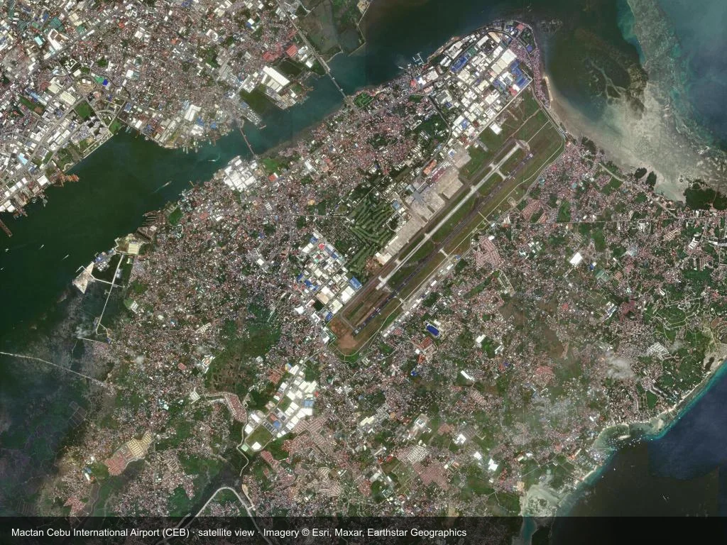
In the satellite image, the layout of Mactan Cebu International Airport (CEB) and its surroundings are clearly visible.
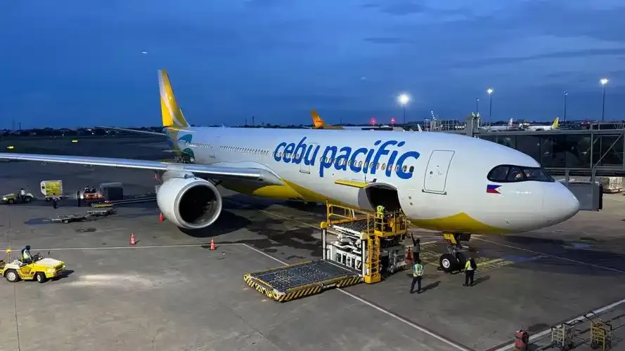
At Mactan-Cebu after sunset — a Cebu Pacific jet at the jet bridge, with ground crew and baggage carts working below.
The photos come from public web sources and remain the copyright of their photographers; full credits and source links sit in the photo gallery on this page.
Facts at a glance
| IATA / ICAO | CEB / RPVM |
| Airport class | medium-sized airport |
| Location | Cebu City/Lapu-Lapu City, Philippines (Southeast Asia) |
| Coordinates | 10.3093, 123.9797 |
| Direct destinations | 27 (see below) |
Airport map
The map on this page is rendered from OpenStreetMap data: airports with terminal polygons show the terminal buildings, aprons and access roads, while small fields show the airfield outline and runway. Icons for parking, buses, food, hotels and car rentals follow whatever OSM has mapped.
- Full-size view — open the map card on this page to zoom in; the 2000 px original can be downloaded.
- Location map — the interactive map lets you pan and zoom to see the field against the city and road network.
- Schematic — the page also draws a size-based schematic to indicate the airport's scale; it is not the actual layout.
Direct routes
Non-stop destinations, nearest first (OpenFlights route dataset, compiled 2014 — treat as indicative and confirm with the airline):
| Destination | Distance | Main carriers |
|---|---|---|
| Bacolod-Silay International Airport (BCD) | ~117 km | Cebu Pacific |
| Sibulan Airport (DGT) | ~131 km | Cebu Pacific |
| Camiguin Airport (CGM) | ~142 km | Cebu Pacific |
| Daniel Z. Romualdez Airport (TAC) | ~153 km | Cebu Pacific |
| Iloilo International Airport (ILO) | ~173 km | Cebu Pacific |
| Surigao Airport (SUG) | ~176 km | Cebu Pacific |
| Laguindingan International Airport (CGY) | ~196 km | Cebu Pacific |
| Dipolog Airport (DPL) | ~202 km | Cebu Pacific |
See the Mactan Cebu International Airport route map for the full list of 27 non-stop destinations.
Nearby airports
If nothing fits, these nearby fields are worth comparing:
| Airport | Distance |
|---|---|
| Ninoy Aquino International Airport (MNL) | 567 km |
| Lanyu Airport (KYD) | 1329 km |
| Lyudao Airport (GNI) | 1401 km |
Getting there
The airport: coordinates 10.3093, 123.9797; elevation about 9 m.
Navigate straight to the field:
- Driving / taxi: 高德地图 | 百度地图 | Google Maps
The location map on this page shows the field against the city and road network, and the ground-transport section lists the public transport recorded for it. For driving routes, timetables and parking, rely on the airport's own information.
Size and facilities
Medium-sized airports are regional hubs: one compact terminal, walkable distances and usually faster check-in than a major hub — but with fewer frequencies, so rebooking after a missed flight is harder. Aim for 90–120 minutes before departure.
Terminal plans, check-in locations and ground-transport timetables are published by the airport itself; for detail that must be right on the day, rely on the airport's own information. If something here looks wrong, please tell us via the Contact page and we will check it.
Tips
- If your destination is not in the table above, you will usually connect via Bacolod-Silay International Airport (BCD) or another larger airport.
- Use the search box at the top of the page to compare alternatives: type a city name or IATA code.
- In peak season parking and rental cars run short at small fields too — book ahead if you are driving.
ความคิดเห็นจากผู้อ่านการสนทนา
ยินดีรับคำถาม รายงานการเดินทาง และการแก้ไข ความคิดเห็นเป็นสาธารณะ
กำลังโหลด…
กำลังโหลดความคิดเห็น…