
Arusha Airport
 Arusha · แทนซาเนีย· Arusha Airport
Arusha Airport (IATA: ARK, ICAO HTAR) เป็นสนามบินขนาดกลางที่ให้บริการArusha, แทนซาเนีย
Arusha Airport is a medium-sized airport, at an elevation of about 4,550 ft, with scheduled passenger service. This page gathers its location map, airport codes and travel information.
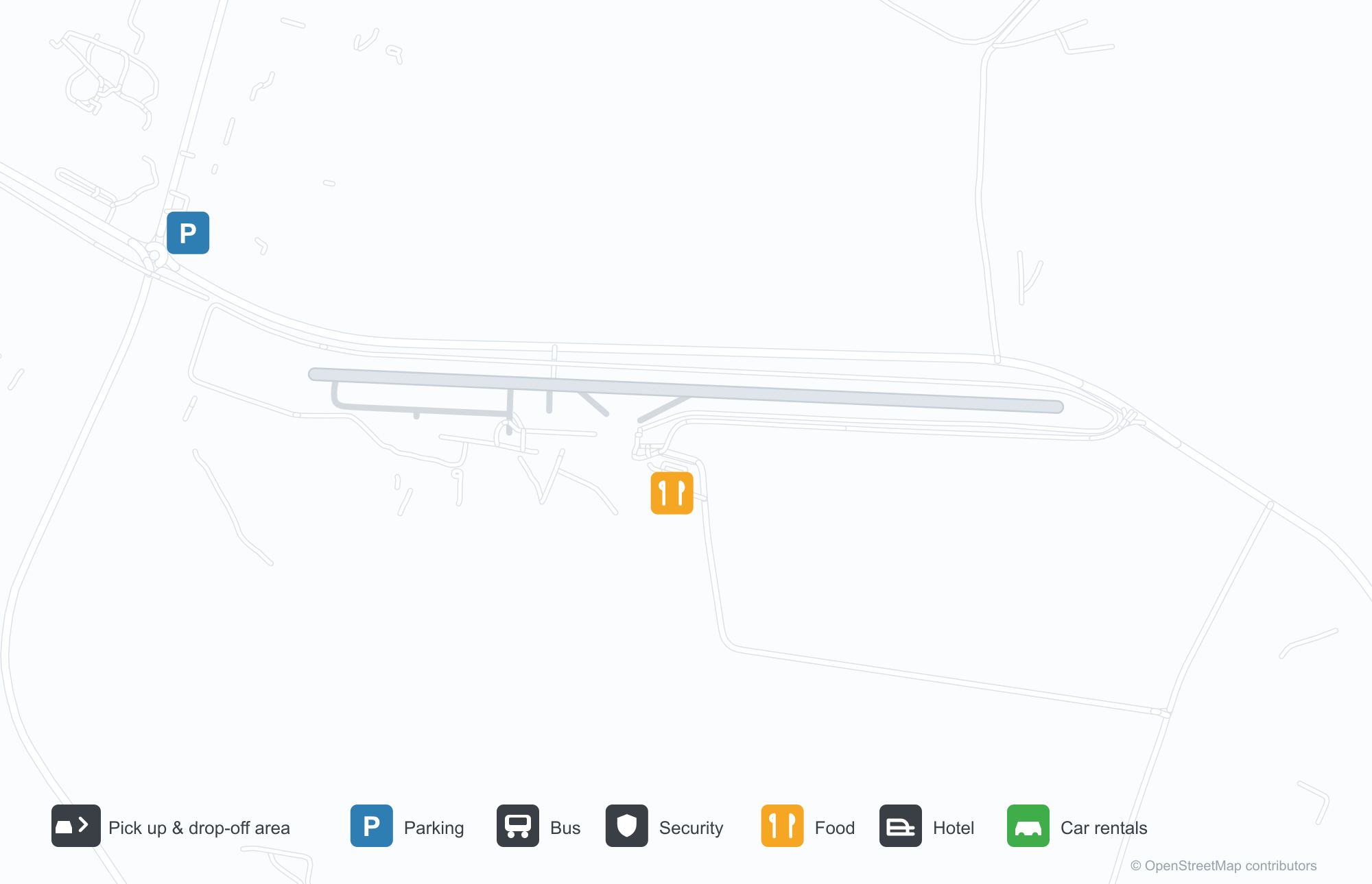
ดาวน์โหลดแผนที่สนามบินดาวน์โหลด
ภาพสนามบินภาพสนามบิน
ภาพจริงของสนามบินแห่งนี้ พร้อมเครดิตของหน้าเว็บสาธารณะที่พบภาพ; ลิขสิทธิ์ยังเป็นของผู้ถ่ายภาพต้นฉบับ คลิกที่ภาพเพื่อขยาย หรือคลิกบรรทัดเครดิตเพื่อเปิดหน้าแหล่งที่มา
ทางเข้าอาคารผู้โดยสาร — ผู้เดินทางและผู้มาส่งรวมตัวกันใต้หลังคากันแดดผ้าใบ
เครื่องบินเบาบนลานจอด — แถวเครื่องบินเซสนาใต้เมฆ โดยมีภูเขาที่ขอบฟ้า
ช่อง 'ARUSHA AIRPORT INFORMATION' ในกระท่อมไม้ — แสดงสิ่งอำนวยความสะดวกของสนามบินอย่างชัดเจน
แผนที่เส้นทาง Arusha Airport — จุดหมายบินตรงแผนที่เส้นทาง
1 จุดหมายบินตรง: แผนที่ สายการบินที่ให้บริการ และระยะทาง
เที่ยวบินของArusha Airport — ขาออกและขาเข้าป้ายเที่ยวบิน
169 หมายเลขเที่ยวบิน ครอบคลุม 13 สายการบิน และ 8 จุดหมายปลายทาง แยกตามทิศทาง หมายเลขเที่ยวบินร่วม (codeshare) รวมอยู่ด้วย
| เที่ยวบิน | สายการบิน | จุดหมายปลายทาง | ประเทศ/ภูมิภาค |
|---|---|---|---|
| 8N101 | Regional Air | LKY | |
| 8N107 | Regional Air | GTZ | |
| 8N111 | Regional Air | LKY | |
| 8N201 | Regional Air | แซนซีบาร์ (ZNZ) Abeid Amani Karume International Airport | แทนซาเนีย |
| 8N301 | Regional Air | Arusha (JRO) Kilimanjaro International Airport | แทนซาเนีย |
| 8N577 | Regional Air | GTZ | |
| 8N586 | Regional Air | SEU | |
| 8N591 | Regional Air | GTZ | |
| A11672 | Apg Airlines | SEU | |
| A11675 | Apg Airlines | แซนซีบาร์ (ZNZ) Abeid Amani Karume International Airport | แทนซาเนีย |
| A11679 | Apg Airlines | แซนซีบาร์ (ZNZ) Abeid Amani Karume International Airport | แทนซาเนีย |
| CQ134 | Coastal Aviation | แซนซีบาร์ (ZNZ) Abeid Amani Karume International Airport | แทนซาเนีย |
| CQ201 | Coastal Aviation | LKY | |
| CQ203 | Coastal Aviation | Arusha (JRO) Kilimanjaro International Airport | แทนซาเนีย |
| CQ505 | Coastal Aviation | แซนซีบาร์ (ZNZ) Abeid Amani Karume International Airport | แทนซาเนีย |
| CQ1693 | Coastal Aviation | LKY | |
| CXT6529 | Coastal Air Transport | แซนซีบาร์ (ZNZ) Abeid Amani Karume International Airport | แทนซาเนีย |
| CXT6555 | Coastal Air Transport | แซนซีบาร์ (ZNZ) Abeid Amani Karume International Airport | แทนซาเนีย |
| F2142 | Safarilink | ไนโรบี (WIL) Nairobi Wilson Airport | เคนยา |
| F2144 | Safarilink | ไนโรบี (WIL) Nairobi Wilson Airport | เคนยา |
หมายเลขเที่ยวบินและเส้นทางจากดัชนีเที่ยวบิน aviability.com (ข้อมูล ณ วันที่ 26 ตุลาคม 2569); รวมหมายเลขเที่ยวบินร่วมและไม่แสดงเวลาเดินทาง ที่มา: aviability.com ↗
ข้อมูลและรายละเอียดสนามบินรายละเอียดสนามบิน
แผนที่อินเทอร์แอกทีฟ — ตำแหน่ง Arusha Airportแผนที่อินเทอร์แอกทีฟ
ดูสนามบินนี้บนบริการแผนที่อื่น:
Arusha Airport (ARK): A Safari Gateway and One Zanzibar Routeคู่มือสนามบิน
Arusha's airport is deliberately plain: a canvas canopy over a busy walkway where passengers and well-wishers gather; a line of Cessnas on the apron with cloud and mountain shadows towards Mount Meru; an information window in a board-walled hut lettered "ARUSHA AIRPORT INFORMATION". The field serves Arusha, Tanzania, at an elevation of about 1,387 m, with a 1,639 m runway; the 2014 snapshot records one domestic destination, Zanzibar at 428 km.
Airport photos

The terminal entrance — travellers and well-wishers gathered under the canvas canopy.
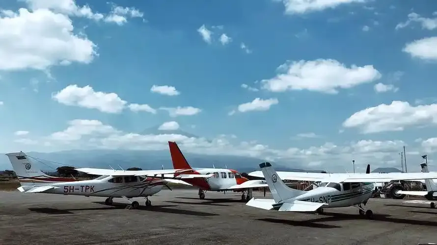
Light aircraft on the apron — a line of Cessnas beneath the clouds, mountains on the horizon.
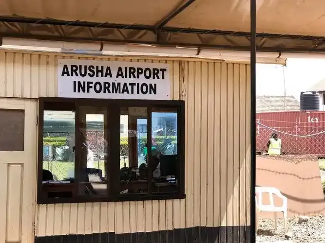
The 'ARUSHA AIRPORT INFORMATION' hatch in its timber hut — the airport's facilities in plain view.
The photos come from public web sources and remain the copyright of their photographers; full credits and source links sit in the photo gallery on this page.
Airport at a glance
| Item | Detail |
|---|---|
| IATA / ICAO | ARK / HTAR |
| Role | Medium-sized airport |
| Elevation | about 1,387 m |
| Coordinates | -3.3678, 36.6333 |
| Runways | 1, 1,639 m |
| Non-stop destinations | 1 (Zanzibar; 2014 snapshot) |
Runways
| Runway | Length | Width | Surface |
|---|---|---|---|
| 09/27 | 1,639 m | 32 m | BIT |
1 runway, the longest 1,639 m.
Non-stop routes
1 non-stop destinations, nearest first (OpenFlights route snapshot compiled in 2014 — confirm with the airline or airport):
| Destination | Distance | Carriers |
|---|---|---|
| Abeid Amani Karume International Airport (ZNZ) | ~428 km | Precision Air |
The carrier column comes from the same snapshot and includes codeshare and interline services; treat it as an indication of how busy the route is and check the airline for who actually flies it.
Nearby airports to compare
If the fares are close, these are the nearest airports of the same class (medium-sized airport) — straight-line distance, with their own non-stop counts from the same dataset:
| Airport | Distance | Non-stop destinations |
|---|---|---|
| Amboseli Airport (ASV) | ~106 km | 1 |
Before you fly
- Light aircraft and safari charters dominate; baggage limits are usually stricter than on mainline flights, so confirm with the operator.
- At about 1,387 m, light-aircraft performance is affected by altitude and heat, and afternoon flights are more weather-sensitive.
About the data
Runways, elevation and coordinates come from OurAirports open data. Routes and carriers come from the June 2014 OpenFlights snapshot and include codeshares and interline services; they indicate network shape and scale, not current schedules.
History
The field handled about 87,000 passengers in 2004; an expansion adding runway length and new terminal buildings is under way as Arusha's safari traffic grows.
Source: Arusha Airport.
ความคิดเห็นจากผู้อ่านการสนทนา
ยินดีรับคำถาม รายงานการเดินทาง และการแก้ไข ความคิดเห็นเป็นสาธารณะ
กำลังโหลด…
กำลังโหลดความคิดเห็น…