
Arusha Airport
 Arusha · 탄자니아· Arusha Airport
Arusha Airport(IATA: ARK, ICAO: HTAR)은 탄자니아 Arusha에 위치한 중형 공항입니다.
Arusha Airport is a medium-sized airport, at an elevation of about 4,550 ft, with scheduled passenger service. This page gathers its location map, airport codes and travel information.
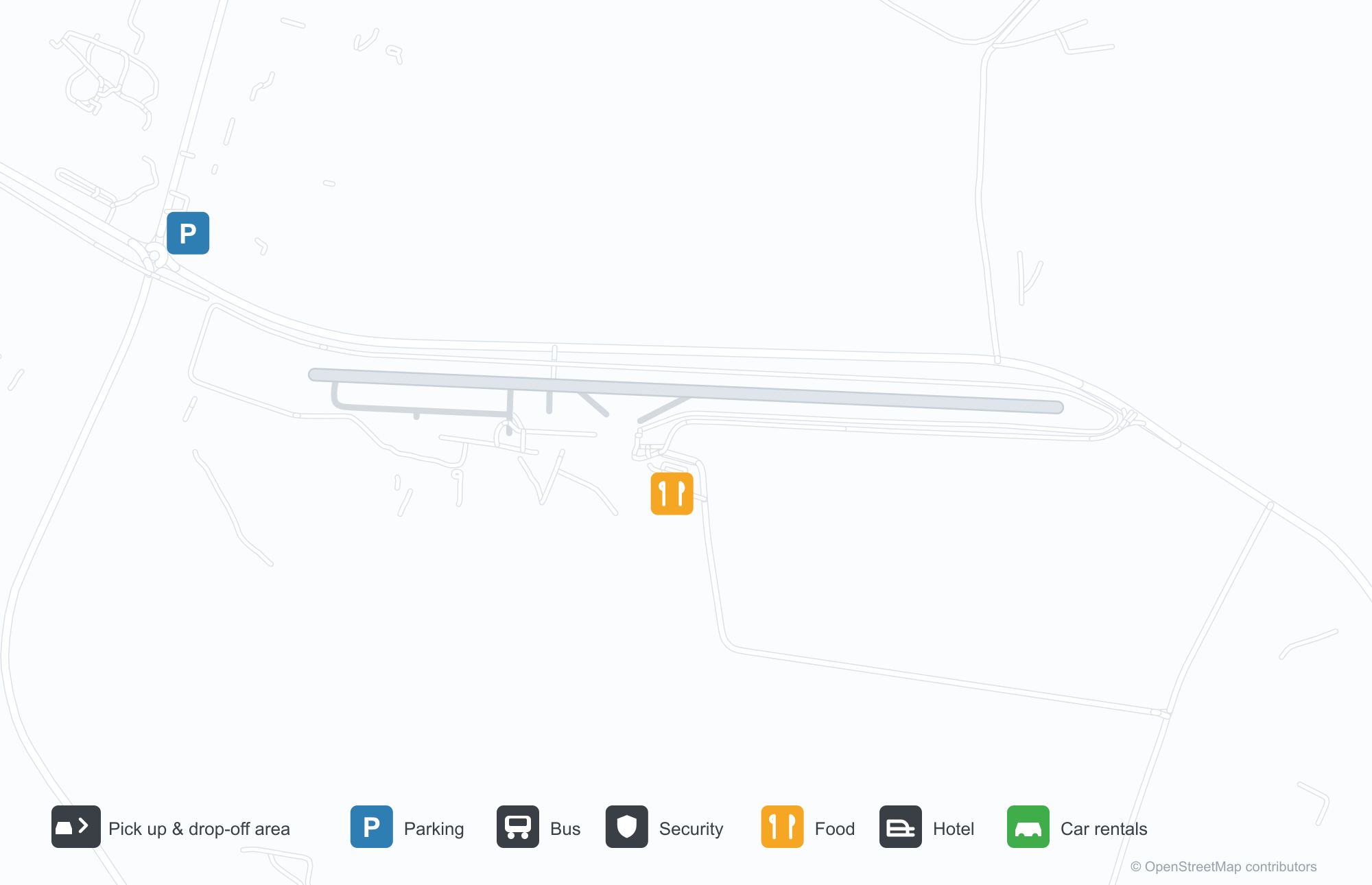
공항 지도 다운로드다운로드
공항 실제 사진공항 사진
다음은 이 공항의 실제 사진으로, 모두 공개된 인터넷 출처에서 가져왔으며 사진마다 출처를 표시했습니다. 저작권은 원저작자에게 있습니다. 사진을 클릭하면 크게 볼 수 있고, 출처를 클릭하면 원본 페이지가 열립니다.
터미널 출입구 — 캔버스 캐노피 아래에 모인 여행객과 마중객.
계류장의 경비행기 — 구름 아래 줄지어 선 Cessna, 지평선의 산.
목조 오두막의 'ARUSHA AIRPORT INFORMATION' 창구 — 공항 시설이 한눈에 들어오는 안내판.
Arusha Airport 노선도 · 직항 목적지노선도
직항 목적지 1개: 노선도, 운항 항공사, 비행 거리.
공항 정보 및 상세공항 상세
Arusha Airport 인터랙티브 지도 — 공항 위치인터랙티브 지도
다른 지도 서비스에서 이 공항 보기:
Arusha Airport (ARK): A Safari Gateway and One Zanzibar Route공항 안내
Arusha's airport is deliberately plain: a canvas canopy over a busy walkway where passengers and well-wishers gather; a line of Cessnas on the apron with cloud and mountain shadows towards Mount Meru; an information window in a board-walled hut lettered "ARUSHA AIRPORT INFORMATION". The field serves Arusha, Tanzania, at an elevation of about 1,387 m, with a 1,639 m runway; the 2014 snapshot records one domestic destination, Zanzibar at 428 km.
Airport photos

The terminal entrance — travellers and well-wishers gathered under the canvas canopy.
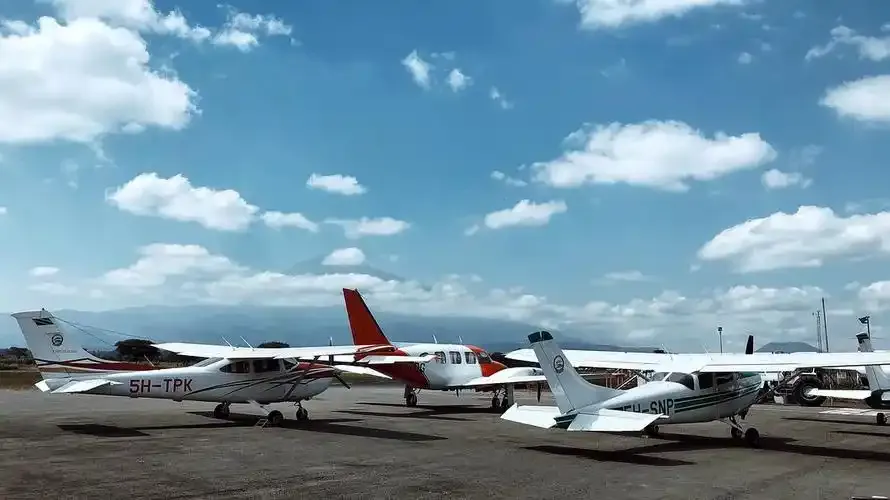
Light aircraft on the apron — a line of Cessnas beneath the clouds, mountains on the horizon.
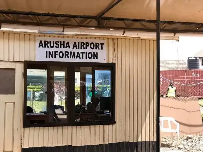
The 'ARUSHA AIRPORT INFORMATION' hatch in its timber hut — the airport's facilities in plain view.
The photos come from public web sources and remain the copyright of their photographers; full credits and source links sit in the photo gallery on this page.
Airport at a glance
| Item | Detail |
|---|---|
| IATA / ICAO | ARK / HTAR |
| Role | Medium-sized airport |
| Elevation | about 1,387 m |
| Coordinates | -3.3678, 36.6333 |
| Runways | 1, 1,639 m |
| Non-stop destinations | 1 (Zanzibar; 2014 snapshot) |
Runways
| Runway | Length | Width | Surface |
|---|---|---|---|
| 09/27 | 1,639 m | 32 m | BIT |
1 runway, the longest 1,639 m.
Non-stop routes
1 non-stop destinations, nearest first (OpenFlights route snapshot compiled in 2014 — confirm with the airline or airport):
| Destination | Distance | Carriers |
|---|---|---|
| Abeid Amani Karume International Airport (ZNZ) | ~428 km | Precision Air |
The carrier column comes from the same snapshot and includes codeshare and interline services; treat it as an indication of how busy the route is and check the airline for who actually flies it.
Nearby airports to compare
If the fares are close, these are the nearest airports of the same class (medium-sized airport) — straight-line distance, with their own non-stop counts from the same dataset:
| Airport | Distance | Non-stop destinations |
|---|---|---|
| Amboseli Airport (ASV) | ~106 km | 1 |
Before you fly
- Light aircraft and safari charters dominate; baggage limits are usually stricter than on mainline flights, so confirm with the operator.
- At about 1,387 m, light-aircraft performance is affected by altitude and heat, and afternoon flights are more weather-sensitive.
About the data
Runways, elevation and coordinates come from OurAirports open data. Routes and carriers come from the June 2014 OpenFlights snapshot and include codeshares and interline services; they indicate network shape and scale, not current schedules.
History
The field handled about 87,000 passengers in 2004; an expansion adding runway length and new terminal buildings is under way as Arusha's safari traffic grows.
Source: Arusha Airport.