
Alpena County Regional Airport
 Alpena · สหรัฐอเมริกา· Alpena County Regional Airport
Alpena County Regional Airport (IATA: APN, ICAO KAPN) เป็นสนามบินขนาดกลางที่ให้บริการAlpena, สหรัฐอเมริกา
Alpena County Regional Airport is a medium-sized airport, at an elevation of about 690 ft, with scheduled passenger service. This page gathers its location map, airport codes and travel information.
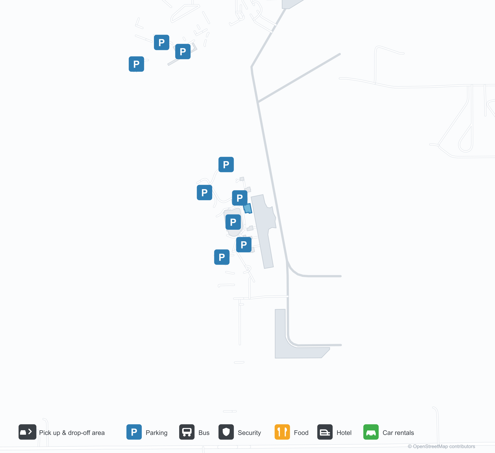
ดาวน์โหลดแผนที่สนามบินดาวน์โหลด
ภาพสนามบินภาพสนามบิน
ภาพจริงของสนามบินแห่งนี้ พร้อมเครดิตของหน้าเว็บสาธารณะที่พบภาพ; ลิขสิทธิ์ยังเป็นของผู้ถ่ายภาพต้นฉบับ คลิกที่ภาพเพื่อขยาย หรือคลิกบรรทัดเครดิตเพื่อเปิดหน้าแหล่งที่มา
ภาพถ่ายดาวเทียม: ทางวิ่งของแอลพีนาอยู่ท่ามกลางป่าไม้และพื้นที่เกษตรกรรมข้างทะเลสาบฮูรอน โดยมีอาคารผู้โดยสารและลานจอดอยู่เคียงข้างสนามบิน
ยามพลบค่ำ แสงโทนอุ่นเรืองอยู่บนด้านหน้าหินและกระจกของอาคารผู้โดยสาร โดยมีตัวอักษร APN เหนือทางเข้า
แผนที่ดาวเทียมมองลงมาที่สนามบินแอลพีนา ซึ่งทางวิ่งตัดกันอยู่ท่ามกลางป่าสีเขียวเข้มโดยมีผืนน้ำที่ขอบด้านหนึ่ง
แสงแดดยามเย็นที่ต่ำย้อมด้านหนึ่งของอาคารผู้โดยสารเป็นสีทอง ขณะที่อีกด้านยังอยู่ในเงา และถนนด้านหน้าว่างเปล่า
ภายในอาคารผู้โดยสาร แถวที่นั่งสีเทาหันหน้าไปทางหน้าต่างสูงข้ามพื้นลายไม้สีอ่อนที่ทอดไปจนถึงผนังด้านไกล
ที่นั่งเรียงตามหน้าต่างเลานจ์ ขณะที่บันไดเลื่อนแบบเคลื่อนที่ได้ตั้งอยู่บนลานจอดและท้องฟ้าเรืองแสงสีส้มจาง ๆ
ตู้บริการตนเองสองตู้ตั้งอยู่หน้าเคาน์เตอร์เช็คอิน โดยมีตราสัญลักษณ์เดลตาอยู่ข้าง ๆ และธงอเมริกันบนผนัง
แผนที่เส้นทาง Alpena County Regional Airport — จุดหมายบินตรงแผนที่เส้นทาง
2 จุดหมายบินตรง: แผนที่ สายการบินที่ให้บริการ และระยะทาง
เที่ยวบินของAlpena County Regional Airport — ขาออกและขาเข้าป้ายเที่ยวบิน
4 หมายเลขเที่ยวบิน ครอบคลุม 1 สายการบิน และ 1 จุดหมายปลายทาง แยกตามทิศทาง หมายเลขเที่ยวบินร่วม (codeshare) รวมอยู่ด้วย
| เที่ยวบิน | สายการบิน | จุดหมายปลายทาง | ประเทศ/ภูมิภาค |
|---|---|---|---|
| DL4252 | Delta Air Lines | Detroit Metropolitan Wayne County Airport | สหรัฐอเมริกา |
| DL4274 | Delta Air Lines | Detroit Metropolitan Wayne County Airport | สหรัฐอเมริกา |
หมายเลขเที่ยวบินและเส้นทางจากดัชนีเที่ยวบิน aviability.com (ข้อมูล ณ วันที่ 26 ตุลาคม 2569); รวมหมายเลขเที่ยวบินร่วมและไม่แสดงเวลาเดินทาง ที่มา: aviability.com ↗
ข้อมูลและรายละเอียดสนามบินรายละเอียดสนามบิน
แผนที่อินเทอร์แอกทีฟ — ตำแหน่ง Alpena County Regional Airportแผนที่อินเทอร์แอกทีฟ
ดูสนามบินนี้บนบริการแผนที่อื่น:
Alpena Airport (APN): Two Domestic Routes by Lake Huronคู่มือสนามบิน
From above, Alpena's runways lie among woodland and farmland beside Lake Huron, with the terminal and apron alongside the field. The airport serves Alpena, Michigan, at an elevation of about 210 m, with runways of 2,744 m and 1,533 m; the 2014 snapshot records two domestic destinations, Detroit at 319 km and Minneapolis at 760 km.
Satellite view
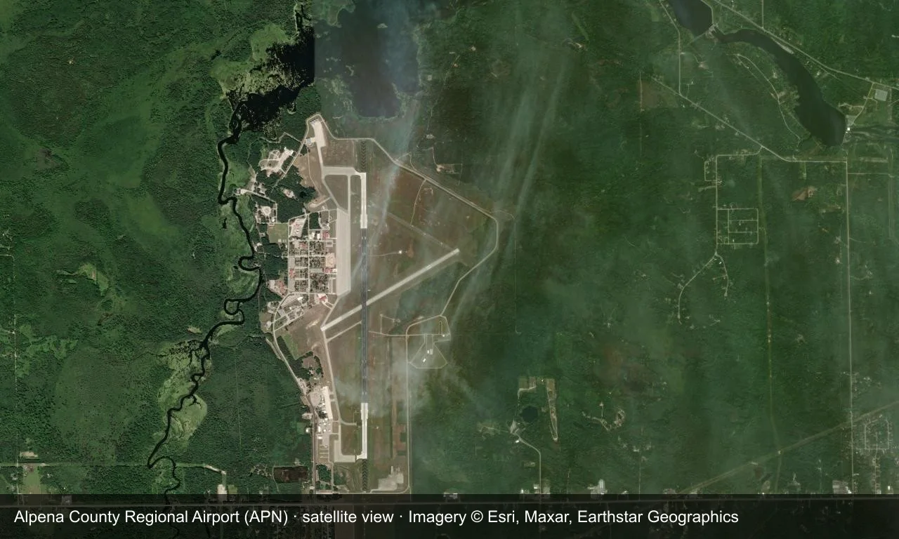
Satellite view: Alpena's runways lie among woodland and farmland beside Lake Huron, with the terminal and apron alongside the field.
The satellite image comes from Esri World Imagery (© Esri, Maxar, Earthstar Geographics); the field and attribution are labelled in the image. This is a satellite view, not a ground-level photograph.
Airport at a glance
| Item | Detail |
|---|---|
| IATA / ICAO | APN / KAPN |
| Role | Medium-sized airport |
| Elevation | about 210 m |
| Coordinates | 45.0781, -83.5603 |
| Runways | 2, longest 2,744 m |
| Non-stop destinations | 2 (2014 snapshot, all domestic US) |
Runways
| Runway | Length | Width | Surface |
|---|---|---|---|
| 01/19 | 2,744 m | 46 m | concrete |
| 07/25 | 1,533 m | 30 m | concrete |
2 runways, the longest 2,744 m.
Non-stop routes
2 non-stop destinations, nearest first (OpenFlights route snapshot compiled in 2014 — confirm with the airline or airport):
| Destination | Distance | Carriers |
|---|---|---|
| Detroit Metropolitan Wayne County Airport (DTW) | ~319 km | Delta Air Lines |
| Minneapolis–Saint Paul International Airport / Wold–Chamberlain Field (MSP) | ~760 km | Delta Air Lines |
The carrier column comes from the same snapshot and includes codeshare and interline services; treat it as an indication of how busy the route is and check the airline for who actually flies it.
Nearby airports to compare
If the fares are close, these are the nearest airports of the same class (medium-sized airport) — straight-line distance, with their own non-stop counts from the same dataset:
| Airport | Distance | Non-stop destinations |
|---|---|---|
| Austin Straubel International Airport (GRB) | ~367 km | 4 |
| Appleton International Airport (ATW) | ~403 km | 7 |
Before you fly
- With only Detroit and Minneapolis, confirm the schedule after booking.
- Lake Huron winters bring snow and wind, and early flights can be delayed.
About the data
Runways, elevation and coordinates come from OurAirports open data. Routes and carriers come from the June 2014 OpenFlights snapshot and include codeshares and interline services; they indicate network shape and scale, not current schedules.
ความคิดเห็นจากผู้อ่านการสนทนา
ยินดีรับคำถาม รายงานการเดินทาง และการแก้ไข ความคิดเห็นเป็นสาธารณะ
กำลังโหลด…
กำลังโหลดความคิดเห็น…