
Comodoro Arturo Merino Benítez International Airport
 Santiago · Chile· Comodoro Arturo Merino Benítez International Airport
O Comodoro Arturo Merino Benítez International Airport (IATA: SCL, ICAO SCEL) é um aeroporto grande que atende Santiago, Chile.
Comodoro Arturo Merino Benítez International Airport is a large airport, at an elevation of about 1,555 ft, with scheduled passenger service. This page gathers its location map, airport codes and travel information.
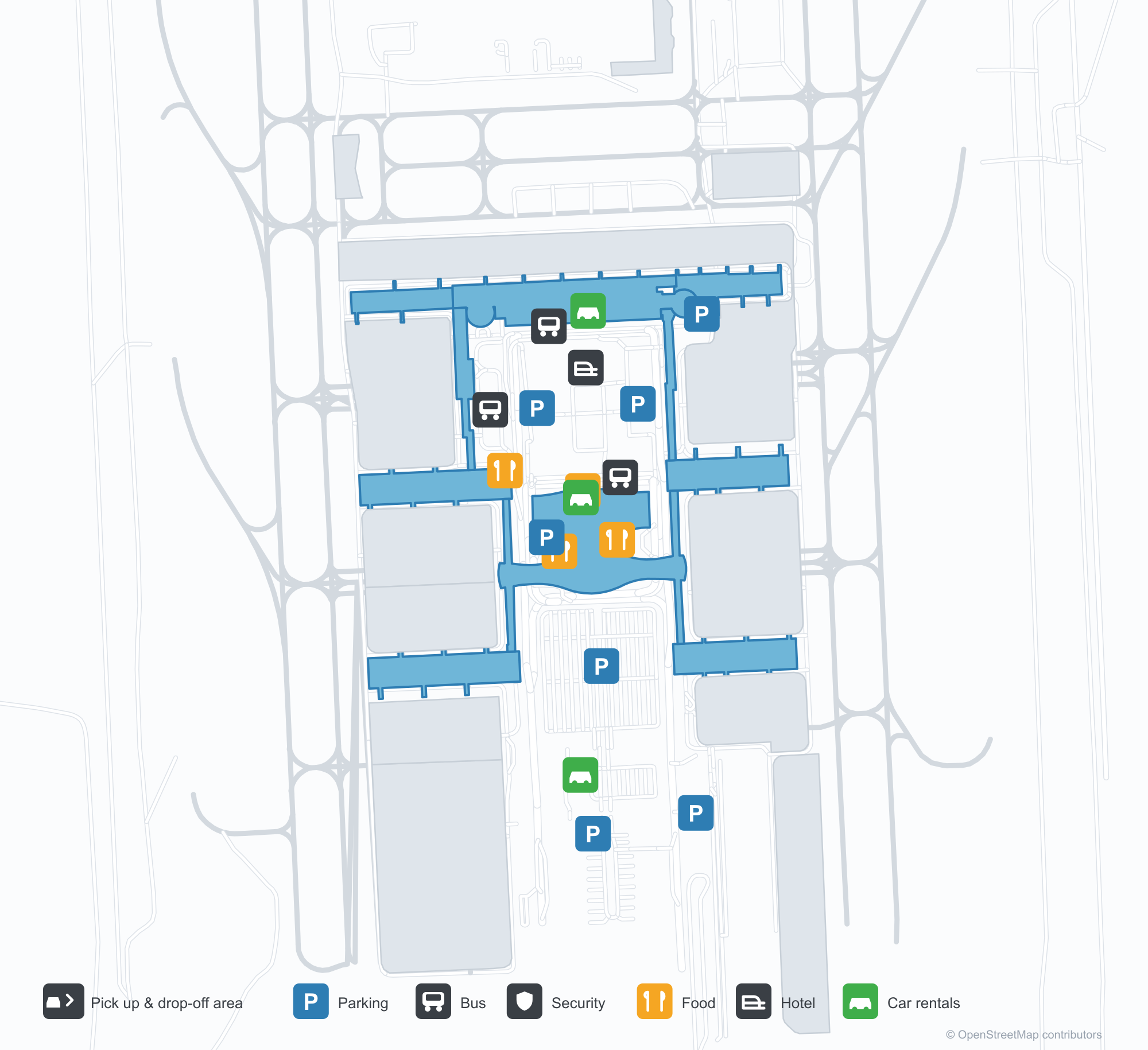
Baixar mapas do aeroportoDownloads
Fotos do aeroportoFotos do aeroporto
Fotos reais deste aeroporto, cada uma creditada à página pública da web onde foi encontrada; os direitos autorais continuam com os fotógrafos originais. Clique em uma foto para ampliar ou em uma linha de crédito para abrir a página de origem.
O terminal visto de fora — um telhado em arco cobrindo a fachada de aço e vidro, com uma passarela ligando a via aos estacionamentos.
Comodoro Arturo Merino Benítez International Airport: mapa de rotas — destinos diretosMapa de rotas
40 destinos diretos: mapa, companhias aéreas em operação e distâncias.
Comodoro Arturo Merino Benítez International Airport: voos — partidas e chegadasPainel de voos
2.534 números de voo de 34 companhias aéreas para 66 destinos, separados por direção. Números de codeshare estão incluídos.
| Voo | Companhia aérea | Destino | País/região |
|---|---|---|---|
| AA912 | American Airlines | Aeroporto Internacional de Miami | Estados Unidos |
| AA940 | American Airlines | Dallas Fort Worth International Airport | Estados Unidos |
| AA7781 | American Airlines | Antofagasta (ANF) Andrés Sabella Gálvez International Airport | Chile |
| AA7782 | American Airlines | Antofagasta (ANF) Andrés Sabella Gálvez International Airport | Chile |
| AA7782 | American Airlines | Concepcion (CCP) Carriel Sur International Airport | Chile |
| AA7784 | American Airlines | Concepcion (CCP) Carriel Sur International Airport | Chile |
| AA7784 | American Airlines | Calama (CJC) El Loa Airport | Chile |
| AA7784 | American Airlines | Iquique (IQQ) Diego Aracena International Airport | Chile |
| AA7784 | American Airlines | Temuco (ZCO) La Araucanía International Airport | Chile |
| AA7786 | American Airlines | Antofagasta (ANF) Andrés Sabella Gálvez International Airport | Chile |
| AA7786 | American Airlines | Puerto Montt (PMC) El Tepual International Airport | Chile |
| AA7787 | American Airlines | Antofagasta (ANF) Andrés Sabella Gálvez International Airport | Chile |
| AA7787 | American Airlines | Iquique (IQQ) Diego Aracena International Airport | Chile |
| AA7789 | American Airlines | Calama (CJC) El Loa Airport | Chile |
| AA7789 | American Airlines | Mendoza (MDZ) Governor Francisco Gabrielli International Airport | Argentina |
| AA7790 | American Airlines | Concepcion (CCP) Carriel Sur International Airport | Chile |
| AA7792 | American Airlines | Antofagasta (ANF) Andrés Sabella Gálvez International Airport | Chile |
| AA7792 | American Airlines | Temuco (ZCO) La Araucanía International Airport | Chile |
| AA7793 | American Airlines | Antofagasta (ANF) Andrés Sabella Gálvez International Airport | Chile |
| AA7795 | American Airlines | Concepcion (CCP) Carriel Sur International Airport | Chile |
Números de voo e rotas do índice de voos da aviability.com (instantâneo de 26 de outubro de 2026); números de codeshare estão incluídos e nenhum horário de partida é exibido. Fonte: aviability.com ↗
Informações e detalhes do aeroportoDetalhes do aeroporto
Mapa interativo — localização do Comodoro Arturo Merino Benítez International AirportMapa interativo
Veja este aeroporto em outros serviços de mapas:
Santiago Airport (SCL): Two Parallel Runways and Chile's Long-Haul GatewayGuia do aeroporto
Santiago's terminal presents itself as a single arched roof spanning a steel-and-glass frontage, with a walkway connecting the roadway directly to the car parks. The airport sits in Santiago, Chile, at an elevation of about 474 m, and its two parallel runways — 17L/35R and 17R/35L — are both 3,750 m long. For a capital-city airport, that pairing means it can handle widebody arrivals and departures at the same time.
In the 2014 route snapshot, 13 of SCL's 40 non-stop destinations are in Chile and 27 are abroad. The domestic network runs north–south along the Andes, while the international map reaches neighbours, Europe and Oceania.
Airport photos
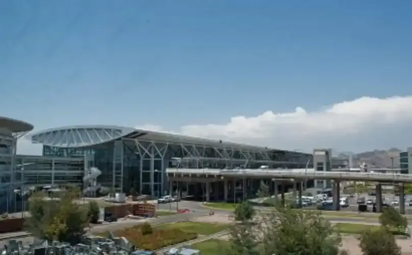
The terminal from outside — an arched roof spanning the steel-and-glass frontage, a walkway linking the roadway to the car parks.
The photos come from public web sources and remain the copyright of their photographers; full credits and source links sit in the photo gallery on this page.
Airport at a glance
| Item | Detail |
|---|---|
| IATA / ICAO | SCL / SCEL |
| Role | Large international airport and Chile's long-haul gateway |
| Elevation | about 474 m |
| Coordinates | -33.3930, -70.7858 |
| Runways | 2 parallel, both 3,750 m |
| Non-stop destinations | 40 (13 domestic, 27 international; 2014 snapshot) |
| Official site | aeropuertosantiago.cl |
Network shape: half in South America, half far away
Group the 40 routes by distance: 8 within 1,000 km, 13 between 1,000 and 3,000 km, 8 between 3,000 and 6,000 km, and 11 beyond 6,000 km. The short layer is the South American west coast — Mendoza at 196 km, La Serena at 389 km, Concepción at 429 km. The long layer includes Madrid (10,719 km), Sydney (11,340 km) and Paris (11,673 km). With 11 routes beyond 6,000 km — a quarter of the total — SCL is more than Chile's domestic hub: it is the southern cone's outlet to Europe and Oceania.
| Distance band | Destinations |
|---|---|
| Under 1,000 km | 8 |
| 1,000–3,000 km | 13 |
| 3,000–6,000 km | 8 |
| Over 6,000 km | 11 |
LAN Airlines (now LATAM) appears on 35 of the 40 routes and Sky Airline on 10. The carrier column includes codeshares, so these figures describe network concentration rather than who operates every flight. The full list is on the Santiago route map.
Getting there and navigating
- Coordinates: -33.3930, -70.7858
- Official site: aeropuertosantiago.cl
- Open in a map: Google Maps | Amap | Baidu Maps
If fares are close, the nearest large-airport comparison in the snapshot is Córdoba, Argentina (COR): about 660 km away with 11 destinations. Travellers heading to Buenos Aires should watch the airport code — AEP and EZE serve different roles, one as the city airport and one for long-haul international flights.
The location map on this page shows the field against Santiago and the surrounding road network. This page does not cover terminal connections or local transport; confirm them with the airport or airline.
Before you fly
- Allow 2–3 hours for an international departure and 90–120 minutes for a domestic one. Two runways do not guarantee short queues, especially at morning and evening peaks.
- The 40 destinations are a 2014 snapshot; LATAM and Sky have both reshaped their networks since. Check current schedules with the airline.
- Flights to Europe and Oceania are 10 hours or more, so seat choice and connection buffers deserve more attention than on a regional trip.
About the data
Runways, elevation and coordinates come from OurAirports open data. Routes and carriers come from the June 2014 OpenFlights snapshot and include codeshares and interline services; they indicate network shape and scale, not current schedules. Photos are from public web sources and remain the copyright of their photographers.
History
Fifteen kilometres north-west of downtown Santiago, Arturo Merino Benítez is Chile's largest aviation facility and its busiest international airport, also known as Nuevo Pudahuel.
Source: Arturo Merino Benítez International Airport.
Comentários dos leitoresDiscussão
Perguntas, relatos de viagem e correções são bem-vindos. Os comentários são públicos.
Carregando…
Carregando comentários…