
Asturias Airport
 Asturias · 스페인· Asturias Airport
Asturias Airport(IATA: OVD, ICAO: LEAS)은 스페인 Asturias에 위치한 대형 공항입니다.
Asturias Airport is a large airport, at an elevation of about 416 ft, with scheduled passenger service. This page gathers its location map, airport codes and travel information.
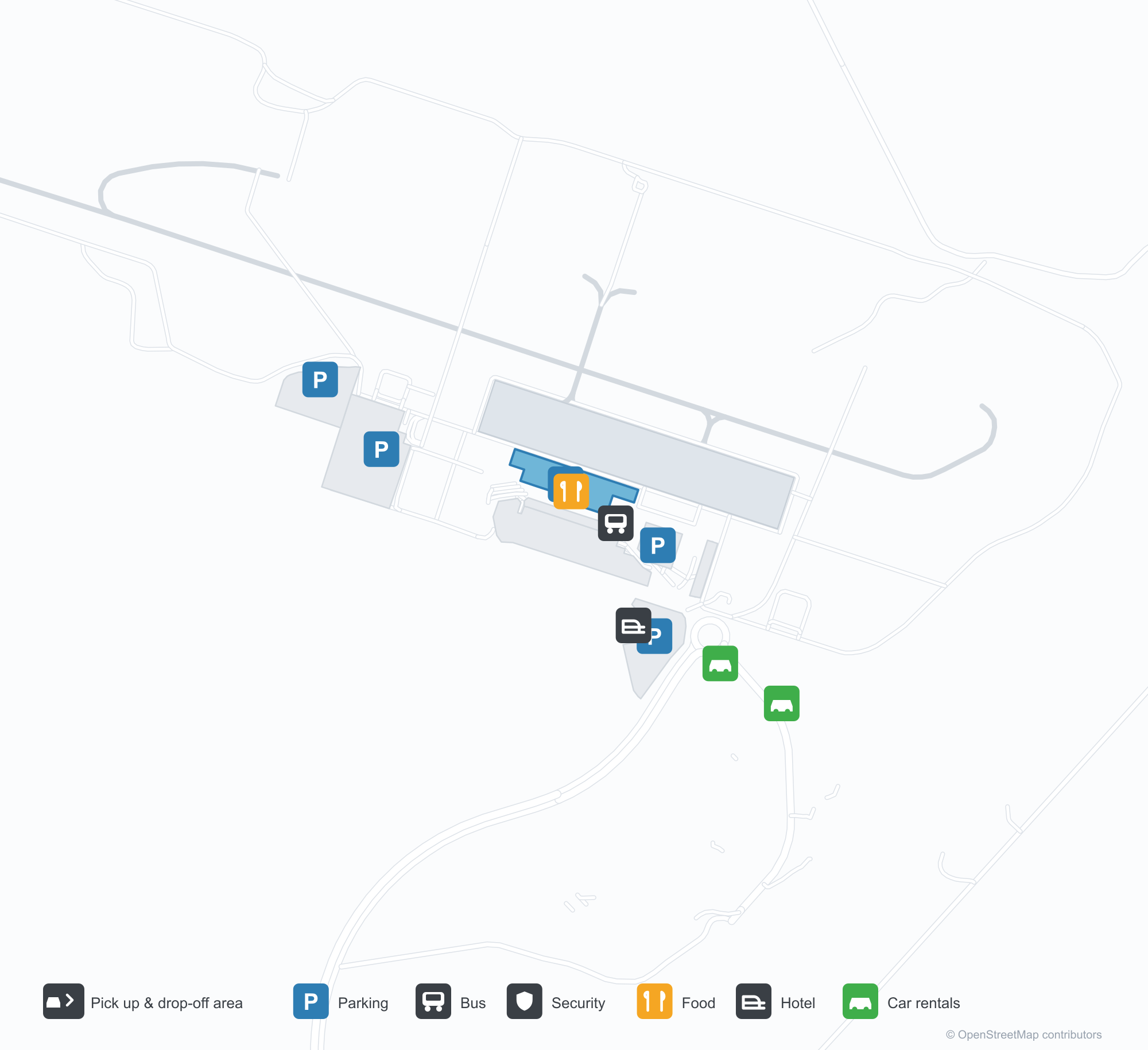
공항 지도 다운로드다운로드
공항 실제 사진공항 사진
다음은 이 공항의 실제 사진으로, 모두 공개된 인터넷 출처에서 가져왔으며 사진마다 출처를 표시했습니다. 저작권은 원저작자에게 있습니다. 사진을 클릭하면 크게 볼 수 있고, 출처를 클릭하면 원본 페이지가 열립니다.
위성 사진: 해안과 구릉 사이의 고원에 자리한 아스투리아스 공항 활주로 — 중간 지점에 터미널과 계류장.
Asturias Airport 노선도 · 직항 목적지노선도
직항 목적지 10개: 노선도, 운항 항공사, 비행 거리.
공항 정보 및 상세공항 상세
Asturias Airport 인터랙티브 지도 — 공항 위치인터랙티브 지도
다른 지도 서비스에서 이 공항 보기:
Asturias Airport (OVD): Ten Routes Between Hills and Coast공항 안내
Seen from above, the runway sits on a plateau between the coast and the hills, with the terminal and apron at its midpoint and green valleys and coastline around. Asturias Airport serves the principality in northern Spain at an elevation of about 127 m, with a 2,200 m runway; the 2014 snapshot records 10 destinations, 8 domestic and 2 international, from Madrid at 397 km to Tenerife South at 1,966 km.
Satellite view
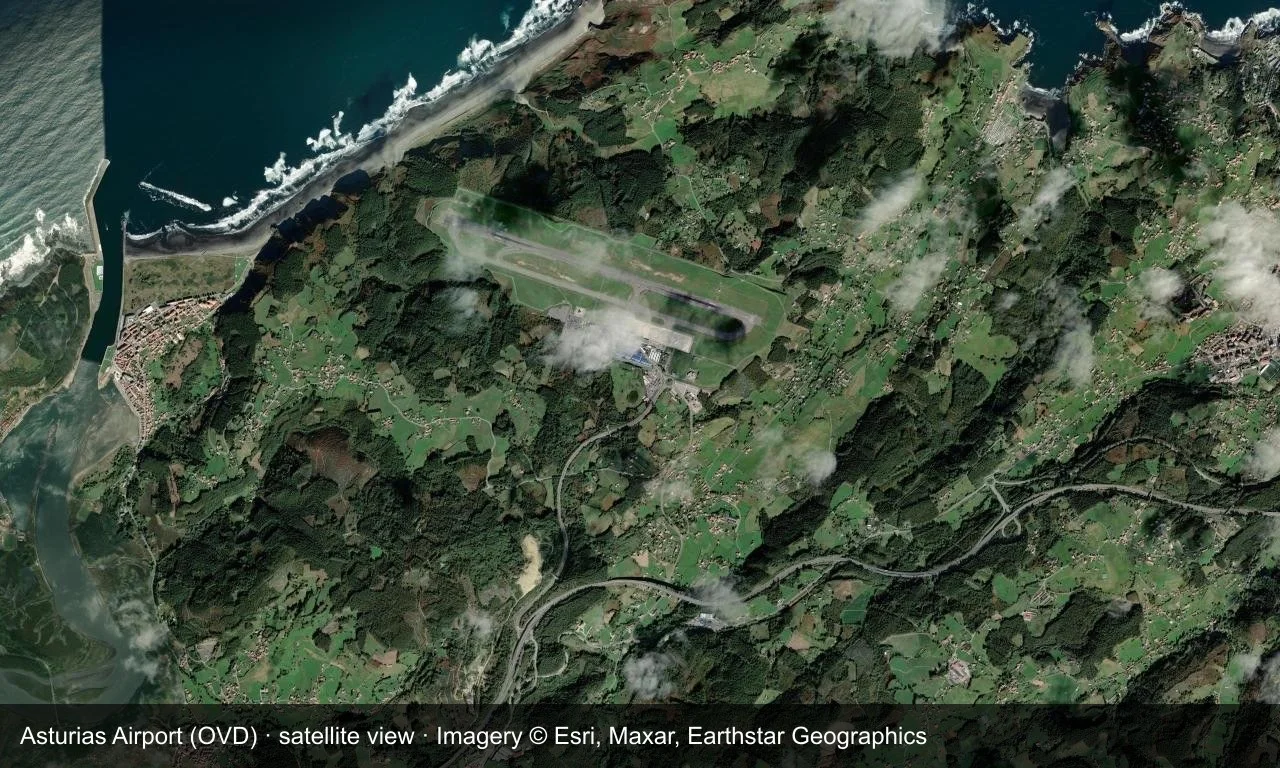
Satellite view: the runway sits on a plateau between the coast and the hills, with the terminal and apron at its midpoint.
The satellite image comes from Esri World Imagery (© Esri, Maxar, Earthstar Geographics); the field and attribution are labelled in the image. This is a satellite view, not a ground-level photograph.
Airport at a glance
| Item | Detail |
|---|---|
| IATA / ICAO | OVD / LEAS |
| Role | Large airport |
| Elevation | about 127 m |
| Coordinates | 43.5636, -6.0346 |
| Runways | 1, 2,200 m |
| Non-stop destinations | 10 (8 domestic, 2 international; 2014 snapshot) |
| Official site | www.aena.es/en/asturias.html |
Runways
| Runway | Length | Width | Surface |
|---|---|---|---|
| 11/29 | 2,200 m | 45 m | asphalt |
1 runway, the longest 2,200 m.
Non-stop routes
10 non-stop destinations, nearest first (OpenFlights route snapshot compiled in 2014 — confirm with the airline or airport):
| Destination | Distance | Carriers |
|---|---|---|
| Adolfo Suárez Madrid–Barajas Airport (MAD) | ~397 km | Iberia Airlines, Air Europa |
| Valencia Airport (VLC) | ~647 km | Iberia Airlines, VOLOTEA Airways |
| Seville Airport (SVQ) | ~683 km | Iberia Airlines, Vueling Airlines |
| Josep Tarradellas Barcelona-El Prat Airport (BCN) | ~712 km | Iberia Airlines, Vueling Airlines |
| Málaga-Costa del Sol Airport (AGP) | ~777 km | Iberia Airlines, Vueling Airlines |
| Palma de Mallorca Airport (PMI) | ~855 km | Iberia Airlines, VOLOTEA Airways |
| Charles de Gaulle International Airport (CDG) | ~895 km | Iberia Airlines, Vueling Airlines |
| London Stansted Airport (STN) | ~1036 km | easyJet |
| César Manrique-Lanzarote Airport (ACE) | ~1760 km | Air Europa |
| Tenerife Sur Airport (TFS) | ~1966 km | Air Europa |
The carrier column comes from the same snapshot and includes codeshare and interline services; treat it as an indication of how busy the route is and check the airline for who actually flies it.
Nearby airports to compare
If the fares are close, these are the nearest airports of the same class (large airport) — straight-line distance, with their own non-stop counts from the same dataset:
| Airport | Distance | Non-stop destinations |
|---|---|---|
| Adolfo Suárez Madrid–Barajas Airport (MAD) | ~397 km | 151 |
| Lisbon Humberto Delgado Airport (LIS) | ~592 km | 99 |
Before you fly
- Allow 90–120 minutes for domestic and 2 hours for international departures; coastal and hill weather can affect operations, so leave a buffer.
- The ten destinations are a 2014 snapshot and Iberia and Vueling have adjusted their Spanish networks; check current information.
About the data
Runways, elevation and coordinates come from OurAirports open data. Routes and carriers come from the June 2014 OpenFlights snapshot and include codeshares and interline services; they indicate network shape and scale, not current schedules.