
Akron Canton Regional Airport
 Akron · 미국· Akron Canton Regional Airport
Akron Canton Regional Airport(IATA: CAK, ICAO: KCAK)은 미국 Akron에 위치한 중형 공항입니다.
Akron Canton Regional Airport is a medium-sized airport, at an elevation of about 1,228 ft, with scheduled passenger service. This page gathers its location map, airport codes and travel information.
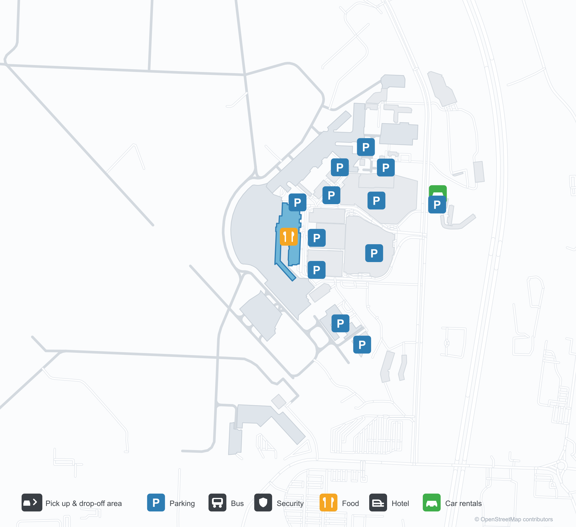
공항 지도 다운로드다운로드
공항 실제 사진공항 사진
다음은 이 공항의 실제 사진으로, 모두 공개된 인터넷 출처에서 가져왔으며 사진마다 출처를 표시했습니다. 저작권은 원저작자에게 있습니다. 사진을 클릭하면 크게 볼 수 있고, 출처를 클릭하면 원본 페이지가 열립니다.
American Airlines 체크인 카운터 — 승객들이 지켜보는 가운데 직원이 가방을 처리하는 모습, 뒤로는 항공사의 파란색과 흰색 브랜딩.
입국 통로 — 'Arrivals' 표지판 아래에서 가방을 든 여행자들이 출구로 향하는 모습.
Akron Canton Regional Airport 노선도 · 직항 목적지노선도
직항 목적지 11개: 노선도, 운항 항공사, 비행 거리.
공항 정보 및 상세공항 상세
Akron Canton Regional Airport 인터랙티브 지도 — 공항 위치인터랙티브 지도
다른 지도 서비스에서 이 공항 보기:
Akron-Canton Airport (CAK): Check-In Desks and Eleven Domestic Routes공항 안내
The official photos show an American Airlines check-in desk with a bag being weighed, and an arrivals corridor where travellers head for the exit beneath the "Arrivals" sign. Akron-Canton Airport serves Akron, Ohio, at an elevation of about 374 m, with runways of 2,501 m and 2,317 m; the 2014 snapshot records eleven domestic destinations, from Detroit at 215 km to Denver at 1,965 km.
Airport photos

An American Airlines check-in counter — an agent handling a bag while passengers look on, the airline's blue-and-white branding behind.

The arrivals corridor — travellers with bags heading for the exit beneath the 'Arrivals' sign.
The photos come from the airport's official site and remain the copyright of their photographers; full credits and source links sit in the photo gallery on this page.
Airport at a glance
| Item | Detail |
|---|---|
| IATA / ICAO | CAK / KCAK |
| Role | Medium-sized airport |
| Elevation | about 374 m |
| Coordinates | 40.9161, -81.4422 |
| Runways | 2, longest 2,501 m |
| Non-stop destinations | 11 (2014 snapshot, all domestic US) |
| Official site | www.akroncantonairport.com |
Runways
| Runway | Length | Width | Surface |
|---|---|---|---|
| 05/23 | 2,501 m | 46 m | asphalt |
| 01/19 | 2,317 m | 46 m | asphalt |
2 runways, the longest 2,501 m.
Non-stop routes
11 non-stop destinations, nearest first (OpenFlights route snapshot compiled in 2014 — confirm with the airline or airport):
| Destination | Distance | Carriers |
|---|---|---|
| Detroit Metropolitan Wayne County Airport (DTW) | ~215 km | Delta Air Lines |
| Ronald Reagan Washington National Airport (DCA) | ~440 km | American Airlines, US Airways |
| Philadelphia International Airport (PHL) | ~538 km | American Airlines, US Airways |
| Chicago O'Hare International Airport (ORD) | ~551 km | United Airlines |
| Charlotte Douglas International Airport (CLT) | ~636 km | American Airlines, US Airways |
| LaGuardia Airport (LGA) | ~637 km | AirTran Airways, Southwest Airlines |
| Hartsfield Jackson Atlanta International Airport (ATL) | ~851 km | Air France, Delta Air Lines, AirTran Airways |
| Boston Logan International Airport (BOS) | ~881 km | AirTran Airways, Southwest Airlines |
| Orlando International Airport (MCO) | ~1389 km | AirTran Airways, Southwest Airlines |
| Tampa International Airport (TPA) | ~1442 km | AirTran Airways, Southwest Airlines |
| Denver International Airport (DEN) | ~1965 km | Southwest Airlines |
The carrier column comes from the same snapshot and includes codeshare and interline services; treat it as an indication of how busy the route is and check the airline for who actually flies it.
Nearby airports to compare
If the fares are close, these are the nearest airports of the same class (medium-sized airport) — straight-line distance, with their own non-stop counts from the same dataset:
| Airport | Distance | Non-stop destinations |
|---|---|---|
| Allegheny County Airport (AGC) | ~142 km | — |
| Arnold Palmer Regional Airport (LBE) | ~186 km | 3 |
Before you fly
- Allow 90–120 minutes for a domestic departure; check-in and security peak around the early flights.
- The eleven destinations are a 2014 snapshot, and Southwest and AirTran have since consolidated routes; check current schedules.
About the data
Runways, elevation and coordinates come from OurAirports open data. Routes and carriers come from the June 2014 OpenFlights snapshot and include codeshares and interline services; they indicate network shape and scale, not current schedules.