
Austin Bergstrom International Airport
 Austin · 미국· Austin Bergstrom International Airport
Austin Bergstrom International Airport(IATA: AUS, ICAO: KAUS)은 미국 Austin에 위치한 대형 공항입니다.
Austin Bergstrom International Airport is a large airport, at an elevation of about 542 ft, with scheduled passenger service. This page gathers its location map, airport codes and travel information.
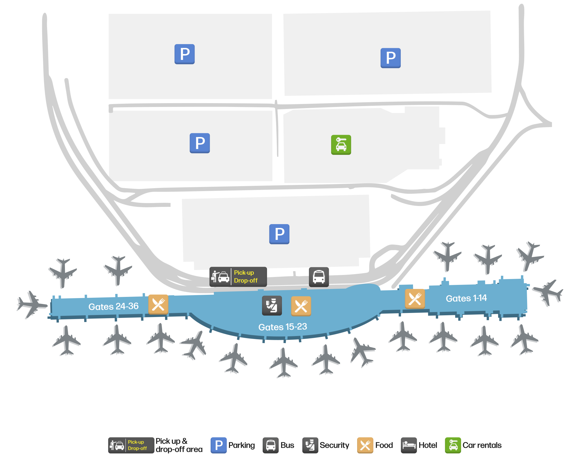
공항 지도 다운로드다운로드
공항 실제 사진공항 사진
다음은 이 공항의 실제 사진으로, 모두 공개된 인터넷 출처에서 가져왔으며 사진마다 출처를 표시했습니다. 저작권은 원저작자에게 있습니다. 사진을 클릭하면 크게 볼 수 있고, 출처를 클릭하면 원본 페이지가 열립니다.
오스틴-버그스트롬 입구의 기념 조형물과 분수 — 해질녘에 조명이 켜진 공항 이름과 로고.
바버라 조던 터미널 내부 — "C Gates 1–25" 표지판과 출발 안내 화면을 지나는 짐 든 여행객들.
Austin Bergstrom International Airport 노선도 · 직항 목적지노선도
직항 목적지 42개: 노선도, 운항 항공사, 비행 거리.
공항 정보 및 상세공항 상세
Austin Bergstrom International Airport 인터랙티브 지도 — 공항 위치인터랙티브 지도
다른 지도 서비스에서 이 공항 보기:
Austin Airport (AUS): The Barbara Jordan Terminal and Forty-Two Routes공항 안내
The official photos of Austin-Bergstrom International Airport (IATA AUS, ICAO KAUS) give two scales. Outside, the entrance monument and fountain light up at dusk, the airport's name and mark set into the stone wall. Inside, travellers with bags pass the "C Gates 1–25" sign and departure screens, glass onto the apron behind them. One is the city's front door; the other is the daily circulation — both under the name Barbara Jordan Terminal.
The field serves Austin, Texas, at an elevation of about 165 m, with two parallel runways of 3,734 m and 2,743 m. The 2014 route snapshot records 42 non-stop destinations: 39 in the United States and 3 abroad.
Airport photos

The entrance monument and fountain at Austin-Bergstrom — the airport's name and mark lit at dusk.
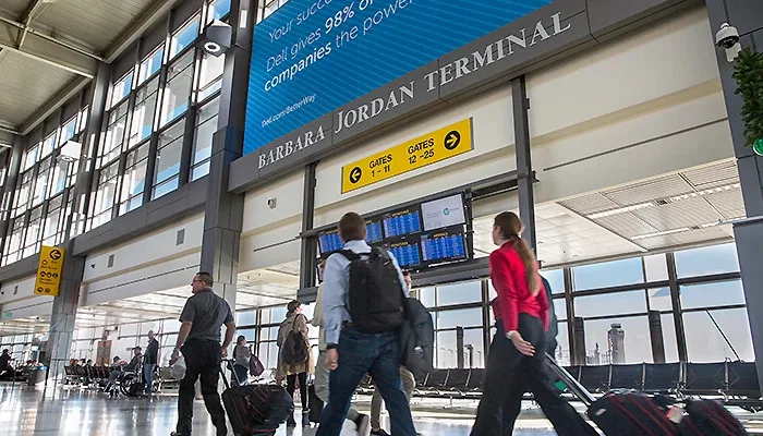
Inside the Barbara Jordan Terminal — travellers with bags passing the "C Gates 1–25" sign and departure screens.
The photos come from the airport's official flyaustin.com site and remain the copyright of their photographers; full credits and source links sit in the photo gallery on this page.
Airport at a glance
| Item | Detail |
|---|---|
| IATA / ICAO | AUS / KAUS |
| Role | Large airport and international gateway for central Texas |
| Elevation | about 165 m |
| Coordinates | 30.1975, -97.6620 |
| Runways | 2: 18R/36L at 3,734 m, 18L/36R at 2,743 m, both concrete |
| Non-stop destinations | 42 (39 domestic, 3 international; 2014 snapshot) |
| Official site | flyaustin.com |
Network shape: 39 domestic, 3 international, one transatlantic
By distance: 9 destinations within 1,000 km, 32 between 1,000 and 3,000 km, none between 3,000 and 6,000 km, and 1 beyond 6,000 km. The near layer is Houston (225 km), Hobby (238 km) and Dallas (304 km). The far layer is London Heathrow (7,892 km), followed by Seattle (2,848 km) and Boston (2,729 km). Only 3 of the 42 destinations are abroad, so AUS remains a domestic network first — but the London route plugs it directly into the transatlantic market.
| Distance band | Destinations |
|---|---|
| Under 1,000 km | 9 |
| 1,000–3,000 km | 32 |
| 3,000–6,000 km | 0 |
| Over 6,000 km | 1 |
Southwest Airlines appears on 22 routes, AirTran on 10, and United and American on 9 each. The carrier column includes codeshares, so the figures describe concentration. The full list is on the Austin route map.
Getting there and navigating
- Coordinates: 30.1975, -97.6620
- Official site: flyaustin.com
- Open in a map: Google Maps | Amap | Baidu Maps
If fares are close, compare Oklahoma City (OKC, about 578 km, 20 destinations) and Ciudad Juárez (CJS, about 851 km, 6 destinations). Austin's domestic network is fuller, so a nearby-airport switch is rarely needed for a short-haul trip.
The location map on this page shows the field against Austin and the surrounding highways. Terminal connections and local transport are not covered here; check the airport's or airline's own information.
Before you fly
- Allow 90–120 minutes for a domestic departure and 2–3 hours for an international one; security at the Barbara Jordan Terminal queues noticeably at peak times.
- The 42 destinations are a 2014 snapshot. Southwest and Austin's network have grown quickly since; check the airline's current schedule.
- The "C Gates" sign in the photo covers one concourse. If your boarding pass shows a different letter, follow the departure screens rather than assuming the C-side layout applies.
About the data
Runways, elevation and coordinates come from OurAirports open data. Routes and carriers come from the June 2014 OpenFlights snapshot and include codeshares and interline services; they indicate network shape and scale, not current schedules. Photos come from the airport's official site and remain the copyright of their photographers.