
Albuquerque International Sunport
 Albuquerque · 미국· Albuquerque International Sunport
Albuquerque International Sunport(IATA: ABQ, ICAO: KABQ)은 미국 Albuquerque에 위치한 대형 공항입니다.
Albuquerque International Sunport is a large airport, at an elevation of about 5,355 ft, with scheduled passenger service. This page gathers its location map, airport codes and travel information.
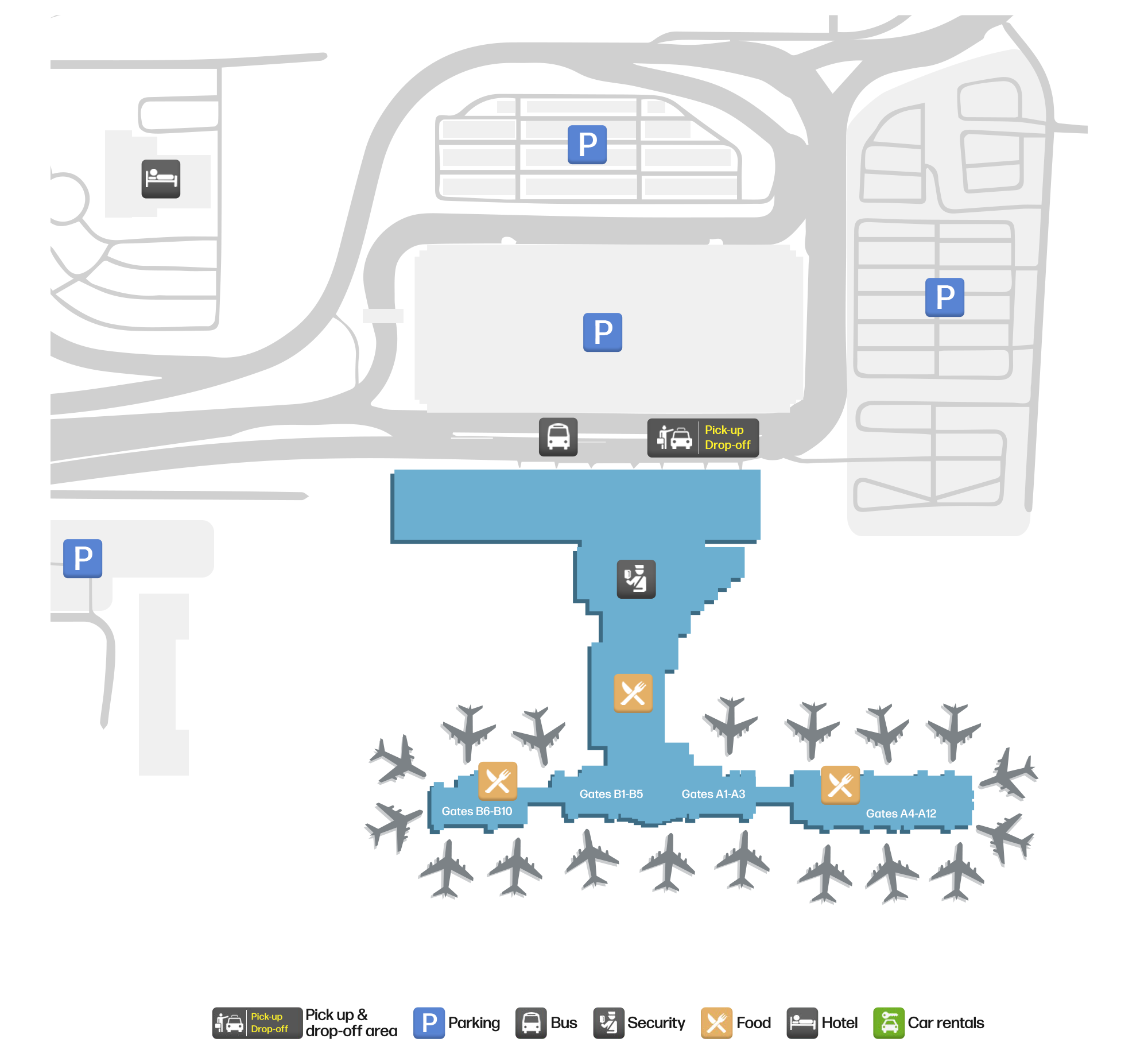
공항 지도 다운로드다운로드
공항 실제 사진공항 사진
다음은 이 공항의 실제 사진으로, 모두 공개된 인터넷 출처에서 가져왔으며 사진마다 출처를 표시했습니다. 저작권은 원저작자에게 있습니다. 사진을 클릭하면 크게 볼 수 있고, 출처를 클릭하면 원본 페이지가 열립니다.
황금빛 시간의 선포트: 주차 구조물과 주차 구획 뒤에 자리한 터미널, 그 너머로 앨버커키 스카이라인과 사막 절벽.
터미널의 육지 쪽 면 — 푸에블로 리바이벌 양식 테라코타 블록 위로 빛나는 'ALBUQUERQUE', 아래 도로의 셔틀과 차량.
터미널과 계류장의 항공 사진: 탑승교로 계류장과 이어진 분홍빛 푸에블로 양식 탑승동, 게이트에 주기된 항공기, 뒤로 주차장과 도시.
Albuquerque International Sunport 노선도 · 직항 목적지노선도
직항 목적지 22개: 노선도, 운항 항공사, 비행 거리.
공항 정보 및 상세공항 상세
Albuquerque International Sunport 인터랙티브 지도 — 공항 위치인터랙티브 지도
다른 지도 서비스에서 이 공항 보기:
Albuquerque Sunport (ABQ): A Desert Airport at 1,632 m공항 안내
Albuquerque International Sunport (IATA ABQ, ICAO KABQ) is hard to confuse with any other US airport. In the photos, the terracotta Pueblo-Revival terminal glows with the word "ALBUQUERQUE" above the roadway; from the air, pink Pueblo-style concourses reach the apron on jet bridges, with parking decks, the city skyline and a desert escarpment behind. The dusk shot makes another point: this is an airport surrounded by open country and distant ridges, not a hub wedged into dense city blocks.
The field serves Albuquerque, New Mexico, at an elevation of about 1,632 m — one of the higher airports in this directory. The 2014 route snapshot records 22 non-stop destinations, all within the United States.
Airport photos
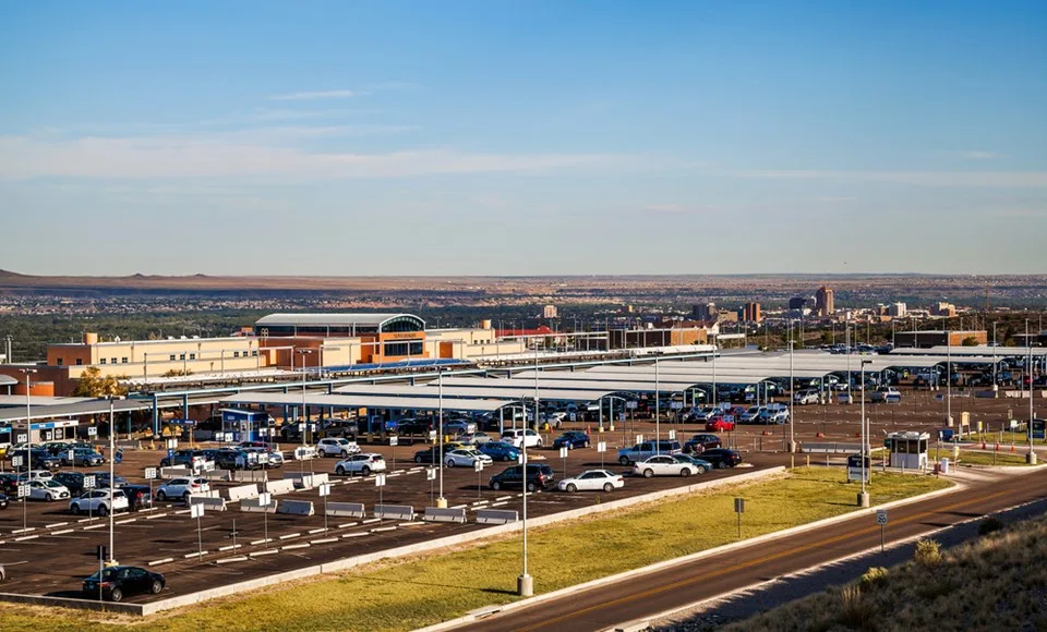
Sunport at golden hour: the terminal sits behind rows of parking structures and stalls, with Albuquerque's skyline and the desert escarpment beyond.
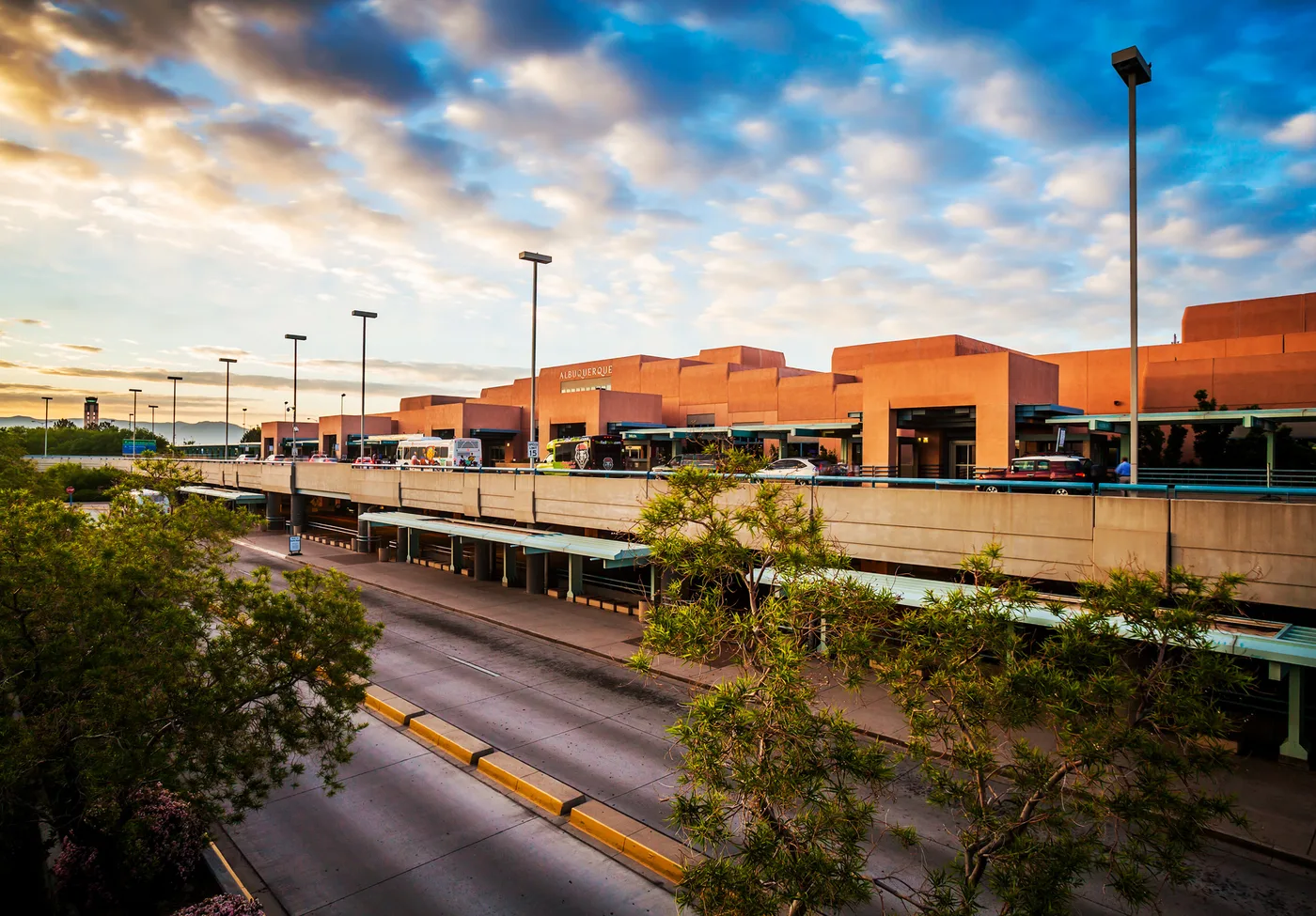
The landside face of the terminal — 'ALBUQUERQUE' glowing on the Pueblo-Revival terracotta blocks, with shuttles and cars on the roadway below.
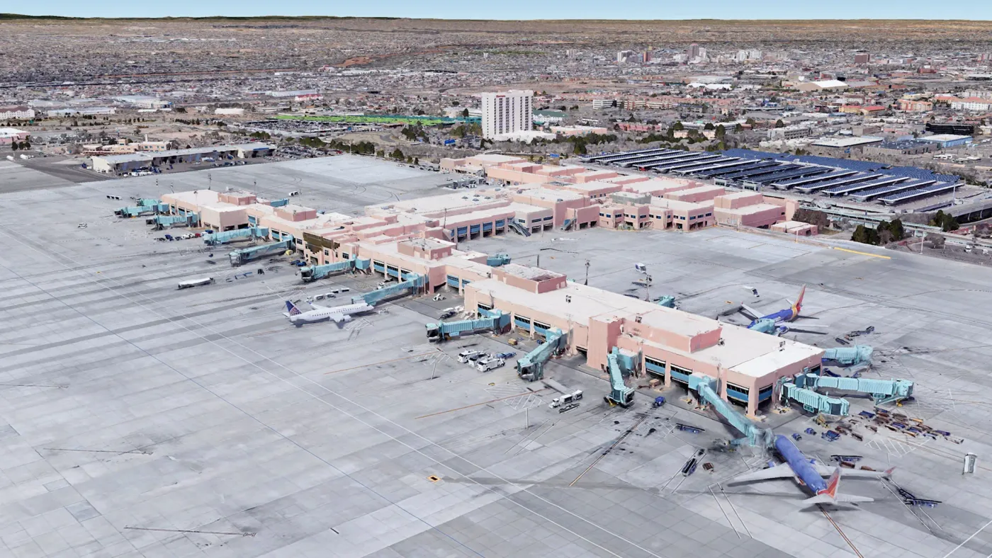
Aerial of the terminal and apron: pink Pueblo-style concourses linking to the ramp through jet bridges, aircraft parked at the gates, parking decks and the city behind.
The photos come from public web sources and remain the copyright of their photographers; full credits and source links sit in the photo gallery on this page.
Airport at a glance
| Item | Detail |
|---|---|
| IATA / ICAO | ABQ / KABQ |
| Role | Large airport and regional gateway for the US Southwest |
| Elevation | about 1,632 m |
| Coordinates | 35.0400, -106.6089 |
| Runways | 3: 08/26 at 4,204 m, 03/21 at 3,048 m, 12/30 at 1,829 m |
| Non-stop destinations | 22 (2014 snapshot, all domestic US) |
| Official site | abqsunport.com |
Why the longest runway is 4,204 m
Of ABQ's three runways, 08/26 is 4,204 m — far longer than the other two. High elevation thins the air, and desert heat thins it further, reducing engine thrust and wing lift; the same aircraft therefore needs a longer runway for take-off and landing. An elevation of 1,632 m in a desert climate explains why this runway exists.
It also shapes the airport's character: the field can handle narrowbodies and widebodies arriving from a long way out, yet all 22 destinations in the 2014 snapshot are domestic. ABQ is a US Southwest domestic network rather than an international gateway.
Network shape: 22 destinations, all in the United States
By distance, 7 destinations are within 1,000 km and 15 between 1,000 and 3,000 km; none are farther. The nearest are Cavern City (CNM, 371 km), Phoenix (527 km) and Denver (562 km). The farthest are Atlanta (2,038 km), Baltimore (2,682 km) and New York JFK (2,931 km).
| Distance band | Destinations |
|---|---|
| Under 1,000 km | 7 |
| 1,000–3,000 km | 15 |
| Over 3,000 km | 0 |
Southwest Airlines appears on 13 of the routes, followed by AirTran, United, American and US Airways. The carrier column includes codeshares, so these numbers describe network concentration. The full list is on the Albuquerque route map.
Getting there and navigating
- Coordinates: 35.0400, -106.6089
- Official site: abqsunport.com
- Open in a map: Google Maps | Amap | Baidu Maps
If fares are close, compare the nearby airports in the snapshot: Ciudad Juárez (CJS) is about 379 km away with 6 destinations, and Oklahoma City (OKC) about 819 km away with 20. CJS can be an option for northern Mexico, but remember the international border formalities.
The location map on this page shows the field against Albuquerque and the surrounding road network. Terminal connections and local transport fall outside this dataset; the airport or airline can confirm them.
Before you fly
- With a mostly domestic network, 90–120 minutes before departure is usually enough; add a buffer for peak season and early-morning departures.
- At 1,632 m and in dry desert air, hydration matters more than at sea level. Summer afternoon storms can also disrupt flights.
- The 22 destinations are a 2014 snapshot. Southwest reshapes its network often, so check the airline's current schedule.
About the data
Runways, elevation and coordinates come from OurAirports open data. Routes and carriers come from the June 2014 OpenFlights snapshot and include codeshares and interline services; they indicate network shape and scale, not current schedules. Photos are from public web sources and remain the copyright of their photographers.
History
Albuquerque's municipal airport opened in 1939 with two paved runways and its Pueblo-style terminal; a year later it became an Army air base, and it still shares its runways with what is now Kirtland Air Force Base.
Source: Albuquerque Intl Sunport Airport.