
Gazipaşa-Alanya Airport
 Gazipaşa · トルコ· Gazipaşa-Alanya Airport
Gazipaşa-Alanya Airport(IATA: GZP、ICAO: LTFG)はGazipaşa、トルコにある中型空港です。
Gazipaşa-Alanya Airport is a medium-sized airport, at an elevation of about 92 ft, with scheduled passenger service. This page gathers its location map, airport codes and travel information.
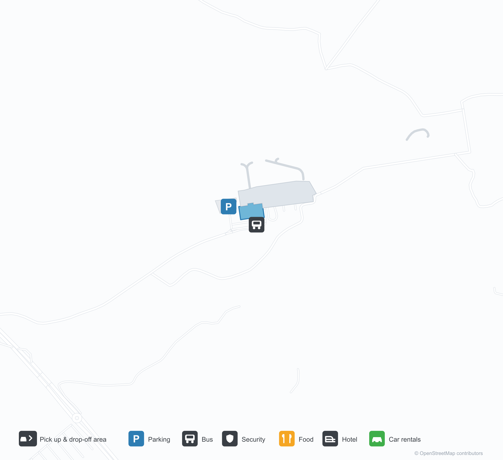
空港マップをダウンロードダウンロード
空港写真空港写真
この空港の実際の写真です。いずれも公開ウェブページを出典として明記しており、著作権は撮影者に帰属します。写真をクリックすると拡大表示され、クレジットをクリックすると元のページが開きます。
衛星画像:ガジパシャの滑走路はタウルス山脈と地中海の間の海岸平野にあり、ターミナルとエプロンが並ぶ。
Gazipaşa-Alanya Airportの路線マップ — 直行便の目的地路線マップ
直行目的地6か所。地図、就航航空会社、距離を掲載しています。
Gazipaşa-Alanya Airport発着便 — 出発と到着フライトボード
便名62件、13社の航空会社、14か所の目的地を出発・到着別に掲載しています。コードシェア便も含みます。
| 便 | 航空会社 | 目的地 | 国・地域 |
|---|---|---|---|
| AY1932 | Finnair | Helsinki Vantaa Airport | フィンランド |
| AY1934 | Finnair | Helsinki Vantaa Airport | フィンランド |
| AY1936 | Finnair | Helsinki Vantaa Airport | フィンランド |
| AY3318 | Finnair | イスタンブール空港 | トルコ |
| CD5152 | Corendon Dutch Airlines | アムステルダム・スキポール空港 | オランダ |
| DK357 | Sunclass Airlines | Helsinki Vantaa Airport | フィンランド |
| DP836 | Pobeda | モスクワ (VKO) Vnukovo International Airport | ロシア |
| DY1265 | Norwegian Air Shuttle | Oslo-Gardermoen International Airport | ノルウェー |
| FS7112 | Flyr | Almaty International Airport | カザフスタン |
| FS7952 | Flyr | アスタナ (NQZ) Nursultan Nazarbayev International Airport | カザフスタン |
| JU8193 | Air Serbia | イスタンブール空港 | トルコ |
| JU8194 | Air Serbia | イスタンブール空港 | トルコ |
| PC2071 | Pegasus Airlines | Istanbul Sabiha Gökçen International Airport | トルコ |
| PC2073 | Pegasus Airlines | Istanbul Sabiha Gökçen International Airport | トルコ |
| PC4255 | Pegasus Airlines | Istanbul Sabiha Gökçen International Airport | トルコ |
| SK2822 | SAS Scandinavian Airlines | コペンハーゲン・カストロップ空港 | デンマーク |
| SK2844 | SAS Scandinavian Airlines | ストックホルム・アーランダ空港 | スウェーデン |
| SK4774 | SAS Scandinavian Airlines | Oslo-Gardermoen International Airport | ノルウェー |
| TG9343 | Thai Airways | イスタンブール空港 | トルコ |
| TG9345 | Thai Airways | イスタンブール空港 | トルコ |
便名と路線はaviability.comのフライトインデックス(スナップショット:2026年10月26日)に基づきます。コードシェア便を含み、出発時刻は掲載していません。出典:aviability.com ↗
空港情報と詳細空港の詳細
インタラクティブマップ — Gazipaşa-Alanya Airportの位置インタラクティブマップ
他の地図サービスでこの空港を見る:
Gazipaşa Airport (GZP): Six Routes Between the Taurus Mountains and the Mediterranean空港ガイド
From above, Gazipaşa's runway sits on the coastal plain between the Taurus Mountains and the Mediterranean, with the terminal and apron alongside. The airport serves Gazipaşa in Antalya province, Turkey, at an elevation of about 28 m, with a 2,350 m runway; the 2014 snapshot records 6 destinations, 3 domestic and 3 international, from Ankara at 430 km to Oslo at 3,055 km.
Satellite view
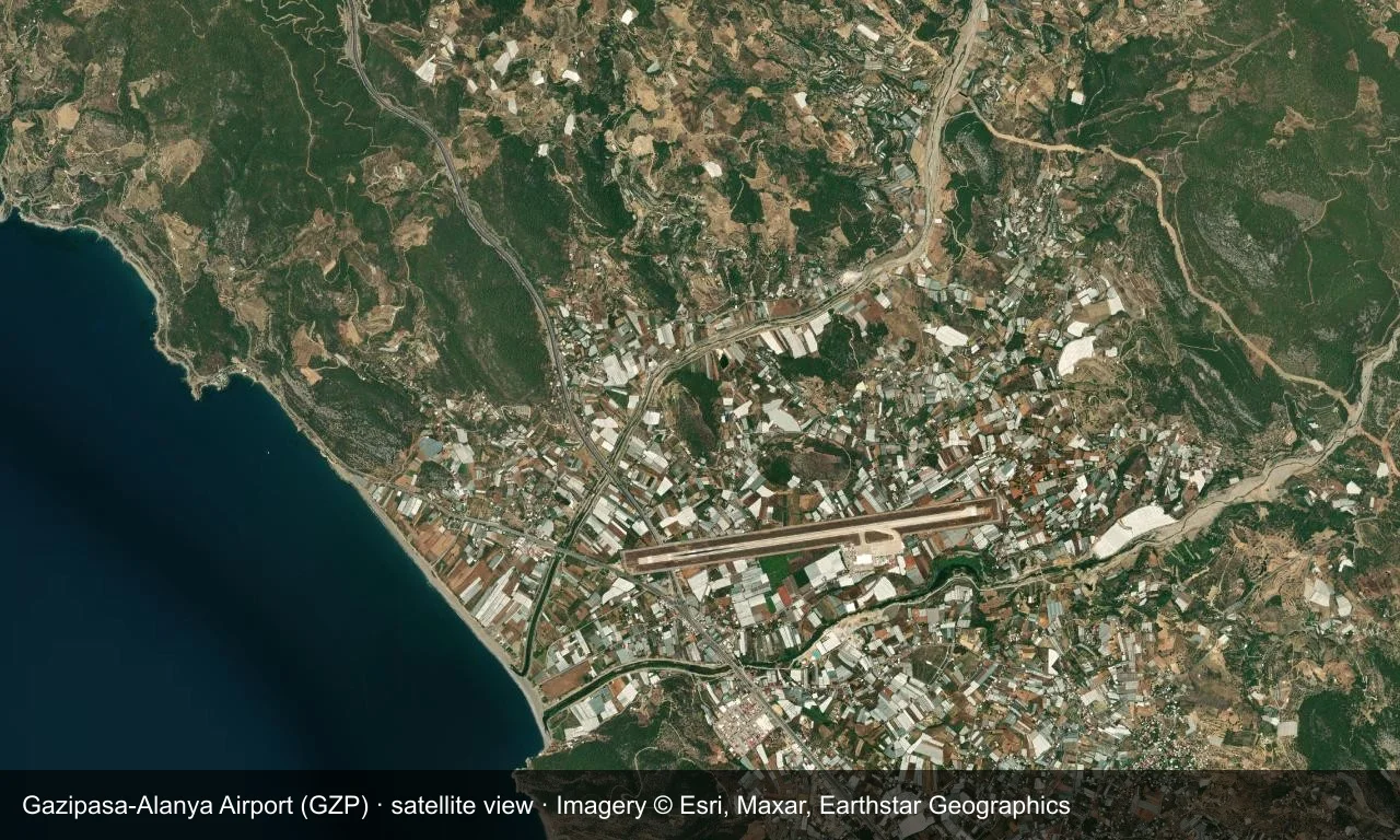
Satellite view: Gazipaşa's runway sits on the coastal plain between the Taurus Mountains and the Mediterranean, with the terminal and apron alongside.
The satellite image comes from Esri World Imagery (© Esri, Maxar, Earthstar Geographics); the field and attribution are labelled in the image. This is a satellite view, not a ground-level photograph.
Airport at a glance
| Item | Detail |
|---|---|
| IATA / ICAO | GZP / LTFG |
| Role | Medium-sized airport |
| Elevation | about 28 m |
| Coordinates | 36.2988, 32.2970 |
| Runways | 1, 2,350 m |
| Non-stop destinations | 6 (3 domestic, 3 international; 2014 snapshot) |
Nearby airports
If nothing fits, these nearby fields are worth comparing:
| Airport | Distance |
|---|---|
| Antalya International Airport (AYT) | 149 km |
| RAF Akrotiri (AKT) | 200 km |
| Afyon Air Base (AFY) | 309 km |
Before you fly
- The airport serves the Alanya resort area, with Nordic flights concentrated in summer; the 2,350 m runway limits long-haul aircraft.
- The six destinations are a 2014 snapshot and holiday routes vary strongly by season.
About the data
Runways, elevation and coordinates come from OurAirports open data. Routes and carriers come from the June 2014 OpenFlights snapshot and include codeshares and interline services; they indicate network shape and scale, not current schedules.
読者コメントディスカッション
質問、旅行記、訂正など、お気軽にお寄せください。コメントは公開されます。
読み込み中…
コメントを読み込み中…