
Abdul Rachman Saleh Airport
 Malang · Indonesia· Abdul Rachman Saleh Airport
Abdul Rachman Saleh Airport (IATA: MLG, OACI WARA) es un aeropuerto mediano que da servicio a Malang, Indonesia.
Abdul Rachman Saleh Airport is a medium-sized airport, at an elevation of about 1,726 ft, with scheduled passenger service. This page gathers its location map, airport codes and travel information.
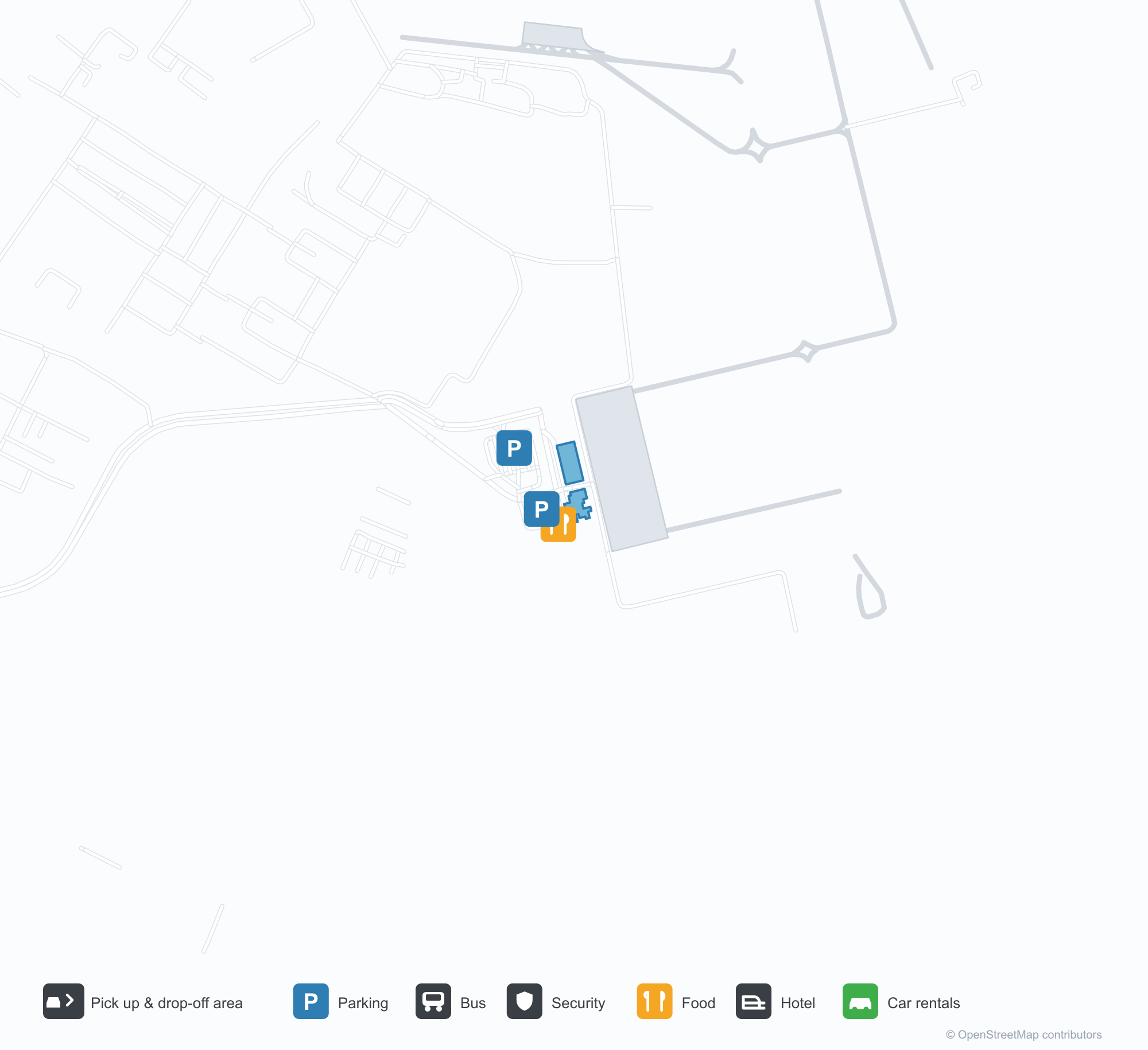
Descargar mapas de aeropuertosDescargas
Fotos del aeropuertoFotos del aeropuerto
Fotos reales de este aeropuerto, cada una con la referencia de la página web pública donde se encontró; los derechos de autor siguen siendo de los fotógrafos originales. Haz clic en una foto para ampliarla o en la línea de crédito para abrir su página de origen.
Vista satelital: las pistas de Malang se extienden entre las localidades y tierras agrícolas de las tierras altas de Java, con la terminal y la plataforma junto al aeródromo y volcanes más allá.
Mapa de rutas de Abdul Rachman Saleh Airport — destinos directosMapa de rutas
2 destinos directos: mapa, aerolíneas que operan y distancias.
Vuelos de Abdul Rachman Saleh Airport — salidas y llegadasPanel de vuelos
12 números de vuelo de 3 aerolíneas y 2 destinos, divididos por dirección. Se incluyen los números de código compartido.
| Vuelo | Aerolínea | Destino | País/región |
|---|---|---|---|
| GA8785 | Garuda Indonesia | Aeropuerto Internacional Soekarno-Hatta | Indonesia |
| ID6565 | Batik Air | Aeropuerto Internacional Soekarno-Hatta | Indonesia |
| ID6567 | Batik Air | Aeropuerto Internacional Soekarno-Hatta | Indonesia |
| ID7580 | Batik Air | Yakarta (HLP) Halim Perdanakusuma International Airport | Indonesia |
| ID7582 | Batik Air | Yakarta (HLP) Halim Perdanakusuma International Airport | Indonesia |
| QG753 | Citilink | Aeropuerto Internacional Soekarno-Hatta | Indonesia |
Números de vuelo y rutas del índice de vuelos de aviability.com (instantánea de 26 de octubre de 2026); se incluyen los números de código compartido y no se muestran horarios de salida. Fuente: aviability.com ↗
Información y datos del aeropuertoDatos del aeropuerto
Mapa interactivo — ubicación de Abdul Rachman Saleh AirportMapa interactivo
Consulta este aeropuerto en otros servicios de mapas:
Malang Airport (MLG): Two Domestic Routes in the Javan HighlandsGuía del aeropuerto
Seen from above, Malang's runways lie among the towns and farmland of the Javan highlands, with the terminal and apron alongside the field and volcanoes beyond. The airport serves Malang, Indonesia, at an elevation of about 526 m, with runways of 2,500 m and 1,500 m; the 2014 snapshot records two domestic destinations, Bali at 285 km and Jakarta at 698 km.
Satellite view
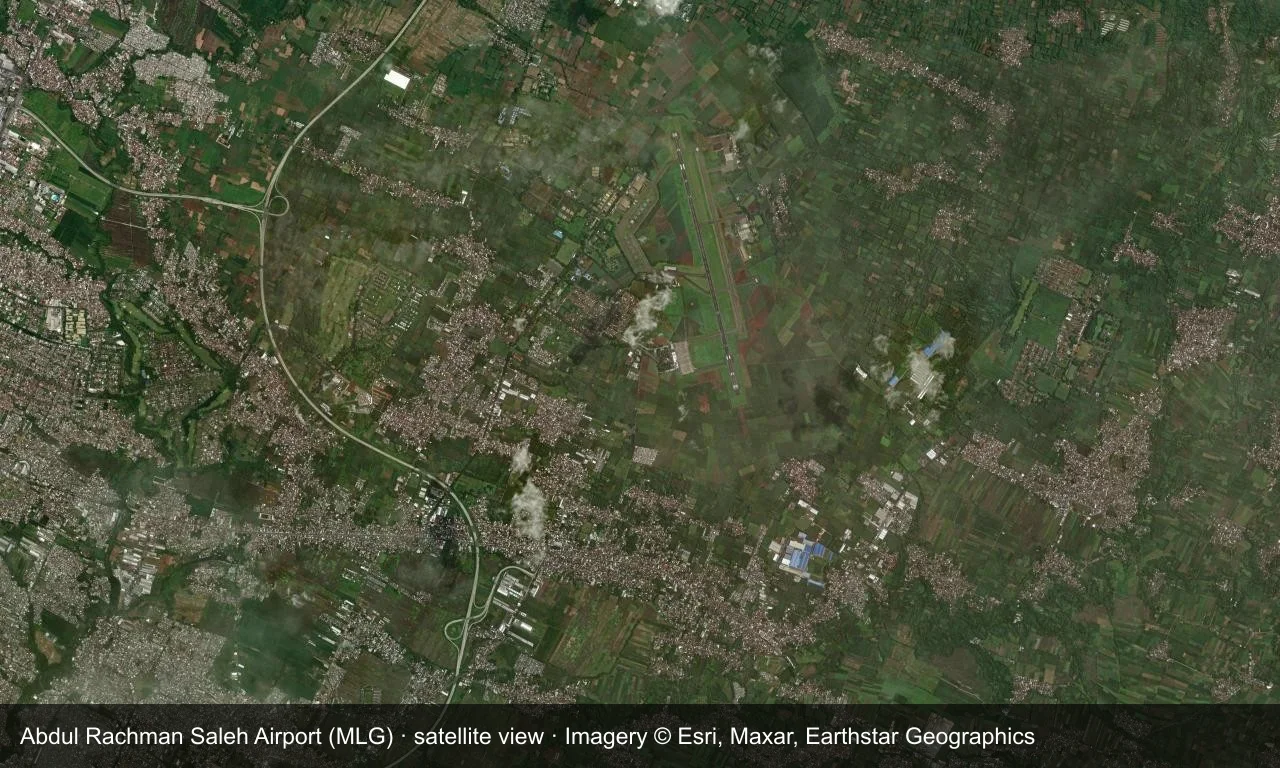
Satellite view: Malang's runways lie among the towns and farmland of the Javan highlands, with the terminal and apron alongside the field and volcanoes beyond.
The satellite image comes from Esri World Imagery (© Esri, Maxar, Earthstar Geographics); the field and attribution are labelled in the image. This is a satellite view, not a ground-level photograph.
Airport at a glance
| Item | Detail |
|---|---|
| IATA / ICAO | MLG / WARA |
| Role | Medium-sized airport |
| Elevation | about 526 m |
| Coordinates | -7.9291, 112.7142 |
| Runways | 2, longest 2,500 m |
| Non-stop destinations | 2 (2014 snapshot, all domestic) |
Nearby airports
If nothing fits, these nearby fields are worth comparing:
| Airport | Distance |
|---|---|
| Adisoemarmo International Airport (SOC) | 220 km |
| Adisutjipto International Airport (JOG) | 252 km |
| Jenderal Ahmad Yani Airport (SRG) | 279 km |
Before you fly
- Malang is a common base for Mount Bromo, so allow road time between the airport and the volcano.
- The two destinations are a 2014 snapshot and Indonesian domestic routes have changed.
About the data
Runways, elevation and coordinates come from OurAirports open data. Routes and carriers come from the June 2014 OpenFlights snapshot and include codeshares and interline services; they indicate network shape and scale, not current schedules.
Comentarios de los lectoresDebate
Las preguntas, los relatos de viaje y las correcciones son bienvenidos. Los comentarios son públicos.
Cargando…
Cargando comentarios…