
Abraham González International Airport
 Ciudad Juárez · México· Abraham González International Airport
Abraham González International Airport (IATA: CJS, OACI MMCS) es un aeropuerto grande que da servicio a Ciudad Juárez, México.
Abraham González International Airport is a large airport, at an elevation of about 3,904 ft, with scheduled passenger service. This page gathers its location map, airport codes and travel information.
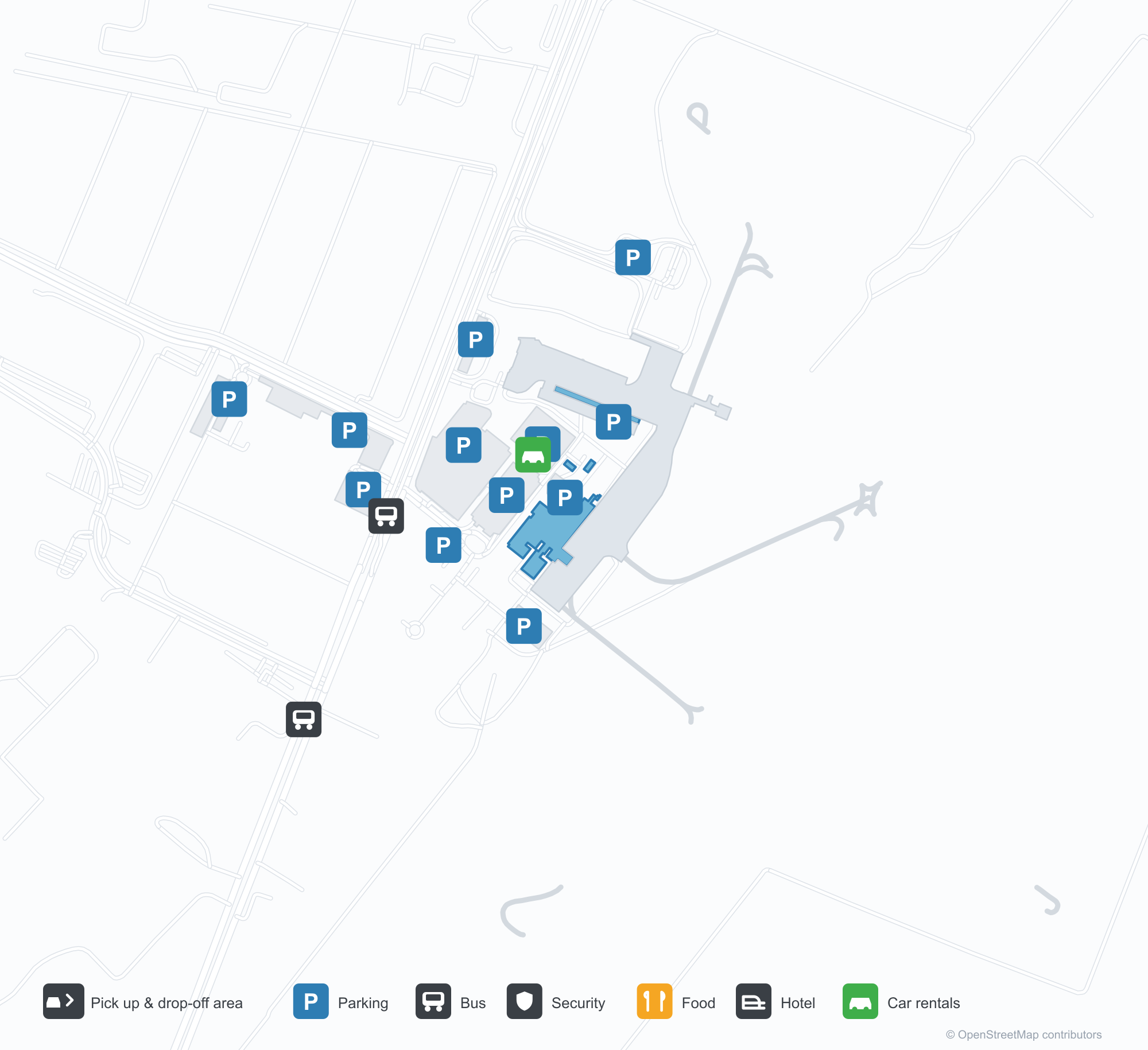
Descargar mapas de aeropuertosDescargas
Fotos del aeropuertoFotos del aeropuerto
Fotos reales de este aeropuerto, cada una con la referencia de la página web pública donde se encontró; los derechos de autor siguen siendo de los fotógrafos originales. Haz clic en una foto para ampliarla o en la línea de crédito para abrir su página de origen.
Vista satelital: las pistas de Ciudad Juárez se extienden entre la ciudad y el terreno seco en el borde del desierto de Chihuahua, con la terminal y la plataforma junto a ellas.
Mapa de rutas de Abraham González International Airport — destinos directosMapa de rutas
6 destinos directos: mapa, aerolíneas que operan y distancias.
Vuelos de Abraham González International Airport — salidas y llegadasPanel de vuelos
202 números de vuelo de 12 aerolíneas y 10 destinos, divididos por dirección. Se incluyen los números de código compartido.
| Vuelo | Aerolínea | Destino | País/región |
|---|---|---|---|
| AF3405 | Air France | Aeropuerto Internacional de Ciudad de México | México |
| AF3444 | Air France | Aeropuerto Internacional de Ciudad de México | México |
| AF3452 | Air France | Aeropuerto Internacional de Ciudad de México | México |
| AF9946 | Air France | Aeropuerto Internacional de Ciudad de México | México |
| AM112 | Aeroméxico | Aeropuerto Internacional de Ciudad de México | México |
| AM116 | Aeroméxico | Aeropuerto Internacional de Ciudad de México | México |
| AM118 | Aeroméxico | Aeropuerto Internacional de Ciudad de México | México |
| AM120 | Aeroméxico | Aeropuerto Internacional de Ciudad de México | México |
| AM1120 | Aeroméxico | Aeropuerto Internacional de Ciudad de México | México |
| AV6701 | Avianca | Aeropuerto Internacional de Ciudad de México | México |
| AV6773 | Avianca | Cancún International Airport | México |
| AV6803 | Avianca | Monterrey International Airport | México |
| CM3282 | Copa Airlines | Guadalajara International Airport | México |
| CM3321 | Copa Airlines | Aeropuerto Internacional de Ciudad de México | México |
| CM3334 | Copa Airlines | Guadalajara International Airport | México |
| IB7462 | Iberia | Monterrey International Airport | México |
| IB7478 | Iberia | Monterrey International Airport | México |
| IB7500 | Iberia | Monterrey International Airport | México |
| IB7505 | Iberia | Monterrey International Airport | México |
| IB7527 | Iberia | Monterrey International Airport | México |
Números de vuelo y rutas del índice de vuelos de aviability.com (instantánea de 26 de octubre de 2026); se incluyen los números de código compartido y no se muestran horarios de salida. Fuente: aviability.com ↗
Información y datos del aeropuertoDatos del aeropuerto
Mapa interactivo — ubicación de Abraham González International AirportMapa interactivo
Consulta este aeropuerto en otros servicios de mapas:
Ciudad Juárez Airport (CJS): Six Domestic Routes in the Border DesertGuía del aeropuerto
Seen from above, Ciudad Juárez's runways lie between the city and dry land at the edge of the Chihuahuan Desert, with the terminal and apron alongside. The airport serves Ciudad Juárez, Mexico, at an elevation of about 1,190 m, with two runways up to 2,700 m; the 2014 snapshot records 6 domestic destinations, from Chihuahua at 329 km to Mexico City at 1,543 km.
Satellite view
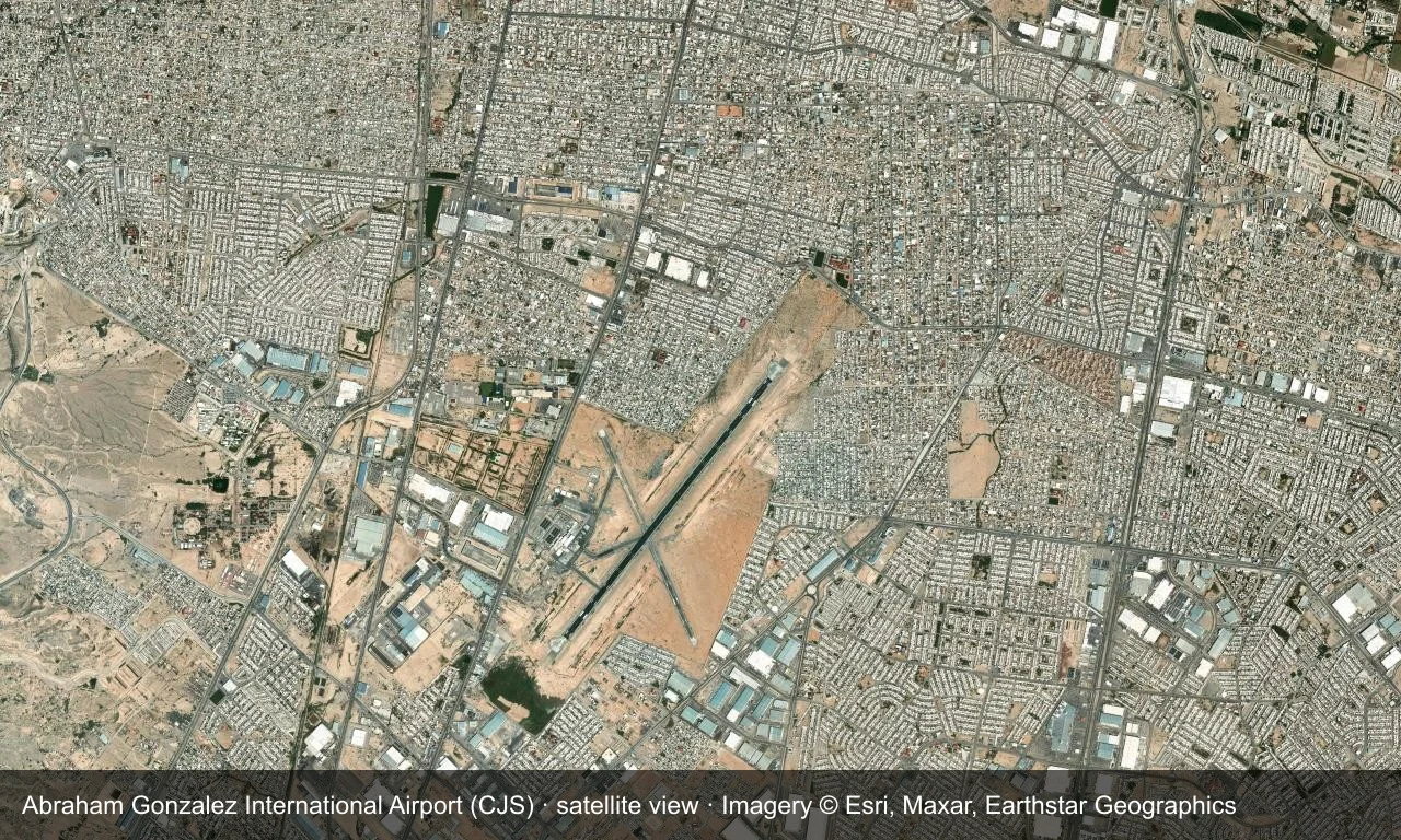
Satellite view: Ciudad Juárez's runways lie between the city and dry land at the edge of the Chihuahuan Desert, with the terminal and apron alongside.
The satellite image comes from Esri World Imagery (© Esri, Maxar, Earthstar Geographics); the field and attribution are labelled in the image. This is a satellite view, not a ground-level photograph.
Airport at a glance
| Item | Detail |
|---|---|
| IATA / ICAO | CJS / MMCS |
| Role | Large airport |
| Elevation | about 1,190 m |
| Coordinates | 31.6367, -106.4285 |
| Runways | 2, longest 2,700 m |
| Non-stop destinations | 6 (2014 snapshot, all domestic) |
Runways
| Runway | Length | Width | Surface |
|---|---|---|---|
| 03/21 | 2,700 m | 45 m | asphalt |
| 14/32 | 1,750 m | 30 m | asphalt |
2 runways, the longest 2,700 m.
Non-stop routes
6 non-stop destinations, nearest first (OpenFlights route snapshot compiled in 2014 — confirm with the airline or airport):
| Destination | Distance | Carriers |
|---|---|---|
| General Roberto Fierro Villalobos International Airport (CUU) | ~329 km | AeroMéxico |
| General Ignacio L. Pesqueira International Airport (HMO) | ~526 km | AeroMéxico |
| Monterrey International Airport (MTY) | ~896 km | AeroMéxico, VB, Volaris |
| General Abelardo L. Rodriguez International Airport (TIJ) | ~998 km | AeroMéxico, Volaris |
| Guadalajara International Airport (GDL) | ~1274 km | VB, Volaris |
| Mexico City Benito Juárez International Airport (MEX) | ~1543 km | Interjet (ABC Aerolineas), AeroMéxico, Volaris |
The carrier column comes from the same snapshot and includes codeshare and interline services; treat it as an indication of how busy the route is and check the airline for who actually flies it.
Nearby airports to compare
If the fares are close, these are the nearest airports of the same class (large airport) — straight-line distance, with their own non-stop counts from the same dataset:
| Airport | Distance | Non-stop destinations |
|---|---|---|
| Albuquerque International Sunport (ABQ) | ~379 km | 22 |
| Austin Bergstrom International Airport (AUS) | ~851 km | 42 |
Before you fly
- The airport sits on the US border, so include border and road time in cross-border plans.
- At about 1,190 m, summer heat reduces performance; the six destinations are a 2014 snapshot.
About the data
Runways, elevation and coordinates come from OurAirports open data. Routes and carriers come from the June 2014 OpenFlights snapshot and include codeshares and interline services; they indicate network shape and scale, not current schedules.
Comentarios de los lectoresDebate
Las preguntas, los relatos de viaje y las correcciones son bienvenidos. Los comentarios son públicos.
Cargando…
Cargando comentarios…