
Taitung Airport
 Taitung · Taiwan· Taitung Airport
Taitung Airport (IATA: TTT, ICAO RCFN) ist ein Regionalflughafen und bedient Taitung, Taiwan.
Taitung Airport is a medium-sized airport, at an elevation of about 143 ft, with scheduled passenger service. This page gathers its location map, airport codes and travel information.
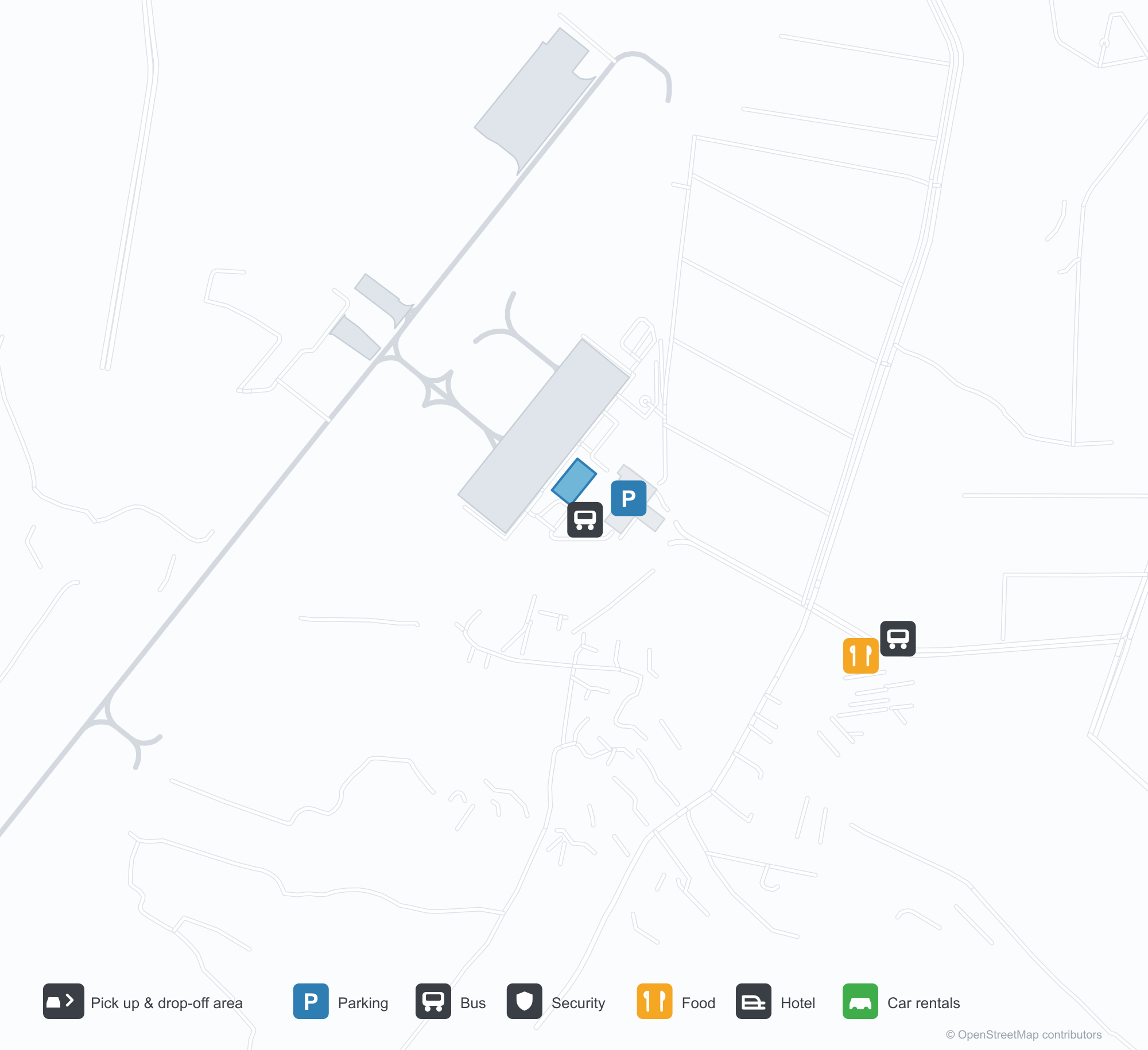
Flughafenpläne herunterladenDownloads
FlughafenfotosFlughafenfotos
Echte Fotos dieses Flughafens, jeweils mit Quellenangabe zur öffentlichen Webseite, auf der sie gefunden wurden; das Urheberrecht liegt bei den Fotografinnen und Fotografen. Klicken Sie auf ein Foto zum Vergrößern oder auf die Quellenangabe, um die Originalseite zu öffnen.
In the satellite image, the layout of Taitung Airport (TTT) and its surroundings are clearly visible.
Taitung Airport's terminal with its triangular gable and green sign, with the control tower at left.
Taitung Airport: Streckenkarte – Nonstop-ZieleStreckenkarte
1 Nonstop-Ziele: Karte, fliegende Gesellschaften und Entfernungen.
Flughafeninformationen und DetailsFlughafendetails
Interaktive Karte – Lage des Flughafens Taitung AirportInteraktive Karte
Diesen Flughafen in anderen Kartendiensten ansehen:
Taitung Airport GuideFlughafenführer
Taitung Airport (IATA TTT, ICAO RCFN) serves Taitung, Taiwan, East Asia, and is classified as a medium-sized airport. This page gathers what the site's database, maps and route dataset say about it in one place.
Airport photos
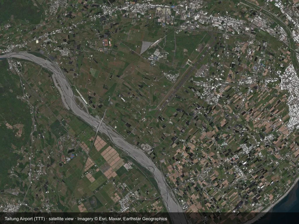
In the satellite image, the layout of Taitung Airport (TTT) and its surroundings are clearly visible.
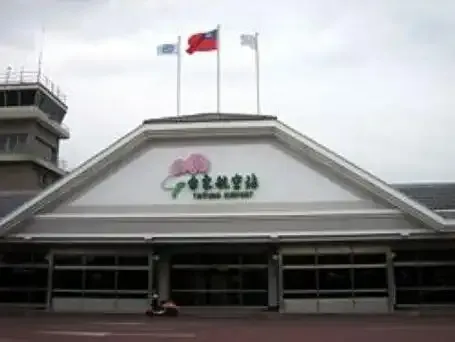
Taitung Airport's terminal with its triangular gable and green sign, with the control tower at left.
The photos come from public web sources and remain the copyright of their photographers; full credits and source links sit in the photo gallery on this page.
Facts at a glance
| IATA / ICAO | TTT / RCFN |
| Airport class | medium-sized airport |
| Location | Taitung, Taiwan (East Asia) |
| Coordinates | 22.7549, 121.1018 |
| Direct destinations | 1 (see below) |
Airport map
The map on this page is rendered from OpenStreetMap data: airports with terminal polygons show the terminal buildings, aprons and access roads, while small fields show the airfield outline and runway. Icons for parking, buses, food, hotels and car rentals follow whatever OSM has mapped.
- Full-size view — open the map card on this page to zoom in; the 2000 px original can be downloaded.
- Location map — the interactive map lets you pan and zoom to see the field against the city and road network.
- Schematic — the page also draws a size-based schematic to indicate the airport's scale; it is not the actual layout.
Direct routes
Non-stop destinations, nearest first (OpenFlights route dataset, compiled 2014 — treat as indicative and confirm with the airline):
| Destination | Distance | Main carriers |
|---|---|---|
| Taipei Songshan Airport (TSA) | ~261 km | Mandarin Airlines |
See the Taitung Airport route map for the full list of 1 non-stop destinations.
Nearby airports
If nothing fits, these nearby fields are worth comparing:
| Airport | Distance |
|---|---|
| Lyudao Airport (GNI) | 38.4 km |
| Kaohsiung International Airport (KHH) | 79.6 km |
| Lanyu Airport (KYD) | 92.4 km |
Getting there
The airport: coordinates 22.7549, 121.1018; elevation about 44 m.
Navigate straight to the field:
- Driving / taxi: 高德地图 | 百度地图 | Google Maps
The location map on this page shows the field against the city and road network, and the ground-transport section lists the public transport recorded for it. For driving routes, timetables and parking, rely on the airport's own information.
Size and facilities
Medium-sized airports are regional hubs: one compact terminal, walkable distances and usually faster check-in than a major hub — but with fewer frequencies, so rebooking after a missed flight is harder. Aim for 90–120 minutes before departure.
Terminal plans, check-in locations and ground-transport timetables are published by the airport itself; for detail that must be right on the day, rely on the airport's own information. If something here looks wrong, please tell us via the Contact page and we will check it.
Tips
- If your destination is not in the table above, you will usually connect via Taipei Songshan Airport (TSA) or another larger airport.
- Use the search box at the top of the page to compare alternatives: type a city name or IATA code.
- In peak season parking and rental cars run short at small fields too — book ahead if you are driving.