
César Manrique-Lanzarote Airport
 Arrecife · Spain· César Manrique-Lanzarote Airport
César Manrique-Lanzarote Airport (IATA: ACE, ICAO GCRR) is a large airport serving Arrecife, Spain.
César Manrique-Lanzarote Airport is a large airport, at an elevation of about 46 ft, with scheduled passenger service. This page gathers its location map, airport codes and travel information.
Download Airport MapsDownloads
César Manrique-Lanzarote Airport route map — direct destinationsRoute Map
51 direct destinations: map, operating airlines and distances.
Airport information & detailsAirport Details
Interactive map — César Manrique-Lanzarote Airport locationInteractive Map
View this airport on other map services:
César Manrique-Lanzarote Airport GuideAirport Guide
César Manrique-Lanzarote Airport (IATA ACE, ICAO GCRR) serves Arrecife, Spain, Europe, and is classified as a large airport. This page gathers what the site's database, maps and route dataset say about it in one place.
Facts at a glance
| IATA / ICAO | ACE / GCRR |
| Airport class | large airport |
| Location | Arrecife, Spain (Europe) |
| Coordinates | 28.9455, -13.6052 |
| Direct destinations | 51 (see below) |
Airport map
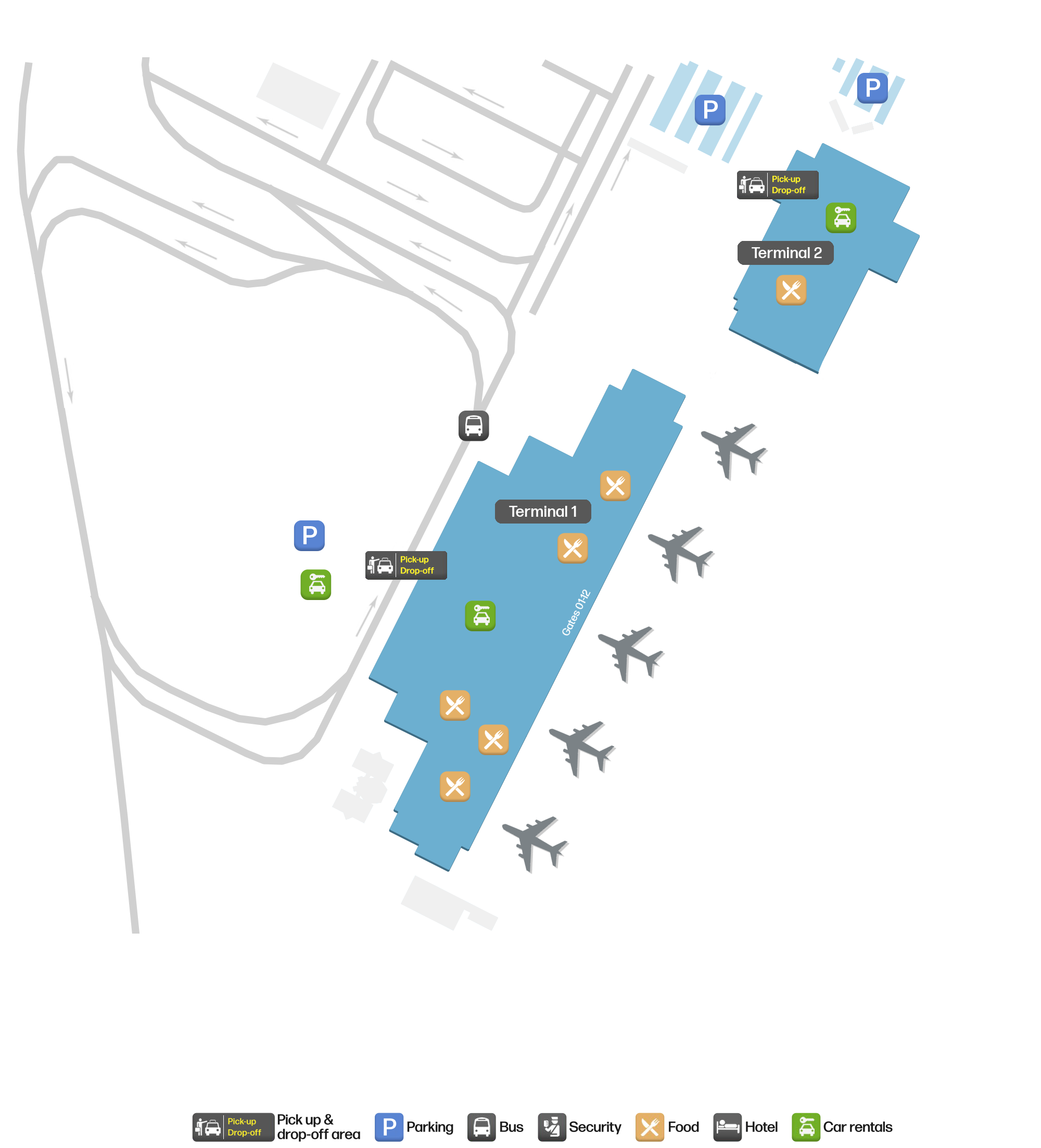
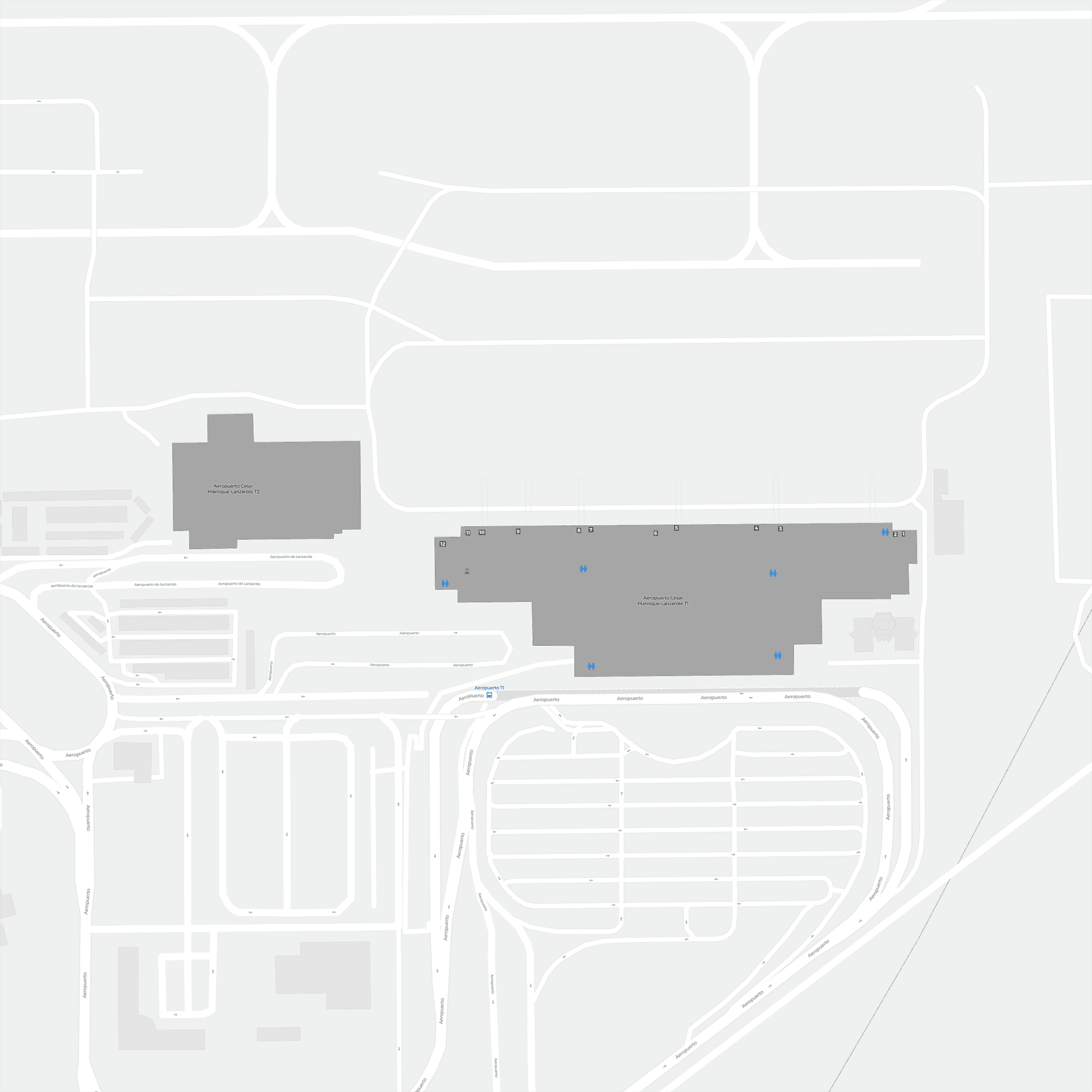
The map on this page is rendered from OpenStreetMap data: airports with terminal polygons show the terminal buildings, aprons and access roads, while small fields show the airfield outline and runway. Icons for parking, buses, food, hotels and car rentals follow whatever OSM has mapped.
- Full-size view — open the map card on this page to zoom in; the 2000 px original can be downloaded.
- Location map — the interactive map lets you pan and zoom to see the field against the city and road network.
- Schematic — the page also draws a size-based schematic to indicate the airport's scale; it is not the actual layout.
Direct routes
Non-stop destinations, nearest first (OpenFlights route dataset, compiled 2014 — treat as indicative and confirm with the airline):
| Destination | Distance | Main carriers |
|---|---|---|
| Fuerteventura Airport (FUE) | ~60 km | Air Berlin, Condor Flugdienst |
| Gran Canaria Airport (LPA) | ~207 km | Binter Canarias, Tropic Air |
| Tenerife Norte-Ciudad de La Laguna Airport (TFN) | ~272 km | Binter Canarias |
| Seville Airport (SVQ) | ~1183 km | Ryanair |
| Madrid–Barajas Airport (MAD) | ~1575 km | Ryanair, Iberia Airlines |
| Santiago-Rosalía de Castro Airport (SCQ) | ~1619 km | Ryanair, Air Europa |
| Asturias Airport (OVD) | ~1760 km | Air Europa |
| Zaragoza Airport (ZAZ) | ~1813 km | Ryanair |
See the César Manrique-Lanzarote Airport route map for the full list of 51 non-stop destinations.
Nearby airports
If nothing fits, these nearby fields are worth comparing:
| Airport | Distance |
|---|---|
| Atar International Airport (ATR) | 940 km |
| Humberto Delgado Airport (LIS) | 1169 km |
| Oujda Angads Airport (OUD) | 1279 km |
Size and facilities
Large airports run multiple runways and terminals and handle millions of passengers a year. Queue times at check-in and security vary strongly by time of day; for international flights plan to arrive 2–3 hours before departure.
Terminal plans, check-in locations and ground-transport timetables are published by the airport itself; for detail that must be right on the day, rely on the airport's own information. If something here looks wrong, please tell us via the Contact page and we will check it.
Tips
- If your destination is not in the table above, you will usually connect via Fuerteventura Airport (FUE) or another larger airport.
- Use the search box at the top of the page to compare alternatives: type a city name or IATA code.
- In peak season parking and rental cars run short at small fields too — book ahead if you are driving.