
Monterrey International Airport
 Monterrey · México· Monterrey International Airport
Monterrey International Airport (IATA: MTY, ICAO MMMY) là một sân bay trung bình phục vụ Monterrey, México.
Monterrey International Airport (MTY) is a medium airport serving Monterrey, Mexico. This page gathers the airport codes, location map and travel information.
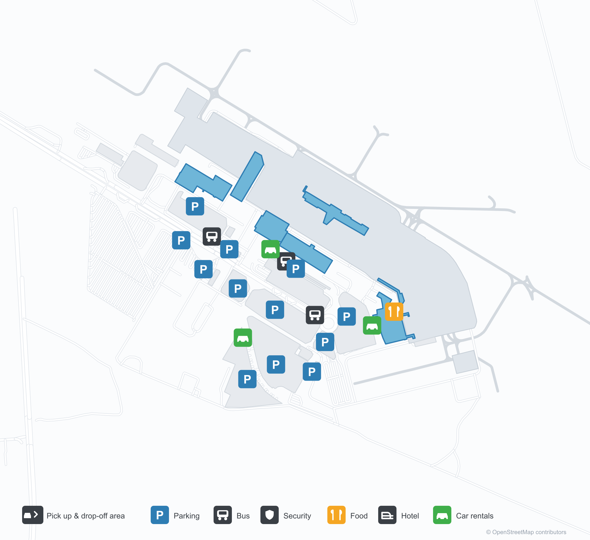
Tải bản đồ sân bayTải xuống
Ảnh sân bayẢnh sân bay
Ảnh thực tế của sân bay này, mỗi ảnh đều ghi nguồn từ trang web công khai nơi tìm thấy ảnh; bản quyền thuộc về nhiếp ảnh gia gốc. Nhấp vào ảnh để phóng to, hoặc nhấp vào dòng ghi nguồn để mở trang nguồn.
Trong ảnh vệ tinh, bố cục của Sân bay Quốc tế Monterrey (MTY) và khu vực xung quanh hiện rõ.
Bản đồ tuyến bay Monterrey International Airport — điểm đến thẳngBản đồ tuyến bay
32 điểm đến thẳng: bản đồ, hãng hàng không khai thác và khoảng cách.
Chuyến bay tại Monterrey International Airport — khởi hành & đếnBảng chuyến bay
1.519 số hiệu chuyến bay của 35 hãng hàng không, kết nối 64 điểm đến, phân theo chiều bay. Bao gồm số hiệu liên danh.
| Chuyến bay | Hãng hàng không | Điểm đến | Quốc gia/khu vực |
|---|---|---|---|
| AA400 | American Airlines | Dallas Fort Worth International Airport | Hoa Kỳ |
| AA1245 | American Airlines | Dallas Fort Worth International Airport | Hoa Kỳ |
| AA1495 | American Airlines | Dallas Fort Worth International Airport | Hoa Kỳ |
| AA1835 | American Airlines | Dallas Fort Worth International Airport | Hoa Kỳ |
| AA2154 | American Airlines | Dallas Fort Worth International Airport | Hoa Kỳ |
| AA2625 | American Airlines | Dallas Fort Worth International Airport | Hoa Kỳ |
| AA3213 | American Airlines | Dallas Fort Worth International Airport | Hoa Kỳ |
| AA3342 | American Airlines | Dallas Fort Worth International Airport | Hoa Kỳ |
| AA3343 | American Airlines | Dallas Fort Worth International Airport | Hoa Kỳ |
| AA3354 | American Airlines | Dallas Fort Worth International Airport | Hoa Kỳ |
| AA3355 | American Airlines | Dallas Fort Worth International Airport | Hoa Kỳ |
| AA3376 | American Airlines | Dallas Fort Worth International Airport | Hoa Kỳ |
| AA3393 | American Airlines | Dallas Fort Worth International Airport | Hoa Kỳ |
| AA3399 | American Airlines | Phoenix Sky Harbor International Airport | Hoa Kỳ |
| AA3406 | American Airlines | Dallas Fort Worth International Airport | Hoa Kỳ |
| AA3474 | American Airlines | Dallas Fort Worth International Airport | Hoa Kỳ |
| AA3490 | American Airlines | Dallas Fort Worth International Airport | Hoa Kỳ |
| AA3531 | American Airlines | Dallas Fort Worth International Airport | Hoa Kỳ |
| AA3536 | American Airlines | Phoenix Sky Harbor International Airport | Hoa Kỳ |
| AA3566 | American Airlines | Dallas Fort Worth International Airport | Hoa Kỳ |
Số hiệu chuyến bay và tuyến bay từ chỉ mục chuyến bay aviability.com (ảnh chụp 26 tháng 10, 2026); bao gồm số hiệu liên danh và không hiển thị giờ khởi hành. Nguồn: aviability.com ↗
Thông tin & chi tiết sân bayChi tiết sân bay
Bản đồ tương tác — vị trí Monterrey International AirportBản đồ tương tác
Xem sân bay này trên các dịch vụ bản đồ khác:
Monterrey International Airport GuideHướng dẫn sân bay
Monterrey International Airport (IATA MTY, ICAO MMMY) serves Monterrey, Mexico, North America, and is classified as a medium-sized airport. This page gathers what the site's database, maps and route dataset say about it in one place.
Airport photos
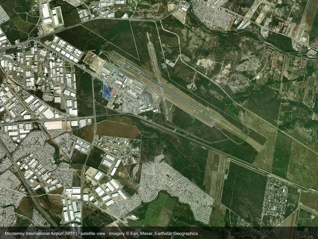
In the satellite image, the layout of Monterrey International Airport (MTY) and its surroundings are clearly visible.
The photos come from public web sources and remain the copyright of their photographers; full credits and source links sit in the photo gallery on this page.
Facts at a glance
| IATA / ICAO | MTY / MMMY |
| Airport class | medium-sized airport |
| Location | Monterrey, Mexico (North America) |
| Coordinates | 25.7785, -100.1070 |
| Direct destinations | 32 (see below) |
Airport map
The map on this page is rendered from OpenStreetMap data: airports with terminal polygons show the terminal buildings, aprons and access roads, while small fields show the airfield outline and runway. Icons for parking, buses, food, hotels and car rentals follow whatever OSM has mapped.
- Full-size view — open the map card on this page to zoom in; the 2000 px original can be downloaded.
- Location map — the interactive map lets you pan and zoom to see the field against the city and road network.
- Schematic — the page also draws a size-based schematic to indicate the airport's scale; it is not the actual layout.
Direct routes
Non-stop destinations, nearest first (OpenFlights route dataset, compiled 2014 — treat as indicative and confirm with the airline):
| Destination | Distance | Main carriers |
|---|---|---|
| San Antonio International Airport (SAT) | ~448 km | Interjet (ABC Aerolineas), AeroMéxico |
| General Francisco Javier Mina International Airport (TAM) | ~449 km | AeroMéxico, VB |
| Aguascalientes International Airport (AGU) | ~506 km | AeroMéxico |
| Guanajuato International Airport (BJX) | ~550 km | AeroMéxico, VB |
| Querétaro Intercontinental Airport (QRO) | ~574 km | AeroMéxico, VB |
| George Bush Intercontinental Airport (IAH) | ~662 km | United Airlines, VB |
| General Roberto Fierro Villalobos International Airport (CUU) | ~664 km | AeroMéxico, Delta Air Lines |
| Guadalajara International Airport (GDL) | ~670 km | Interjet (ABC Aerolineas), AeroMéxico |
See the Monterrey International Airport route map for the full list of 32 non-stop destinations.
Nearby airports
If nothing fits, these nearby fields are worth comparing:
| Airport | Distance |
|---|---|
| Alice International Airport (ALI) | 300 km |
| Austin Bergstrom International Airport (AUS) | 547 km |
| Austin Executive Airport (EDC) | 571 km |
Getting there
The airport: coordinates 25.7785, -100.1070; elevation about 390 m.
Navigate straight to the field:
- Driving / taxi: 高德地图 | 百度地图 | Google Maps
The location map on this page shows the field against the city and road network, and the ground-transport section lists the public transport recorded for it. For driving routes, timetables and parking, rely on the airport's own information.
Size and facilities
Medium-sized airports are regional hubs: one compact terminal, walkable distances and usually faster check-in than a major hub — but with fewer frequencies, so rebooking after a missed flight is harder. Aim for 90–120 minutes before departure.
Terminal plans, check-in locations and ground-transport timetables are published by the airport itself; for detail that must be right on the day, rely on the airport's own information. If something here looks wrong, please tell us via the Contact page and we will check it.
Tips
- If your destination is not in the table above, you will usually connect via San Antonio International Airport (SAT) or another larger airport.
- Use the search box at the top of the page to compare alternatives: type a city name or IATA code.
- In peak season parking and rental cars run short at small fields too — book ahead if you are driving.
Bình luận của độc giảThảo luận
Hoan nghênh mọi câu hỏi, báo cáo chuyến đi và góp ý chỉnh sửa. Bình luận được công khai.
Đang tải…
Đang tải bình luận…