
Andersen Air Force Base
 Yigo · Guam· Andersen Air Force Base
Andersen Air Force Base (IATA: UAM, ICAO PGUA), Yigo, Guam kentine hizmet veren bir orta büyüklükte havalimanıdır.
Andersen Air Force Base is a medium-sized airport, at an elevation of about 627 ft. This page gathers its location map, airport codes and travel information.
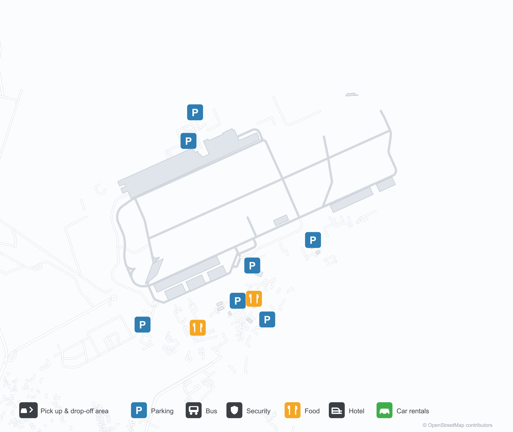
Havalimanı Haritalarını İndirinİndirmeler
Havalimanı fotoğraflarıHavalimanı Fotoğrafları
Bu havalimanının gerçek fotoğrafları; her fotoğrafın altında, fotoğrafın bulunduğu kamuya açık web sayfasına bir atıf yer alır ve telif hakkı özgün fotoğrafçılarda kalır. Yakınlaştırmak için bir fotoğrafa, kaynak sayfasını açmak için bir atıf satırına tıklayın.
Uydu görüntüsünde Andersen Hava Kuvvetleri Üssü (UAM) çevredeki su ve kıyı şeridiyle bütünleşiyor.
Havalimanı bilgileri ve ayrıntılarıHavalimanı Ayrıntıları
Etkileşimli harita — Andersen Air Force Base konumuEtkileşimli Harita
Bu havalimanını diğer harita hizmetlerinde görüntüleyin:
Andersen Air Force Base (UAM) Guide: The regional field, seen from orbitHavalimanı Rehberi
In Guam, Andersen Air Force Base (UAM) appears from orbit as a field set among water, green vegetation and farmland. It is a medium-sized airport at about 191 m above sea level, with 2 runways, the longest 3,409 m, and no scheduled routes appear in the 2014 snapshot. Antonio B. Won Pat International Airport is the closest airport, 18.1 km away.
Satellite view
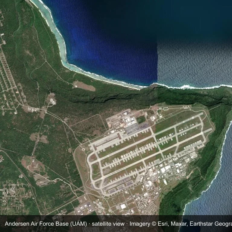
Satellite view: Andersen Air Force Base (UAM) occupies a patch of water, green vegetation and farmland.
Source: Esri World Imagery (© Esri, Maxar, Earthstar Geographics); attribution is in the image. This is an overhead view, not a ground-level photograph.
Airport at a glance
| Item | Detail |
|---|---|
| IATA / ICAO | UAM / PGUA |
| Role | medium-sized airport |
| Elevation | about 191 m |
| Coordinates | 13.5840, 144.9300 |
| Runways | 2, longest 3,409 m |
| Non-stop destinations | 0 in the 2014 snapshot |
| Official site | www.andersen.af.mil |
Runways
| Runway | Length | Surface |
|---|---|---|
| 06R/24L | 3,409 m | PEM |
| 06L/24R | 3,218 m | PEM |
Why there is no route table
UAM has an empty route table in the 2014 snapshot. The dataset only covers services it recorded, so treat the blank as a gap rather than a closure notice.
Nearby airports
| Airport | Distance | Non-stop destinations |
|---|---|---|
| Antonio B. Won Pat International Airport (GUM) | ~18.1 km | 19 |
| Rota International Airport (ROP) | ~73.6 km | 2 |
| Francisco Manglona Borja / Tinian International Airport (TIQ) | ~174 km | — |
Getting there and navigating
- Coordinates: 13.5840, 144.9300
- Official site: www.andersen.af.mil
- Open in a map: Google Maps | Amap | Baidu Maps
The location map on this page places the field in relation to nearby towns and roads. Terminal connections and local transport fall outside this dataset; the airport or airline can confirm them.
Using this airport
Andersen Air Force Base sits in Guam, where water, green vegetation and farmland surrounds the field. Runway 06R/24L runs northeast–southwest, with 3,409 m of runway at an elevation of about 191 m.
Operationally, 3,409 m of runway places the field in the narrowbody bracket. The surface type is not listed in the open data. Antonio B. Won Pat International Airport is the closest alternative, 18.1 km away, with 19 destinations in the same snapshot.
The 2014 route record is empty. For a planned trip, begin with Antonio B. Won Pat International Airport or another airport with a recorded schedule, then check locally whether a charter can use this field.
Before you fly
- The 3,409 m runway can take larger regional aircraft, but that does not guarantee scheduled service.
- The runway is paved, which supports year-round operations, but scheduled service is still not guaranteed.
- Antonio B. Won Pat International Airport is 18.1 km away with 19 destinations in the 2014 snapshot, making it the nearest alternative for a scheduled flight.
- Ask the operator about customs, fuel and handling before booking; services at fields this size are not always available on demand.
- Treat this as a general-aviation or charter field rather than a large terminal; confirm handling and opening hours in advance.
About the data
OurAirports supplies the runway, elevation and coordinate figures. The 2014 OpenFlights snapshot supplies the route list; both are reference data, not live operational information.
Okuyucu yorumlarıTartışma
Sorular, seyahat deneyimleri ve düzeltmeler memnuniyetle karşılanır. Yorumlar herkese açıktır.
Yükleniyor…
Yorumlar yükleniyor…