
Albert Whitted Airport
 St Petersburg · ABD· Albert Whitted Airport
Albert Whitted Airport (IATA: SPG, ICAO KSPG), St Petersburg, ABD kentine hizmet veren bir küçük havalimanıdır.
Albert Whitted Airport is a small airport, at an elevation of about 7 ft. This page gathers its location map, airport codes and travel information.
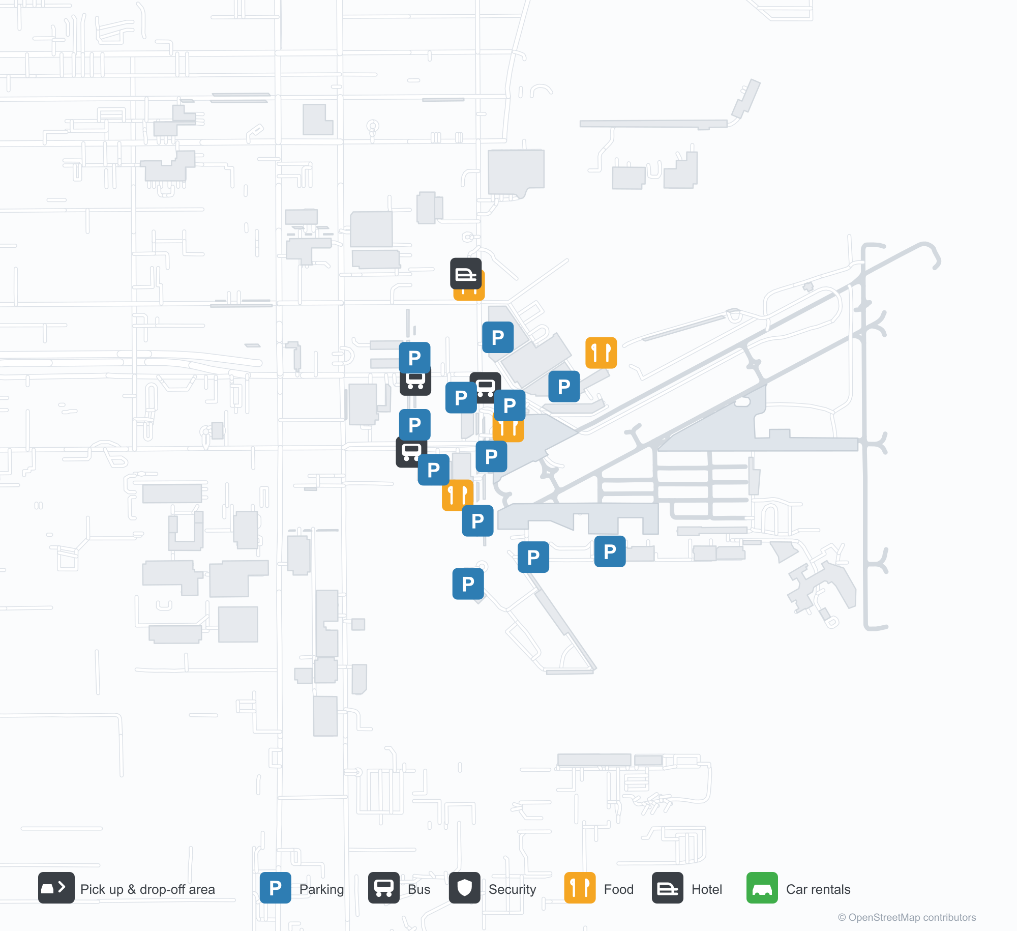
Havalimanı Haritalarını İndirinİndirmeler
Havalimanı fotoğraflarıHavalimanı Fotoğrafları
Bu havalimanının gerçek fotoğrafları; her fotoğrafın altında, fotoğrafın bulunduğu kamuya açık web sayfasına bir atıf yer alır ve telif hakkı özgün fotoğrafçılarda kalır. Yakınlaştırmak için bir fotoğrafa, kaynak sayfasını açmak için bir atıf satırına tıklayın.
Uydu görüntüsü: Albert Whitted Havalimanı (SPG) kasaba, tarım arazileri ve bitki örtüsüyle çevrili.
Havalimanı bilgileri ve ayrıntılarıHavalimanı Ayrıntıları
Etkileşimli harita — Albert Whitted Airport konumuEtkileşimli Harita
Bu havalimanını diğer harita hizmetlerinde görüntüleyin:
Albert Whitted Airport (SPG) Guide: Satellite context for a thin recordHavalimanı Rehberi
Albert Whitted Airport (SPG) lies in the United States, with satellite imagery showing green vegetation and farmland. The field sits at about 2 m above sea level and has 2 runways, the longest 1,120 m; the 2014 route snapshot records no scheduled services. The nearest airport is St. Petersburg Clearwater International Airport (17.2 km).
Satellite view
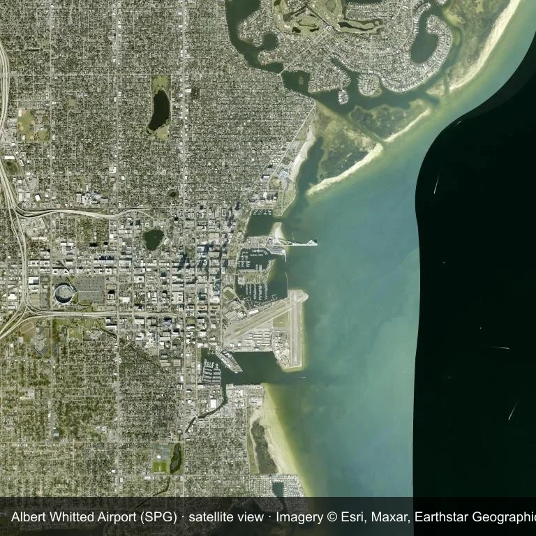
The field at Albert Whitted Airport (SPG) seen from orbit, set in green vegetation and farmland.
The image is Esri World Imagery (© Esri, Maxar, Earthstar Geographics), labelled with the field and source. It is a satellite view, not a ground photo.
Airport at a glance
| Item | Detail |
|---|---|
| IATA / ICAO | SPG / KSPG |
| Role | small airport |
| Elevation | about 2 m |
| Coordinates | 27.7651, -82.6270 |
| Runways | 2, longest 1,120 m |
| Non-stop destinations | 0 in the 2014 snapshot |
Runways
| Runway | Length | Surface |
|---|---|---|
| 07/25 | 1,120 m | ASP |
| 18/36 | 873 m | ASP |
Why there is no route table
This airport's route list is blank in the 2014 snapshot. That may reflect a small or seasonal operation, or simply missing data; confirm before planning a flight.
Nearby airports
| Airport | Distance | Non-stop destinations |
|---|---|---|
| St. Petersburg Clearwater International Airport (PIE) | ~17.2 km | 30 |
| Tampa International Airport (TPA) | ~25.1 km | 67 |
| Sarasota Bradenton International Airport (SRQ) | ~41.8 km | 6 |
Getting there and navigating
- Coordinates: 27.7651, -82.6270
- Open in a map: Google Maps | Amap | Baidu Maps
Use the location map to see how the airfield sits against local roads and settlements. For terminal connections and local transport, check with the airport or airline.
Runway and surroundings
From the air, Albert Whitted Airport appears within green vegetation and farmland in the United States. The primary strip, 07/25, is oriented east–west and extends 1,120 m at about 2 m.
That 1,120 m length is typical of turboprop and light-jet operations. The paved surface supports regular operations, though it does not imply scheduled service. The nearest airport is St. Petersburg Clearwater International Airport, 17.2 km away, with 30 destinations in the same snapshot.
No scheduled services appear in the 2014 snapshot, so the field is best treated as a general-aviation or charter stop; confirm handling and current movements with the operator.
Before you fly
- The 1,120 m runway limits operations to small aircraft; baggage and payload limits are usually strict.
- The runway is paved, which supports year-round operations, but scheduled service is still not guaranteed.
- St. Petersburg Clearwater International Airport is 17.2 km away with 30 destinations in the 2014 snapshot, making it the nearest alternative for a scheduled flight.
- Because the 2014 route table is empty, check the airport operator's current notices before making travel plans.
- Treat this as a general-aviation or charter field rather than a large terminal; confirm handling and opening hours in advance.
About the data
The airport facts on this page are drawn from OurAirports. Route data is the June 2014 OpenFlights snapshot, so treat it as historical context rather than a timetable.
Okuyucu yorumlarıTartışma
Sorular, seyahat deneyimleri ve düzeltmeler memnuniyetle karşılanır. Yorumlar herkese açıktır.
Yükleniyor…
Yorumlar yükleniyor…