
Armstrong Airport
 Armstrong · แคนาดา· Armstrong Airport
Armstrong Airport (IATA: YYW, ICAO CYYW) เป็นสนามบินขนาดกลางที่ให้บริการArmstrong, แคนาดา
Armstrong Airport is a medium-sized airport, at an elevation of about 1,058 ft. This page gathers its location map, airport codes and travel information.

ดาวน์โหลดแผนที่สนามบินดาวน์โหลด
ภาพสนามบินภาพสนามบิน
ภาพจริงของสนามบินแห่งนี้ พร้อมเครดิตของหน้าเว็บสาธารณะที่พบภาพ; ลิขสิทธิ์ยังเป็นของผู้ถ่ายภาพต้นฉบับ คลิกที่ภาพเพื่อขยาย หรือคลิกบรรทัดเครดิตเพื่อเปิดหน้าแหล่งที่มา
ภาพถ่ายดาวเทียม: ทางวิ่งตัดผ่านป่าในตอนเหนือของออนแทรีโอ โดยมีลานจอดและอาคารผู้โดยสารเล็ก ๆ อยู่ที่จุดกึ่งกลาง
ถนนกรวดทอดตรงข้ามทุ่งสีเขียวไปยังกลุ่มอาคารอุตสาหกรรมสีขาวขอบแดง มีเสาไฟฟ้าเรียงตามไหล่ทางภายใต้ท้องฟ้าสีเทาอ่อน
ข้อมูลและรายละเอียดสนามบินรายละเอียดสนามบิน
แผนที่อินเทอร์แอกทีฟ — ตำแหน่ง Armstrong Airportแผนที่อินเทอร์แอกทีฟ
ดูสนามบินนี้บนบริการแผนที่อื่น:
Armstrong Airport (YYW): A Forest Runway in Northern Ontarioคู่มือสนามบิน
From above, a runway cuts through forest in northern Ontario, with the apron and small terminal at its midpoint and lakes and woodland around. The field serves Armstrong, Ontario, at an elevation of about 322 m, with runways of 1,219 m and 896 m; the 2014 snapshot records no scheduled routes.
Satellite view
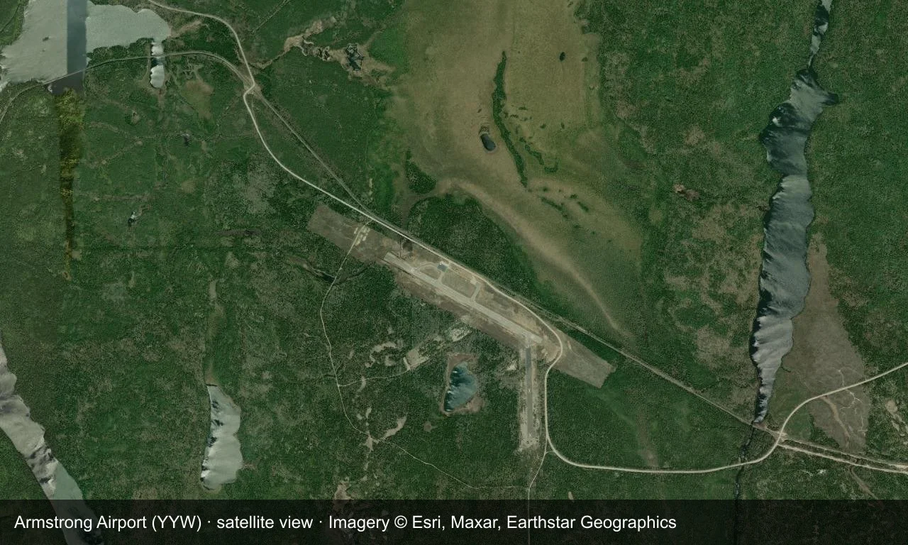
Satellite view: a runway cuts through forest in northern Ontario, with the apron and small terminal at its midpoint.
The satellite image comes from Esri World Imagery (© Esri, Maxar, Earthstar Geographics); the field and attribution are labelled in the image. This is a satellite view, not a ground-level photograph.
Airport at a glance
| Item | Detail |
|---|---|
| IATA / ICAO | YYW / CYYW |
| Role | Medium-sized airport |
| Elevation | about 322 m |
| Coordinates | 50.2903, -88.9097 |
| Runways | 2, longest 1,219 m |
| Non-stop destinations | 0 in the 2014 snapshot |
Runways
| Runway | Length | Width | Surface |
|---|---|---|---|
| 12/30 | 1,219 m | 30 m | asphalt |
| 18/36 | 896 m | 30 m | asphalt |
2 runways, the longest 1,219 m.
Non-stop routes
The route dataset carries no scheduled non-stop services for this airport. Regional schedules change often — confirm with the airline or airport before booking.
Nearby airports to compare
If the fares are close, these are the nearest airports of the same class (medium-sized airport) — straight-line distance, with their own non-stop counts from the same dataset:
| Airport | Distance | Non-stop destinations |
|---|---|---|
| Atikokan Municipal Airport (YIB) | ~259 km | — |
| Austin Straubel International Airport (GRB) | ~648 km | 4 |
Before you fly
- General aviation and charters dominate; confirm runway and fuel availability with the operator before departure.
- No scheduled routes are recorded; for longer trips, the usual pattern is to connect via a larger Ontario airport such as Thunder Bay.
About the data
Runways, elevation and coordinates come from OurAirports open data. Routes and carriers come from the June 2014 OpenFlights snapshot and include codeshares and interline services; they indicate network shape and scale, not current schedules.
History
Operated by the Government of Ontario about 8 km south-east of Armstrong, the field is part of the small-community air network of north-western Ontario.
Source: Armstrong Airport.
ความคิดเห็นจากผู้อ่านการสนทนา
ยินดีรับคำถาม รายงานการเดินทาง และการแก้ไข ความคิดเห็นเป็นสาธารณะ
กำลังโหลด…
กำลังโหลดความคิดเห็น…