
Mopti Airport
 Mopti · มาลี· Mopti Airport
Mopti Airport (IATA: MZI, ICAO GAMB) เป็นสนามบินขนาดกลางที่ให้บริการMopti, มาลี
Mopti Airport is a medium-sized airport, at an elevation of about 906 ft, with scheduled passenger service. This page gathers its location map, airport codes and travel information.
ดาวน์โหลดแผนที่สนามบินดาวน์โหลด
ภาพสนามบินภาพสนามบิน
ภาพจริงของสนามบินแห่งนี้ พร้อมเครดิตของหน้าเว็บสาธารณะที่พบภาพ; ลิขสิทธิ์ยังเป็นของผู้ถ่ายภาพต้นฉบับ คลิกที่ภาพเพื่อขยาย หรือคลิกบรรทัดเครดิตเพื่อเปิดหน้าแหล่งที่มา
ภาพถ่ายดาวเทียม: ท่าอากาศยานมอปตี (MZI) อยู่ท่ามกลางพื้นดินแห้งและที่ดินว่างเปล่า
ใต้ต้นปาล์มสูง อาคารผู้โดยสารสีครีมมีป้ายเขียนว่า Aeroport de Mopti Hambodedjo โดยมีผู้เดินทางรออยู่บนพื้นดินแดงด้านนอก
เครื่องบินใบพัดสองเครื่องยนต์สีขาวจอดอยู่บนลานจอดสีอ่อนขณะผู้โดยสารเดินออกไปขึ้นเครื่อง โดยมีไม้พุ่มแห้งทอดไปถึงขอบฟ้า
เหนือทางเข้าอาคารผู้โดยสาร ป้ายเขียนว่าขาเข้าและขาออกเป็นภาษาฝรั่งเศสและอังกฤษ มีรถกระบะสีขาวจอดอยู่ด้านนอกและทหารสวมหมวกเบเรต์สีฟ้ายืนอยู่ใกล้ ๆ
ภายใต้ท้องฟ้าสีฟ้าใส เครื่องบินสองใบพัดสีขาวที่มีแถบข้างลำตัวสีฟ้าจอดตะแคงอยู่ที่ลานจอด มีต้นปาล์มและอาคารผู้โดยสารเตี้ย ๆ อยู่ด้านหลัง
ผู้เดินทางในหมวกกันแดดเดินไปยังเครื่องบินสองใบพัดลำเล็กบนลานจอดสีแดงเรื่อ ขณะที่รถบรรทุกน้ำมันรออยู่ข้าง ๆ
ในหมอกสีขาวแบนราบ ทหารในชุดพรางยืนอยู่บนคอนกรีตมองเครื่องบินสองใบพัดสีเหลืองทรายแล่นข้ามลานจอด
เครื่องบินเจ็ตที่มีตราหางสีเขียวรออยู่เลยสัมภาระที่วางเรียงบนพื้นแห้ง ซึ่งพนักงานขนกระเป๋ากำลังเรียงกระเป๋าขึ้นรถเข็น
เที่ยวบินของMopti Airport — ขาออกและขาเข้าป้ายเที่ยวบิน
2 หมายเลขเที่ยวบิน ครอบคลุม 1 สายการบิน และ 2 จุดหมายปลายทาง แยกตามทิศทาง หมายเลขเที่ยวบินร่วม (codeshare) รวมอยู่ด้วย
| เที่ยวบิน | สายการบิน | จุดหมายปลายทาง | ประเทศ/ภูมิภาค |
|---|---|---|---|
| ML100 | Sky Mali | Timbuktu (TOM) Tombouktou Airport | มาลี |
หมายเลขเที่ยวบินและเส้นทางจากดัชนีเที่ยวบิน aviability.com (ข้อมูล ณ วันที่ 26 ตุลาคม 2569); รวมหมายเลขเที่ยวบินร่วมและไม่แสดงเวลาเดินทาง ที่มา: aviability.com ↗
ข้อมูลและรายละเอียดสนามบินรายละเอียดสนามบิน
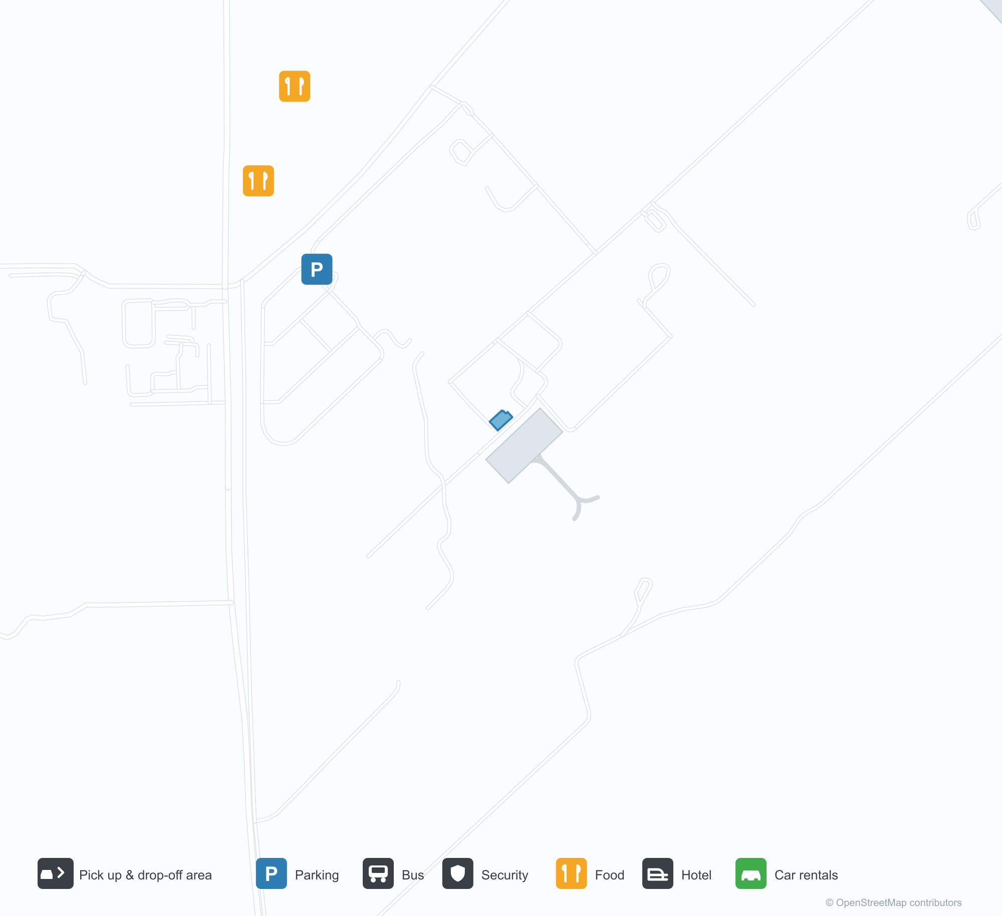
แผนที่อินเทอร์แอกทีฟ — ตำแหน่ง Mopti Airportแผนที่อินเทอร์แอกทีฟ
ดูสนามบินนี้บนบริการแผนที่อื่น:
Mopti Airport (MZI) Guide: The field is visible; the figures are notคู่มือสนามบิน
Mopti Airport (MZI) occupies a site among dry ground and bare land in Mali. It is about 276 m above sea level, with a single 2,542 m runway, and records no scheduled services in the 2014 snapshot. Tombouktou Airport is the nearest airport at 272 km.
Satellite view
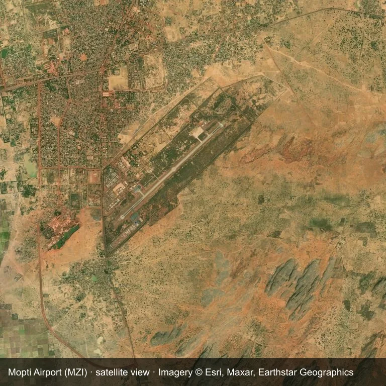
Overhead view of Mopti Airport (MZI) and the dry ground and bare land around it.
Satellite imagery © Esri, Maxar, Earthstar Geographics; the field and attribution are labelled in the image. This is an overhead view, not a ground-level photograph.
Airport at a glance
| Item | Detail |
|---|---|
| IATA / ICAO | MZI / GAMB |
| Role | medium-sized airport |
| Elevation | about 276 m |
| Coordinates | 14.5128, -4.0796 |
| Runways | 1, longest 2,542 m |
| Non-stop destinations | 0 in the 2014 snapshot |
Runways
| Runway | Length | Surface |
|---|---|---|
| 05/23 | 2,542 m | ASP |
Why there is no route table
The 2014 snapshot lists no destinations from MZI. Schedules for fields this size change quietly, so verify with the operator rather than assuming there is no service.
Nearby airports
| Airport | Distance | Non-stop destinations |
|---|---|---|
| Tombouktou Airport (TOM) | ~272 km | — |
| Ouagadougou Thomas Sankara International Airport (OUA) | ~367 km | 14 |
| Bobo Dioulasso Airport (BOY) | ~374 km | 2 |
Getting there and navigating
- Coordinates: 14.5128, -4.0796
- Open in a map: Google Maps | Amap | Baidu Maps
Use the location map to see how the airfield sits against local roads and settlements. For terminal connections and local transport, check with the airport or airline.
Local context
The site at Mopti Airport is set in dry ground and bare land in Mali. Its main runway, 05/23, is aligned northeast–southwest and measures 2,542 m; the field lies at about 276 m.
With 2,542 m of asphalt, the airport sits in the narrowbody bracket. The paved surface supports regular operations, though it does not imply scheduled service. The closest airport, Tombouktou Airport, lies 272 km away, with no recorded destinations in the same snapshot.
Because no scheduled routes were captured in 2014, the practical question is charter or private access; ask the operator before building an itinerary around it.
Before you fly
- The 2,542 m runway can take larger regional aircraft, but that does not guarantee scheduled service.
- The runway is paved, which supports year-round operations, but scheduled service is still not guaranteed.
- Tombouktou Airport is the nearest airport in this dataset, 272 km away, but it also has no recorded destinations for 2014.
- Treat this as a general-aviation or charter field rather than a large terminal; confirm handling and opening hours in advance.
- The site has no terminal guide on this page, so allow extra time for local arrangements and onward transport.
About the data
Runway and location data follow OurAirports. The route table is the June 2014 OpenFlights snapshot and may lag current airline schedules.
ความคิดเห็นจากผู้อ่านการสนทนา
ยินดีรับคำถาม รายงานการเดินทาง และการแก้ไข ความคิดเห็นเป็นสาธารณะ
กำลังโหลด…
กำลังโหลดความคิดเห็น…