
Altus Air Force Base
 Altus · สหรัฐอเมริกา· Altus Air Force Base
Altus Air Force Base (IATA: LTS, ICAO KLTS) เป็นสนามบินขนาดกลางที่ให้บริการAltus, สหรัฐอเมริกา
Altus Air Force Base is a medium-sized airport, at an elevation of about 1,382 ft. This page gathers its location map, airport codes and travel information.
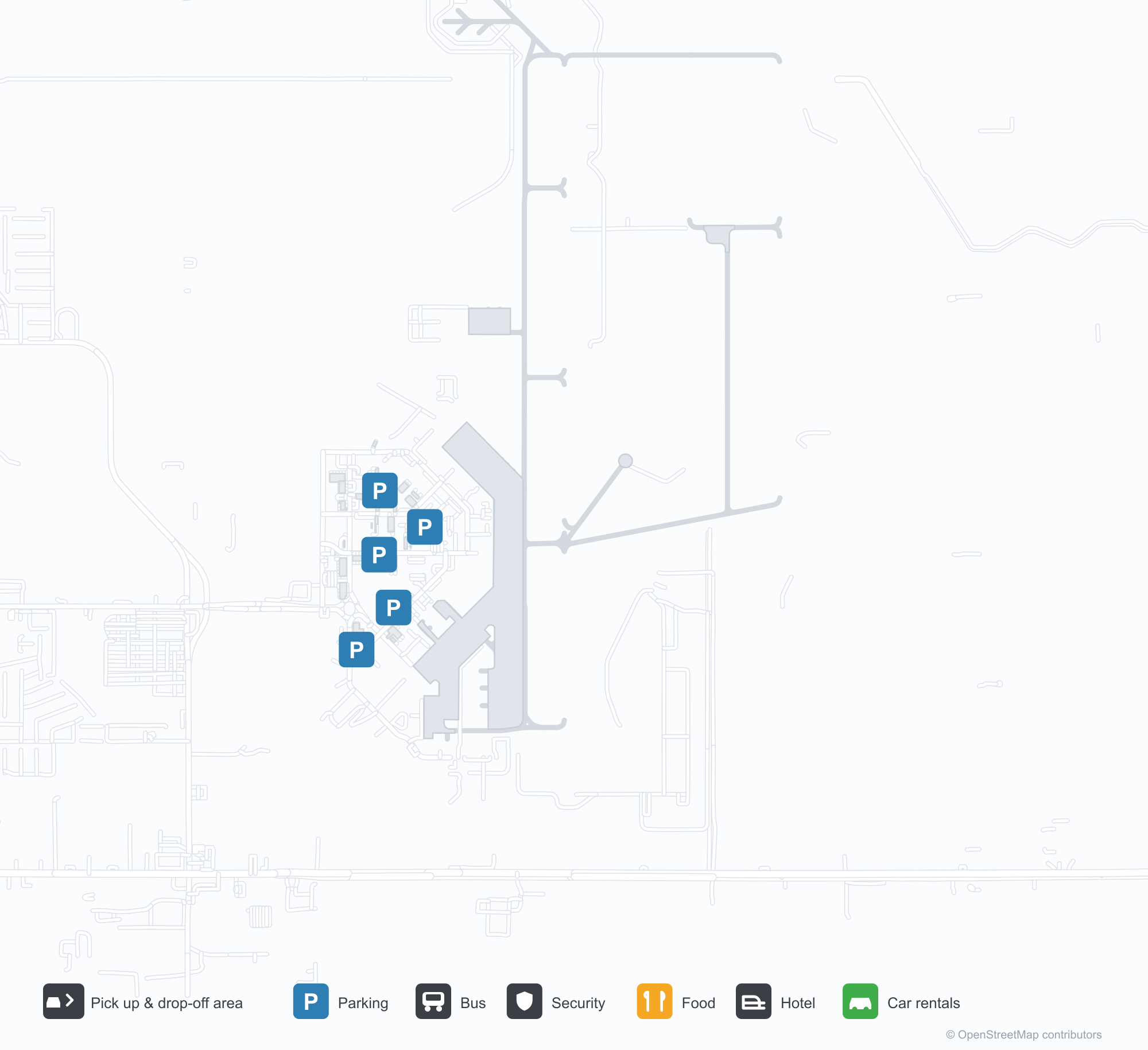
ดาวน์โหลดแผนที่สนามบินดาวน์โหลด
ภาพสนามบินภาพสนามบิน
ภาพจริงของสนามบินแห่งนี้ พร้อมเครดิตของหน้าเว็บสาธารณะที่พบภาพ; ลิขสิทธิ์ยังเป็นของผู้ถ่ายภาพต้นฉบับ คลิกที่ภาพเพื่อขยาย หรือคลิกบรรทัดเครดิตเพื่อเปิดหน้าแหล่งที่มา
ในภาพถ่ายดาวเทียม ฐานทัพอากาศอัลทัส (LTS) กลมกลืนกับตัวเมือง พื้นที่เกษตรกรรม และพืชพรรณโดยรอบ
ในหมอกหนา แถวเครื่องบินทหารสีเทายาวจอดหันจมูกชนหางบนทางขับ ทั้งหมดหันหน้าเข้าหากล้อง
เครื่องบินขนส่งทหารสีเทาลำใหญ่ที่ทำเครื่องหมาย U.S. Air Force จอดอยู่บนลานจอดพร้อมบันไดขึ้นเครื่องที่ประตูหน้า
ภายใต้ท้องฟ้าสีฟ้า เครื่องบินขนส่งสีเทาไต่ขึ้นทันทีหลังทะยานขึ้น โดยล้อยังห้อยอยู่ เหนือทุ่งหญ้าแบนราบที่ทอดไปถึงขอบฟ้า
เครื่องบินขนส่งทหารเฉียดต่ำเหนือทางวิ่ง โดยมีแถวรถบรรทุกเชื้อเพลิงที่จอดอยู่และโรงเก็บสีอ่อนเรียงรายเลยหญ้าแห้งออกไป
จมูกเครื่องของรถบรรทุกเชื้อเพลิงแถวหนึ่งเรียงกันทั่วลานจอด ขณะที่เจ้าหน้าที่ภาคพื้นในเสื้อสะท้อนแสงและเครื่องแบบยืนอยู่ท่ามกลางเครื่องหมายสีเหลือง
ภายใต้ท้องฟ้าครึ้ม ทางขับคอนกรีตกว้างทอดตรงไปยังขอบฟ้า ซึ่งมียานพาหนะภาคพื้นไม่กี่คันเคลื่อนไหวอยู่ไกล ๆ
มองผ่านท่อเติมเชื้อเพลิงในฉากหน้า จมูกและเครื่องยนต์ของรถบรรทุกเชื้อเพลิงสีเทาโดดเด่นชัดเจน ขณะที่อากาศยานอีกลำรออยู่ไกลออกไป
ข้อมูลและรายละเอียดสนามบินรายละเอียดสนามบิน
แผนที่อินเทอร์แอกทีฟ — ตำแหน่ง Altus Air Force Baseแผนที่อินเทอร์แอกทีฟ
ดูสนามบินนี้บนบริการแผนที่อื่น:
Altus Air Force Base (LTS) Guide: An airport mapped, partly unmeasuredคู่มือสนามบิน
In the United States, Altus Air Force Base (LTS) appears from orbit as a field set among a patchwork of vegetation and open ground. It is a medium-sized airport at about 421 m above sea level, with 3 runways, the longest 4,097 m, and no scheduled routes appear in the 2014 snapshot. Lawton Fort Sill Regional Airport is the closest airport, 78.6 km away.
Satellite view
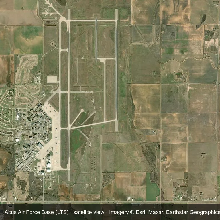
Satellite view: Altus Air Force Base (LTS) occupies a patch of a patchwork of vegetation and open ground.
Source: Esri World Imagery (© Esri, Maxar, Earthstar Geographics); attribution is in the image. This is an overhead view, not a ground-level photograph.
Airport at a glance
| Item | Detail |
|---|---|
| IATA / ICAO | LTS / KLTS |
| Role | medium-sized airport |
| Elevation | about 421 m |
| Coordinates | 34.6671, -99.2667 |
| Runways | 3, longest 4,097 m |
| Non-stop destinations | 0 in the 2014 snapshot |
| Official site | www.altus.af.mil |
Runways
| Runway | Length | Surface |
|---|---|---|
| 18R/36L | 4,097 m | CON |
| 18L/36R | 2,744 m | ASP |
| 176/356 | 1,067 m | ASPH |
Why there is no route table
No non-stop schedule was captured for LTS in 2014. For current movements, consult the airport operator or a recent flight-planning source.
Nearby airports
| Airport | Distance | Non-stop destinations |
|---|---|---|
| Lawton Fort Sill Regional Airport (LAW) | ~78.6 km | 1 |
| Wichita Falls Municipal Airport / Sheppard Air Force Base (SPS) | ~104 km | 1 |
| OKC Will Rogers World Airport (OKC) | ~172 km | 20 |
Getting there and navigating
- Coordinates: 34.6671, -99.2667
- Official site: www.altus.af.mil
- Open in a map: Google Maps | Amap | Baidu Maps
You can use the map to place the airport against the surrounding road network. For terminal connections and local transport, consult the airport or airline.
Using this airport
Altus Air Force Base sits in the United States, where a patchwork of vegetation and open ground surrounds the field. Runway 18R/36L runs north–south, with 4,097 m of runway at an elevation of about 421 m.
Operationally, 4,097 m of runway places the field in the narrowbody bracket. The surface type is not listed in the open data. Lawton Fort Sill Regional Airport is the closest alternative, 78.6 km away, with 1 destination in the same snapshot.
The 2014 route record is empty. For a planned trip, begin with Lawton Fort Sill Regional Airport or another airport with a recorded schedule, then check locally whether a charter can use this field.
Before you fly
- The 4,097 m runway can take larger regional aircraft, but that does not guarantee scheduled service.
- The runway is paved, which supports year-round operations, but scheduled service is still not guaranteed.
- Lawton Fort Sill Regional Airport is 78.6 km away with 1 destination in the 2014 snapshot, making it the nearest alternative for a scheduled flight.
- Ask the operator about customs, fuel and handling before booking; services at fields this size are not always available on demand.
- Treat this as a general-aviation or charter field rather than a large terminal; confirm handling and opening hours in advance.
About the data
OurAirports supplies the runway, elevation and coordinate figures. The 2014 OpenFlights snapshot supplies the route list; both are reference data, not live operational information.
ความคิดเห็นจากผู้อ่านการสนทนา
ยินดีรับคำถาม รายงานการเดินทาง และการแก้ไข ความคิดเห็นเป็นสาธารณะ
กำลังโหลด…
กำลังโหลดความคิดเห็น…