
Alxa Left Banner Bayanhot Airport
 Bayanhot · จีน· Alxa Left Banner Bayanhot Airport
Alxa Left Banner Bayanhot Airport (IATA: AXF, ICAO ZBAL) เป็นสนามบินขนาดกลางที่ให้บริการBayanhot, จีน
Alxa Left Banner Bayanhot Airport is a medium-sized airport, at an elevation of about 4,560 ft, with scheduled passenger service. This page gathers its location map, airport codes and travel information.
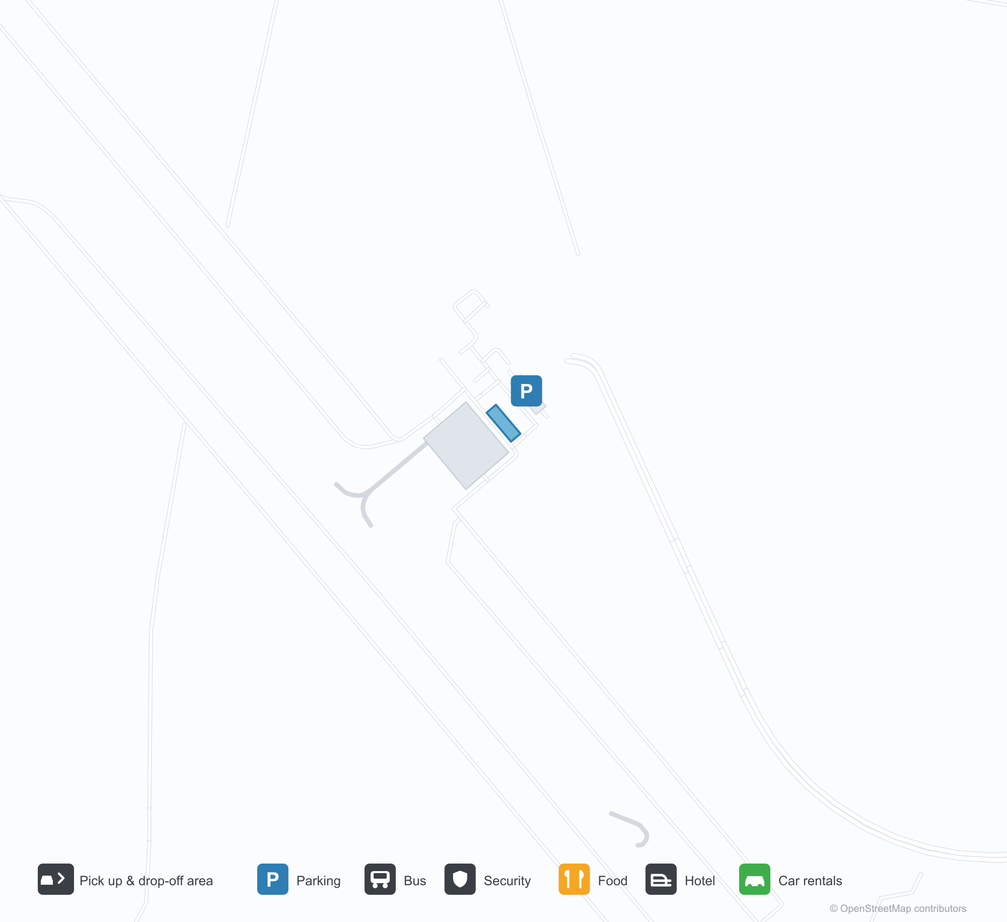
ดาวน์โหลดแผนที่สนามบินดาวน์โหลด
ภาพสนามบินภาพสนามบิน
ภาพจริงของสนามบินแห่งนี้ พร้อมเครดิตของหน้าเว็บสาธารณะที่พบภาพ; ลิขสิทธิ์ยังเป็นของผู้ถ่ายภาพต้นฉบับ คลิกที่ภาพเพื่อขยาย หรือคลิกบรรทัดเครดิตเพื่อเปิดหน้าแหล่งที่มา
ในภาพถ่ายดาวเทียม ท่าอากาศยานปายันฮอท (Alxa Left Banner, AXF) กลมกลืนกับพื้นดินแห้งและที่ดินว่างเปล่าโดยรอบ
เที่ยวบินของAlxa Left Banner Bayanhot Airport — ขาออกและขาเข้าป้ายเที่ยวบิน
30 หมายเลขเที่ยวบิน ครอบคลุม 4 สายการบิน และ 3 จุดหมายปลายทาง แยกตามทิศทาง หมายเลขเที่ยวบินร่วม (codeshare) รวมอยู่ด้วย
| เที่ยวบิน | สายการบิน | จุดหมายปลายทาง | ประเทศ/ภูมิภาค |
|---|---|---|---|
| 3U4311 | Sichuan Airlines | Ordos (DSN) Ordos Ejin Horo International Airport | จีน |
| 3U4353 | Sichuan Airlines | Hohhot Baita International Airport | จีน |
| 3U4360 | Sichuan Airlines | Hohhot Baita International Airport | จีน |
| 3U4442 | Sichuan Airlines | Hohhot Baita International Airport | จีน |
| 3U4444 | Sichuan Airlines | Hohhot Baita International Airport | จีน |
| 9D5660 | Genghis Khan Airlines | Ordos (DSN) Ordos Ejin Horo International Airport | จีน |
| 9D5686 | Genghis Khan Airlines | Hohhot Baita International Airport | จีน |
| CA8151 | Air China | Chengdu Tianfu International Airport | จีน |
| CA8152 | Air China | Hohhot Baita International Airport | จีน |
| G54039 | China Express | Ordos (DSN) Ordos Ejin Horo International Airport | จีน |
| G54327 | China Express | Hohhot Baita International Airport | จีน |
| G54354 | China Express | Hohhot Baita International Airport | จีน |
| G54950 | China Express | Hohhot Baita International Airport | จีน |
| G54952 | China Express | Hohhot Baita International Airport | จีน |
| G54958 | China Express | Hohhot Baita International Airport | จีน |
หมายเลขเที่ยวบินและเส้นทางจากดัชนีเที่ยวบิน aviability.com (ข้อมูล ณ วันที่ 26 ตุลาคม 2569); รวมหมายเลขเที่ยวบินร่วมและไม่แสดงเวลาเดินทาง ที่มา: aviability.com ↗
ข้อมูลและรายละเอียดสนามบินรายละเอียดสนามบิน
แผนที่อินเทอร์แอกทีฟ — ตำแหน่ง Alxa Left Banner Bayanhot Airportแผนที่อินเทอร์แอกทีฟ
ดูสนามบินนี้บนบริการแผนที่อื่น:
Alxa Left Banner Bayanhot Airport (AXF) Guide: An airport with no non-stop servicesคู่มือสนามบิน
From above, Alxa Left Banner Bayanhot Airport (AXF) sits among a patchwork of vegetation and open ground in China. The airport is about 1,390 m above sea level and has runway dimensions that OurAirports does not list; its 2014 route table is empty. The nearest airport is Yinchuan Hedong International Airport (84.8 km).
Satellite view
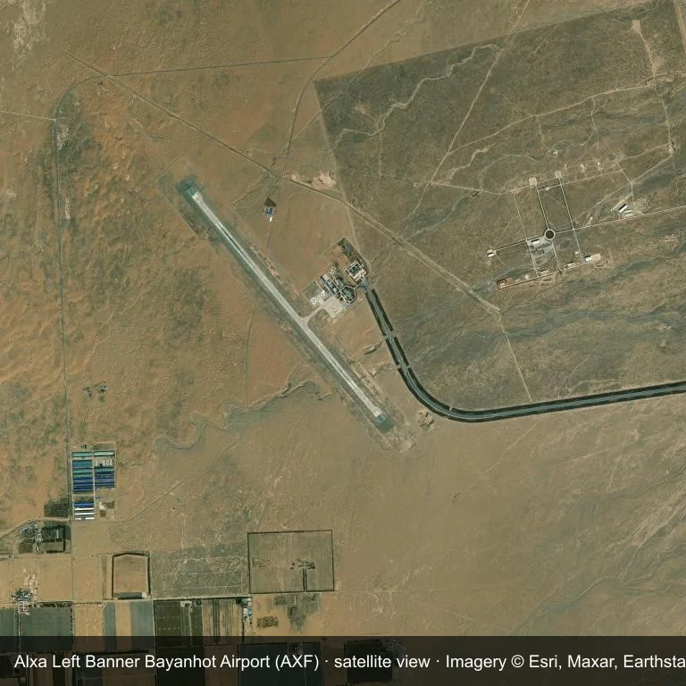
Satellite view: the airfield at Alxa Left Banner Bayanhot Airport (AXF) surrounded by a patchwork of vegetation and open ground.
Source: Esri World Imagery (© Esri, Maxar, Earthstar Geographics); attribution is in the image. This is an overhead view, not a ground-level photograph.
Airport at a glance
| Item | Detail |
|---|---|
| IATA / ICAO | AXF / ZBAL |
| Role | medium-sized airport |
| Elevation | about 1,390 m |
| Coordinates | 38.7483, 105.5842 |
| Runways | Not listed in OurAirports |
| Non-stop destinations | 0 in the 2014 snapshot |
Runways
OurAirports does not list runway dimensions for this airport.
Why there is no route table
No non-stop schedule was captured for AXF in 2014. For current movements, consult the airport operator or a recent flight-planning source.
Nearby airports
| Airport | Distance | Non-stop destinations |
|---|---|---|
| Yinchuan Hedong International Airport (INC) | ~84.8 km | 29 |
| Zhongwei Shapotou Airport (ZHY) | ~136 km | 2 |
| Wuhai Airport (WUA) | ~156 km | 3 |
Getting there and navigating
- Coordinates: 38.7483, 105.5842
- Open in a map: Google Maps | Amap | Baidu Maps
The map shows the field in its local road context. This page does not cover terminal links or local transport; confirm those with the operator.
Site and data gaps
Alxa Left Banner Bayanhot Airport lies in China, with a patchwork of vegetation and open ground around the field. The open dataset does not list runway dimensions. Elevation is about 1,390 m.
Yinchuan Hedong International Airport is the nearest airport in the comparison set, 84.8 km away. No scheduled routes appear in the 2014 snapshot; treat the field as a general-aviation or charter stop and confirm access with the operator.
Before you fly
- Yinchuan Hedong International Airport is 84.8 km away with 29 destinations in the 2014 snapshot, making it the nearest alternative for a scheduled flight.
- Ask the operator about customs, fuel and handling before booking; services at fields this size are not always available on demand.
- Treat this as a general-aviation or charter field rather than a large terminal; confirm handling and opening hours in advance.
About the data
OurAirports supplies the runway, elevation and coordinate figures. The 2014 OpenFlights snapshot supplies the route list; both are reference data, not live operational information.
ความคิดเห็นจากผู้อ่านการสนทนา
ยินดีรับคำถาม รายงานการเดินทาง และการแก้ไข ความคิดเห็นเป็นสาธารณะ
กำลังโหลด…
กำลังโหลดความคิดเห็น…