
Anshun Huangguoshu Airport
 Anshun (Xixiu) · จีน· Anshun Huangguoshu Airport
Anshun Huangguoshu Airport (IATA: AVA, ICAO ZUAS) เป็นสนามบินขนาดกลางที่ให้บริการAnshun (Xixiu), จีน
Anshun Huangguoshu Airport is a medium-sized airport, at an elevation of about 4,812 ft, with scheduled passenger service. This page gathers its location map, airport codes and travel information.
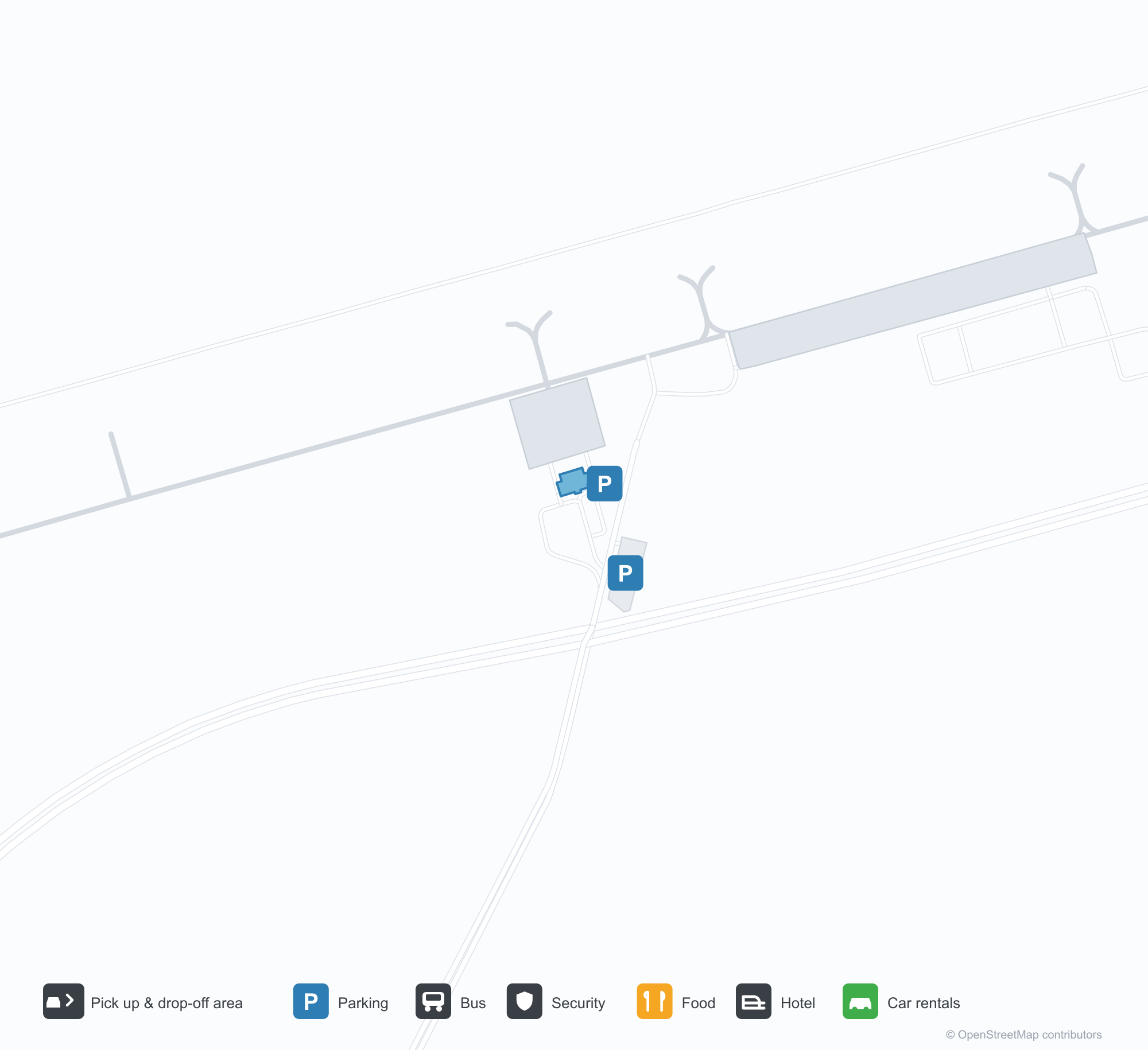
ดาวน์โหลดแผนที่สนามบินดาวน์โหลด
ภาพสนามบินภาพสนามบิน
ภาพจริงของสนามบินแห่งนี้ พร้อมเครดิตของหน้าเว็บสาธารณะที่พบภาพ; ลิขสิทธิ์ยังเป็นของผู้ถ่ายภาพต้นฉบับ คลิกที่ภาพเพื่อขยาย หรือคลิกบรรทัดเครดิตเพื่อเปิดหน้าแหล่งที่มา
อาคารผู้โดยสารท่าอากาศยานอานชุ่นหวงกั๋วซู่ ตัวอักษร '黄果树' สีแดงบนหลังคาโค้งกว้าง ลานหน้าด้านล่างแทบว่างเปล่า
อาคารผู้โดยสารและหอบังคับการบินยามพลบค่ำ — ป้ายโฆษณาข้างถนนที่เขียนว่า '21℃的城市' โดยมีหอบังคับการบินสว่างไสวตัดกับท้องฟ้ายามเย็น
ผู้โดยสารเดินออกไปขึ้นเครื่อง — ป้าย '黄果树' สีทองและด้านหน้ากระจกอยู่ด้านหลัง และมีหอบังคับการบินอยู่เหนือศีรษะ
ภายใต้ท้องฟ้าใส หลังคาโค้งสีเงินของอาคารผู้โดยสารมีตัวอักษรสีแดงขนาดใหญ่เหนือด้านหน้ากระจกและถนนที่ว่างเปล่า
ภาพถ่ายทางอากาศของอาคารผู้โดยสารใหม่ หอบังคับการบินอยู่ทางซ้าย ทางวิ่งอยู่หลังหลังคา และแถวต้นไม้เล็กที่จัดเรียบในลานจอดรถ
ในวันฝนตกฟ้าครึ้ม ผู้โดยสารปีนบันไดขึ้นเครื่องแบบมีหลังคาที่ทาสีชื่อสนามบิน ขณะที่ลานจอดเปล่งประกายด้วยน้ำฝน
อาคารผู้โดยสารเก่าผนังสีครีมพร้อมหลังคากันแดดขอบแดง หอบังคับการบินตั้งอยู่ด้านหลังและเสากันชนสีขาวตามทางรถ
แผนที่เส้นทาง Anshun Huangguoshu Airport — จุดหมายบินตรงแผนที่เส้นทาง
2 จุดหมายบินตรง: แผนที่ สายการบินที่ให้บริการ และระยะทาง
เที่ยวบินของAnshun Huangguoshu Airport — ขาออกและขาเข้าป้ายเที่ยวบิน
14 หมายเลขเที่ยวบิน ครอบคลุม 4 สายการบิน และ 7 จุดหมายปลายทาง แยกตามทิศทาง หมายเลขเที่ยวบินร่วม (codeshare) รวมอยู่ด้วย
| เที่ยวบิน | สายการบิน | จุดหมายปลายทาง | ประเทศ/ภูมิภาค |
|---|---|---|---|
| 9C6898 | Spring Airlines | ท่าอากาศยานนานาชาติเซี่ยงไฮ้ผู่ตง | จีน |
| 9C8577 | Spring Airlines | Ningbo Lishe International Airport | จีน |
| JD5083 | Beijing Capital Airlines | Sanya Phoenix International Airport | จีน |
| JD5084 | Beijing Capital Airlines | Xi'an Xianyang International Airport | จีน |
| KN5068 | China United Airlines | Wenzhou (Longwan) (WNZ) Wenzhou Longwan International Airport | จีน |
| KN5676 | China United Airlines | Beijing Daxing International Airport | จีน |
| MU8244 | China Eastern Airlines | Beijing Daxing International Airport | จีน |
หมายเลขเที่ยวบินและเส้นทางจากดัชนีเที่ยวบิน aviability.com (ข้อมูล ณ วันที่ 26 ตุลาคม 2569); รวมหมายเลขเที่ยวบินร่วมและไม่แสดงเวลาเดินทาง ที่มา: aviability.com ↗
ข้อมูลและรายละเอียดสนามบินรายละเอียดสนามบิน
แผนที่อินเทอร์แอกทีฟ — ตำแหน่ง Anshun Huangguoshu Airportแผนที่อินเทอร์แอกทีฟ
ดูสนามบินนี้บนบริการแผนที่อื่น:
Anshun Huangguoshu Airport (AVA): A 21°C City and Two Routesคู่มือสนามบิน
Anshun puts its identity on the roof: red "Huangguoshu" characters stand above the terminal's flowing roofline. At dusk a roadside billboard reads "a 21°C city" while the tower lights up; another photo shows passengers walking out to board beneath the golden Huangguoshu sign. The airport serves Anshun in Guizhou, China, at an elevation of about 1,467 m, with a 2,800 m runway; the 2014 snapshot records two domestic destinations, Chongqing at 391 km and Guangzhou at 814 km.
Airport photos
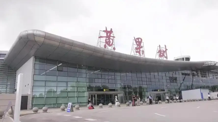
The terminal of Anshun Huangguoshu Airport, the red '黄果树' characters on its sweeping roof, an almost empty forecourt below.
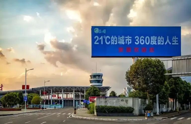
The terminal and tower at dusk — a roadside billboard reading '21℃的城市' with the control tower lit against the evening sky.
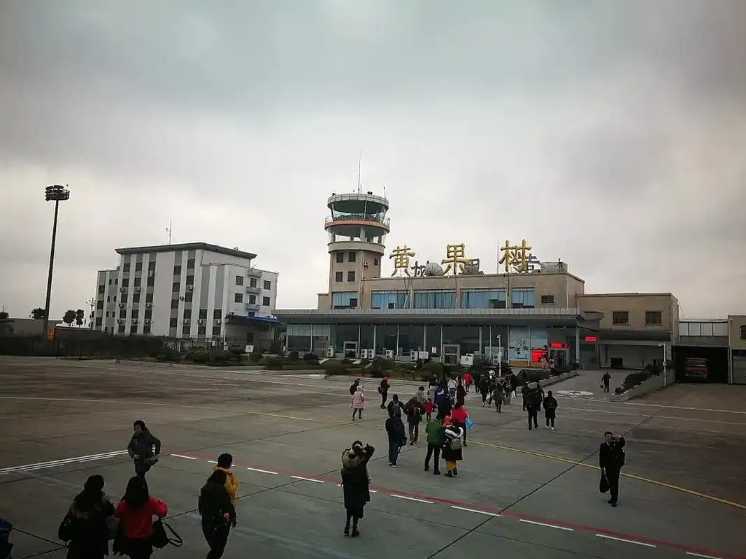
Passengers walking out to board — the gilded '黄果树' sign and glazed frontage behind them, the tower overhead.
The photos come from public web sources and remain the copyright of their photographers; full credits and source links sit in the photo gallery on this page.
Airport at a glance
| Item | Detail |
|---|---|
| IATA / ICAO | AVA / ZUAS |
| Role | Medium-sized airport |
| Elevation | about 1,467 m |
| Coordinates | 26.2606, 105.8733 |
| Runways | 1, 2,800 m |
| Non-stop destinations | 2 (2014 snapshot, all domestic) |
Runways
| Runway | Length | Width | Surface |
|---|---|---|---|
| 08/26 | 2,800 m | — | — |
1 runway, the longest 2,800 m.
Non-stop routes
2 non-stop destinations, nearest first (OpenFlights route snapshot compiled in 2014 — confirm with the airline or airport):
| Destination | Distance | Carriers |
|---|---|---|
| Chongqing Jiangbei International Airport (CKG) | ~391 km | Huaxia |
| Guangzhou Baiyun International Airport (CAN) | ~814 km | China Southern Airlines |
The carrier column comes from the same snapshot and includes codeshare and interline services; treat it as an indication of how busy the route is and check the airline for who actually flies it.
Nearby airports to compare
If the fares are close, these are the nearest airports of the same class (medium-sized airport) — straight-line distance, with their own non-stop counts from the same dataset:
| Airport | Distance | Non-stop destinations |
|---|---|---|
| Anqing Tianzhushan Airport / Anqing North Air Base (AQG) | ~1,193 km | 7 |
| Lengpui Airport (AJL) | ~1,361 km | 3 |
Before you fly
- With two domestic routes, 90–120 minutes is usually enough; add road time for the Huangguoshu scenic area.
- At about 1,467 m the summer is cool but changeable, and thunderstorms can affect flights.
About the data
Runways, elevation and coordinates come from OurAirports open data. Routes and carriers come from the June 2014 OpenFlights snapshot and include codeshares and interline services; they indicate network shape and scale, not current schedules.
ความคิดเห็นจากผู้อ่านการสนทนา
ยินดีรับคำถาม รายงานการเดินทาง และการแก้ไข ความคิดเห็นเป็นสาธารณะ
กำลังโหลด…
กำลังโหลดความคิดเห็น…