
Alice International Airport
 Alice · สหรัฐอเมริกา· Alice International Airport
Alice International Airport (IATA: ALI, ICAO KALI) เป็นสนามบินขนาดกลางที่ให้บริการAlice, สหรัฐอเมริกา
Alice International Airport is a medium-sized airport, at an elevation of about 178 ft. This page gathers its location map, airport codes and travel information.
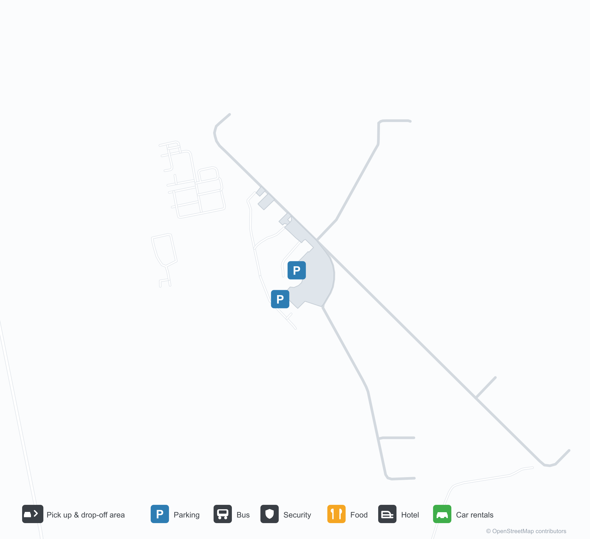
ดาวน์โหลดแผนที่สนามบินดาวน์โหลด
ภาพสนามบินภาพสนามบิน
ภาพจริงของสนามบินแห่งนี้ พร้อมเครดิตของหน้าเว็บสาธารณะที่พบภาพ; ลิขสิทธิ์ยังเป็นของผู้ถ่ายภาพต้นฉบับ คลิกที่ภาพเพื่อขยาย หรือคลิกบรรทัดเครดิตเพื่อเปิดหน้าแหล่งที่มา
ภาพถ่ายดาวเทียม: ท่าอากาศยานนานาชาติแอลิส (ALI) ล้อมรอบด้วยตัวเมือง พื้นที่เกษตรกรรม และพืชพรรณ
แผนที่การบิน VFR แบบ sectional ที่มีศูนย์กลางอยู่ที่ท่าอากาศยานนานาชาติแอลิส (ALI) ทำเครื่องหมาย VOR ระดับความสูงจุดต่าง ๆ โดยรอบ และเมืองใกล้เคียง
ข้อมูลและรายละเอียดสนามบินรายละเอียดสนามบิน
แผนที่อินเทอร์แอกทีฟ — ตำแหน่ง Alice International Airportแผนที่อินเทอร์แอกทีฟ
ดูสนามบินนี้บนบริการแผนที่อื่น:
Alice International Airport (ALI) Guide: A route list that stays emptyคู่มือสนามบิน
Alice International Airport (ALI) is a medium-sized airport in the United States, with a patchwork of vegetation and open ground clear around it from above. The field is about 54 m above sea level with 2 runways, the longest 1,828 m; no scheduled routes were recorded in 2014. The closest airport, Corpus Christi International Airport, lies 51.8 km away.
Satellite view
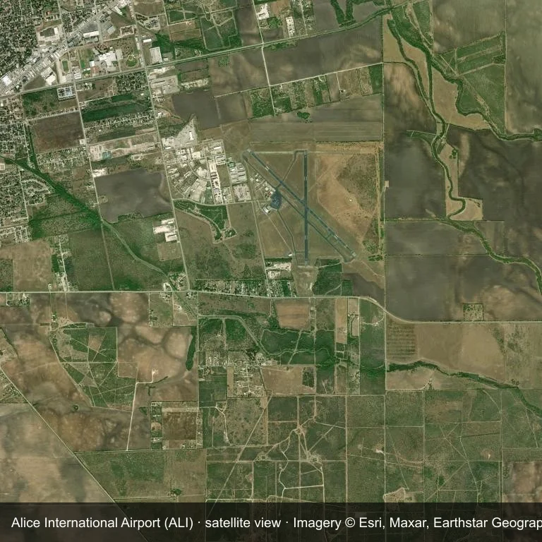
From orbit, Alice International Airport (ALI) appears as a field within a patchwork of vegetation and open ground.
The image is Esri World Imagery (© Esri, Maxar, Earthstar Geographics), labelled with the field and source. It is a satellite view, not a ground photo.
Airport at a glance
| Item | Detail |
|---|---|
| IATA / ICAO | ALI / KALI |
| Role | medium-sized airport |
| Elevation | about 54 m |
| Coordinates | 27.7409, -98.0269 |
| Runways | 2, longest 1,828 m |
| Non-stop destinations | 0 in the 2014 snapshot |
Runways
| Runway | Length | Surface |
|---|---|---|
| 13/31 | 1,828 m | ASP |
| 17/35 | 1,369 m | ASP |
Why there is no route table
This airport's route list is blank in the 2014 snapshot. That may reflect a small or seasonal operation, or simply missing data; confirm before planning a flight.
Nearby airports
| Airport | Distance | Non-stop destinations |
|---|---|---|
| Corpus Christi International Airport (CRP) | ~51.8 km | 4 |
| Laredo International Airport (LRD) | ~143 km | 3 |
| Quetzalcóatl International Airport (NLD) | ~156 km | 1 |
Getting there and navigating
- Coordinates: 27.7409, -98.0269
- Open in a map: Google Maps | Amap | Baidu Maps
The map on this page shows the airfield and nearby roads. Terminal connections and local transport are not covered here; the operator can confirm them.
Runway and surroundings
From the air, Alice International Airport appears within a patchwork of vegetation and open ground in the United States. The primary strip, 13/31, is oriented northwest–southeast and extends 1,828 m at about 54 m.
That 1,828 m length is typical of regional-jet operations. The paved surface supports regular operations, though it does not imply scheduled service. The nearest airport is Corpus Christi International Airport, 51.8 km away, with 4 destinations in the same snapshot.
No scheduled services appear in the 2014 snapshot, so the field is best treated as a general-aviation or charter stop; confirm handling and current movements with the operator.
Before you fly
- The 1,828 m runway can take larger regional aircraft, but that does not guarantee scheduled service.
- The runway is paved, which supports year-round operations, but scheduled service is still not guaranteed.
- Corpus Christi International Airport is 51.8 km away with 4 destinations in the 2014 snapshot, making it the nearest alternative for a scheduled flight.
- Because the 2014 route table is empty, check the airport operator's current notices before making travel plans.
- Treat this as a general-aviation or charter field rather than a large terminal; confirm handling and opening hours in advance.
About the data
The airport facts on this page are drawn from OurAirports. Route data is the June 2014 OpenFlights snapshot, so treat it as historical context rather than a timetable.
ความคิดเห็นจากผู้อ่านการสนทนา
ยินดีรับคำถาม รายงานการเดินทาง และการแก้ไข ความคิดเห็นเป็นสาธารณะ
กำลังโหลด…
กำลังโหลดความคิดเห็น…