
Joint Base Andrews
 Camp Springs · สหรัฐอเมริกา· Joint Base Andrews
Joint Base Andrews (IATA: ADW, ICAO KADW) เป็นสนามบินขนาดกลางที่ให้บริการCamp Springs, สหรัฐอเมริกา
Joint Base Andrews is a medium-sized airport, at an elevation of about 280 ft. This page gathers its location map, airport codes and travel information.
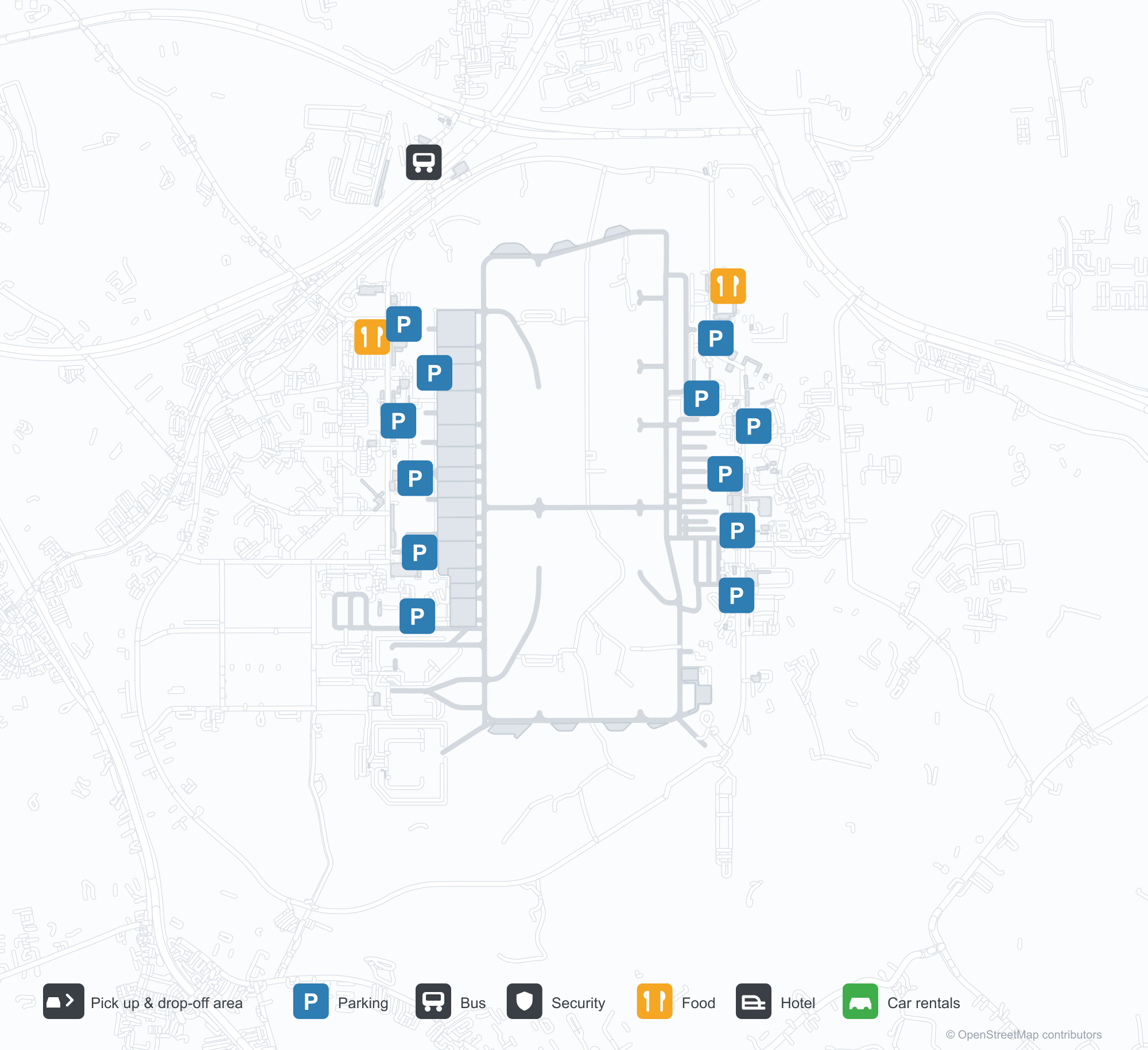
ดาวน์โหลดแผนที่สนามบินดาวน์โหลด
ภาพสนามบินภาพสนามบิน
ภาพจริงของสนามบินแห่งนี้ พร้อมเครดิตของหน้าเว็บสาธารณะที่พบภาพ; ลิขสิทธิ์ยังเป็นของผู้ถ่ายภาพต้นฉบับ คลิกที่ภาพเพื่อขยาย หรือคลิกบรรทัดเครดิตเพื่อเปิดหน้าแหล่งที่มา
ภาพถ่ายดาวเทียม: ฐานทัพร่วมแอนดรูส์ (ADW) อยู่ท่ามกลางพืชพรรณสีเขียวและพื้นที่เกษตรกรรม
มองจากที่สูง ฐานทัพร่วมแอนดรูส์แสดงทางวิ่งขนานยาวสองเส้นและทางขับเชื่อมที่ทอดผ่านสนามหญ้ากว้างและลานปูพื้น
แถวเครื่องบินเจ็ตขนาดเล็กจอดเรียบร้อยบนลานจอด โดยมีกลุ่มโรงเก็บอากาศยานหลังคาโค้งอยู่ทางซ้ายและทางวิ่งหลักอยู่ด้านหลัง
เครื่องบินเจ็ตสองเครื่องยนต์สีขาวจอดเป็นแถวเรียบบนลานคอนกรีตกว้าง โดยมีเฮลิคอปเตอร์สามลำอยู่ใกล้ขอบล่างของภาพ
ภายใต้ท้องฟ้าสีเทา แถวเครื่องบินขับไล่รออยู่หน้าโรงเก็บอากาศยานหลังคาโค้งหลังใหญ่ ขณะที่ทางวิ่งพาดผ่านในระยะไกล
ป้ายทางเข้าฐานเริ่มด้วยตราสัญลักษณ์กองทัพอากาศสหรัฐฯ เหนือตัวอักษร Andrews Air Force Base และ Joint Base Andrews
ภาพถ่ายดาวเทียม Google แสดงผังทางวิ่งของฐาน ล้อมรอบด้วยที่อยู่อาศัยชานเมือง ทางหลวง และป่าลึกเป็นหย่อม ๆ
ข้อมูลและรายละเอียดสนามบินรายละเอียดสนามบิน
แผนที่อินเทอร์แอกทีฟ — ตำแหน่ง Joint Base Andrewsแผนที่อินเทอร์แอกทีฟ
ดูสนามบินนี้บนบริการแผนที่อื่น:
Joint Base Andrews (ADW) Guide: Where the route map stopsคู่มือสนามบิน
Joint Base Andrews (ADW) serves the United States. Seen from above, it sits among green vegetation and farmland; its elevation is about 85 m above sea level and it has 2 runways, the longest 3,445 m. No scheduled non-stop services are recorded for 2014. The nearest airport is Ronald Reagan Washington National Airport (15.5 km).
Satellite view
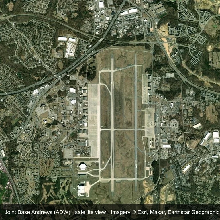
Satellite view: Joint Base Andrews (ADW) set among green vegetation and farmland.
Satellite imagery © Esri, Maxar, Earthstar Geographics; the field and attribution are labelled in the image. This is an overhead view, not a ground-level photograph.
Airport at a glance
| Item | Detail |
|---|---|
| IATA / ICAO | ADW / KADW |
| Role | medium-sized airport |
| Elevation | about 85 m |
| Coordinates | 38.8108, -76.8670 |
| Runways | 2, longest 3,445 m |
| Non-stop destinations | 0 in the 2014 snapshot |
| Official site | www.jba.af.mil |
Runways
| Runway | Length | Surface |
|---|---|---|
| 01L/19R | 3,445 m | CON |
| 01R/19L | 2,974 m | PEM |
Why there is no route table
The 2014 snapshot lists no destinations from ADW. Schedules for fields this size change quietly, so verify with the operator rather than assuming there is no service.
Nearby airports
| Airport | Distance | Non-stop destinations |
|---|---|---|
| Ronald Reagan Washington National Airport (DCA) | ~15.5 km | 90 |
| Baltimore/Washington International Thurgood Marshall Airport (BWI) | ~44 km | 71 |
| Washington Dulles International Airport (IAD) | ~53.1 km | 125 |
Getting there and navigating
- Coordinates: 38.8108, -76.8670
- Official site: www.jba.af.mil
- Open in a map: Google Maps | Amap | Baidu Maps
The map on this page shows the airfield and nearby roads. Terminal connections and local transport are not covered here; the operator can confirm them.
Local context
The site at Joint Base Andrews is set in green vegetation and farmland in the United States. Its main runway, 01L/19R, is aligned north–south and measures 3,445 m; the field lies at about 85 m.
With 3,445 m of runway, the airport sits in the narrowbody bracket. The surface type is not listed in the open data. The closest airport, Ronald Reagan Washington National Airport, lies 15.5 km away, with 90 destinations in the same snapshot.
Because no scheduled routes were captured in 2014, the practical question is charter or private access; ask the operator before building an itinerary around it.
Before you fly
- The 3,445 m runway can take larger regional aircraft, but that does not guarantee scheduled service.
- The runway is paved, which supports year-round operations, but scheduled service is still not guaranteed.
- Ronald Reagan Washington National Airport is 15.5 km away with 90 destinations in the 2014 snapshot, making it the nearest alternative for a scheduled flight.
- Treat this as a general-aviation or charter field rather than a large terminal; confirm handling and opening hours in advance.
- The site has no terminal guide on this page, so allow extra time for local arrangements and onward transport.
About the data
Runway and location data follow OurAirports. The route table is the June 2014 OpenFlights snapshot and may lag current airline schedules.
ความคิดเห็นจากผู้อ่านการสนทนา
ยินดีรับคำถาม รายงานการเดินทาง และการแก้ไข ความคิดเห็นเป็นสาธารณะ
กำลังโหลด…
กำลังโหลดความคิดเห็น…