
Alluitsup Paa Heliport
 Alluitsup Paa · Гренландия· Alluitsup Paa Heliport
Alluitsup Paa Heliport (IATA: LLU, ICAO BGAP) — вертолётная площадка в городе Alluitsup Paa, Гренландия.
Alluitsup Paa Heliport is a heliport, at an elevation of about 54 ft, with scheduled passenger service. This page gathers its location map, airport codes and travel information.

Скачать карты аэропортаЗагрузки
Фотографии аэропортаФото аэропорта
Реальные фотографии этого аэропорта; у каждой указан источник — общедоступная веб-страница. Авторские права принадлежат фотографам. Нажмите на фото, чтобы увеличить, или на подпись, чтобы открыть источник.
На спутниковом снимке полоса вертодрома Аллуитсуп-Паа (LLU) лежит между городом, сельхозугодьями и растительностью.
Информация об аэропортеСведения об аэропорте
Интерактивная карта: Alluitsup Paa HeliportИнтерактивная карта
Посмотреть этот аэропорт на других картографических сервисах:
Alluitsup Paa Heliport (LLU) Guide: What the open data leaves outПутеводитель по аэропорту
Satellite imagery of Alluitsup Paa Heliport (LLU) in Greenland shows a field surrounded by dense green vegetation and small fields. At about 16 m above sea level, it has a single 60 m runway. The 2014 snapshot lists no scheduled destinations; Qaqortoq Airport is 42.9 km away.
Satellite view
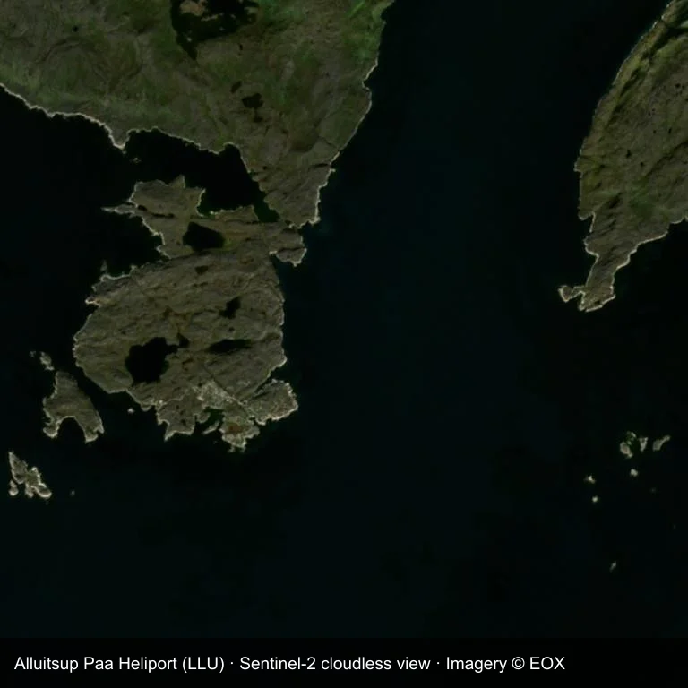
Satellite view of Alluitsup Paa Heliport (LLU), with the airfield visible among dense green vegetation and small fields.
The satellite image comes from Sentinel-2 cloudless (© EOX); the field and attribution are labelled in the image. This is a satellite view, not a ground-level photograph.
Airport at a glance
| Item | Detail |
|---|---|
| IATA / ICAO | LLU / BGAP |
| Role | heliport |
| Elevation | about 16 m |
| Coordinates | 60.4645, -45.5692 |
| Runways | 1, longest 60 m |
| Non-stop destinations | 0 in the 2014 snapshot |
Runways
| Runway | Length | Surface |
|---|---|---|
| H1/ | 60 m | ASP |
Why there is no route table
LLU has an empty route table in the 2014 snapshot. The dataset only covers services it recorded, so treat the blank as a gap rather than a closure notice.
Nearby airports
| Airport | Distance | Non-stop destinations |
|---|---|---|
| Qaqortoq Airport (JJU) | ~42.9 km | — |
| Nuuk International Airport (GOH) | ~520 km | 6 |
| Kulusuk Airport (KUS) | ~709 km | 4 |
Getting there and navigating
- Coordinates: 60.4645, -45.5692
- Open in a map: Google Maps | Amap | Baidu Maps
You can use the map to place the airport against the surrounding road network. For terminal connections and local transport, consult the airport or airline.
Reading the airfield
Alluitsup Paa Heliport lies in Greenland, with dense green vegetation and small fields around the field. The published runway is H1/, 60 m of asphalt. Elevation is about 16 m.
Qaqortoq Airport is the nearest airport in the comparison set, 42.9 km away. No scheduled routes appear in the 2014 snapshot; treat the field as a general-aviation or charter stop and confirm access with the operator.
Before you fly
- The 60 m runway limits operations to small aircraft; baggage and payload limits are usually strict.
- Qaqortoq Airport is the nearest airport in this dataset, 42.9 km away, but it also has no recorded destinations for 2014.
- The site has no terminal guide on this page, so allow extra time for local arrangements and onward transport.
- Treat this as a general-aviation or charter field rather than a large terminal; confirm handling and opening hours in advance.
About the data
Runways, elevation and coordinates come from OurAirports open data; routes come from the June 2014 OpenFlights snapshot. That snapshot describes network shape and scale, not current schedules.
Комментарии читателейОбсуждение
Вопросы, отчёты о поездках и исправления приветствуются. Комментарии видны всем.
Загрузка…
Загрузка комментариев…