
Harry Reid International Airport
 Las Vegas · Estados Unidos· Harry Reid International Airport
O Harry Reid International Airport (IATA: LAS, ICAO KLAS) é um aeroporto grande que atende Las Vegas, Estados Unidos.
Harry Reid International Airport (LAS) is a large international airport serving Las Vegas, United States. This page gathers the airport codes, location map and travel information.
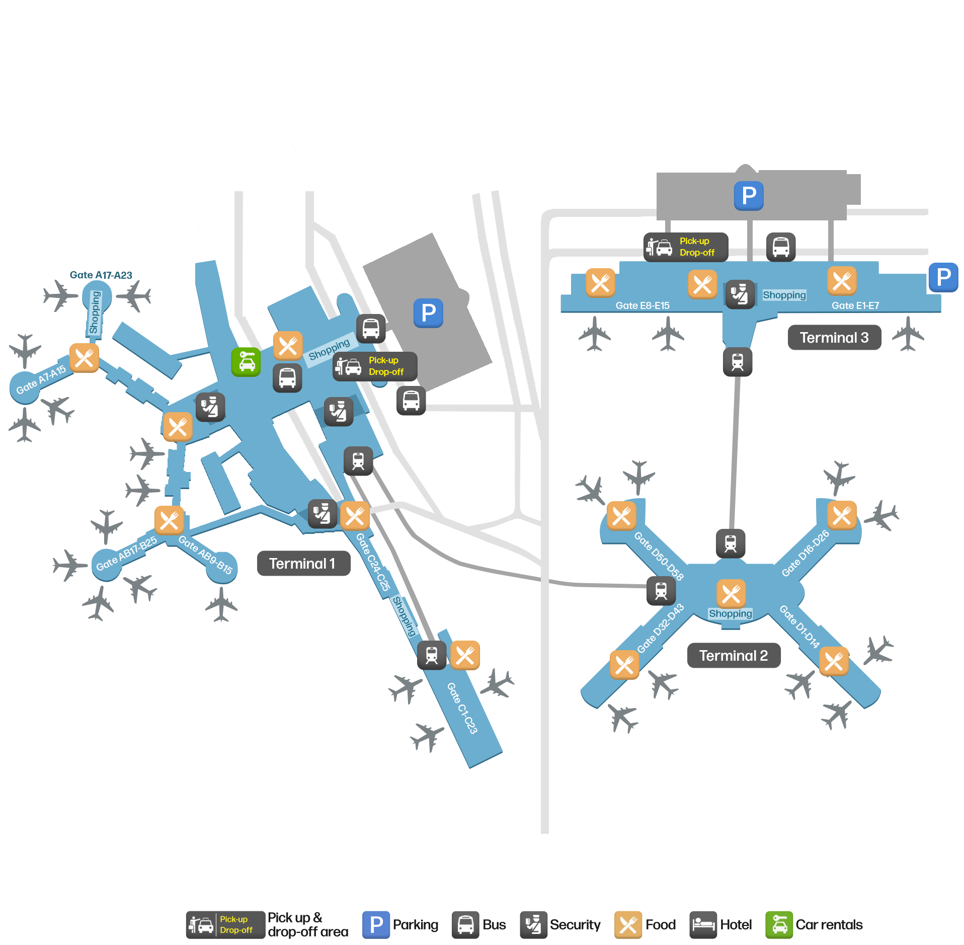
Baixar mapas do aeroportoDownloads
Fotos do aeroportoFotos do aeroporto
Fotos reais deste aeroporto, cada uma creditada à página pública da web onde foi encontrada; os direitos autorais continuam com os fotógrafos originais. Clique em uma foto para ampliar ou em uma linha de crédito para abrir a página de origem.
Vista aérea do Aeroporto Internacional Harry Reid (LAS), mostrando os píeres dos terminais, as posições de aeronaves e as pistas.
Na imagem de satélite, é possível ver claramente o traçado do Aeroporto Internacional Harry Reid (LAS) e do entorno.
Harry Reid International Airport: mapa de rotas — destinos diretosMapa de rotas
133 destinos diretos: mapa, companhias aéreas em operação e distâncias.
Harry Reid International Airport: voos — partidas e chegadasPainel de voos
11.430 números de voo de 73 companhias aéreas para 174 destinos, separados por direção. Números de codeshare estão incluídos.
| Voo | Companhia aérea | Destino | País/região |
|---|---|---|---|
| 4Y55 | Eurowings Discover | Aeroporto de Frankfurt | Alemanha |
| AA8 | American Airlines | Charlotte Douglas International Airport | Estados Unidos |
| AA288 | American Airlines | Aeroporto de Londres-Heathrow | Reino Unido |
| AA365 | American Airlines | Charlotte Douglas International Airport | Estados Unidos |
| AA375 | American Airlines | Dallas Fort Worth International Airport | Estados Unidos |
| AA379 | American Airlines | Dallas Fort Worth International Airport | Estados Unidos |
| AA380 | American Airlines | Dallas Fort Worth International Airport | Estados Unidos |
| AA421 | American Airlines | Aeroporto Internacional de Los Angeles | Estados Unidos |
| AA431 | American Airlines | Aeroporto Internacional John F. Kennedy | Estados Unidos |
| AA437 | American Airlines | Aeroporto Internacional O'Hare | Estados Unidos |
| AA438 | American Airlines | Charlotte Douglas International Airport | Estados Unidos |
| AA452 | American Airlines | Dallas Fort Worth International Airport | Estados Unidos |
| AA455 | American Airlines | Dallas Fort Worth International Airport | Estados Unidos |
| AA459 | American Airlines | Charlotte Douglas International Airport | Estados Unidos |
| AA479 | American Airlines | Charlotte Douglas International Airport | Estados Unidos |
| AA483 | American Airlines | Dallas Fort Worth International Airport | Estados Unidos |
| AA484 | American Airlines | Aeroporto Internacional John F. Kennedy | Estados Unidos |
| AA485 | American Airlines | Aeroporto Internacional de Los Angeles | Estados Unidos |
| AA488 | American Airlines | Aeroporto Internacional O'Hare | Estados Unidos |
| AA544 | American Airlines | Dallas Fort Worth International Airport | Estados Unidos |
Números de voo e rotas do índice de voos da aviability.com (instantâneo de 26 de outubro de 2026); números de codeshare estão incluídos e nenhum horário de partida é exibido. Fonte: aviability.com ↗
Informações e detalhes do aeroportoDetalhes do aeroporto
Mapa interativo — localização do Harry Reid International AirportMapa interativo
Veja este aeroporto em outros serviços de mapas:
Harry Reid International Airport GuideGuia do aeroporto
Harry Reid International Airport (IATA LAS, ICAO KLAS) serves Las Vegas, United States, North America, and is classified as a large airport. This page gathers what the site's database, maps and route dataset say about it in one place.
Facts at a glance
| IATA / ICAO | LAS / KLAS |
| Airport class | large airport |
| Location | Las Vegas, United States (North America) |
| Coordinates | 36.0834, -115.1518 |
| Direct destinations | 133 (see below) |
Airport map
The map on this page is rendered from OpenStreetMap data: airports with terminal polygons show the terminal buildings, aprons and access roads, while small fields show the airfield outline and runway. Icons for parking, buses, food, hotels and car rentals follow whatever OSM has mapped.
- Full-size view — open the map card on this page to zoom in; the 2000 px original can be downloaded.
- Location map — the interactive map lets you pan and zoom to see the field against the city and road network.
- Schematic — the page also draws a size-based schematic to indicate the airport's scale; it is not the actual layout.
Direct routes
Non-stop destinations, nearest first (OpenFlights route dataset, compiled 2014 — treat as indicative and confirm with the airline):
| Destination | Distance | Main carriers |
|---|---|---|
| Palm Springs International Airport (PSP) | ~279 km | United Airlines |
| Ontario International Airport (ONT) | ~317 km | Southwest Airlines |
| Hollywood Burbank/Bob Hope Airport (BUR) | ~359 km | AirTran Airways, Southwest Airlines |
| John Wayne Orange County International Airport (SNA) | ~365 km | AirTran Airways, Southwest Airlines |
| Long Beach International Airport (LGB) | ~372 km | JetBlue Airways |
| Los Angeles International Airport (LAX) | ~380 km | Boutique Air (Priv), American Airlines |
| Phoenix Sky Harbor International Airport (PHX) | ~411 km | American Airlines, AirTran Airways |
| Fresno Yosemite International Airport (FAT) | ~416 km | Allegiant Air, United Airlines |
See the Harry Reid International Airport route map for the full list of 133 non-stop destinations.
Nearby airports
If nothing fits, these nearby fields are worth comparing:
| Airport | Distance |
|---|---|
| John Wayne Orange County International Airport (SNA) | 365 km |
| Los Angeles International Airport (LAX) | 380 km |
| Phoenix Sky Harbor International Airport (PHX) | 411 km |
Getting there
The airport: coordinates 36.0834, -115.1518; elevation about 665 m.
Navigate straight to the field:
- Driving / taxi: 高德地图 | 百度地图 | Google Maps
The location map on this page shows the field against the city and road network, and the ground-transport section lists the public transport recorded for it. For driving routes, timetables and parking, rely on the airport's own information.
Size and facilities
Large airports run multiple runways and terminals and handle millions of passengers a year. Queue times at check-in and security vary strongly by time of day; for international flights plan to arrive 2–3 hours before departure.
Terminal plans, check-in locations and ground-transport timetables are published by the airport itself; for detail that must be right on the day, rely on the airport's own information. If something here looks wrong, please tell us via the Contact page and we will check it.
Tips
- If your destination is not in the table above, you will usually connect via Palm Springs International Airport (PSP) or another larger airport.
- Use the search box at the top of the page to compare alternatives: type a city name or IATA code.
- In peak season parking and rental cars run short at small fields too — book ahead if you are driving.
LAS: guias do aeroportoDo blog
2 artigos deste site cobrem LAS: chegadas, transporte terrestre, bagagem e conexões.
Os aeroportos mais movimentados do mundo: Dallas mantém o primeiro lugar pelo segundo mês, e O'Hare sobe para segundo
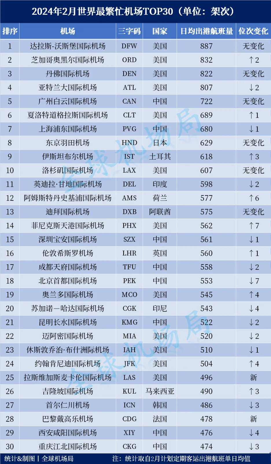
O top 30 de fevereiro de 2024, classificado pela média planejada de partidas diárias de passageiros, coloca Dallas/Fort Worth em primeiro pelo segundo mês com 887 partidas, Chicago O'Hare em segundo com 832 e Atlanta em quarto com 807. Istambul volta ao top ten, Las Vegas e Paris CDG retornam ao top 30, e Phoenix salta sete posições.6 min de leitura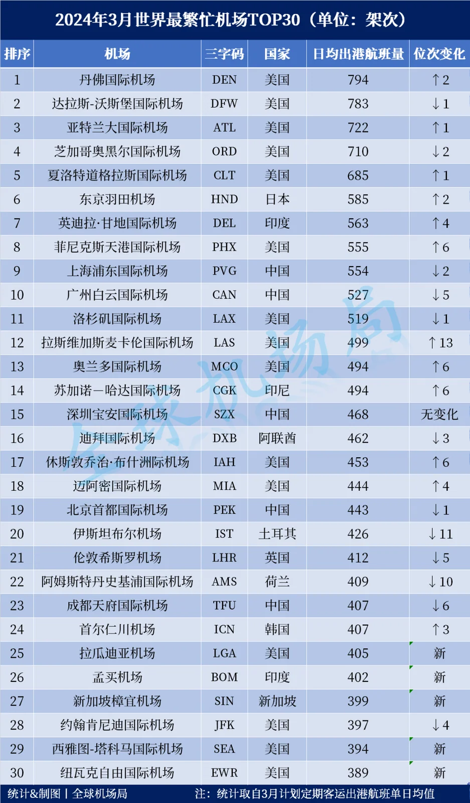
Comentários dos leitoresDiscussão
Perguntas, relatos de viagem e correções são bem-vindos. Os comentários são públicos.
Carregando…
Carregando comentários…