
Ashgabat International Airport
 Ashgabat · Turcomenistão· Ashgabat International Airport
O Ashgabat International Airport (IATA: ASB, ICAO UTAA) é um aeroporto grande que atende Ashgabat, Turcomenistão.
Ashgabat International Airport is a large airport, at an elevation of about 692 ft, with scheduled passenger service. This page gathers its location map, airport codes and travel information.
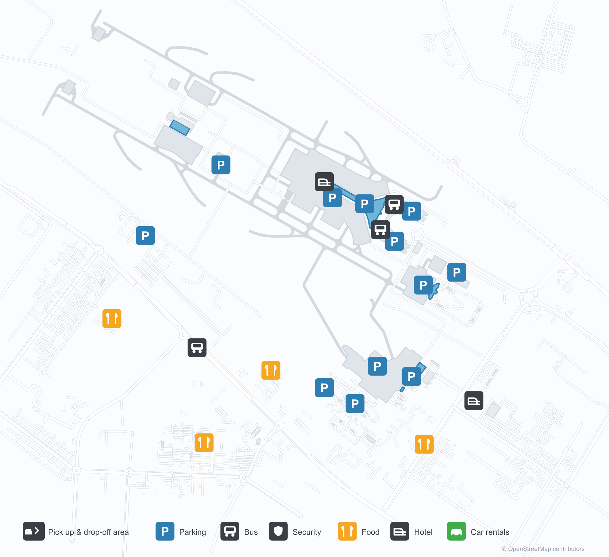
Baixar mapas do aeroportoDownloads
Fotos do aeroportoFotos do aeroporto
Fotos reais deste aeroporto, cada uma creditada à página pública da web onde foi encontrada; os direitos autorais continuam com os fotógrafos originais. Clique em uma foto para ampliar ou em uma linha de crédito para abrir a página de origem.
No pátio de carga: um cargueiro An-74 da Turkmenistan Airlines estacionado diante do terminal YÜK (carga).
O edifício do terminal de carga — paredes brancas sob uma faixa verde, com uma longa fileira de docas de carga no nível do solo.
Ashgabat International Airport: mapa de rotas — destinos diretosMapa de rotas
11 destinos diretos: mapa, companhias aéreas em operação e distâncias.
Ashgabat International Airport: voos — partidas e chegadasPainel de voos
168 números de voo de 6 companhias aéreas para 22 destinos, separados por direção. Números de codeshare estão incluídos.
| Voo | Companhia aérea | Destino | País/região |
|---|---|---|---|
| CZ6016 | China Southern Airlines | Ürümqi Tianshan International Airport | China |
| CZ8176 | China Southern Airlines | Ürümqi Tianshan International Airport | China |
| EK2033 | Emirates | Aeroporto Internacional de Dubai | Emirados Árabes Unidos |
| EK2372 | Emirates | Aeroporto Internacional de Dubai | Emirados Árabes Unidos |
| EK2483 | Emirates | Aeroporto Internacional de Dubai | Emirados Árabes Unidos |
| FZ732 | Flydubai | Aeroporto Internacional de Dubai | Emirados Árabes Unidos |
| FZ740 | Flydubai | Aeroporto Internacional de Dubai | Emirados Árabes Unidos |
| FZ8128 | Flydubai | Aeroporto Internacional de Dubai | Emirados Árabes Unidos |
| S73236 | S7 Airlines | Moscou (DME) Domodedovo International Airport | Rússia |
| T5101 | Turkmenistan Airlines | Daşoguz (TAZ) Dashoguz International Airport | Turcomenistão |
| T5103 | Turkmenistan Airlines | Daşoguz (TAZ) Dashoguz International Airport | Turcomenistão |
| T5105 | Turkmenistan Airlines | Daşoguz (TAZ) Dashoguz International Airport | Turcomenistão |
| T5109 | Turkmenistan Airlines | Daşoguz (TAZ) Dashoguz International Airport | Turcomenistão |
| T5111 | Turkmenistan Airlines | Daşoguz (TAZ) Dashoguz International Airport | Turcomenistão |
| T5113 | Turkmenistan Airlines | Daşoguz (TAZ) Dashoguz International Airport | Turcomenistão |
| T5115 | Turkmenistan Airlines | Daşoguz (TAZ) Dashoguz International Airport | Turcomenistão |
| T5127 | Turkmenistan Airlines | Mary (MYP) Mary International Airport | Turcomenistão |
| T5131 | Turkmenistan Airlines | Mary (MYP) Mary International Airport | Turcomenistão |
| T5133 | Turkmenistan Airlines | Mary (MYP) Mary International Airport | Turcomenistão |
| T5171 | Turkmenistan Airlines | Türkmenabat (CRZ) Türkmenabat International Airport | Turcomenistão |
Números de voo e rotas do índice de voos da aviability.com (instantâneo de 26 de outubro de 2026); números de codeshare estão incluídos e nenhum horário de partida é exibido. Fonte: aviability.com ↗
Informações e detalhes do aeroportoDetalhes do aeroporto
Mapa interativo — localização do Ashgabat International AirportMapa interativo
Veja este aeroporto em outros serviços de mapas:
Ashgabat Airport (ASB): A Central Asian Airport Seen Through Its Cargo AreaGuia do aeroporto
The photos of Ashgabat International Airport (IATA ASB, ICAO UTAA) have an unusual focus: they show the cargo area rather than the passenger terminal. In the first, a Turkmenistan Airlines An-74 freighter stands in front of a building marked "YÜK TERMINAL" (cargo terminal). The second shows the newer cargo building — white walls under a green fascia, with a long row of loading docks at ground level. For an airport whose passenger information is hard to verify, these images offer a reliable observation point: its ground handling is not built around travellers alone.
The field serves Ashgabat, Turkmenistan, at an elevation of about 211 m, with two parallel 3,800 m concrete runways. The 2014 route snapshot records 11 non-stop destinations, all outside the country.
Airport photos
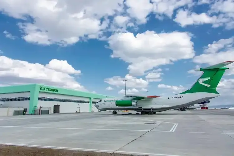
On the cargo apron: a Turkmenistan Airlines An-74 freighter parked before the YÜK (cargo) terminal.

The cargo terminal building — white walls under a green fascia, a long row of loading docks at ground level.
The photos come from public web sources and remain the copyright of their photographers; full credits and source links sit in the photo gallery on this page.
Airport at a glance
| Item | Detail |
|---|---|
| IATA / ICAO | ASB / UTAA |
| Role | Large airport and Central Asian international gateway |
| Elevation | about 211 m |
| Coordinates | 37.9868, 58.3610 |
| Runways | 2: 11L/29R and 11R/29L, both 3,800 m concrete |
| Non-stop destinations | 11 (2014 snapshot, all international) |
Network shape: 11 destinations, all abroad
By distance, only one destination is within 1,000 km: Baku at 767 km. Seven fall between 1,000 and 3,000 km, three between 3,000 and 6,000 km, and none beyond 6,000 km. The near layer is Baku (767 km), Dubai (1,444 km) and Amritsar (1,651 km); the far layer is Frankfurt (4,116 km), London Heathrow (4,741 km) and Birmingham (4,819 km).
| Distance band | Destinations |
|---|---|
| Under 1,000 km | 1 |
| 1,000–3,000 km | 7 |
| 3,000–6,000 km | 3 |
| Over 6,000 km | 0 |
Turkmenistan Airlines appears on 8 of the 11 routes, with Lufthansa Cargo, Fly Dubai and others filling out the list. The carrier column includes codeshares and cargo flights, so the figures describe concentration rather than passenger service. The full list is on the Ashgabat route map.
Getting there and navigating
- Coordinates: 37.9868, 58.3610
- Open in a map: Google Maps | Amap | Baidu Maps
If your destination is not on the list, Dubai International (DXB) is the practical connection: about 1,444 km away with 180 destinations in the snapshot. The nearest large-airport comparison is Aktau, Kazakhstan (SCO), about 893 km away with 16 destinations.
The location map on this page shows the field against Ashgabat and the road network. This page does not cover terminal connections or local transport; confirm them with the airport or airline.
Before you fly
- Entry and transit rules for Turkmenistan are set by the authorities; confirm visa and invitation requirements with an embassy or airline before booking.
- Allow 2–3 hours for an international departure. The photos show the cargo side; for passenger-terminal flows and walking distances, follow the signs on the day.
- The 11 destinations are a 2014 snapshot and the carrier column mixes cargo services. Check passenger schedules directly with the airline.
About the data
Runways, elevation and coordinates come from OurAirports open data. Routes and carriers come from the June 2014 OpenFlights snapshot and include codeshares and cargo flights; they indicate network shape and scale, not current schedules. Photos are from public web sources and remain the copyright of their photographers.
History
Opened in 1994 and named after Turkmenistan's first president, the airport sits about 10 km north-west of Ashgabat with a 3,800 m precision-approach runway — one of the country's two international airports.
Source: Ashgabat Airport.
Comentários dos leitoresDiscussão
Perguntas, relatos de viagem e correções são bem-vindos. Os comentários são públicos.
Carregando…
Carregando comentários…