
Hualien Airport
 Hualien · 대만· Hualien Airport
Hualien Airport(IATA: HUN, ICAO: RCYU)은 대만 Hualien에 위치한 대형 공항입니다.
Hualien Airport is a large airport, at an elevation of about 52 ft, with scheduled passenger service. This page gathers its location map, airport codes and travel information.
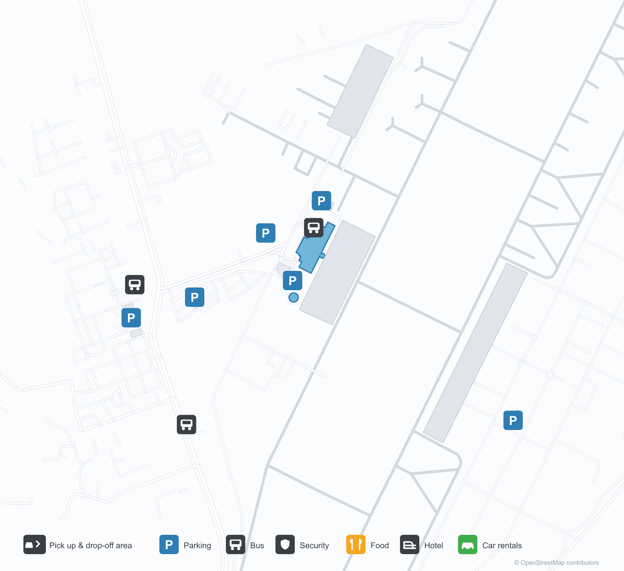
공항 지도 다운로드다운로드
공항 실제 사진공항 사진
다음은 이 공항의 실제 사진으로, 모두 공개된 인터넷 출처에서 가져왔으며 사진마다 출처를 표시했습니다. 저작권은 원저작자에게 있습니다. 사진을 클릭하면 크게 볼 수 있고, 출처를 클릭하면 원본 페이지가 열립니다.
In the satellite image, the layout of Hualien Airport (HUN) and its surroundings are clearly visible.
The flower-lined stone wall at Hualien Airport's entrance, lettered "Hualien Airport".
The front of Hualien Airport's terminal, with palm trees along the glass facade and the control tower at left.
Hualien Airport 노선도 · 직항 목적지노선도
직항 목적지 4개: 노선도, 운항 항공사, 비행 거리.
공항 정보 및 상세공항 상세
Hualien Airport 인터랙티브 지도 — 공항 위치인터랙티브 지도
다른 지도 서비스에서 이 공항 보기:
Hualien Airport Guide공항 안내
Hualien Airport (IATA HUN, ICAO RCYU) serves Hualien, Taiwan, East Asia, and is classified as a large airport. This page gathers what the site's database, maps and route dataset say about it in one place.
Airport photos
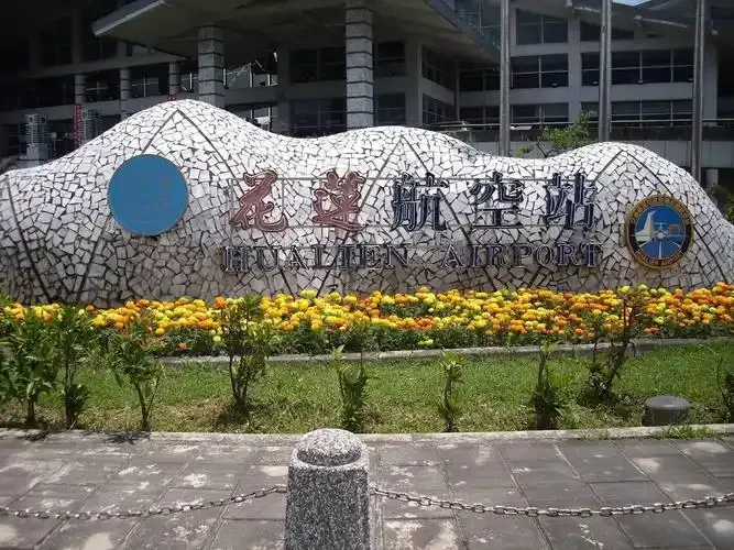
The flower-lined stone wall at Hualien Airport's entrance, lettered "Hualien Airport".
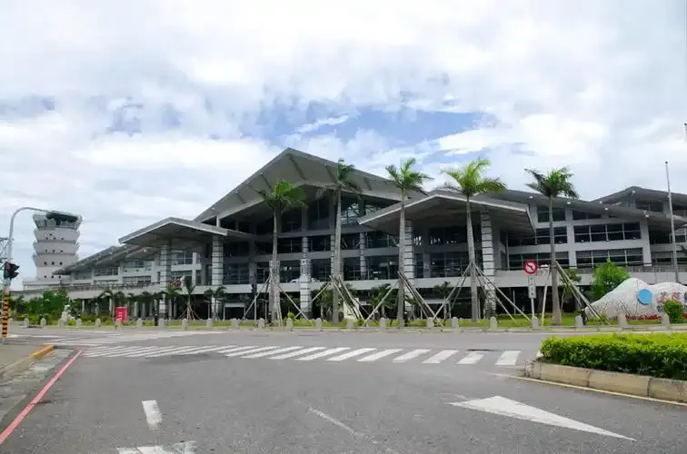
The front of Hualien Airport's terminal, with palm trees along the glass facade and the control tower at left.
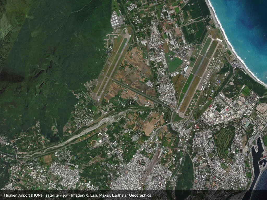
In the satellite image, the layout of Hualien Airport (HUN) and its surroundings are clearly visible.
The photos come from public web sources and remain the copyright of their photographers; full credits and source links sit in the photo gallery on this page.
Facts at a glance
| IATA / ICAO | HUN / RCYU |
| Airport class | large airport |
| Location | Hualien, Taiwan (East Asia) |
| Coordinates | 24.0232, 121.6180 |
| Direct destinations | 4 (see below) |
Airport map
The map on this page is rendered from OpenStreetMap data: airports with terminal polygons show the terminal buildings, aprons and access roads, while small fields show the airfield outline and runway. Icons for parking, buses, food, hotels and car rentals follow whatever OSM has mapped.
- Full-size view — open the map card on this page to zoom in; the 2000 px original can be downloaded.
- Location map — the interactive map lets you pan and zoom to see the field against the city and road network.
- Schematic — the page also draws a size-based schematic to indicate the airport's scale; it is not the actual layout.
Direct routes
Non-stop destinations, nearest first (OpenFlights route dataset, compiled 2014 — treat as indicative and confirm with the airline):
| Destination | Distance | Main carriers |
|---|---|---|
| Taichung International Airport (RMQ) | ~105 km | TransAsia Airways |
| Taipei Songshan Airport (TSA) | ~116 km | TransAsia Airways |
| Kaohsiung International Airport (KHH) | ~206 km | Mandarin Airlines |
| Jinan Yaoqiang International Airport (TNA) | ~1488 km | Shandong Airlines |
See the Hualien Airport route map for the full list of 4 non-stop destinations.
Nearby airports
If nothing fits, these nearby fields are worth comparing:
| Airport | Distance |
|---|---|
| Taichung International Airport (RMQ) | 105 km |
| Taipei Songshan Airport (TSA) | 116 km |
| Taiwan Taoyuan International Airport (TPE) | 124 km |
Getting there
The airport: coordinates 24.0232, 121.6180; elevation about 16 m.
Navigate straight to the field:
- Driving / taxi: 高德地图 | 百度地图 | Google Maps
The location map on this page shows the field against the city and road network, and the ground-transport section lists the public transport recorded for it. For driving routes, timetables and parking, rely on the airport's own information.
Size and facilities
Large airports run multiple runways and terminals and handle millions of passengers a year. Queue times at check-in and security vary strongly by time of day; for international flights plan to arrive 2–3 hours before departure.
Terminal plans, check-in locations and ground-transport timetables are published by the airport itself; for detail that must be right on the day, rely on the airport's own information. If something here looks wrong, please tell us via the Contact page and we will check it.
Tips
- If your destination is not in the table above, you will usually connect via Taichung International Airport (RMQ) or another larger airport.
- Use the search box at the top of the page to compare alternatives: type a city name or IATA code.
- In peak season parking and rental cars run short at small fields too — book ahead if you are driving.