
Bucharest Băneasa Aurel Vlaicu International Airport
 부쿠레슈티 · 루마니아· Bucharest Băneasa Aurel Vlaicu International Airport
Bucharest Băneasa Aurel Vlaicu International Airport(IATA: BBU, ICAO: LRBS)은 루마니아 부쿠레슈티에 위치한 대형 공항입니다.
Bucharest Băneasa Aurel Vlaicu International Airport is a large airport, at an elevation of about 297 ft, with scheduled passenger service. This page gathers its location map, airport codes and travel information.
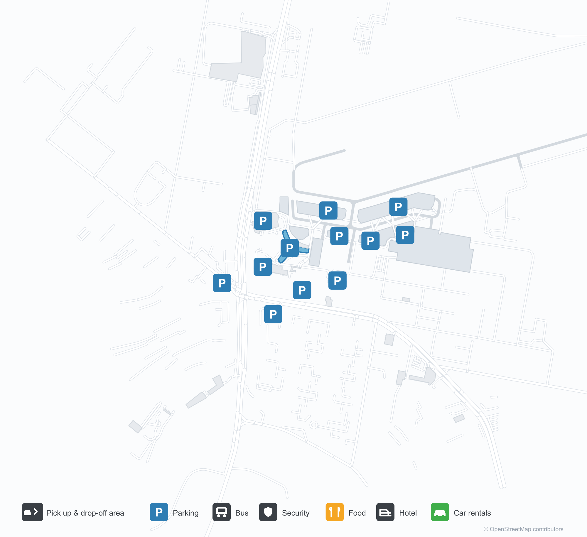
공항 지도 다운로드다운로드
공항 실제 사진공항 사진
다음은 이 공항의 실제 사진으로, 모두 공개된 인터넷 출처에서 가져왔으며 사진마다 출처를 표시했습니다. 저작권은 원저작자에게 있습니다. 사진을 클릭하면 크게 볼 수 있고, 출처를 클릭하면 원본 페이지가 열립니다.
해질녘의 버네아사 — 불 켜진 파란 터미널과 관제탑, 계류장의 버스와 여객기.
공항 정보 및 상세공항 상세
Bucharest Băneasa Aurel Vlaicu International Airport 인터랙티브 지도 — 공항 위치인터랙티브 지도
다른 지도 서비스에서 이 공항 보기:
Bucharest Băneasa Airport (BBU): A City Airport at Dusk공항 안내
The photo of Bucharest Băneasa Aurel Vlaicu International Airport (IATA BBU, ICAO LRBS) is a dusk scene: the blue terminal and control tower lit up, buses and an airliner on the apron, the wet surface reflecting the lights. It sits close to the city and at a modest scale — not what most people picture for a capital's international gateway, which is exactly the point.
The field serves Bucharest, Romania, at an elevation of about 91 m, with a single 3,200 m runway (07/25). The 2014 OpenFlights snapshot records no scheduled non-stop routes.
Airport photos
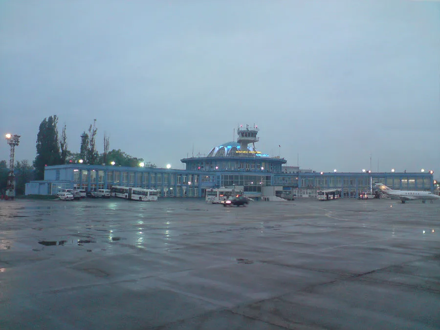
Băneasa at dusk — the blue terminal and tower lit up, buses and an airliner on the apron.
The photos come from public web sources and remain the copyright of their photographers; full credits and source links sit in the photo gallery on this page.
Airport at a glance
| Item | Detail |
|---|---|
| IATA / ICAO | BBU / LRBS |
| Role | Large airport by this site's classification; Bucharest's city airport |
| Elevation | about 91 m |
| Coordinates | 44.5031, 26.1029 |
| Runway | 1: 07/25, 3,200 m × 45 m concrete |
| Non-stop destinations | 0 in the 2014 snapshot (not proof that none operate today) |
| Official site | baneasa-airport.ro |
Why there is no route table
The 2014 OpenFlights snapshot did not capture BBU's scheduled routes. The terminal, tower and apron buses in the photo show the field is still in use, but an airport this close to the city often hands scheduled traffic to a larger hub and shifts towards business aviation, general aviation or charters. Check the airport's and operators' current information for what actually flies.
So this page lists no route table and does not guess destinations. The key point for travellers: Bucharest's main international gateway is Otopeni (OTP). Always check the airport code; BBU and OTP are not the same airport.
Getting there and navigating
- Coordinates: 44.5031, 26.1029
- Official site: baneasa-airport.ro
- Open in a map: Google Maps | Amap | Baidu Maps
This site's nearby-airport table lists Istanbul (IST, about 418 km, 212 destinations) and Atatürk (ISL, about 451 km). They are not local substitutes for Bucharest — their presence reflects gaps in the compiled dataset, not geography. Use OTP as the practical reference and confirm with the airport whether your flight uses BBU.
The location map on this page shows the field against Bucharest and the road network. Terminal connections and local transport are not covered here; check the airport's or airline's own information.
Before you fly
- Confirm the airport code first: BBU and OTP are different airports, and arriving at the wrong one is expensive.
- The 2014 snapshot has no scheduled BBU routes. If an airline or charter operator sells you a BBU departure, re-confirm the terminal and arrival time.
- The airport is small, so 90 minutes before departure is usually enough; allow more for document checks and checked bags on an international flight.
About the data
Runways, elevation and coordinates come from OurAirports open data. Route data comes from the June 2014 OpenFlights snapshot, in which BBU has no scheduled routes recorded. Photos are from public web sources and remain the copyright of their photographers.
History
The story starts in 1909, when French aviation pioneer Louis Blériot flew here at Băneasa; Romania's first flight school opened on the field in 1912. That makes it the oldest continuously operating airport in Eastern Europe and among the five oldest in the world — and from 1920 the home of Romania's first airline.
Source: Bucharest Aurel Vlaicu International Airport.