
Zayed International Airport
 아부다비 · 아랍에미리트· Zayed International Airport
Zayed International Airport(IATA: AUH, ICAO: OMAA)은 아랍에미리트 아부다비에 위치한 대형 공항입니다.
Zayed International Airport is a large airport, at an elevation of about 88 ft, with scheduled passenger service. This page gathers its location map, airport codes and travel information.
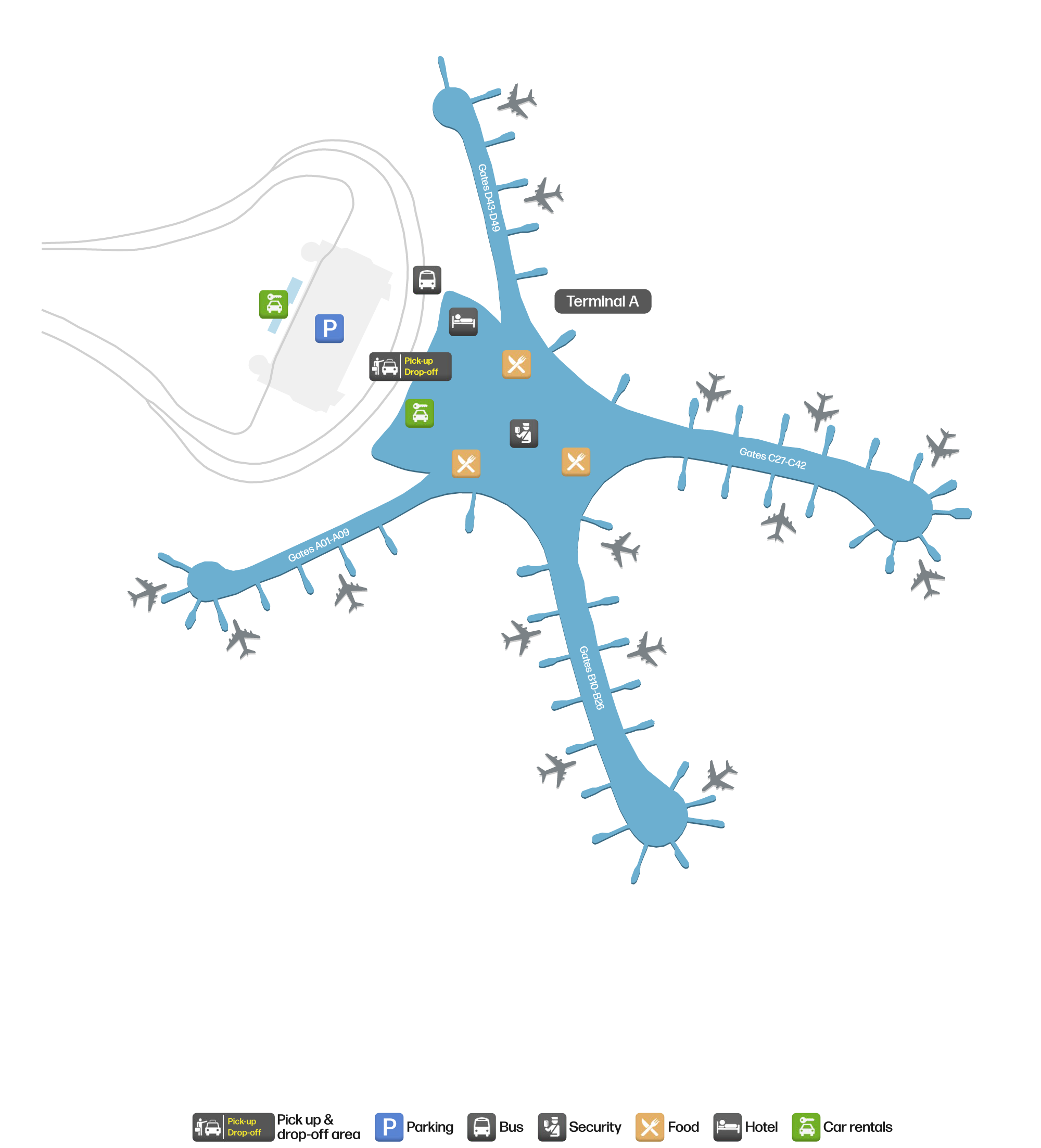
공항 지도 다운로드다운로드
공항 실제 사진공항 사진
다음은 이 공항의 실제 사진으로, 모두 공개된 인터넷 출처에서 가져왔으며 사진마다 출처를 표시했습니다. 저작권은 원저작자에게 있습니다. 사진을 클릭하면 크게 볼 수 있고, 출처를 클릭하면 원본 페이지가 열립니다.
자예드 국제공항의 물결형 지붕 — 머리 위로 지나가는 여객기, 앞쪽으로 하차 도로와 차양.
Zayed International Airport 노선도 · 직항 목적지노선도
직항 목적지 85개: 노선도, 운항 항공사, 비행 거리.
공항 정보 및 상세공항 상세
Zayed International Airport 인터랙티브 지도 — 공항 위치인터랙티브 지도
다른 지도 서비스에서 이 공항 보기:
Zayed International Airport (AUH): A Transfer Hub Under a Wave-Form Roof공항 안내
The first thing you notice at Zayed International Airport (IATA AUH, ICAO OMAA) is the roof: a continuous white wave that runs above the drop-off road, with an airliner passing just over its crest and sun canopies sheltering the kerbside below. This is not primarily a city airport for arrivals that immediately leave for downtown. It is a transfer hub linking Europe, South Asia, Southeast Asia and North America, and the route data makes that shape unusually clear.
The field sits in Abu Dhabi, United Arab Emirates, at an elevation of only about 27 m. Its two parallel runways — 13R/31L at 4,106 m and 13L/31R at 4,100 m — are both long enough for long-haul widebodies. The 2014 OpenFlights snapshot records 85 non-stop destinations, every one of them outside the UAE.
Airport photos
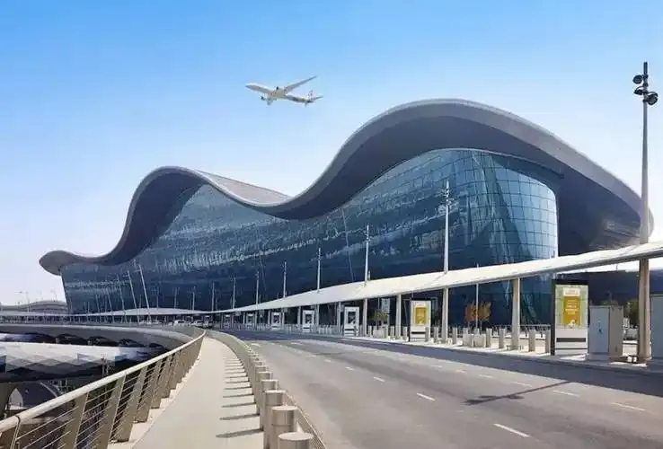
The wave-form roof of Zayed International Airport — an airliner passing overhead, with the drop-off road and sun canopies in the foreground.
The photos come from public web sources and remain the copyright of their photographers; full credits and source links sit in the photo gallery on this page.
Airport at a glance
| Item | Detail |
|---|---|
| IATA / ICAO | AUH / OMAA |
| Role | Large international airport and one of the UAE's national transfer gateways |
| Elevation | about 27 m |
| Coordinates | 24.4410, 54.6492 |
| Runways | 2, longest 4,106 m, both 60 m asphalt |
| Non-stop destinations | 85 (2014 snapshot, all international) |
| Official site | zayedinternationalairport.ae |
Network shape: 38 of 85 destinations are within 3,000 km
Split the 85 routes by distance and four layers appear: 8 within 1,000 km, 30 between 1,000 and 3,000 km, 32 between 3,000 and 6,000 km, and 15 beyond 6,000 km. The short layer is the Gulf and northern South Asia — Kish Island at 241 km, Doha at 320 km, Muscat at 381 km. The long layer reaches São Paulo (12,121 km), Sydney (12,062 km) and Chicago (11,687 km). Dense near, long far: that is the classic route map of a connecting hub.
| Distance band | Destinations |
|---|---|
| Under 1,000 km | 8 |
| 1,000–3,000 km | 30 |
| 3,000–6,000 km | 32 |
| Over 6,000 km | 15 |
Etihad Airways appears on 79 of the 85 routes. The snapshot counts codeshares and interline services, so read that as "the network is built around Etihad" rather than "Etihad operates 79 routes". The full list, with distances, is on the Abu Dhabi route map.
Getting there and navigating
- Coordinates: 24.4410, 54.6492
- Official site: zayedinternationalairport.ae
- Open in a map: Google Maps | Amap | Baidu Maps
If fares or timings do not line up, compare the neighbours: Dubai International (DXB) is about 116 km away with 180 destinations in the same snapshot, while Al Ain International (AAN) is only 99 km away but has just 2. All three are in the UAE, so include the road transfer in any comparison.
The location map on this page shows the field against Abu Dhabi and the surrounding road network. This page does not cover terminal connections or local transport; confirm them with the airport or airline.
Before you fly
- Allow 2–3 hours for an international departure. If an itinerary mixes AUH and DXB, the two airports are about 116 km apart — do not cut the transfer too fine.
- The 85 destinations are a 2014 snapshot. Gulf airline networks have changed substantially since then; check the airline's current schedule before booking.
- Abu Dhabi is hot for much of the year and the indoor-outdoor temperature gap is sharp. On a long layover, a light layer helps with the terminal air conditioning.
About the data
Runways, elevation and coordinates come from OurAirports open data. Routes and carriers come from the June 2014 OpenFlights snapshot and include codeshares and interline services; they indicate network shape and scale, not current schedules. Photos are from public web sources and remain the copyright of their photographers.
History
Etihad's hub and one of the world's fastest-growing airports around 2008 (+34% passengers in that year's first quarter), Abu Dhabi has since pushed through an AED 25 billion (US$6.8 billion) expansion — by January 2012, 53 airlines served 85 destinations in 49 countries.
Source: Abu Dhabi Intl Airport.