
Aden International Airport
 Aden · 예멘· Aden International Airport
Aden International Airport(IATA: ADE, ICAO: OYAA)은 예멘 Aden에 위치한 대형 공항입니다.
Aden International Airport is a large airport, at an elevation of about 7 ft, with scheduled passenger service. This page gathers its location map, airport codes and travel information.
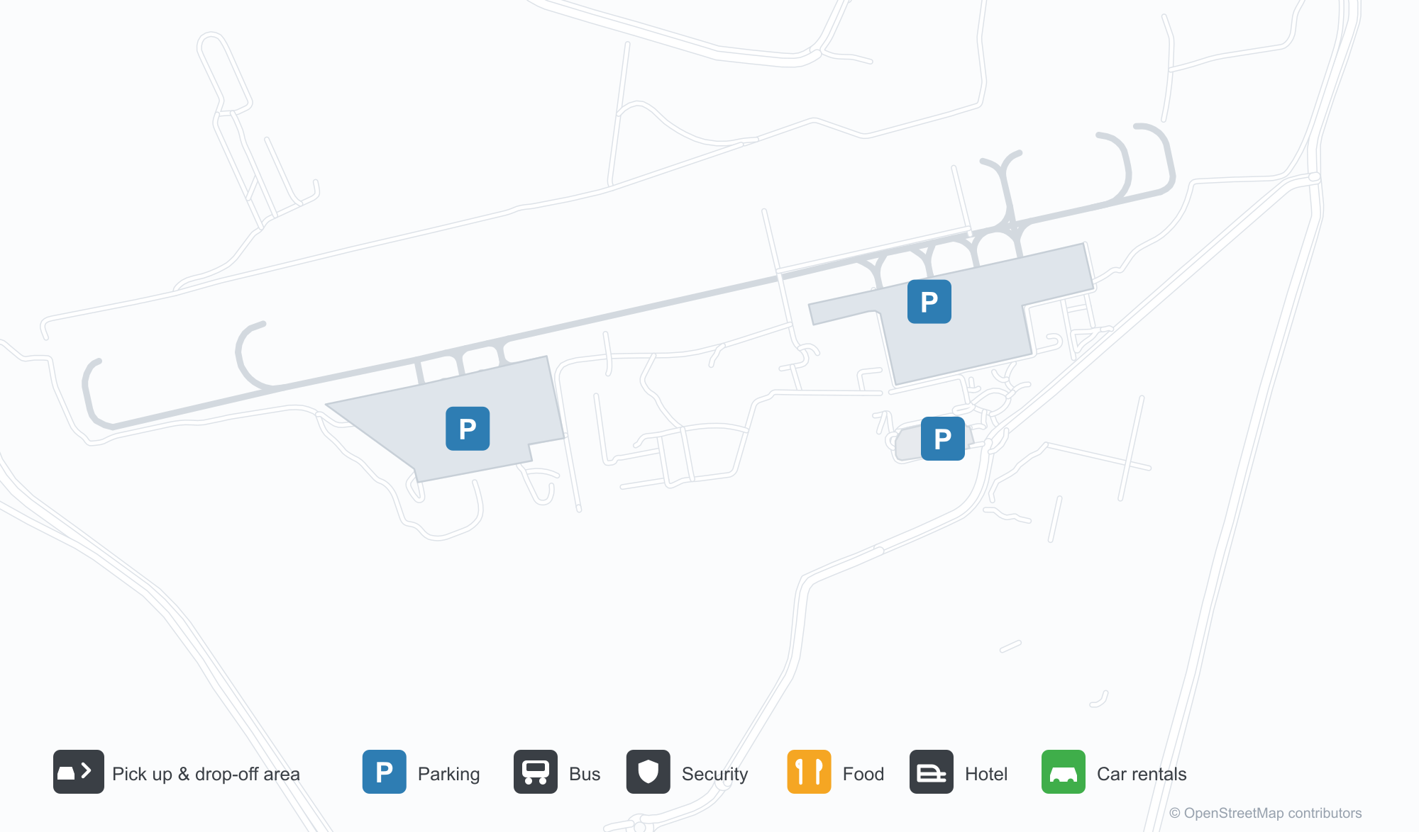
공항 지도 다운로드다운로드
공항 실제 사진공항 사진
다음은 이 공항의 실제 사진으로, 모두 공개된 인터넷 출처에서 가져왔으며 사진마다 출처를 표시했습니다. 저작권은 원저작자에게 있습니다. 사진을 클릭하면 크게 볼 수 있고, 출처를 클릭하면 원본 페이지가 열립니다.
아덴 국제공항의 터미널과 관제탑 — 벽에 아랍어로 적힌 공항 이름, 앞에 세워진 푸시백 트랙터 두 대.
Aden International Airport 노선도 · 직항 목적지노선도
직항 목적지 18개: 노선도, 운항 항공사, 비행 거리.
공항 정보 및 상세공항 상세
Aden International Airport 인터랙티브 지도 — 공항 위치인터랙티브 지도
다른 지도 서비스에서 이 공항 보기:
Aden Airport (ADE): Fifteen International Routes and a Port City공항 안내
The photo of Aden International Airport (IATA ADE, ICAO OYAA) is a straightforward front view: terminal and control tower side by side, the airport's name in Arabic on the wall, two pushback tractors parked in front. No passengers, no aircraft on the move — but enough to recognise a port-city airport with full ground support.
The field serves Aden, Yemen, at an elevation of only about 2 m, with a single 3,100 m runway (08/26) running towards the coast. The 2014 route snapshot records 18 non-stop destinations: 3 in Yemen and 15 abroad.
Airport photos

Aden International Airport's terminal and control tower — the airport's name in Arabic on the wall, with two pushback tractors parked in front.
The photos come from public web sources and remain the copyright of their photographers; full credits and source links sit in the photo gallery on this page.
Airport at a glance
| Item | Detail |
|---|---|
| IATA / ICAO | ADE / OYAA |
| Role | Large airport and international gateway for southern Yemen |
| Elevation | about 2 m |
| Coordinates | 12.8296, 45.0300 |
| Runway | 1: 08/26, 3,100 m |
| Non-stop destinations | 18 (3 domestic, 15 international; 2014 snapshot) |
Network shape: fifteen international routes, the longest to Istanbul
By distance: 6 destinations within 1,000 km, 10 between 1,000 and 3,000 km, 2 between 3,000 and 6,000 km, and none beyond 6,000 km. The near layer is Berbera (272 km), Sana'a (307 km) and Riyan (512 km). The far layer is Istanbul (3,537 km) and Mumbai (3,052 km); Cairo (2,379 km) falls in the 1,000–3,000 km band. For an airport at the southern end of the Arabian Peninsula, the map reaches the Horn of Africa, the Gulf, South Asia and Europe at once.
| Distance band | Destinations |
|---|---|
| Under 1,000 km | 6 |
| 1,000–3,000 km | 10 |
| 3,000–6,000 km | 2 |
| Over 6,000 km | 0 |
Yemenia appears on 10 routes, with Nasair, Turkish Airlines and others on the rest. The carrier column includes codeshares, so the figures describe concentration. The full list is on the Aden route map.
Getting there and navigating
- Coordinates: 12.8296, 45.0300
- Open in a map: Google Maps | Amap | Baidu Maps
In the comparison table, Djibouti–Ambouli (JIB) is about 248 km away with 12 destinations, and Abha (AHB) about 653 km away with 11. Both sit within short range of Aden, but cross-border or cross-region travel brings extra entry and security formalities, so neither is a simple same-city substitute.
The location map on this page shows the field against Aden and the port area. This page does not cover terminal connections or local transport; confirm them with the airport or airline.
Before you fly
- The security situation and flight operations in Yemen can change quickly. Check your foreign ministry's travel advice and the airline's latest notices before planning.
- Allow 2–3 hours for an international departure. With a single runway, delays can cascade when traffic bunches up.
- The 18 destinations are a 2014 snapshot; routes and carriers have changed substantially since. Use this page to understand the network shape, not as a live timetable.
About the data
Runways, elevation and coordinates come from OurAirports open data. Routes and carriers come from the June 2014 OpenFlights snapshot and include codeshares and interline services; they indicate network shape and scale, not current schedules. Photos are from public web sources and remain the copyright of their photographers.
History
The field began as RAF Khormaksar — opened in 1917 and closed as an RAF station in 1967 — and hosted a Soviet Air Force station through the 1970s and 80s. Its present tower and three-storey terminal, built from 1999 and opened in 2001, carry Islamic design elements; it is also a Yemeni Air Force base and Yemen's second largest airport after Sana'a.
Source: Aden Intl Airport.