
Romeu Zema Airport
 Araxá · 브라질· Romeu Zema Airport
Romeu Zema Airport(IATA: AAX, ICAO: SBAX)은 브라질 Araxá에 위치한 중형 공항입니다.
Romeu Zema Airport is a medium-sized airport, at an elevation of about 3,276 ft, with scheduled passenger service. This page gathers its location map, airport codes and travel information.
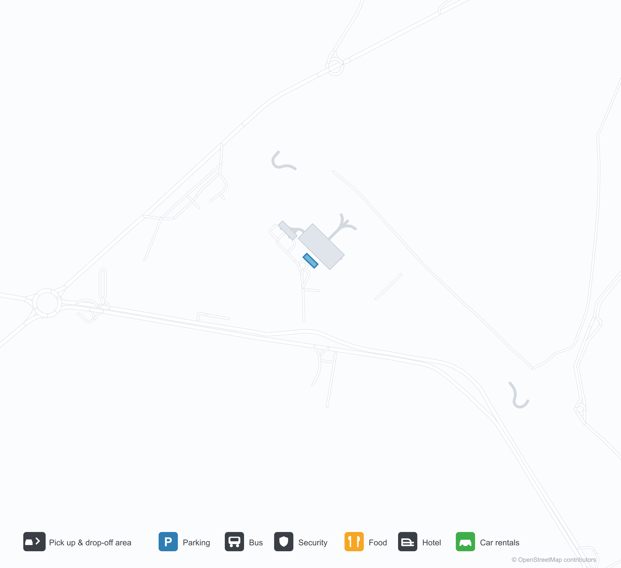
공항 지도 다운로드다운로드
공항 실제 사진공항 사진
다음은 이 공항의 실제 사진으로, 모두 공개된 인터넷 출처에서 가져왔으며 사진마다 출처를 표시했습니다. 저작권은 원저작자에게 있습니다. 사진을 클릭하면 크게 볼 수 있고, 출처를 클릭하면 원본 페이지가 열립니다.
아락사 공항 터미널 내부: 체크인 카운터에 늘어선 줄과, 계류장 쪽 유리문을 마주한 금속 의자들.
공중에서 본 아락사 공항: 붉은 흙 고원 지대를 가로지르는 아스팔트 활주로 하나, 활주로 중간 옆으로 계류장과 격납고.
공항 정보 및 상세공항 상세
Romeu Zema Airport 인터랙티브 지도 — 공항 위치인터랙티브 지도
다른 지도 서비스에서 이 공항 보기:
Araxá Airport (AAX): A Check-In Queue and a Runway With No Route Data공항 안내
The first photo of Araxá Airport (IATA AAX, ICAO SBAX) is inside the terminal: a queue at the check-in counter, rows of metal seats facing glass doors out to the apron. The second is from the air: a single asphalt runway across red-earth plateau country, with the apron and hangars alongside its midpoint. There are passengers and ground facilities in the frame, yet the 2014 OpenFlights snapshot records no scheduled non-stop routes at all. That mismatch is the story.
The field serves Araxá in Minas Gerais, Brazil, at an elevation of about 999 m, with one runway 1,900 m long and 30 m wide (16/34).
Airport photos
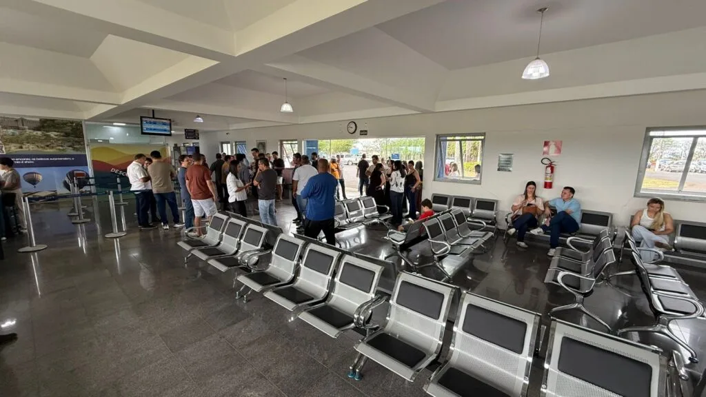
Inside Araxá Airport's terminal: a queue at the check-in counter and rows of metal seats facing the glass doors out to the apron.
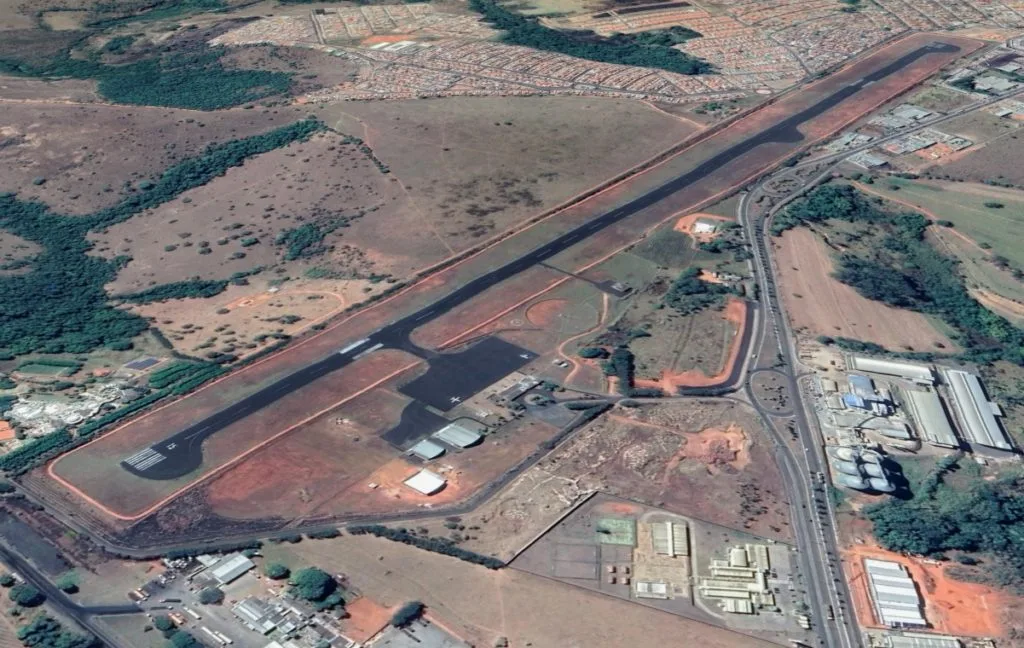
Aerial view of Araxá Airport: a single asphalt runway across red-earth plateau country, with the apron and hangars alongside its midpoint.
The photos come from public web sources and remain the copyright of their photographers; full credits and source links sit in the photo gallery on this page.
Airport at a glance
| Item | Detail |
|---|---|
| IATA / ICAO | AAX / SBAX |
| Role | Medium-sized airport in Minas Gerais, Brazil |
| Elevation | about 999 m |
| Coordinates | -19.5632, -46.9604 |
| Runway | 1: 16/34, 1,900 m × 30 m |
| Non-stop destinations | 0 in the 2014 snapshot (the photos show the field is not idle) |
The queue in the photo and the blank in the snapshot
The check-in queue suggests the airport has handled scheduled or charter passengers, but OpenFlights' 2014 snapshot did not capture AAX's routes. That is not a contradiction: regional schedules may be operated by charters, seasonal services or carriers outside the dataset. A gap in coverage means "not recorded", not "no aircraft".
So this page lists no route table and does not guess destinations. To find out what operates today, check the websites of Brazilian regional airlines or contact the airport directly.
Getting there and navigating
- Coordinates: -19.5632, -46.9604
- Open in a map: Google Maps | Amap | Baidu Maps
In the comparison table, Araraquara (AQA) is about 278 km away with 1 destination, and Araçatuba (ARU) about 402 km away with 2. If no AAX flight turns up, use the search box at the top of the page to compare those airports before deciding whether to start from a larger city.
The location map on this page shows the field against Araxá and the surrounding highways. This page does not cover terminal connections or local transport; confirm them with the airport or airline.
Before you fly
- Regional schedules change often. After booking, confirm with the airline that the flight is operating rather than relying on an aggregator's display alone.
- The airport is small, so 90 minutes before departure is usually enough; for a connection, include the road time to São Paulo or Belo Horizonte.
- At about 999 m, altitude is far from high-altitude territory, but plateau weather can still affect operations. Check airline notices before departure.
About the data
Runways, elevation and coordinates come from OurAirports open data. Route data comes from the June 2014 OpenFlights snapshot, in which AAX has no scheduled routes recorded. Photos are from public web sources and remain the copyright of their photographers.