
Antonio Maceo International Airport
 サンティアゴ · キューバ· Antonio Maceo International Airport
Antonio Maceo International Airport(IATA: SCU、ICAO: MUCU)はサンティアゴ、キューバにある大型空港です。
Antonio Maceo International Airport is a large airport, at an elevation of about 249 ft, with scheduled passenger service. This page gathers its location map, airport codes and travel information.
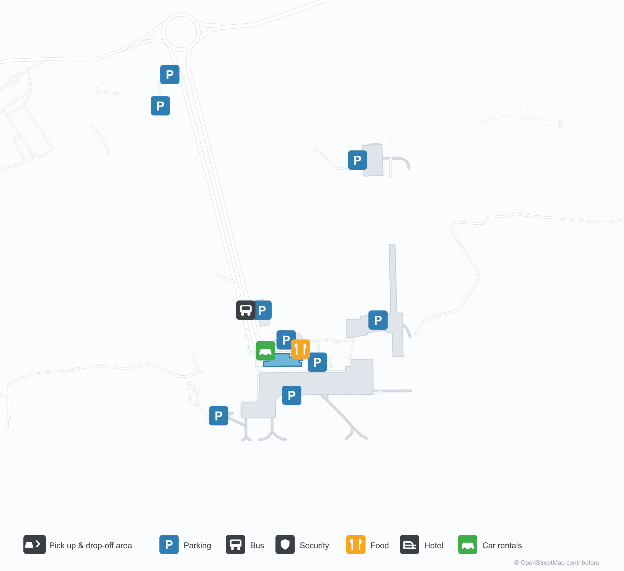
空港マップをダウンロードダウンロード
空港写真空港写真
この空港の実際の写真です。いずれも公開ウェブページを出典として明記しており、著作権は撮影者に帰属します。写真をクリックすると拡大表示され、クレジットをクリックすると元のページが開きます。
衛星画像:滑走路はサンティアゴ・デ・クーバの海岸沿いにあり、ターミナルとエプロンが並び、下にはカリブ海。
赤と白のターミナルにサンティアゴ・デ・クーバ空港の名、青空の下、荷物を持った乗客がエプロンを横切る。
エプロンには旅客機の赤・白・青の尾翼だけが見え、そばに手荷物カート、近くに黄色いベストの地上係員。
チェックインロビーは空っぽで、青い行列バリアと赤い柱が静かな通路を縁取り、タイル床には丸い距離標示。
白い矢印標示がアスファルト滑走路へ導き、両側に乾いた草、地平線沿いに霞んだ青い山々。
シルバーの文字の双発ターボプロップ機がエプロンに停まり、背後に管制塔とターミナルの空港名バナー。
草地から見ると、長い赤と白のターミナルが画面を横切り、左に管制塔、澄んだ青空の下に山々。
青と白の案内看板がチェックインエリア前に立ち、バリアの列が空の通路を作り、床には赤い円形標示。
Antonio Maceo International Airportの路線マップ — 直行便の目的地路線マップ
直行目的地4か所。地図、就航航空会社、距離を掲載しています。
Antonio Maceo International Airport発着便 — 出発と到着フライトボード
便名21件、8社の航空会社、8か所の目的地を出発・到着別に掲載しています。コードシェア便も含みます。
| 便 | 航空会社 | 目的地 | 国・地域 |
|---|---|---|---|
| 5R2231 | Rutaca Airlines | Arturo Michelena International Airport | ベネズエラ |
| 8W629 | Fly All Ways | Camaguey (CMW) Ignacio Agramonte International Airport | キューバ |
| 8W630 | Fly All Ways | Camaguey (CMW) Ignacio Agramonte International Airport | キューバ |
| AA1532 | American Airlines | マイアミ国際空港 | アメリカ合衆国 |
| CU7887 | Cubana | ハバナ (HAV) José Martí International Airport | キューバ |
| DO821 | Skyhigh Dominicana | サントドミンゴ (SDQ) Las Américas International Airport | ドミニカ共和国 |
| DO823 | Skyhigh Dominicana | サントドミンゴ (SDQ) Las Américas International Airport | ドミニカ共和国 |
| JY317 | Intercaribbean Airways | Providenciales (PLS) Providenciales International Airport | タークス・カイコス諸島 |
| JY614 | Intercaribbean Airways | Kingston (KIN) Norman Manley International Airport | ジャマイカ |
| Q47887 | Euroairlines | ハバナ (HAV) José Martí International Airport | キューバ |
| Y2112 | Air Century | La Isabela (JBQ) La Isabela International Airport | ドミニカ共和国 |
便名と路線はaviability.comのフライトインデックス(スナップショット:2026年10月26日)に基づきます。コードシェア便を含み、出発時刻は掲載していません。出典:aviability.com ↗
空港情報と詳細空港の詳細
インタラクティブマップ — Antonio Maceo International Airportの位置インタラクティブマップ
他の地図サービスでこの空港を見る:
Santiago de Cuba Airport (SCU): A Coastal Runway and Three International Routes空港ガイド
From above, the runway lies beside the Santiago de Cuba coast, with the terminal and apron alongside it and the Caribbean below. Antonio Maceo International Airport serves Santiago de Cuba at an elevation of about 76 m, with a 4,002 m main runway; the 2014 snapshot records four destinations, one domestic and three international, from Santo Domingo at 670 km to Rome at 8,391 km.
Satellite view
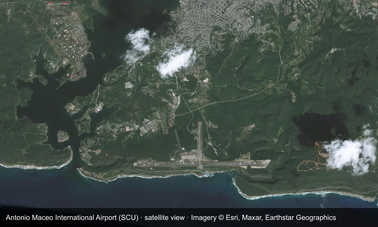
Satellite view: the runway lies beside the Santiago de Cuba coast, with the terminal and apron alongside it and the Caribbean below.
The satellite image comes from Esri World Imagery (© Esri, Maxar, Earthstar Geographics); the field and attribution are labelled in the image. This is a satellite view, not a ground-level photograph.
Airport at a glance
| Item | Detail |
|---|---|
| IATA / ICAO | SCU / MUCU |
| Role | Large airport |
| Elevation | about 76 m |
| Coordinates | 19.9747, -75.8355 |
| Runways | 2, longest 4,002 m |
| Non-stop destinations | 4 (1 domestic, 3 international; 2014 snapshot) |
Runways
| Runway | Length | Width | Surface |
|---|---|---|---|
| 10/28 | 4,002 m | 45 m | asphalt |
| 19/01 | 1,400 m | 45 m | asphalt |
2 runways, the longest 4,002 m.
Non-stop routes
4 non-stop destinations, nearest first (OpenFlights route snapshot compiled in 2014 — confirm with the airline or airport):
| Destination | Distance | Carriers |
|---|---|---|
| Las Américas International Airport (SDQ) | ~670 km | Cubana de Aviación |
| José Martí International Airport (HAV) | ~758 km | Cubana de Aviación |
| Montreal / Pierre Elliott Trudeau International Airport (YUL) | ~2841 km | Cubana de Aviación |
| Rome–Fiumicino Leonardo da Vinci International Airport (FCO) | ~8391 km | Blue Panorama Airlines, Cubana de Aviación |
The carrier column comes from the same snapshot and includes codeshare and interline services; treat it as an indication of how busy the route is and check the airline for who actually flies it.
Nearby airports to compare
If the fares are close, these are the nearest airports of the same class (large airport) — straight-line distance, with their own non-stop counts from the same dataset:
| Airport | Distance | Non-stop destinations |
|---|---|---|
| Abel Santamaria International Airport (SNU) | ~509 km | 4 |
| Miami International Airport (MIA) | ~792 km | 133 |
Before you fly
- Allow 2–3 hours for an international departure; only four destinations appear in 2014 and Cuban routes have changed since.
- Havana and Santo Domingo are common connection fallbacks; confirm the airline and entry requirements when booking.
About the data
Runways, elevation and coordinates come from OurAirports open data. Routes and carriers come from the June 2014 OpenFlights snapshot and include codeshares and interline services; they indicate network shape and scale, not current schedules.
History
Primarily a turboprop field that also takes jets, Santiago sees about twenty international flights a week, mostly by Cuban carriers. Pope John Paul II flew through here on his final visit to Cuba in 1998.
Source: Antonio Maceo Intl Airport.
読者コメントディスカッション
質問、旅行記、訂正など、お気軽にお寄せください。コメントは公開されます。
読み込み中…
コメントを読み込み中…