
Anshan Teng'ao Airport / Anshan Air Base
 Anshan · 中国· Anshan Teng'ao Airport / Anshan Air Base
Anshan Teng'ao Airport / Anshan Air Base(IATA: AOG、ICAO: ZYAS)はAnshan、中国にある中型空港です。
Anshan Teng'ao Airport / Anshan Air Base is a medium-sized airport, with scheduled passenger service. This page gathers its location map, airport codes and travel information.
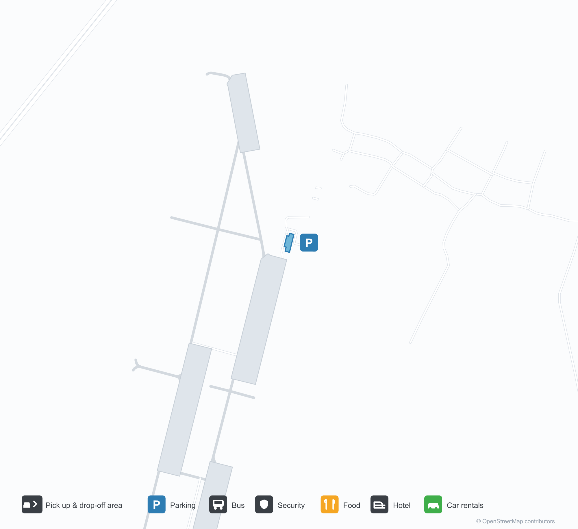
空港マップをダウンロードダウンロード
空港写真空港写真
この空港の実際の写真です。いずれも公開ウェブページを出典として明記しており、著作権は撮影者に帰属します。写真をクリックすると拡大表示され、クレジットをクリックすると元のページが開きます。
鞍山騰鰲空港ターミナルの正面——屋根に赤い「鞍山」の文字と「An Shan」の表記、下の前庭はほとんど空っぽ。
ターミナルをもう少し近くから——ガラス張り正面の前に階段と灯籠、左には丸い管制塔。
濃い青空の下、ターミナル屋根に大きな赤い鞍山の文字と「An Shan」の筆記体、背後に管制塔のガラス面。
灰色のターミナル入口に赤い横断幕が掛かり、窓の列の下で一団が階段を上っていく。
地図のスクリーンショットが鞍山市のすぐ西に赤いピンを落とし、G15・G16高速道路と東の山々がはっきり読める。
Anshan Teng'ao Airport / Anshan Air Baseの路線マップ — 直行便の目的地路線マップ
直行目的地2か所。地図、就航航空会社、距離を掲載しています。
Anshan Teng'ao Airport / Anshan Air Base発着便 — 出発と到着フライトボード
便名8件、3社の航空会社、2か所の目的地を出発・到着別に掲載しています。コードシェア便も含みます。
| 便 | 航空会社 | 目的地 | 国・地域 |
|---|---|---|---|
| FM9098 | Shanghai Airlines | 上海浦東国際空港 | 中国 |
| KN5572 | China United Airlines | Beijing Daxing International Airport | 中国 |
| MU8262 | China Eastern Airlines | Beijing Daxing International Airport | 中国 |
| MU8330 | China Eastern Airlines | 上海浦東国際空港 | 中国 |
便名と路線はaviability.comのフライトインデックス(スナップショット:2026年10月26日)に基づきます。コードシェア便を含み、出発時刻は掲載していません。出典:aviability.com ↗
空港情報と詳細空港の詳細
インタラクティブマップ — Anshan Teng'ao Airport / Anshan Air Baseの位置インタラクティブマップ
他の地図サービスでこの空港を見る:
Anshan Teng'ao Airport (AOG): Two Routes for a Steel City空港ガイド
Anshan Teng'ao is quiet in the photos: red "Anshan" characters and the An Shan mark stand above the terminal frontage, with only a few cars on the plaza; closer in, steps and lanterns sit before the glazing, a round tower to the left. The airport serves Anshan in Liaoning, China, with a 2,600 m runway; the 2014 snapshot records two domestic destinations, Beijing at 540 km and Shanghai at 1,112 km.
Airport photos
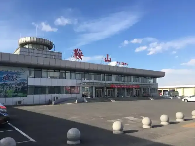
The front of Anshan Teng'ao Airport's terminal — red '鞍山' characters and 'An Shan' lettering on the roof, an almost empty forecourt below.
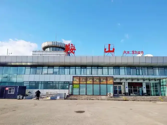
A closer view of the terminal — steps and lanterns before the glazed frontage, the round control tower to the left.
The photos come from public web sources and remain the copyright of their photographers; full credits and source links sit in the photo gallery on this page.
Airport at a glance
| Item | Detail |
|---|---|
| IATA / ICAO | AOG / ZYAS |
| Role | Medium-sized airport |
| Elevation | Not listed in OurAirports |
| Coordinates | 41.1053, 122.8540 |
| Runways | 1, 2,600 m |
| Non-stop destinations | 2 (2014 snapshot, all domestic) |
Runways
| Runway | Length | Width | Surface |
|---|---|---|---|
| 02/20 | 2,600 m | — | — |
1 runway, the longest 2,600 m.
Non-stop routes
2 non-stop destinations, nearest first (OpenFlights route snapshot compiled in 2014 — confirm with the airline or airport):
| Destination | Distance | Carriers |
|---|---|---|
| Beijing Capital International Airport (PEK) | ~540 km | China Southern Airlines |
| Shanghai Pudong International Airport (PVG) | ~1112 km | Shanghai Airlines, China Eastern Airlines |
The carrier column comes from the same snapshot and includes codeshare and interline services; treat it as an indication of how busy the route is and check the airline for who actually flies it.
Nearby airports to compare
If the fares are close, these are the nearest airports of the same class (medium-sized airport) — straight-line distance, with their own non-stop counts from the same dataset:
| Airport | Distance | Non-stop destinations |
|---|---|---|
| Arxan Yi'ershi Airport (YIE) | ~729 km | 1 |
Before you fly
- With two domestic routes, 90–120 minutes is usually enough; for Shenyang or Dalian, compare high-speed rail with flying.
- The 2014 snapshot records only Beijing and Shanghai; check current airline information.
About the data
Runways, elevation and coordinates come from OurAirports open data. Routes and carriers come from the June 2014 OpenFlights snapshot and include codeshares and interline services; they indicate network shape and scale, not current schedules.
読者コメントディスカッション
質問、旅行記、訂正など、お気軽にお寄せください。コメントは公開されます。
読み込み中…
コメントを読み込み中…